Go to top

847 CE Damascus Quake

Dawn on Thursday 24 Nov. 847 CE

by Jefferson Williams


Introduction & Summary

Several sources describe an earthquake in Damascus which one source stated struck at dawn on 24 November 847 CE (11 Rabi' II A.H. 233). That source was Damascus native and scion Ibn 'Asakir as quoted by al-Suyuti. As all of the sources wrote about this event at least 300 years after it occurred, it appears that Ibn 'Asakir's 300+ year old account is the most reliable as he was widely noted for his encyclopedic work Tarikh Dimashq (History of Damascus) and would have had access to many documents detailing the city's past. Ibn 'Asakir wrote that many bridges and houses collapsed in Damascus and seems to have indicated that there was damage to the Great Umayyad Mosque of Damascus. Late writing source and Damascus native Ibn al-Imad also wrote that there was damage to the Great Umayyad Mosque of Damascus. Ibn 'Asakir wrote that the earthquake also affected the surrounding area of al-Ghut'ah, Darayyah, al Mazza, Bait Lihyah and others as well as Antioch. Damascus natives al-Dhahabi and Ibn al-Imad reported that Antioch and Mosul were badly affected by the same earthquake with what appear to be inflated numbers of house collapses and casualties and/or conflation with an 850 CE earthquake in Antioch and an 846 CE earthquake in Mosul. al-Dhahabi and Ibn al-Imad also stated that the earthquake in Damascus lasted 3 hours which may approximate the time between the initial shock and the last energetic aftershock.

Textual Evidence

Text (with hotlink) Original Language Biographical Info Religion Date of Composition Location Composed Notes
Damage and Chronology Reports from Textual Sources n/a n/a n/a n/a n/a n/a
Ibn al-Jawzi Arabic
Biography

Hanbali Sunni Muslim 2nd half of the 12th c. CE Baghdad Ibn al-Jawzi wrote that an earthquake took place in Hara and many buildings collapsed in A.H. 231 (7 September 845 CE - 27 August 846 CE) - two years earlier than other sources. This may not refer to the same earthquake despite its inclusion in Ambraseys' (2009) catalog.
al-Dhahabi Arabic
Biography

Muslim Early 14th century CE Damascus al-Dhahabi wrote that a dreadful three hour long earthquake struck Damascus in A.H. 233 (17 August 847 CE - 4 August 848 CE). Walls were said to have collapsed and many people died in the ruins. al-Dhahabi reports that it was said that 20,000 people in Antioch died due to the same earthquake and it was claimed that another 50,000 people died in Mosul - also due to the same earthquake.
as-Suyuti quoting Ibn 'Asakir Arabic
Arabic
Biography - as-Suyuti


Biography - Ibn 'Asakir

Sufi Muslim
Sunni Muslim
15th c. CE
late 12th c. CE
Cairo
Damascus
al-Suyuti sourced his entire account from Damascene Ibn 'Asakir who wrote that an earthquake struck Damascus at dawn on Thursday 24 November 947 CE (11 Rabi' II A.H. 233). A quarter of the [Great Umayyad ?] Mosque [of Damascus ?] was torn open, its great stone blocks were thrown down, and the minaret collapsed. Bridges and houses also collapsed and the earthquake also affected al-Ghut'ah, Darayyah, al Mazza, Bait Lihyah and others. The earthquake was also experienced in Antioch.
Ibn al-Imad Arabic
Biography

Hanbali Sunni Muslim 1670 CE Damascus Ibn al-Imad wrote that there was 3 hours of heavy shaking in Damascus destroying houses, [] displacing huge stones, [] breaking many windows of Souks, and killing many people under debris. Ibn al-Imad also wrote that many terraces and a quarter of the minaret of the Great Umayyad Mosque of Damascus fell. He also wrote that a village in Al-Ghoutah (adjacent to Damascus) was overturned with only one survivor. The same earthquake was said to have been strong in Antioch and Mosul where more than 2000 houses collapsed and there were 20,000 victims. The date of the earthquake was specified as A.H. 233 (17 August 847 CE - 4 August 848 CE).
Text (with hotlink) Original Language Biographical Info Religion Date of Composition Location Composed Notes
Damage and Chronology Reports from Textual Sources

Seismic Effects

Location Sources Notes
Damascus affected Ibn al-Imad, al-Suyuti quoting Ibn 'Asakir, al-Dhahabi
3 hours of shaking in Damascus Ibn al-Imad, al-Dhahabi
Great Umayyad Mosque of Damascus damaged Ibn al-Imad, al-Suyuti quoting Ibn 'Asakir
  • Ibn al-Imad wrote that many terraces of Ommyad Mosque the Great fell down, a quarter of its minaret fell down
  • al-Suyuti quoting Ibn 'Asakir wrote that a quarter of the mosque was torn open, its great stone blocks were thrown down, and the minaret collapsed.
  • al-Suyuti quoting Ibn 'Asakir did not explicitly refer to the Great Umayyad Mosque of Damascus but the similarity of damage reports to Ibn al-Imad's account suggests that he was may have been referring to the Great Umayyad Mosque of Damascus.
Antioch affected Ibn al-Imad, al-Suyuti quoting Ibn 'Asakir, al-Dhahabi
  • Ibn al-Imad wrote that that there were 2000 house collapses and 20,000 in Antioch and Mosul
  • al-Suyuti quoting Ibn 'Asakir wrote that the earthquake reached Antioch but did not report on damage or fatalities
  • al-Dhahabi wrote that 20,000 people died in Antioch
Mosul affected Ibn al-Imad, al-Dhahabi
  • Ibn al-Imad wrote that that there were 2000 house collapses and 20,000 in Antioch and Mosul
  • al-Dhahabi wrote that it was claimed that 50,000 people died in Mosul
damage and fatalities in al-Ghut’ah (adjacent to Damascus) Ibn al-Imad, al-Suyuti quoting Ibn 'Asakir
  • Ibn al-Imad wrote that a village in Al-Ghoutah was overturned with only one survivor.
  • al-Suyuti quoting Ibn 'Asakir wrote that the earthquake affected al-Ghut’ah

Dates and Times

Date(s) or Time(s) Sources Notes
at dawn on Thursday 11 Rabi’ II in the year A.H. 233 al-Suyuti quoting Ibn 'Asakir Dawn on Thursday 24 November 947 CE - Date and Day of Week are in agreement
A.H. 233 al-Dhahabi, Ibn al-Imad 17 August 847 CE - 4 August 848 CE
A.H. 231 Ibn al-Jawzi 7 September 845 CE - 27 August 846 CE

Locations

Location Sources Notes
Damascus al-Dhahabi, al-Suyuti quoting Ibn 'Asakir, Ibn al-Imad
Antioch al-Dhahabi, al-Suyuti quoting Ibn 'Asakir, Ibn al-Imad
  • al-Dhahabi wrote that 20,000 people died in Antioch
  • Ibn al-Imad wrote that that there were 2000 house collapses and 20,000 in Antioch and Mosul
  • al-Suyuti quoting Ibn 'Asakir wrote that the earthquake reached Antioch but did not report on damage or fatalities
  • Mosul al-Dhahabi, Ibn al-Imad
  • al-Dhahabi wrote that it was claimed that 50,000 people died in Mosul
  • Ibn al-Imad wrote that that there were 2000 house collapses and 20,000 in Antioch and Mosul
  • al-Ghut’ah - adjacent to Damascus al-Suyuti quoting Ibn 'Asakir, Ibn al-Imad
    Darayyah al-Suyuti quoting Ibn 'Asakir
    al-Mazza al-Suyuti quoting Ibn 'Asakir
    Bait Lahya al-Suyuti quoting Ibn 'Asakir
    other places al-Suyuti quoting Ibn 'Asakir
    Hara Ibn al-Jawzi Should we access Sibt Ibn al-Jawzi instead of Ibn al-Jawzi ?
    Homs Al-Suyuti - possibly according to Al-Suyuti's source named as the author of Al-Mireât [Sibt Ibn al-Jawzi?] Should we access Sibt Ibn al-Jawzi instead of Ibn al-Jawzi ?

    Kitab al-muntazam by Ibn al-Jawzi

    by ابن الجوزي

    Aliases

    Aliases Arabic
    Ibn al-Jawzi ابن الجوزي
    Background and Biography
    Background and Biography

    Excerpts
    English from Ambraseys (2009)

    ‘(a.H. 231) An earthquake took place in Hara and many buildings collapsed.’ (Ibn al-Jauzi, K116, Seth. 83b).

    Chronology
    Date Reference Corrections Notes
    7 September 845 CE - 27 August 846 CE A.H. 231 none
    Seismic Effects Locations Sources
    Sources

    Online Versions and Further Reading
    References

    Notes
    Ibn al-Jawzi vs. Sibt Ibn al-Jawzi

    Great History of Islam by al-Dhahabi

    تاريخ الإسلام by الذهبي

    Aliases

    Aliases Arabic
    Shams ad-Dīn adh-Dhahabī شمس الدين الذهبي
    Shams ad-Dīn Abū ʿAbdillāh Muḥammad ibn Aḥmad ibn ʿUthmān ibn Qāymāẓ سهامس ادءدين ابو عابديللاه موحامماد يبن احماد يبن عوتهمان يبن قايماظ يبن عابديللاه اتءتوركوماني الءفاريقي ادءديماسهقي (?)
    ʿAbdillāh at-Turkumānī al-Fāriqī ad-Dimashqī عابديللاه اتءتوركوماني الءفاريقي ادءديماسهقي (?)
    Background and Biography
    Background and Biography

    Excerpts
    English from Sbeinati et al. (2005)

    In 233 A.H. Rabi’ II, it was a dreadful earthquake in Damascus which lasted for three hours, causing walls to fall down and people die under debris. It extended to Antioch killing 20000 as it was said, then to Al-Mousel where 50000 people were killed under debris as it was said. (Al-Dhahabi)

    English from Guidoboni et al. (1994)

    In that year [233 of the Hegira = 17 August 847 4 August 848 AD ] there was a dreadful earthquake at Damascus. It lasted for three hours, causing the walls to collapse. People ran to the mosques to invoke God's mercy, and many of them died in the ruins. The earthquake reached Antioch, and it was said that 20,000 people died there. Then it reached Mawsil; it was claimed that 50,000 people died in the ruins.

    Chronology
    Date Reference Corrections Notes
    17 August 847 CE - 4 August 848 CE A.H. 233 none
    Seismic Effects Locations Online Versions and Further Reading
    References

    Clearing up the Description of Earthquakes by Jalal al-Din al-Suyuti

    كتاب كشف الصلصلة عن وصف الزلزلة by عبد الرحمن بن كمال الدين أبي بكر بن محمد سابق الدين خضر الخضيري الأسيوطي

    Aliases

    al-Suyuti
    Aliases Arabic
    Al-Suyuti
    As-Suyuti
    Jalal al-Din al-Suyuti
    Abu 'l-Fadl 'Abd al-Rahman ibn Abi Bakr ibn Muhammad Djalal al_Din al-Khudayri
    Ibn 'Asakir
    Aliases Arabic
    Ibn 'Asakir
    al-Hafidh ’ibn ‘Asakir
    Alī ibn al-Ḥasan ibn Hibat Allāh ibn `Abd Allāh, Thiqat al-Dīn, Abū al-Qasim, known as Ibn `Asakir al-Dimashqi al-Shafi`i al-Ash`ari الحافظ المؤرخ علي بن الحسن بن ھبة اللہ بن عبداللہ بن الحسین الدمشقي الشافعي
    Thikat al-Din Abu 'l-Kasim 'Ali b. Abi Muhammad al-Hasan b. Hibat Allah b. 'Abd Allah b. al-Husayn al-Dimashki al-Shafi'i al-Hafiz
    Background and Biography
    Background and Biography - al-Suyuti

    Background and Biography - Ibn 'Asakir

    Excerpts
    English from Ambraseys (2009)

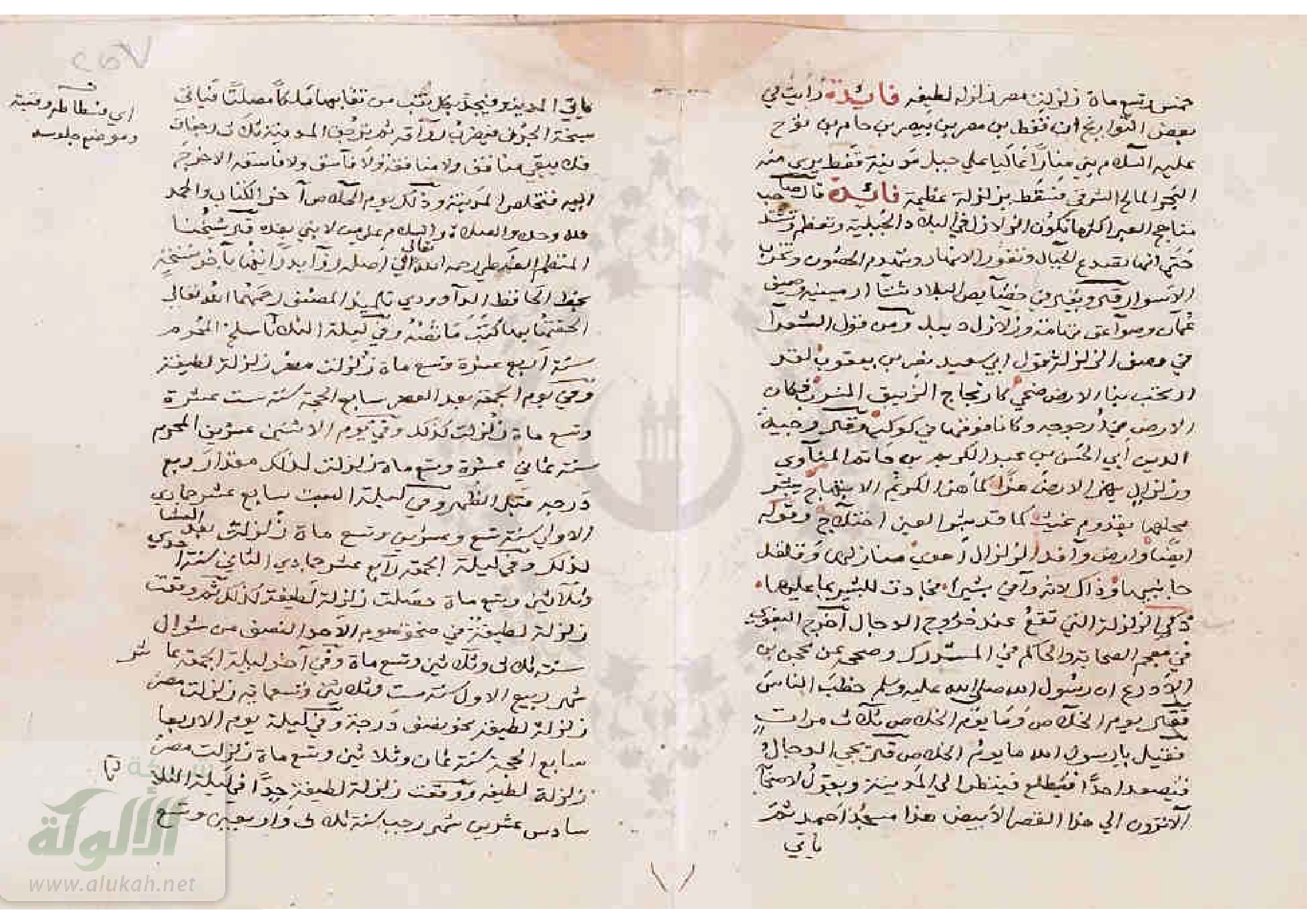
    In A.H. 233, a very violent earthquake occurred; al-Hafidh ’ibn ‘Asakir mentions it in the Book of Earthquakes, and he says:
    Damascus was shaken by an earthquake at dawn on Thursday 11 Rabi’ II in the year 233; a quarter of the mosque [Ommayad?] was torn open, its great stone blocks were thrown down, and the minaret collapsed. The bridges and houses collapsed, and the earthquake traversed al-Ghut’ah; it destroyed Darayyah, al Mazza, Bait Lihyah and others. People went to the musallah where they prayed until midday. Then everything calmed down. The earthquake reached Antioch.’ (al-Suyuti Kashf 25, 26).

    English from Sbeinati et al. (2005)

    In 233 A.H. 11 (847 A.D. November 25) there was a dreadful earthquake in Damascus where houses fell down and people died under debris. This earthquake extended to Antioch causing destruction, to Al-Jazira causing damage, and to Al-Mousel killing 50000 people as it was said. In his book Al-Zalazel (the earthquakes), Al-Hafez Ibn Asaker mentioned that there was an earthquake in Damascus on Thursday 11 Rab’ 253, destroying a quarter of the Ommyad Mosque the great, the minaret fell down and bridges and houses collapsed, this earthquake reached Al-Ghouta where Darayya, Al-Mazzeh, Bait Lahya and others were destroyed. (Al-Suyuti)

    English from Guidoboni et al. (1994)

    There was a strong earthquake mentioned by al-Hdfiz Ibn Asakir, in [his] Kitab al-zalazil (Book of earthquakes):
    The earth shook in Damascus on Thursday morning, 11 rabi` II of the year 233 [24 November 847 A.D.]. A quarter of the mosque [the Ommiad Great Mosque] was broken off and its great stones were pulled apart. The minaret fell down; and bridges and houses collapsed. The earthquake reached al-Ghtita [al-Ghouta] and it destroyed Darayya, al-Mazzah, Bayt Lahya and other. People went to the mosques to pray till mid-day; then the world became calm again.

    English from Taher (1979)

    220 A.H./835 A.D.

    220 A.H./835 :

    The earth was shaken by earthquakes for forty days; the city of Antioch was subject to destruction.4
    Footnotes

    Footnotes

    4 As Suyûti, Kashf, 25.

    232 A.H./847 AD

    232 A.H./847 AD

    Earthquakes5 increased throughout the world, notably in Syria, the walls of Damascus and Homs were destroyed; the most violent earthquakes occurred in Antioch and al-'Awàçim. This intense seismic activity continued for several days. The author of Al-Mireât [Sibt Ibn al-Jawzi?] then says:
    Footnotes

    5 As Suyûti, Kashf, 25. He cited another earthquake in the year 230 AH with the same details - and events.

    233 A.H./848 AD

    233 A.H./848 AD

    In 233/848, a very violent earthquake1 occurred; al-H'âfidh'ibn 'Asakir mentioned it in "Kitâb az-zalazil (the book of earthquakes); he says again:
    Damascus was shaken by an earthquake at dawn on Thursday 11 Rabi' II and 233; a quarter of the mosque was torn to pieces, the large stones were uprooted and the minaret collapsed. Bridges and houses collapsed, the seismic wave traveled through al-Ghût'a; she destroyed Dârayyâ, al-Mazza, Bait Lihyâ and others. The people went to al-Muçallâ where they prayed until noon. Then everything calmed down. The seismic wave reached Antioch.
    Footnotes

    1 As Suyûti, Kashf, 25, 26. according to Ib 'Asa kir; adh Dhahabi, al 'iber, 1/413.

    French from Taher (1979)

    220 A.H./835 A.D.

    220 A.H./835 :

    La terre fut secouée par des tremblements de terre durant quarante jours; la ville d'Ant'êkia fut sujette à des destructiones4
    Footnotes

    4 As Suyûti, Kashf, 25.

    232 A.H./847 AD

    232 A.H./847 :

    Les séismes5 se multiplièrent de par le monde, notamment au Châm, les murs de Damas et Hums furent détruits; les séismes les plus violents se produisirent à Antioche et à al-'Awâcim. Cette intense activité séismique se poursuivit durant plusieurs jours. L'auteur de Al-Mir'at dit ensuite :
    Footnotes

    5 As Suyûti, Kashf, 25. Il a cité un autre séisme l'année 230 H. avec les mêmes détails et événements.

    233 A.H./848 AD

    233 A.H./848:

    En 233/848, un séisme1 très violent se produisit; al-H'äfidh'ibn 'Asakir le mentionna dans "Kitâb az-zalâzil (le livre des tremblements de terre); il dit encore :
    Damas fut secouée par un séisme à l'aube du jeudi 11 Rabî' II et 233; le quart de la mosquée fut déchiqueté, les grosses pierres furent arrachées et le miraret s'affaissa. Les ponts et les maisons s'effordrèrent, l'onde sismique parcourut a1-Ghût'a; elle détruisit Darayya, al-Mazza, Bait Lihyâ et d'autres. Les gens gagnèrent el-Muçalla où ils prièrent jusqu'à midi. Puis tout s'apaisa. L'onde séismique atteignit Antioche.
    Footnotes

    1 As Suyûti, Kashf, 25,26, selon Ib'Asa kir; adh Dhahabi, al 'iber, 1/413.

    English from Sprenger (1843)

    A.H. 233. On Thursday, the 11th of Rabi-al-Akhar, many buildings were destroyed at Damascus by an earthquake.

    English from Sprenger (1843) - embedded


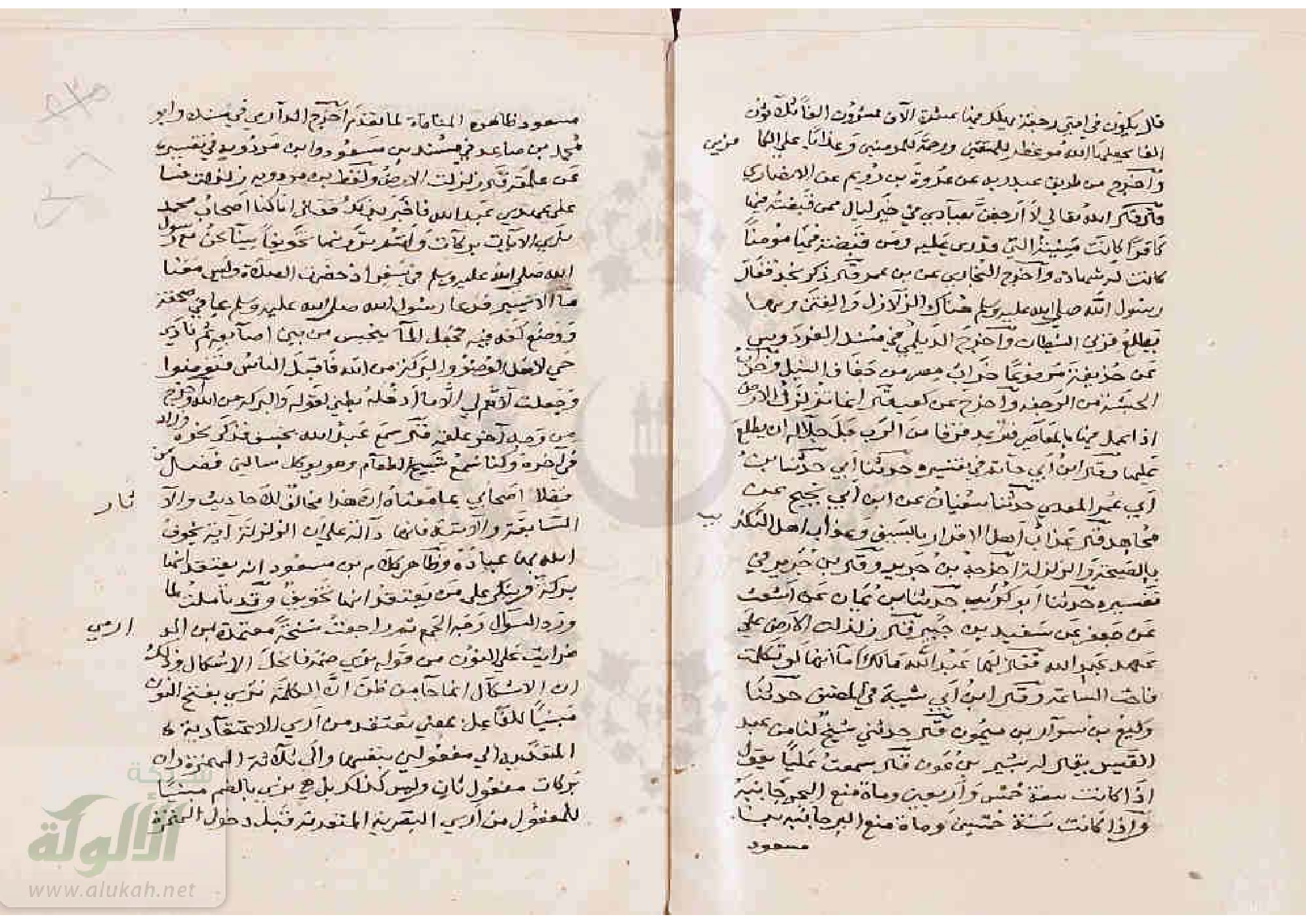
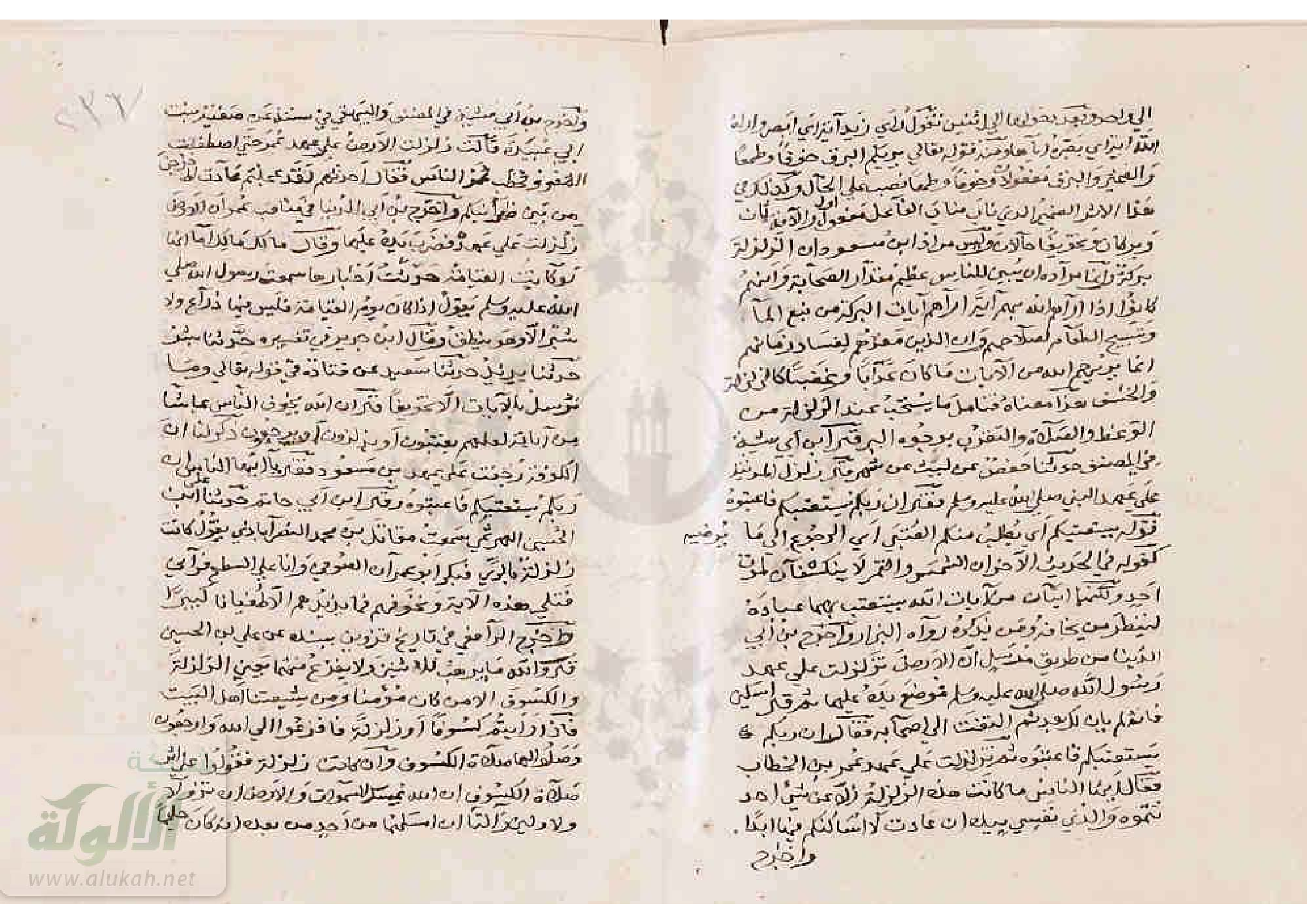
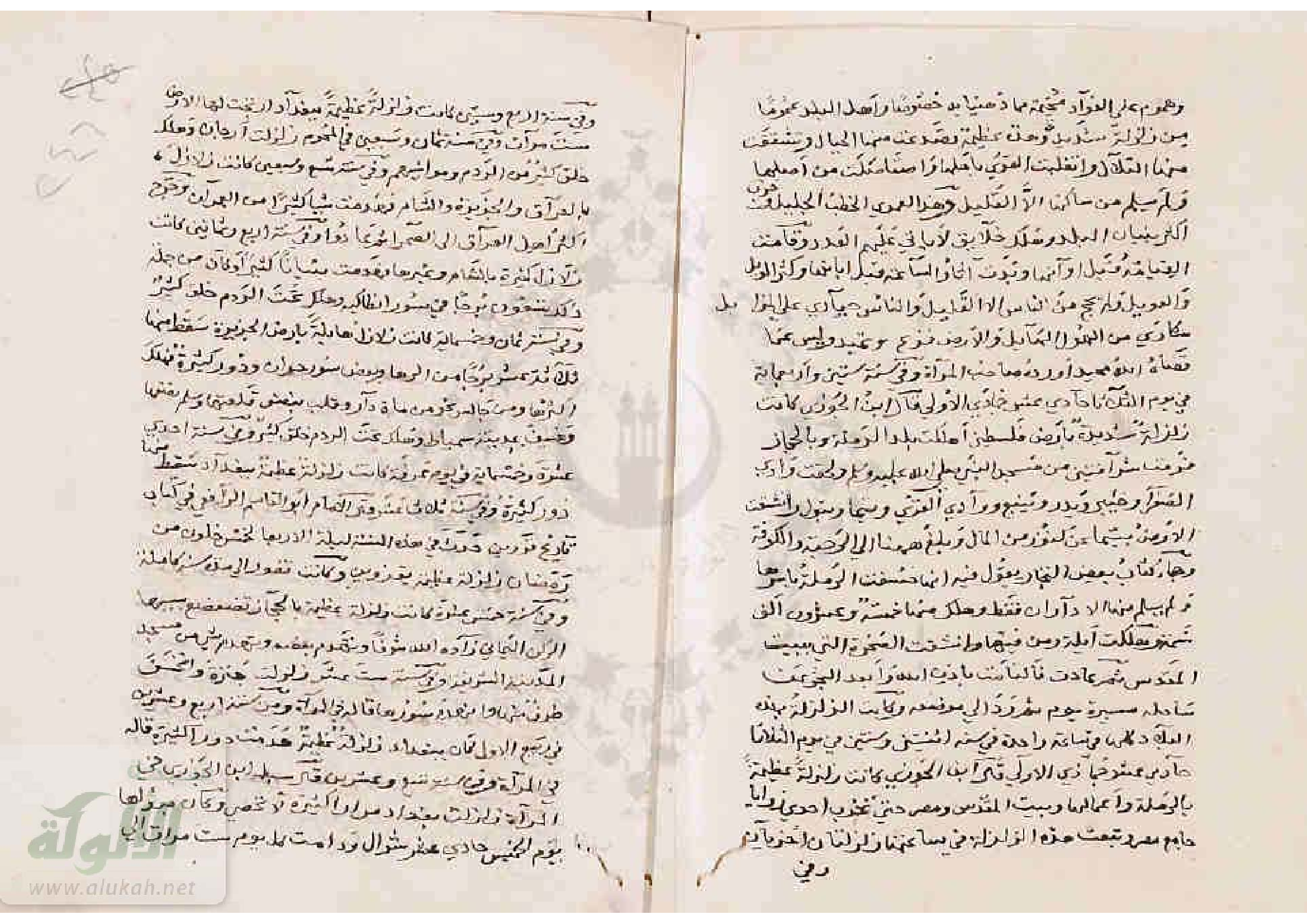
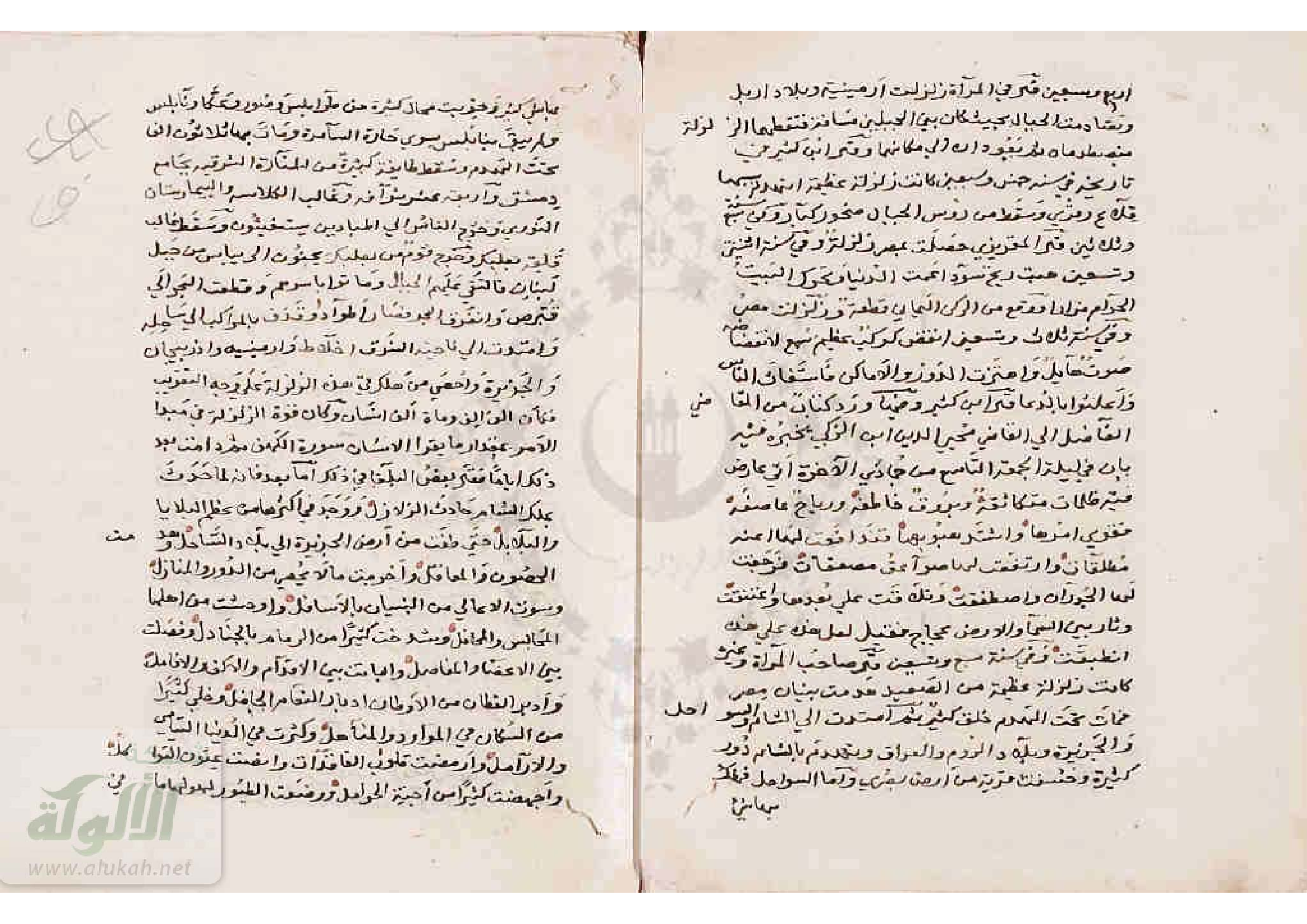
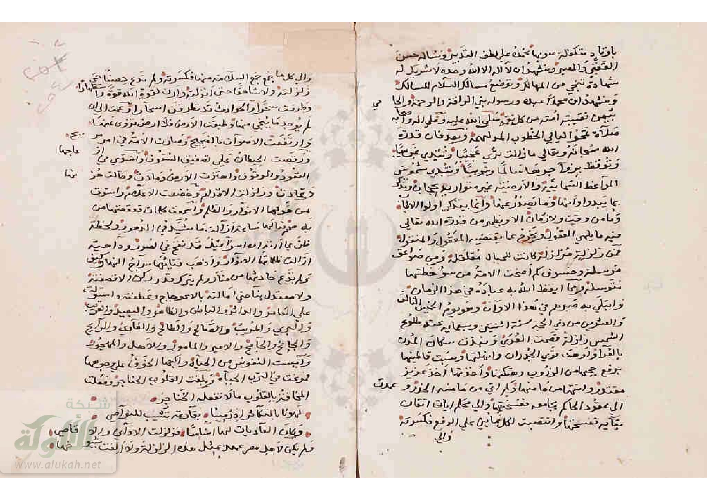
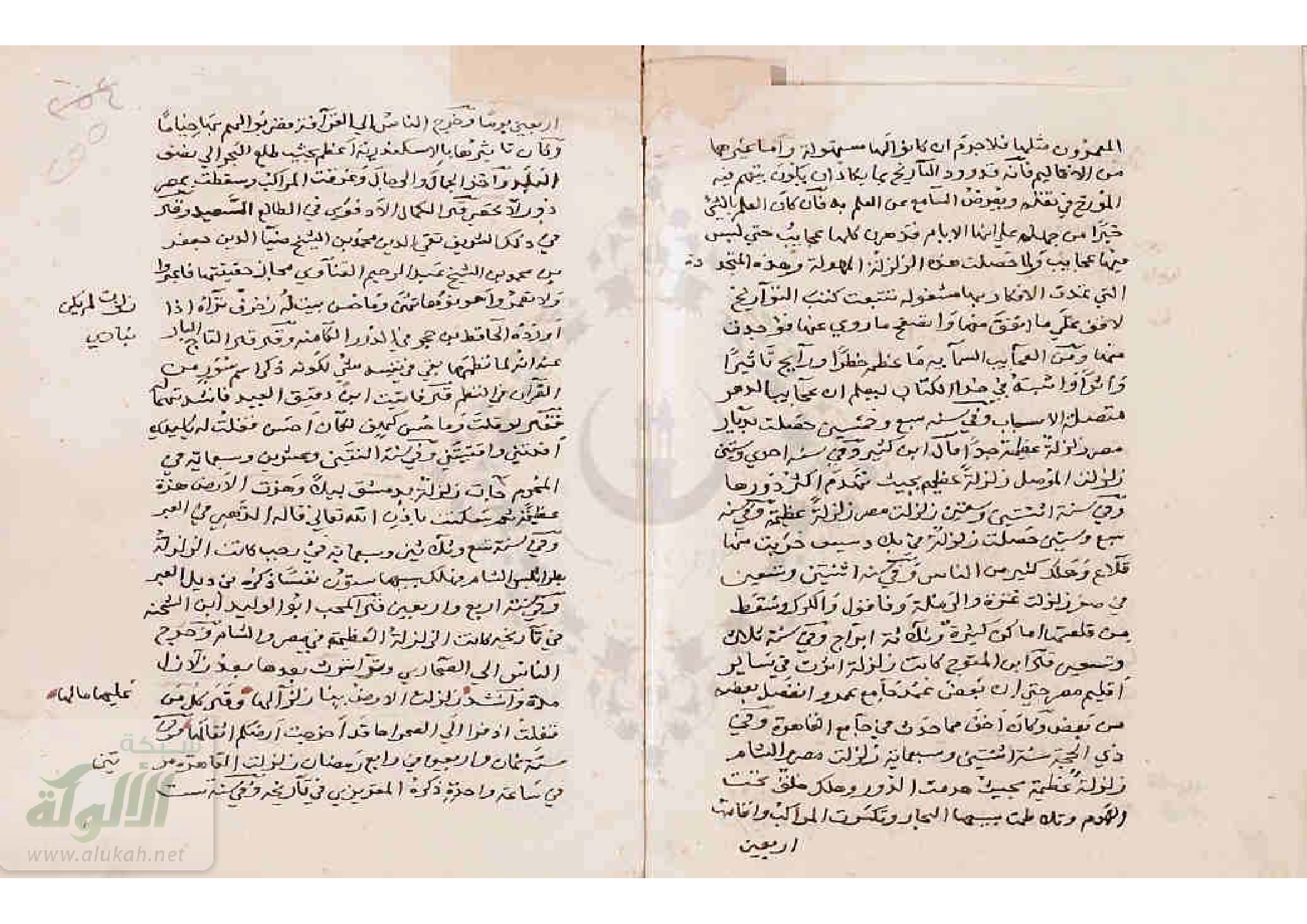
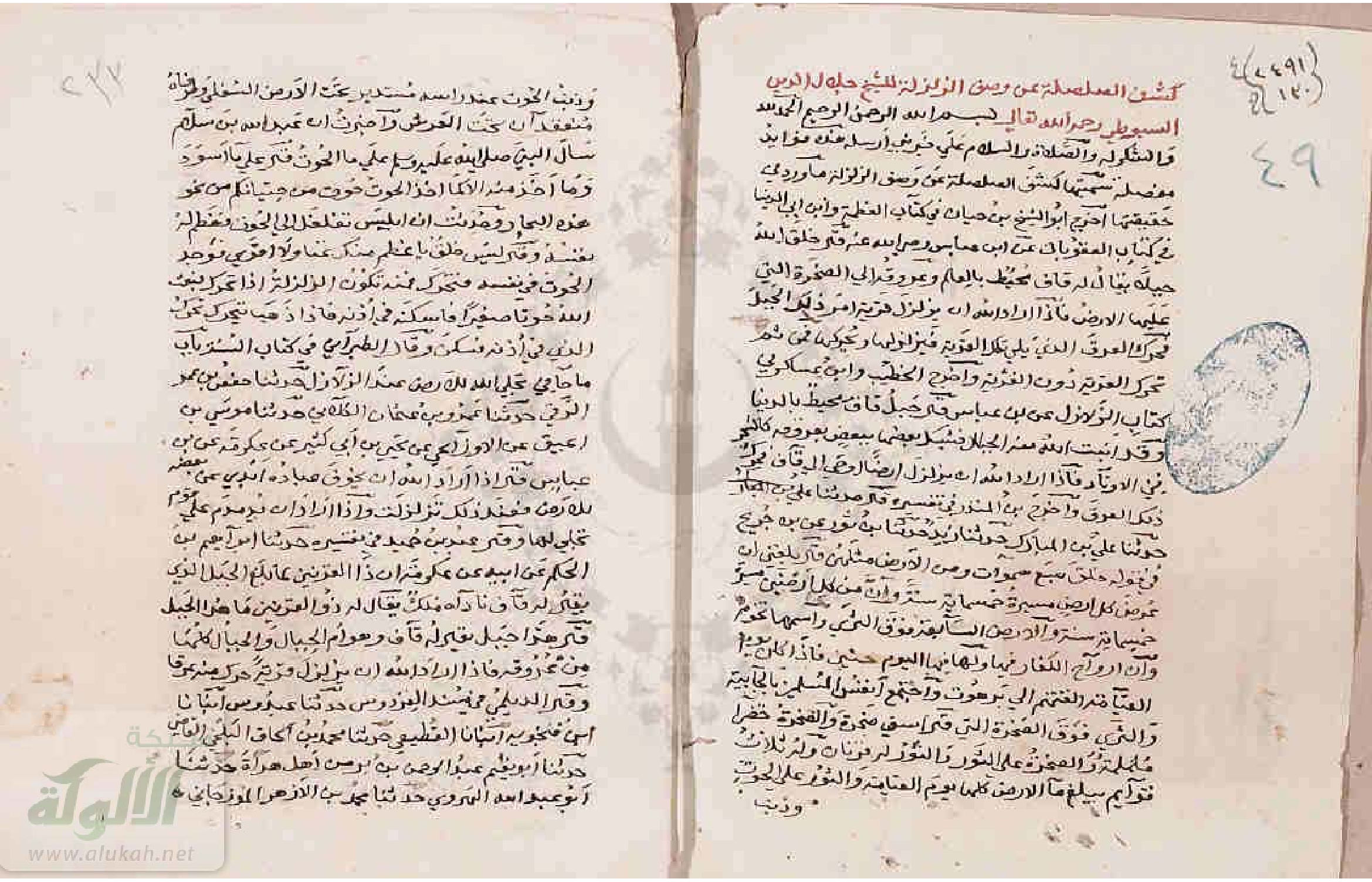
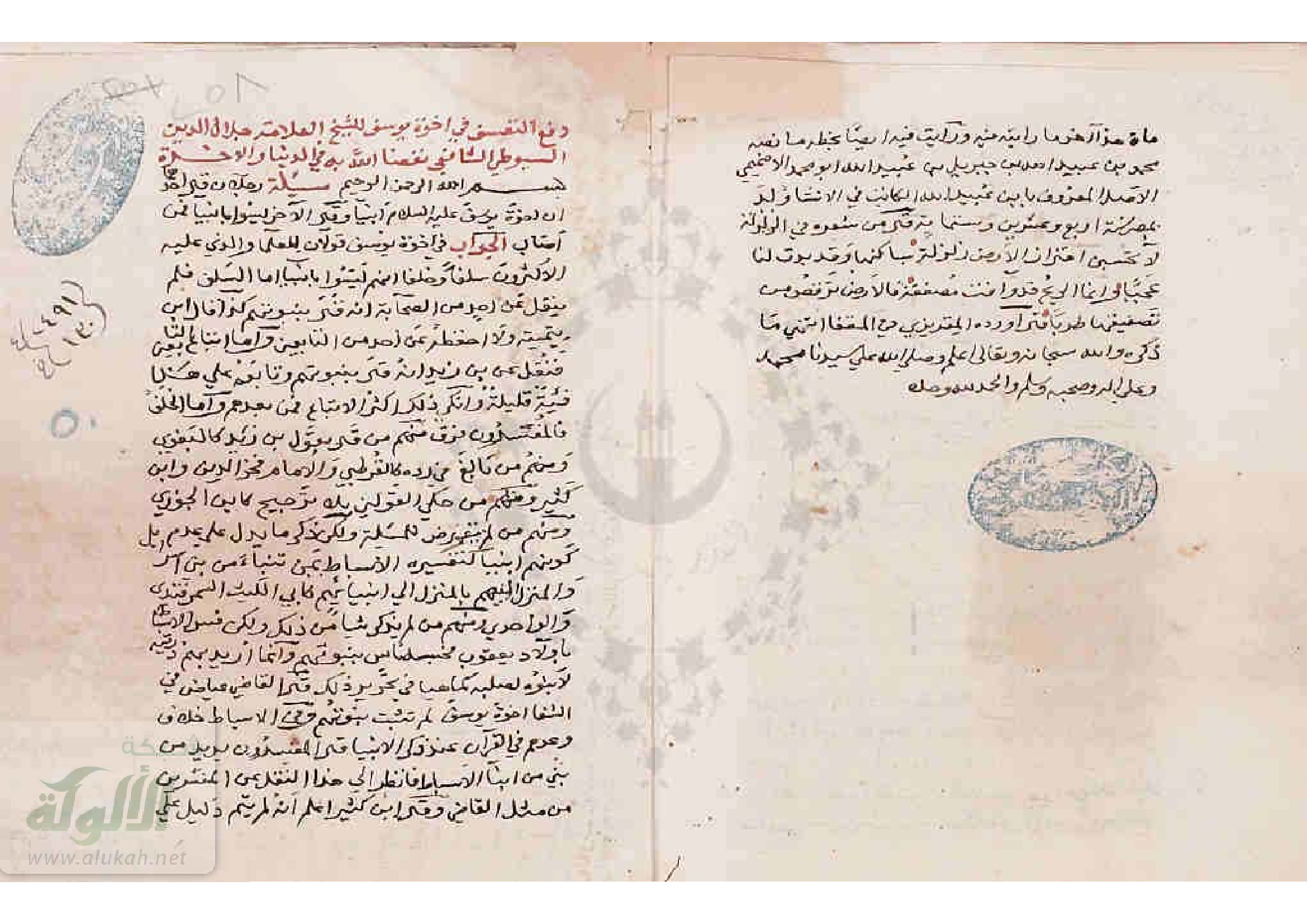
    An Original Manuscript - Arabic

    • The Noor book courtesy of Najib Abou Karaki (personal correspondence, 2022)



    Chronology
    Date Reference Corrections Notes
    Dawn on Thursday 24 November 947 CE at dawn on Thursday 11 Rabi’ II in the year A.H. 233 none
    • Calculated using CHRONOS
    • Day of week (Thursday) matches Date (11 Rabi’ II A.H. 233)
    Seismic Effects Locations Sources
    Sources - al-Suyuti

    Notes and Further Reading
    References - al-Suyuti

    References - Ibn 'Asakir

    Fragments of Gold in the Accounts of Those Who Have Departed by Ibn al-Imad

    Shadharat al-dhahab fi akhbar man dhahab by إبن العماد

    Aliases

    Aliases Arabic
    Ibn al-ʿImād إبن العماد
    ʿAbd al-Ḥayy bin Aḥmad bin Muḥammad ibn al-ʿImād al-ʿAkarī al-Ḥanbalī Abū al-Falāḥ عبد الحي بن أحمد بن محمد ابن العماد العكري الحنبلي أبو الفلاح
    Background and Biography
    Background and Biography

    Excerpts
    English from Sbeinati et al. (2005)

    An earthquake caused heavy shaking in Damascus since morning for 3 hours, destroying houses and displacing huge stones and breaking many windows of Souks and killing many people under debris. Many terraces of Ommyad Mosque the Great fell down, a quarter of its minaret fell down. A village in Al-Ghoutah was overturned on its inhabitants unless one person survived. It was strong at Antioch and Al-Mousel where more than 2000 houses collapsed over their residents and 20000 victims. (Ibn Al-Imad)

    English machine translated from Arabic

    A.H. 233

    Damascus shook violently from the rising of the forenoon, that is, for three hours, as he said in “Al-Ibr” [1]. Then the houses collapsed from it and the great stones were removed, and several streams of rain fell from the markets on those in it, killing many people. Some of the balconies of the mosque, a quarter of its minaret was cut off, a village of Ghouta collapsed on its people, and only one man survived. The earthquakes intensified in Antioch and Mosul, and more than two thousand houses fell on its people, killing them, and twenty thousand of its people died, and more than two hundred orchards were lost. A palm tree has its roots, but no trace remains of it. I finish

    Chronology
    Date Reference Corrections Notes
    17 August 847 CE - 4 August 848 CE A.H. 233 none
    Seismic Effects Locations Online Versions and Further Reading
    References

    Notes
    Ambraseys (2009) terminology

    As he is sometimes wont to do, Ambraseys (2009) refers to Ibn al-Imad by a less common variant of his name - Ibn al-Hanbali.

    Archaeoseismic Evidence

    Location (with hotlink) Status Intensity Notes
    Jerash - Introduction n/a n/a n/a
    Jerash - Umayyad Congregational Mosque possible ≥ 8
    Latter half of the 9th -10th (perhaps early 10th) century CE Earthquake

    Rattenborg and Blanke (2017:19-21) report the following:

    The later phase of occupation in the domestic complexes, bracketed between 800-900, saw the addition of steps in several outer doorways to prevent refuse and accumulated soil on exterior surfaces from slipping into living quarters. This corroborates the long period of usage inferable from architectural alterations. Occupation was punctuated by another round of structural collapse, which is associated with the abandonment of two rooms in the northern wing of Building B and with the collapse and subsequent infilling of the subsurface compartment around the cistern shaft in the courtyard of the same structure. Finds of discarded fragments of reduction-fired roof tiles in subsurface packing of the latest phase of domestic occupation in Area GO can be associated with identical material retrieved from underneath a substantial wall collapse in the laneway between the mosque west wall and Building A, and suggest that the dwellings in Area GO may have had tiled roofs. These strata likely relate to the same event that marked the termination of the penultimate phase of the congregational mosque.

    Given the prolonged usage of the Area GO housing units and the nature of the subsequent collapse, this event should be dated to the latter half of the 9th century at the earliest, perhaps corresponding with the collapse of the residential units on the hilltop (Blanke forthcoming). Associated structural collapse, outside the mosque qibla wall and within and around the domestic complexes to the east, is less imposing than the mid-8th century collapse layers, but a number of potentially significant earthquakes in the area are known from the late 9th and 10th centuries (see Ghawanmeh 1992: p. 56 Table I; Sbeinati et al. 2005: pp. 365-367 and Table II; also el-Isa 1985: pp. 232-233 and Table 1 JW: I suggest cross-checking catalogues of Ambraseys, 2009, Guidoboni and Comastri, 2005, and this one). Pottery finds from paved floors of GO Phase 3/II in Building A provides a good range of material characteristic of a late 8th — 9th century date with painted red terracotta and cream and pale orange wares well represented, accentuating the changing horizons of Early Islamic material culture (Walmsley 1995: 668; 2001b: 310). A nearly complete decorated Cream Ware jug was retrieved from below wall collapse overlying a paved floor in the eastern part of Building A. Comparable material is available from the Abbasid housings further north (Gawlikowski 1986: Plates XII-XIII; also Gawlikowski 1995), and finds further parallels e.g. in the assemblage from Area Z at Umm Qais (Gadara) (el-Khouri and Omoush 2015: 17-20).
    Rattenborg and Blanke (2017:24) add:
    Following another round of structural collapse in the late 9th or early 10th century, the mosque was rebuilt to house a much more modest congregation, utilising only the westernmost third of the prayer hall, and leaving the spacious courtyard in a dilapidated state. Wall collapse clogged the laneway along the northwest perimeter wall of the mosque courtyard, blocking access from the main westward street, and was, apparently, never removed. Curiously enough, this collapse layer was not found in the passageway between the mosque's western entrance and its southwest corner, suggesting that access to the prayer hall from the residential units was maintained for a longer span of time.
    Based on the above, it appears that the collapse layer described (below) but not dated by Barnes et al (2006:295) fell during the 9th or 10th centuries CE.
    The Qiblat Hall (IRS)

    ...

    So far over five tonnes of roof tile pieces have been found within the qiblat hall. The oblong plan of the hall, with its qiblat wall, the double colonnade and the row of entrance piers, suggests a long triple-gabled roof covered the qiblat hall. The tile fragments have mostly been recovered from a thick dark layer that is largely uniform throughout the qiblat hall. No complete roofing tiles have been found, probably because any roof tiles that had not smashed were taken for reuse elsewhere after the initial collapse of the roof. Other salvageable building materials were also taken and only a few small areas of the paved floor remain. Post-collapse salvaging activity would explain the disturbance of the collapse layer.

    There is a great deal of stone tumble lying outside the mosque walls from the collapse of the qiblat hall. Much less stone is found inside the hall, which shows that the walls fell outwards, pushed by the force of the heavy roof. The pattern of the fallen outer walls, the uniformity of the collapse layer and abundance of roof tile fragments indicate that the roof and some of the mosque walls collapsed in one event. Barnes et al (2006:295)
    Rattenborg and Blanke (2017:29) noted that the available archaeological record of the 9th-11th centuries is notoriously meagre and marred by a dissatisfying degree of chronological control.

    Jerash - Southwest Hill (Late Antique Jarash Project) possible ≥ 8
    Latter half of the 9th -10th (perhaps early 10th) century CE Earthquake

    Rattenborg and Blanke (2017:19-21) report arcaheoseismic evidence as follows:

    On the southwest hill, excavations conducted by the Late Antique Jarash Project (LAW) exposed a storeroom located in the southern part of a residential building and opening onto a courtyard. The stone-built walls were placed directly on bedrock with a floor comprised by hard-packed yellow clay. The installation of piers along the north and south walls as well as the recovery of arch-stones shows that the roof was vaulted and covered in the same yellow clay that was also used for the walls. The building collapsed in a single violent event — an earthquake — causing the structure to be abandoned.

    A deposit associated with the final use of the building and sealed by collapse, contained ceramic vessels associated with cooking and the storage of food. The ceramic assemblage comprised roughly 1,000 sherds amounting to 22 nearly intact vessels with only a few sherds from other pots. Of the 22 vessels, nine were larger pithoi-style storage containers, while the remaining 13 comprised smaller storage jars, cooking pots and a few examples of fine wares (Pappalardo forthcoming). Several vessels can confidently be dated to the Abbasid period. Most striking are sherds from three vessels that were produced in a hard black fabric with a polished surface, which are comparable to sherds found in Abbasid layers near the congregational mosque in the centre of town. A black beaker is distinctively Abbasid in its form and is comparable in shape to vessels found in e.g. Pella and Jerusalem and dating to the late 8th or 9th centuries. The fabric matches a rare ceramic specimen from Nabratein of the same early Abbasid date (Magness 1994).
    Rattenborg and Blanke (2017:29) noted that the available archaeological record of the 9th-11th centuries is notoriously meagre and marred by a dissatisfying degree of chronological control.

    Baalbek No archaeoseismic evidence has been reported that I know of.
    Damascus No archaeoseismic evidence has been reported that I know of.
    Reṣafa possible Al Khabour (2016) notes that the Basilica of St. Sergius (Basilica A) suffered earthquake destructions but did not supply dates. The apse displays fractures that appear to be a result of earthquakes or differential subsidence . Sack et al (2010:307) reported that from the building of the church [Basilica A first built in the 5th century CE] up to the abandonment of the city in the 13th century, earthquakes and the building ground weakened by underground dolines [aka sinkholes] have caused considerable damage.
    Location (with hotlink) Status Intensity Notes
    Jerash - Introduction


    Jerash - Umayyad Congregational Mosque


    Jerash - Southwest Hill (Late Antique Jarash Project)


    Baalbek


    Damascus


    Reṣafa


    Tsunamogenic Evidence

    Paleoseismic Evidence

    Location (with hotlink) Status Intensity Notes
    Kazzab Trench possible ≥ 7 Daeron et al (2007) dated Event ?S2 to 405-945 CE and Event S1 to 926-1381 CE.
    Jarmaq Trench possible ≥ 7 Nemer and Meghraoui (2006) date Event Z to after 84-239 CE. They suggested the Safed Earthquake of 1837 CE as the most likely candidate.
    Jordan Valley - Tell Saidiyeh and Ghor Kabed Trenches possible ≥ 7 Ferry et al (2011) detected 12 surface rupturing seismic events in 4 trenches (T1-T4) in Tell Saidiyeh and Ghor Kabed; 10 of which were prehistoric. The tightest chronology came from the Ghor Kabed trenches (T1 and T2) where Events Y and Z were constrained to between 560 and 1800 CE.
    Dead Sea - Seismite Types n/a n/a n/a
    Dead Sea - En Feshka probable 5.8-7.5 (104 cm)
    5.7-7.1 (110.5 cm)
    8.0-8.8 (113 cm)
    7.9-8.8 (125 cm))
    8.0-8.8 (126.5 cm.)
    Kagan et. al. (2011) identified several seismites from around this time and suggested that a 3cm. thick Type 4 seismite at a depth of 113 cm was created by the 847 CE Damascus Quake or a local earthquake.
    Depth (cm.) Thickness (cm.) Seismite Type Modeled Age (± 1σ) Modeled Age (± 2σ) Quake Assignment (Kagan) Quake Assignment (Williams)
    104 6 1 912 CE ± 27 894 CE ± 61 873 A.D., Local Source not assigned
    110.5 1.5 Questionable 887 CE ± 28 864 CE ± 63 859 A.D., Local Source not assigned
    113 3 4 877 CE ± 28 852 CE ± 64 847 A.D., Local Source not assigned
    125 1 4 831 CE ± 30 802 CE ± 69 757 A.D. not assigned
    126.5 2.5 4 826 CE ± 31 797 CE ± 68 748 ± 1 A.D. (Sabbatical Year Quakes) not assigned
    Dead Sea - En Gedi possible 5.6 - 7.0 Migowski et. al. (2004) assigned a 859 CE date to a 0.8 cm. thick linear wave (Type 1) seismite at a depth of 169.8 cm (1.698 m)
    Dead Sea - Nahal Ze 'elim unlikely 8.0-8.8 At site ZA-2, Kagan et. al. (2011) identified one seismite which fits within a time window that encompasses 847 CE although it appears more likely to have been the result of one of the mid 8th century CE earthquakes associated with the Sabbatical Year Earthquakes.
    Depth (cm.) Thickness (cm.) Seismite Type Modeled Age (± 1σ) Modeled Age (± 2σ) Quake Assignment (Kagan) Quake Assignment (Williams)
    242 2 4 774 CE ± 75 771 CE ± 89 748 CE ± 1 Holy Desert Quake of the Sabbatical Year Quake sequence (749 CE) or Event E4 or E5 of Klinger et al. (2015)
    Location (with hotlink) Status Intensity Notes
    Kazzab Trench

    Daeron et al (2007) dated Event ?S2 to 405-945 CE and Event S1 to 926-1381 CE.

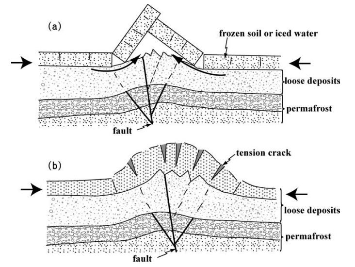
    Fig. 7. - Sketches showing the sections of (a) angular-ridge type and
    (b) bulge-type mole tracks. Both types of mole tracks were produced by
    horizontal compression (indicated by short arrows). The angular-ridge
    type mole track was produced by flexural slip folding and faulting of
    the top rigid layer. The bulge-type mole track formed mainly by folding
    and shortening of the unconsolidated to weakly consolidated alluvial
    deposits. - Lin et al (2004)


    Jarmaq Trench

    Nemer and Meghraoui (2006) date Event Z to after 84-239 CE. They suggested the Safed Earthquake of 1837 CE as the most likely candidate.


    Tell Saidiyeh and Ghor Kabed Trenches

    Ferry et al (2011) detected 12 surface rupturing seismic events in 4 trenches (T1-T4) in Tell Saidiyeh and Ghor Kabed; 10 of which were prehistoric. The tightest chronology came from the Ghor Kabed trenches (T1 and T2) where Events Y and Z were constrained to between 560 and 1800 CE.

    Note: Although Ferry et al (2011) combined archaeoseismic interpretations, their paleoseismic evidence, and entries from earthquake catalogs to produce earthquake dates and some overly optimistic probabilities, only the paleoseismic data is presented here. Ferry et al (2011)'s archaeoseismic data was researched and is treated separately.


    Dead Sea - Seismite Types


    Dead Sea - En Feshka

    Kagan et. al. (2011) identified several seismites from around this time and suggested that a 3cm. thick Type 4 seismite at a depth of 113 cm was created by the 847 CE Damascus Quake or a local earthquake.

    Depth (cm.) Thickness (cm.) Seismite Type Modeled Age (± 1σ) Modeled Age (± 2σ) Quake Assignment (Kagan) Quake Assignment (Williams)
    104 6 1 912 CE ± 27 894 CE ± 61 873 A.D., Local Source not assigned
    110.5 1.5 Questionable 887 CE ± 28 864 CE ± 63 859 A.D., Local Source not assigned
    113 3 4 877 CE ± 28 852 CE ± 64 847 A.D., Local Source not assigned
    125 1 4 831 CE ± 30 802 CE ± 69 757 A.D. not assigned
    126.5 2.5 4 826 CE ± 31 797 CE ± 68 748 ± 1 A.D. (Sabbatical Year Quakes) not assigned


    Dead Sea - En Gedi

    Migowski et. al. (2004) assigned a 859 CE date to a 0.8 cm. thick linear wave (Type 1) seismite at a depth of 169.8 cm (1.698 m).


    Dead Sea - Nahal Ze 'elim

    At site ZA-2, Kagan et. al. (2011) identified one seismite which fits within a time window that encompasses 847 CE although it appears more likely to have been the result of one of the mid 8th century CE earthquakes associated with the Sabbatical Year Earthquakes.

    Depth (cm.) Thickness (cm.) Seismite Type Modeled Age (± 1σ) Modeled Age (± 2σ) Quake Assignment (Kagan) Quake Assignment (Williams)
    242 2 4 774 CE ± 75 771 CE ± 89 748 CE ± 1 Holy Desert Quake of the Sabbatical Year Quake sequence (749 CE) or Event E4 or E5 of Klinger et al. (2015)


    Notes

    Ambraseys (2009)

    AD 846 Mosul

    AD 846 Mosul

    On Thursday, 11 Rabi II 233 A.H. (24 November 847) there was a destructive earthquake in the region of Damascus. The shocks lasted from early morning until midday and caused considerable damage and loss of life.

    During the period AD 846–847 frequent earthquakes affected the Middle East, in particular Mosul and al Jazira, Antioch and the Awasim, and Syria.

    It is said that in Mosul and in al-Jazira, that is, the region between the Euphrates and Tigris rivers, in north ern Iraq and Syria, 2000 houses collapsed, 20000–50000 people were killed and 200 palm trees were uprooted.

    It is rather odd that for such a destructive earthquake no urban centre is mentioned by name to have suffered any damage. It is likely that these grossly exaggerated casualty figures are wholly fictitious, representing a global estimate of the total losses caused by all three earthquakes during that period.

    This earthquake seems to have been confused in many sources with the events that followed shortly after wards in Antioch and Damascus, and near-contemporary sources mention this event as part of the other earthquake in 232 A.H. (28 August 846 to 16 August 847; al Bakri, al-khamis.ii.338).

    Guidoboni et al. (1994, 378–379) syncretise all three earthquakes during the period in the regions of al-Jazira, al-Wasim and Damascus–Homs, which are 600 and 300 km apart, into one earthquake, which they date to 24 November 847.

    Notes

    ‘In 232 there were numerous earthquakes all over the world, notably in the Maghrib and in Sham; the walls of Damascus and Hims were destroyed. The most violent earthquakes occurred at Antioch andal-’Awasim; al-Jazirah was destroyed, as was Mosul. This intense seismic activity lasted for several days.’ (Ibn al-Jauzi, K116 (al-Suyuti 28/11)).
    ‘(A.H. 230) One day in the afternoon Damascus was shaken severely. The buildings were destroyed and large stones were scattered all over; many roofs collapsed, killing a great number of people. A number of the parapets of the mosque fell and one quarter of the tower was cut off. A village in the Ghuta area was destroyed, and all the people in it with the exception of one man were killed.
    Strong earthquakes hit Antiochia and Mosul, bringing down more than 2000 houses over the heads of their inhabitants, killing them all. 20000 were killed in Mosul. In an orchard, more than 200 palm trees disappeared with their trunks.’ (Ibn al-Jauzi, Seth. 83b).
    ‘In 233 a terrible earthquake occurred at Damascus which destroyed many houses, thereby killing many people. The earthquake reached Antioch, which it destroyed, and al-Jazirah, which was ruined. It also affected Mosul, where as a result 50000 of the inhabitants lost their lives: this is mentioned in adh Dhahabi’s Tarikh. And the author of al-Mirat [Ibn al-Jauzi] says... [see above]’ (al-Suyuti 27/11).
    ‘(A.H. 233) There was a great earthquake in Damascus, lasting three hours. Walls fell down and the people fled to the musallah to pray to God. Many creatures perished beneath the ruins. The earthquake extended to Antioch, where 20000 peo ple perished beneath the ruins. And it extended also to Mosul, which was shaken, and 50000 people died.’ (al-’Umari Al-athar, f. 23v–f. 29r)

    References

    Ambraseys, N. N. (2009). Earthquakes in the Mediterranean and Middle East: a multidisciplinary study of seismicity up to 1900.

    AD 847 Awasim

    AD 847 Awasim

    In the same year (233 A.H.), after 17 August, another earthquake caused extensive damage and considerable loss of life over a large area that affected the district of al-Awasim, in Balis, and Membij in Antioch.

    Details about this event are lacking. Al-Suyuti himself, who gives his description of this earthquake before quoting Ibn al-Jauzi, who dates the event to a.H. 233 (17 August 847 to 4 August 848), includes Damas cus, al-Jazirah and Mosul, which seems to be based on an account in the Tarikh of al-Dhahabi (1274–1348/52).

    Notes

    See the notes for the previous entry above as well as Ajami (viii. 11a/7).

    References

    Ambraseys, N. N. (2009). Earthquakes in the Mediterranean and Middle East: a multidisciplinary study of seismicity up to 1900.

    AD 847 Nov 24 Damascus, Homs

    AD 847 Nov 24 Damascus, Homs

    On Thursday, 11 Rabi II 233 A.H. (24 November 847) there was a destructive earthquake in the region of Damascus. The shocks lasted from early morning until midday and caused considerable damage and loss of life.

    In Damascus buildings were ruined with some loss of life. Parapets fell off the al-’Amr mosque.

    Allegedly the nearby plain of al-Ghuta was destroyed with no survivors. Also Darya, al-Mazza and Bayt Lahya in the district of Damascus were destroyed. Dams and irrigation canals in the al-Ghuta district were ruined. Damage extended to Homs, where the walls of the town collapsed.

    With the exception of a relatively late chronicler (al-Suyuti), all the other sources (see the notes for the previous two entries) syncretise this earthquake with the Mesopotamian and al-Wasim earthquakes.

    Notes

    ‘In A.H. 233, a very violent earthquake occurred; al-Hafidh ’ibn ‘Asakir mentions it in the Book of Earthquakes, and he says: “Damascus was shaken by an earthquake at dawn on Thursday 11 Rabi’ II in the year 233; a quarter of the mosque [Ommayad?] was torn open, its great stone blocks were thrown down, and the minaret collapsed. The bridges and houses collapsed, and the earthquake traversed al-Ghut’ah; it destroyed Darayyah, al Mazza, Bait Lihyah and others. People went to the musallah where they prayed until midday. Then everything calmed down. The earthquake reached Antioch.’ (al-Suyuti Kashf 25, 26).


    ‘(A.H. 231) An earthquake took place in Hara and many buildings collapsed.’ (Ibn al-Jauzi, K116, Seth. 83b).

    References

    Ambraseys, N. N. (2009). Earthquakes in the Mediterranean and Middle East: a multidisciplinary study of seismicity up to 1900.

    AD 850 Antioch

    AD 850 Antioch

    A strong earthquake in Antioch in 235 A.H. (26 July 849 to 14 July 850; Al-Tabbakh, A’lam, i. 201).

    References

    Ambraseys, N. N. (2009). Earthquakes in the Mediterranean and Middle East: a multidisciplinary study of seismicity up to 1900.

    Guidoboni et al (1994)

    (264) 24 November 847

    • Antioch
    • Bayt Lahya
    • Damascus
    • Darayya, al-Ghouta, Mawsil
    • al-Mazzah
    • sources 1 al-Dhahabi, al-Ibar 1.413
    • sources 2 al-Suyuti, Kashf 25-6
    • literature Taher (1979)
    • catalogues Sieberg (1932 a); Ben-Menahem (1979); Poirier and Taher (1980)
    According to al-Dhahabi a violent earthquake struck Damascus and Antioch, causing serious damage and many deaths:
    In that year [233 of the Hegira = 17 August 847 4 August 848 AD ] there was a dreadful earthquake at Damascus. It lasted for three hours, causing the walls to collapse. People ran to the mosques to invoke God's mercy, and many of them died in the ruins. The earthquake reached Antioch, and it was said that 20,000 people died there. Then it reached Mawsil; it was claimed that 50,000 people died in the ruins.
    al-Suyuti repeats the information from al-Dhahabi and goes on to quote a passage from a work on earthquakes by al-Hafiz Ibn Asakir, in which this particular one is referred to. From all this we can deduce that the earthquake took place on 24 November 847 A.D.:
    There was a strong earthquake mentioned by al-Hdfiz Ibn Asakir, in [his] Kitab al-zalazil (Book of earthquakes):
    The earth shook in Damascus on Thursday morning, 11 rabi` II of the year 233 [24 November 847 A.D.]. A quarter of the mosque [the Ommiad Great Mosque] was broken off and its great stones were pulled apart. The minaret fell down; and bridges and houses collapsed. The earthquake reached al-Ghtita [al-Ghouta] and it destroyed Darayya, al-Mazzah, Bayt Lahya and other. People went to the mosques to pray till mid-day; then the world became calm again".
    References

    Guidoboni, E., et al. (1994). Catalogue of Ancient Earthquakes in the Mediterranean Area up to the 10th Century. Rome, Istituto nazionale di geofisica.

    Sbeinati et al (2005)

    〈056〉 847 November 24

    • Damascus: VII-VIII
    • Al-Ghouta: VII-VIII
    • Al-Mazzeh: VII
    • Beit Lahya: VII
    • Darayya: VII
    • Antioch: VI
    • Al-Mousel: V
    Sources
    In 253 A.H. Rabi’ II, it was a dreadful earthquake in Damascus which lasted for three hours, causing walls to fall down and people die under debris. It extended to Antioch killing 20000 as it was said, then to Al-Mousel where 50000 people were killed under debris as it was said. (Al-Dhahabi)
    In 253 A.H. 11 (847 A.D. November 25) there was a dreadful earthquake in Damascus where houses fell down and people died under debris. This earthquake extended to Antioch causing destruction, to Al-Jazira caus ing damage, and to Al-Mousel killing 50000 people as it was said. In his book Al-Zalazel (the earthquakes), Al-Hafez Ibn Asaker mentioned that there was an earthquake in Damascus on Thursday 11 Rab’ 253, destroying a quarter of the Ommyad Mosque the great, the minaret fell down and bridges and houses collapsed, this earthquake reached Al-Ghouta where Darayya, Al-Mazzeh, Bait Lahya and others were destroyed. (Al-Suyuti)
    New original Sources
    An earthquake caused heavy shaking in Damascus since morning for 3 h, destroying houses and displacing huge stones and breaking many windows of Souks and killing many people under debris. Many terraces of Ommyad Mosque the Great fell down, a quarter of its minaret fell down. A village in Al-Ghoutah was overturned on its inhabitants unless one person survived. It was strong at Antioch and Al-Mousel where more than 2000 houses collapsed over their residents and 20000 victims. (Ibn Al-Imad)
    Parametric catalogues
    • Plassard and Kogoj (1981) 847 November 24, I =V in Lebanon, this earthquake caused destruction in Damascus and damage in Homs (Al-Suyuti)
    • Ben-Menahem (1979): 847, Ml = 6.2, destruction in Lebanon (Plassard and Kogoj; Sieberg; Willis).
    Seismological compilations
    • Guidoboni et al. (1994): 847 November 24, Antioch, Bayt Lahya, Damascus IX≤I≤XI, Darayya, Al-Ghoutah, Al-Mousel and Al-Mazzah. A dreadful earthquake occurred at Damascus, causing the walls to collapse and people to die in the ruins, the earthquake reached Antioch and 20000 people died there and it reached Mawsel where 50000 people died in the ruins (Al-Dhahabi). The earthquake took place on 24 November 847, it was strong in Damascus, destroying a part of the Ommiad Great Mosque, the minaret fell down and bridges and houses collapsed, it reached Al-Ghouta, Darayya, Al-Mazzeh, Bayt Lahya and others were destroyed (Al-Suyuti).
    References

    Sbeinati, M. R., R. Darawcheh, and M. Monty (2005). "The historical earthquakes of Syria: An analysis of large and moderate earthquakes from 1365 B.C. to 1900 A.D.", Ann. Geophys. 48(3): 347-435.

    Taher (1996)

    232/847 : earthquakes are increasing around the world, particularly in Châm . The ramparts in Damascus and Homs are destroyed; the most violent earthquakes occur in Antioch and in the ` Awâsim . This intense seismic activity occurs for several days71.

    233/848 : Damascus is shaken by an earthquake at dawn on Thursday 11 Rabi “II; a quarter of the Umayyad mosque is ruined, the large stones are torn up and the minaret collapses; bridges and houses collapse. The seismic wave travels through the Ghûta , it destroys Dâreya , al-Mazza , Bayt Lihya and others; it reaches Antioch72.

    Footnotes

    71 Al-Suyûtî , op. cit ., 25; he cited another earthquake in the year 230 AH with the same details and events.

    72 Al-Dhahabi, al-`Mar, 1//413; al-Suyûtî , Kashf , 25, 26.

    References

    TAHER, M.A. (1996) "Les grandes zones sismiques du monde musul-mans a travers l'histoire. I. L'Orient musulman," Annales Islamologiques 30 (1996): 79-104. - open access

    Taher (1979)

    232 A.H./847 AD and 233 A.H./848 AD

    Earthquakes5 increased throughout the world, notably in Syria, the walls of Damascus and Homs were destroyed; the most violent earthquakes occurred in Antioch and al-'Awàçim. This intense seismic activity continued for several days. The author of Al-Mireât then says:

    In 233/848, a very violent earthquake1 occurred; al -H'âfidh'ibn 'Asakir mentioned it in "Kitâb az-zalazil (the book of earthquakes); he says again:
    Damascus was shaken by an earthquake at dawn on Thursday 11 Rabi' II and 233; a quarter of the mosque was torn to pieces, the large stones were uprooted and the minaret collapsed. Bridges and houses collapsed, the seismic wave traveled through al-Ghût'a; she destroyed Dârayyâ, al-Mazza, Bait Lihyâ and others. The people went to al-Muçallâ where they prayed until noon. Then everything calmed down. The seismic wave reached Antioch.
    Footnotes

    5 As Suyûti, Kashf, 25. He cited another earthquake in the year 230 AH with the same details - and events.

    1 As Suyûti, Kashf, 25, 26. according to Ib 'Asa kir; adh Dhahabi, al 'iber, 1/413.

    References

    Taher, M.A. (1979): Corpus des texts arabes relatifs aux tremblements de terre et autres catastrophes naturelles, de la conquete arabe au XII H/XVIII JC, Ph.D. Thesis (Univ. Paris), 337 pp.

    Paleoclimate - Droughts

    References