Tell Masos
 Tel Masos
click on image to explore this site on a new tab in govmap.gov.il
| Transliterated Name | Source | Name |
|---|---|---|
| Tel Masos | Hebrew | תל מסוס |
| Horma | Hebrew | חרמה |
| Tel Mashush | Arabic | تل مشوش |
| Khirbat al-Mashush | Arabic | خربة المشوش |
| Khirbat el Mashash | Arabic | خربة المشاش |
- Fig. 2 Location Map
from Kempinski (1978)
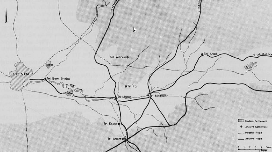 Figure 2
General Map of the Valley of Beer-sheba and its main transport routes
click on image to open in a new tab
Kempinski (1978)
- Fig. 2 Location Map
from Kempinski (1978)
Figure 2
General Map of the Valley of Beer-sheba and its main transport routes
click on image to open in a new tab
Kempinski (1978)
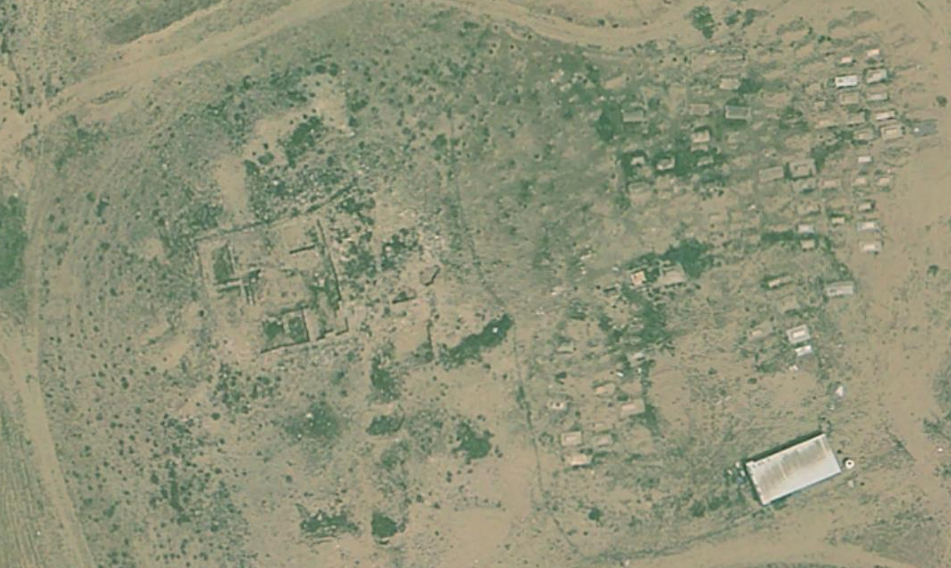
- Tel Masos in Google Earth
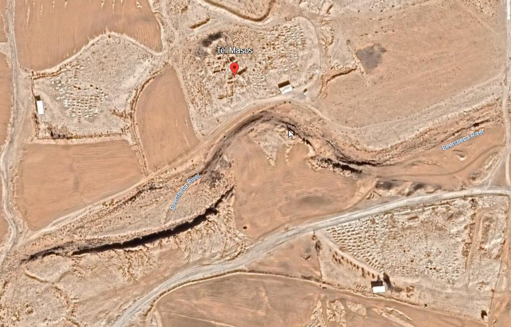 Tel Masos
click on image to explore this site on a new tab in Google Earth - Tel Masos on govmap.gov.il
Tel Masos
click on image to explore this site on a new tab in govmap.gov.il
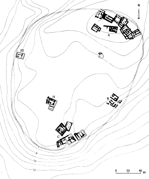
- Fig. 1 Site Plan
from Kempinski (1978)
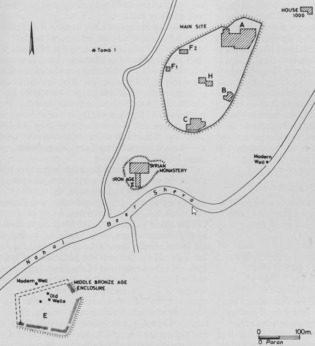 Figure 1
The Excavated AReas of Tel Masos
click on image to open in a new tab
Kempinski (1978) - Plan of Stratum II Settlement
plan from Stern et. al. (1993 v. 3)
 Plan of Stratum II Settlement
click on image to open in a new tab
Stern et. al. (1993 v. 3)
- Fig. 1 Site Plan
from Kempinski (1978)
Figure 1
The Excavated AReas of Tel Masos
click on image to open in a new tab
Kempinski (1978) - Plan of Stratum II Settlement
plan from Stern et. al. (1993 v. 3)
Plan of Stratum II Settlement
click on image to open in a new tab
Stern et. al. (1993 v. 3)
- Fig. 12 Area A. Stratum II
plan from Kempinski (1978)
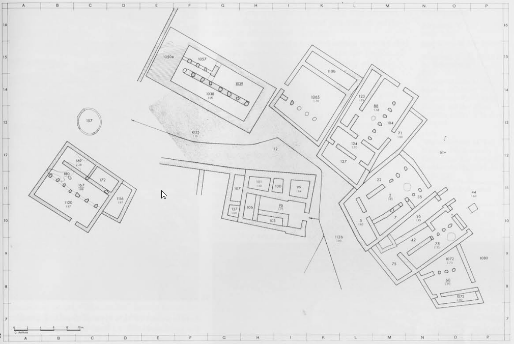 Figure 12
Area A. Stratum II: the peropheral chain of buildings
click on image to open in a new tab
Kempinski (1978)
- Fig. 12 Area A. Stratum II
plan from Kempinski (1978)
Figure 12
Area A. Stratum II: the peropheral chain of buildings
click on image to open in a new tab
Kempinski (1978)
- Fig. 11 Artists's reconstruction
of the settlement of Stratum II from Kempinski (1978)
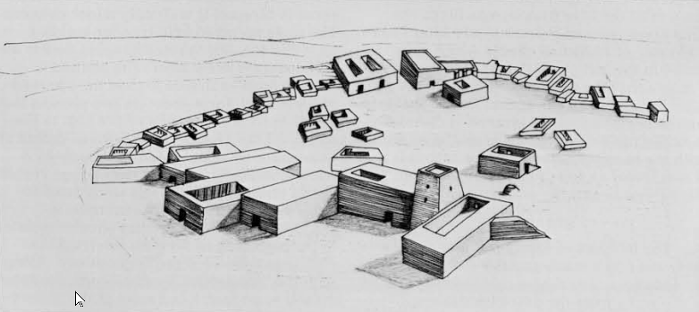 Figure 11
An artists's reconstruction of the settlement of Stratum II
click on image to open in a new tab
Kempinski (1978)
- Fig. 11 Artists's reconstruction
of the settlement of Stratum II from Kempinski (1978)
Figure 11
An artists's reconstruction of the settlement of Stratum II
click on image to open in a new tab
Kempinski (1978)
| Effect | Location | Image(s) | Description |
|---|---|---|---|
|
Area A
Plan of Stratum II Settlement
click on image to open in a new tab Stern et. al. (1993 v. 3)
Figure 12
Area A. Stratum II: the peropheral chain of buildings click on image to open in a new tab Kempinski (1978) |
|
|
|
Area C
Plan of Stratum II Settlement
click on image to open in a new tab Stern et. al. (1993 v. 3) |
|
|
|
Area H
Plan of Stratum II Settlement
click on image to open in a new tab Stern et. al. (1993 v. 3) |
|
|
|
Site-wide
Plan of Stratum II Settlement
click on image to open in a new tab Stern et. al. (1993 v. 3) |
|
- Earthquake Archeological Effects chart
of Rodríguez-Pascua et al (2013: 221-224)
 Earthquake Archeological Effects (EAE)
Rodríguez-Pascua et al (2013: 221-224)
| Effect | Location | Image(s) | Description | Intensity |
|---|---|---|---|---|
|
Area A
Plan of Stratum II Settlement
click on image to open in a new tab Stern et. al. (1993 v. 3)
Figure 12
Area A. Stratum II: the peropheral chain of buildings click on image to open in a new tab Kempinski (1978) |
|
|
|
|
Area C
Plan of Stratum II Settlement
click on image to open in a new tab Stern et. al. (1993 v. 3) |
|
|
|
|
Area H
Plan of Stratum II Settlement
click on image to open in a new tab Stern et. al. (1993 v. 3) |
|
|
|
|
Site-wide
Plan of Stratum II Settlement
click on image to open in a new tab Stern et. al. (1993 v. 3) |
|
|