Tel 'Eton
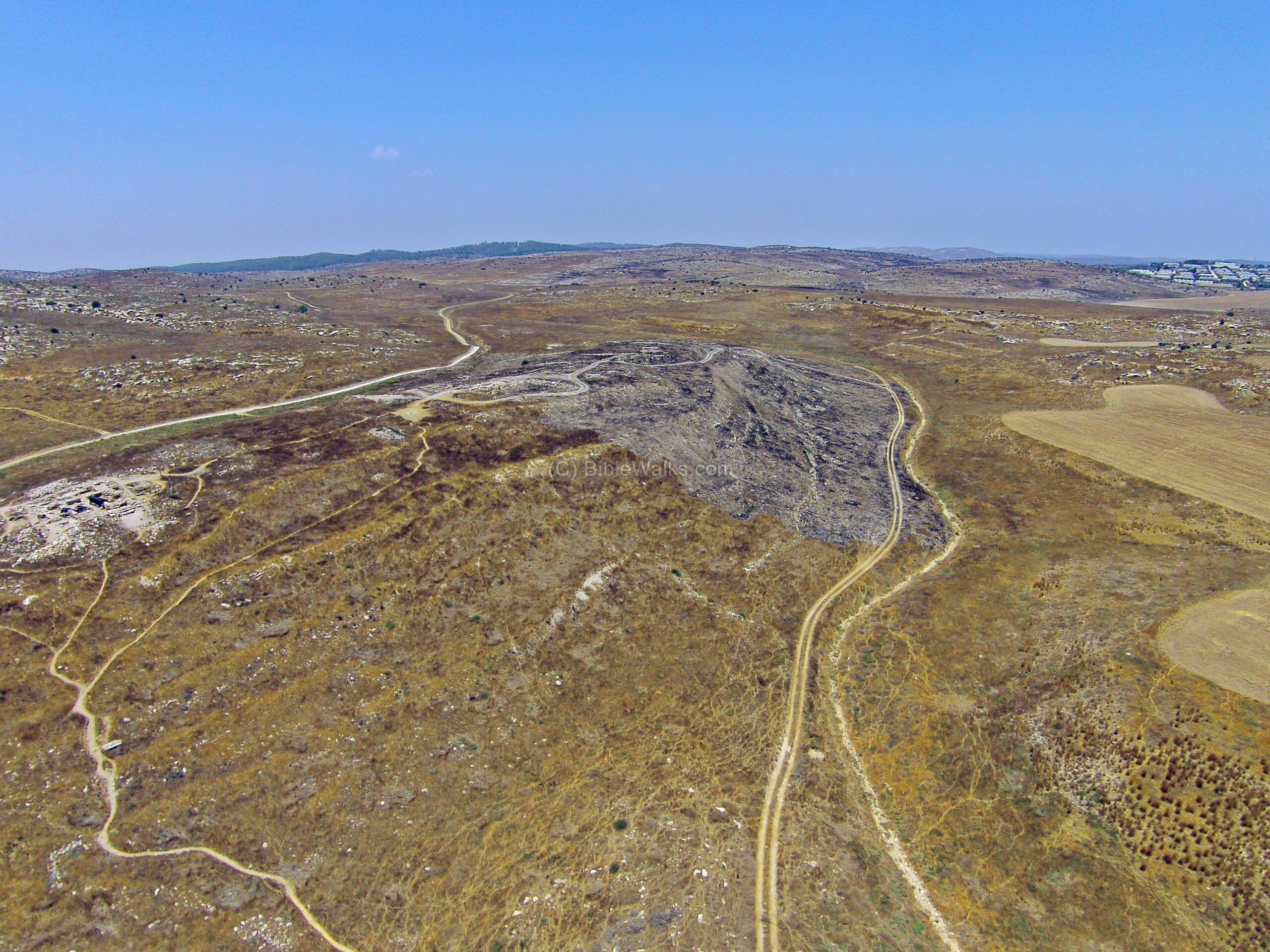
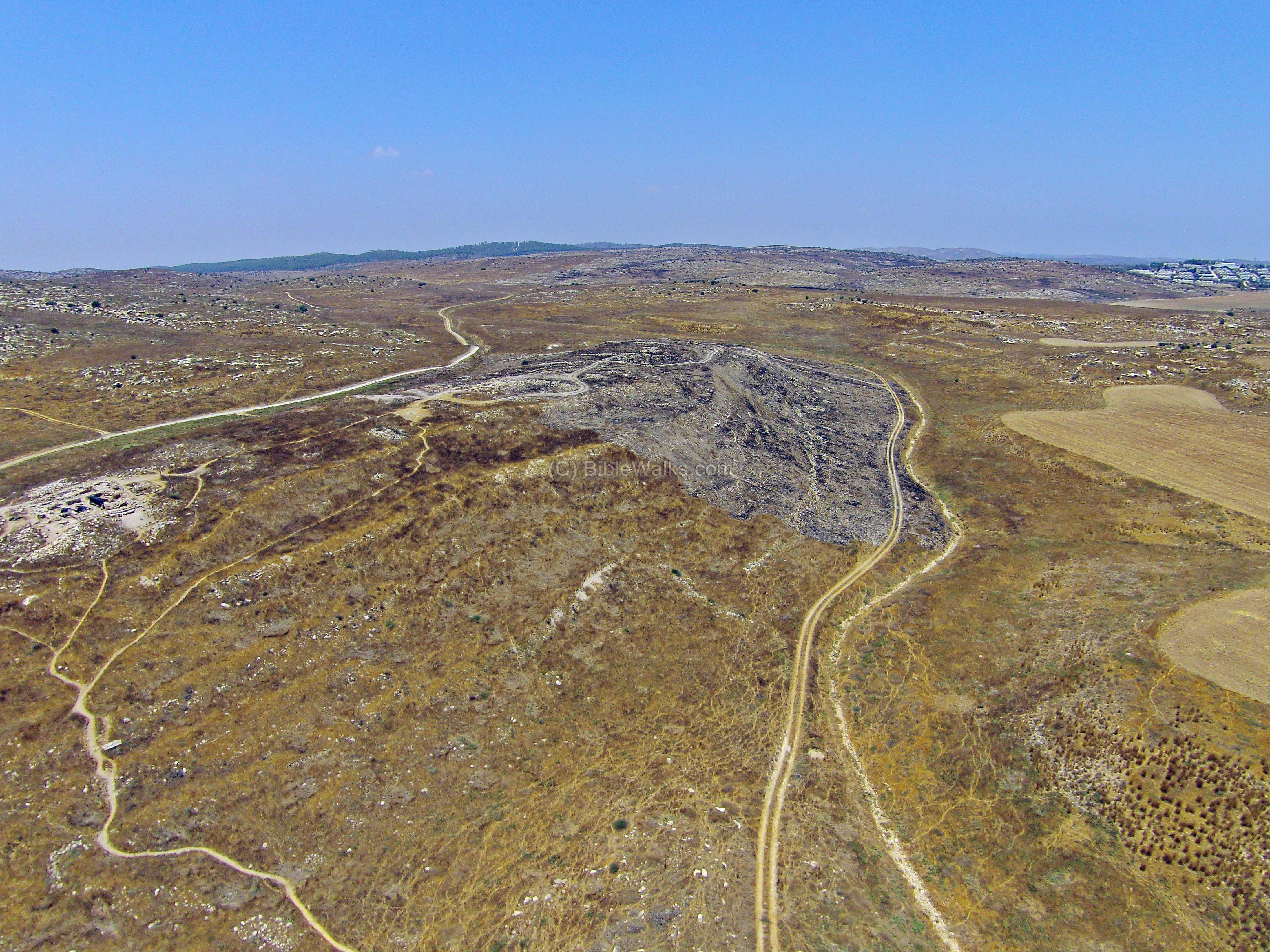 Aerial Drone shot of Tel 'Eton
Click on image to open in a new tab
Used with permission from BibleWalks.com
| Transliterated Name | Source | Name |
|---|---|---|
| Tel 'Eton | Hebrew | תל עיטון |
| Eglon | Hebrew | עֶגְלוֹן |
- Biblical Location Map
from BibleWalks.com
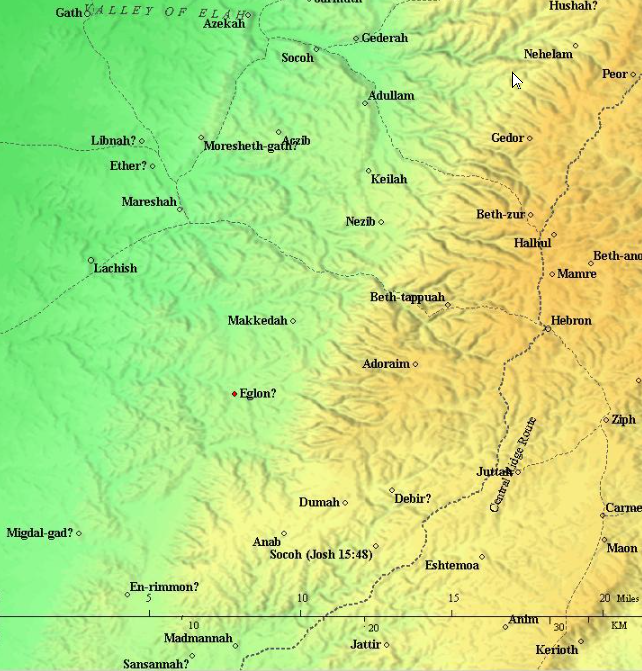 Map of the area around Eglon (red circle) – 20C BC through 6th C BC (based on Bible Mapper 3.0)
Click on image to open in a new tab
Used with permission from BibleWalks.com - Location Map from
from Tel 'Eton Excavations as found on an ASOR Blog
 Location Map
Click on image to open in a new tab
Tel 'Eton Excavations
- Biblical Location Map
from BibleWalks.com
Map of the area around Eglon (red circle) – 20C BC through 6th C BC (based on Bible Mapper 3.0)
Click on image to open in a new tab
Used with permission from BibleWalks.com - Location Map from
from Tel 'Eton Excavations as found on an ASOR Blog
Location Map
Click on image to open in a new tab
Tel 'Eton Excavations
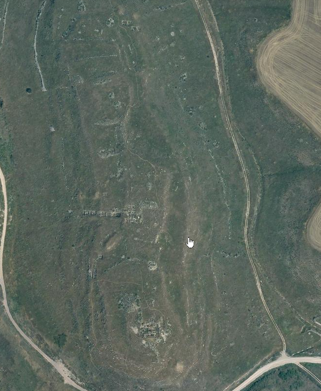
- Annotated Satellite Photo
of Tel 'Eton and environs from BibleWalks.com
 Annotated Satellite Photo of Tel 'Eton and environs
Click on image to open in a new tab
Used with permission from BibleWalks.com - Aerial Drone shot of Tel 'Eton
from BibleWalks.com
 Aerial Drone shot of Tel 'Eton
Click on image to open in a new tab
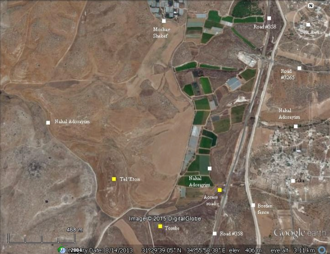
Used with permission from BibleWalks.com - Tel 'Eton in Google Earth
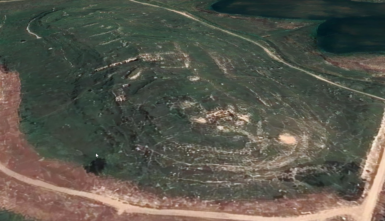 Tel 'Eton
click on image to explore this site on a new tab in Google Earth - Tel 'Eton on govmap.gov.il
 Tel 'Eton
click on image to explore this site on a new tab in govmap.gov.il
- Annotated Satellite Photo
of Tel 'Eton and environs from BibleWalks.com
Annotated Satellite Photo of Tel 'Eton and environs
Click on image to open in a new tab
Used with permission from BibleWalks.com - Aerial Drone shot of Tel 'Eton
from BibleWalks.com
Aerial Drone shot of Tel 'Eton
Click on image to open in a new tab
Used with permission from BibleWalks.com - Tel 'Eton in Google Earth
Tel 'Eton
click on image to explore this site on a new tab in Google Earth - Tel 'Eton on govmap.gov.il
Tel 'Eton
click on image to explore this site on a new tab in govmap.gov.il
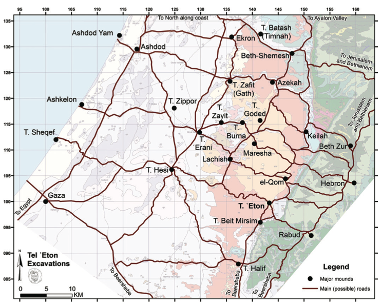
- Site Map from
from Tel 'Eton Excavations as found on an ASOR Blog
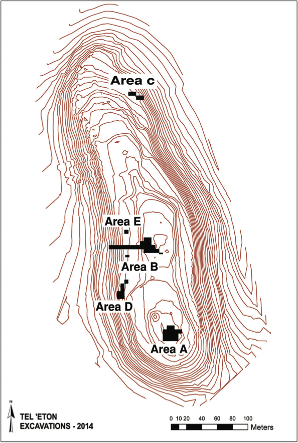 Map of Tel ‘Eton and the roads in its vicinity (prepared by Yair Sapir),
on the background geological map. Courtesy of Israel’s Institute of Geology
Map of Tel ‘Eton and the roads in its vicinity (prepared by Yair Sapir),
on the background geological map. Courtesy of Israel’s Institute of Geology
Click on image to open in a new tab
Tel 'Eton Excavations
- Site Map from
from Tel 'Eton Excavations as found on an ASOR Blog
Map of Tel ‘Eton and the roads in its vicinity (prepared by Yair Sapir),
on the background geological map. Courtesy of Israel’s Institute of Geology
Click on image to open in a new tab
Tel 'Eton Excavations
- Fig. 2 Aerial View of Area A
from Katz and Faust (2012)
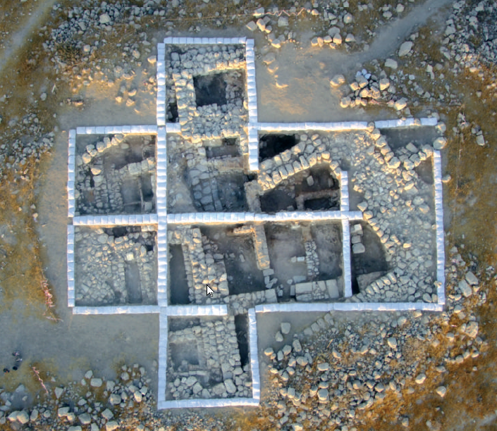 Fig. 2
Area A: aerial view after conclusion of 2009 season (photograph: Sky View)
Click on image to open in a new tab
Katz and Faust (2012)
- Fig. 2 Aerial View of Area A
from Katz and Faust (2012)
Fig. 2
Area A: aerial view after conclusion of 2009 season (photograph: Sky View)
Click on image to open in a new tab
Katz and Faust (2012)
- Fig. 4 Plan of Area B
from Katz and Faust (2012)
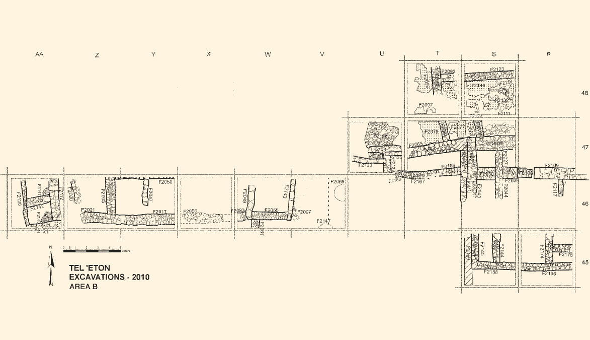 Fig. 4
Area B: plan (after 2010 season)
Click on image to open in a new tab
Katz and Faust (2012)
- Fig. 4 Plan of Area B
from Katz and Faust (2012)
Fig. 4
Area B: plan (after 2010 season)
Click on image to open in a new tab
Katz and Faust (2012)
- Fig. 7 The Assyrian destruction
in Area B from Faust (2012)
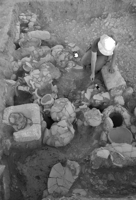 Fig. 7
The Assyrian destruction in Area B (square S48)
Click on image to open in a new tab
Faust (2012) - Fig. 3 Destruction layer
in Area A from Katz and Faust (2012)
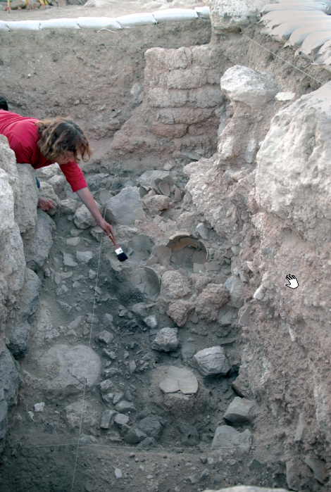 Fig. 3
Destruction layer in Area A
Click on image to open in a new tab
Katz and Faust (2012) - Fig. 5 Destruction layer
in Area B (upper portion) from Katz and Faust (2012)
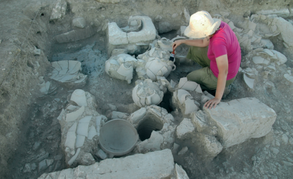 Fig. 5
Destruction layer in Area B (upper portion): in situ vessels
Click on image to open in a new tab
Katz and Faust (2012) - Fig. 6 Destruction layer
in Area B (lower portion) from Katz and Faust (2012)
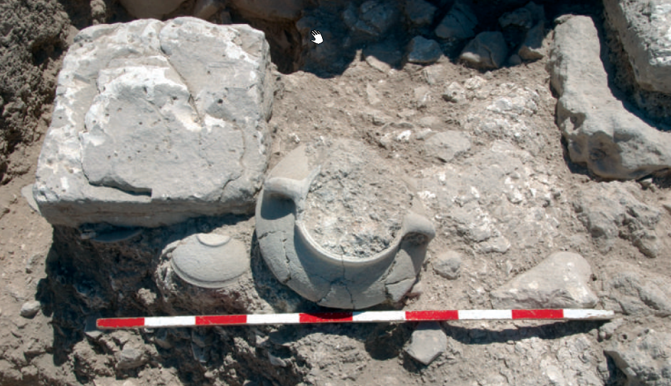 Fig. 6
Destruction layer in Area B (lower portion): in situ vessels
Click on image to open in a new tab
Katz and Faust (2012)
- Fig. 7 The Assyrian destruction
in Area B from Faust (2012)
Fig. 7
The Assyrian destruction in Area B (square S48)
Click on image to open in a new tab
Faust (2012) - Fig. 3 Destruction layer
in Area A from Katz and Faust (2012)
Fig. 3
Destruction layer in Area A
Click on image to open in a new tab
Katz and Faust (2012) - Fig. 5 Destruction layer
in Area B (upper portion) from Katz and Faust (2012)
Fig. 5
Destruction layer in Area B (upper portion): in situ vessels
Click on image to open in a new tab
Katz and Faust (2012) - Fig. 6 Destruction layer
in Area B (lower portion) from Katz and Faust (2012)
Fig. 6
Destruction layer in Area B (lower portion): in situ vessels
Click on image to open in a new tab
Katz and Faust (2012)
- from Faust (2011)
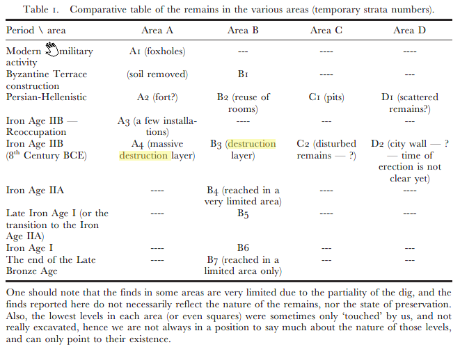 Table 1
Comparative table of the remains in the various areas (temporary strata numbers)
Click on image to open in a new tab
Faust (2011)
| Effect | Location | Image (s) | Comments |
|---|---|---|---|
|
Area A
Map of Tel ‘Eton and the roads in its vicinity (prepared by Yair Sapir),
on the background geological map. Courtesy of Israel’s Institute of Geology
Click on image to open in a new tab Tel 'Eton Excavations
Fig. 2
Area A: aerial view after conclusion of 2009 season (photograph: Sky View) Click on image to open in a new tab Katz and Faust (2012) |
Fig. 3
Destruction layer in Area A Click on image to open in a new tab Katz and Faust (2012) |
|
|
Area B
Map of Tel ‘Eton and the roads in its vicinity (prepared by Yair Sapir),
on the background geological map. Courtesy of Israel’s Institute of Geology
Click on image to open in a new tab Tel 'Eton Excavations
Fig. 4
Area B: plan (after 2010 season) Click on image to open in a new tab Katz and Faust (2012) |
Fig. 7
The Assyrian destruction in Area B (square S48) Click on image to open in a new tab Faust (2012) Fig. 5
Fig. 5
Destruction layer in Area B (upper portion): in situ vessels Click on image to open in a new tab Katz and Faust (2012) Fig. 6
Fig. 6
Destruction layer in Area B (lower portion): in situ vessels Click on image to open in a new tab Katz and Faust (2012) |
|
- Earthquake Archeological Effects chart
of Rodríguez-Pascua et al (2013: 221-224)
 Earthquake Archeological Effects (EAE)
Rodríguez-Pascua et al (2013: 221-224)
| Effect | Location | Image (s) | Comments | Intensity |
|---|---|---|---|---|
|
Area A
Map of Tel ‘Eton and the roads in its vicinity (prepared by Yair Sapir),
on the background geological map. Courtesy of Israel’s Institute of Geology
Click on image to open in a new tab Tel 'Eton Excavations
Fig. 2
Area A: aerial view after conclusion of 2009 season (photograph: Sky View) Click on image to open in a new tab Katz and Faust (2012) |
Fig. 3
Destruction layer in Area A Click on image to open in a new tab Katz and Faust (2012) |
|
|
|
Area B
Map of Tel ‘Eton and the roads in its vicinity (prepared by Yair Sapir),
on the background geological map. Courtesy of Israel’s Institute of Geology
Click on image to open in a new tab Tel 'Eton Excavations
Fig. 4
Area B: plan (after 2010 season) Click on image to open in a new tab Katz and Faust (2012) |
Fig. 7
The Assyrian destruction in Area B (square S48) Click on image to open in a new tab Faust (2012) Fig. 5
Fig. 5
Destruction layer in Area B (upper portion): in situ vessels Click on image to open in a new tab Katz and Faust (2012) Fig. 6
Fig. 6
Destruction layer in Area B (lower portion): in situ vessels Click on image to open in a new tab Katz and Faust (2012) |
|
|