
Tell Abu en-Ni'aj
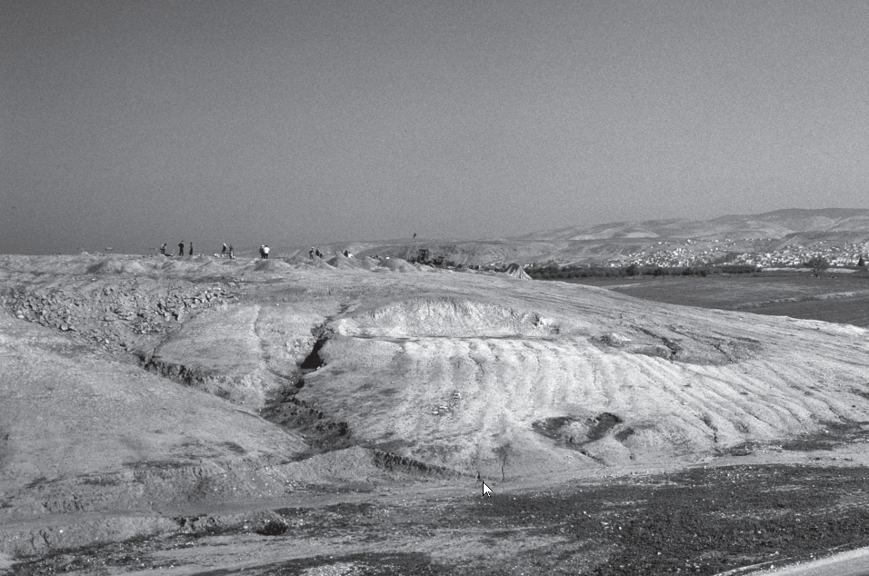 Photo 4.6
View of Tell Abu en-Ni‘aj, facing northeast, during backfilling at the end of the 1996/97 field season. Tell el-Hayyat is visible as the distant low mound to the right. The town of Meshara lies in the distance.
click on image to open in a new tab
Falconer et al. (2019)
| Transliterated Name | Language | Name |
|---|---|---|
| Tell Abu en-Niaj | Arabic | تل أبو النِّعاج |
- Fig. 11.1 - Location Map from
Falconer et al. (2019)
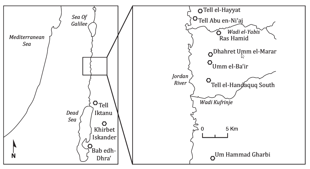 Map 11.1
Dhahret Umm el-Marar and other Early Bronze IV settlements in the northern Jordan Valley (drawn by J. Jones; modified by P. Jones).
click on image to open in a new tab
Falconer et al. (2019)
- Tell Abu en-Niaj vicinity in Google Earth
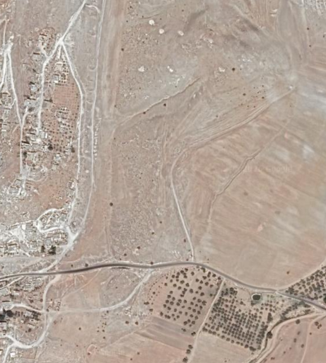 Tell Abu en-Niaj Vicinity
click on image to explore this site on a new tab in Google Earth
- Fig. 2.1 - Topographic Map with
excavation squares from Falconer et al. (2019)
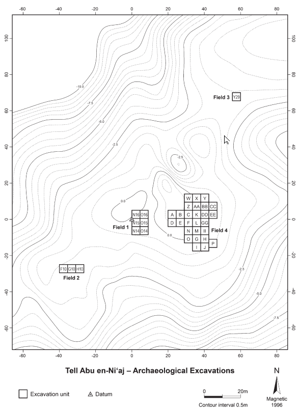 Figure 2.1
Topographic plan of Tell Abu en-Ni‘aj showing locations of Fields 1-4 and 5 x 5 m excavation squares.
click on image to open in a new tab
Falconer et al. (2019)
- Fig. 2.1 - Topographic Map with
excavation squares from Falconer et al. (2019)
Figure 2.1
Topographic plan of Tell Abu en-Ni‘aj showing locations of Fields 1-4 and 5 x 5 m excavation squares.
click on image to open in a new tab
Falconer et al. (2019)
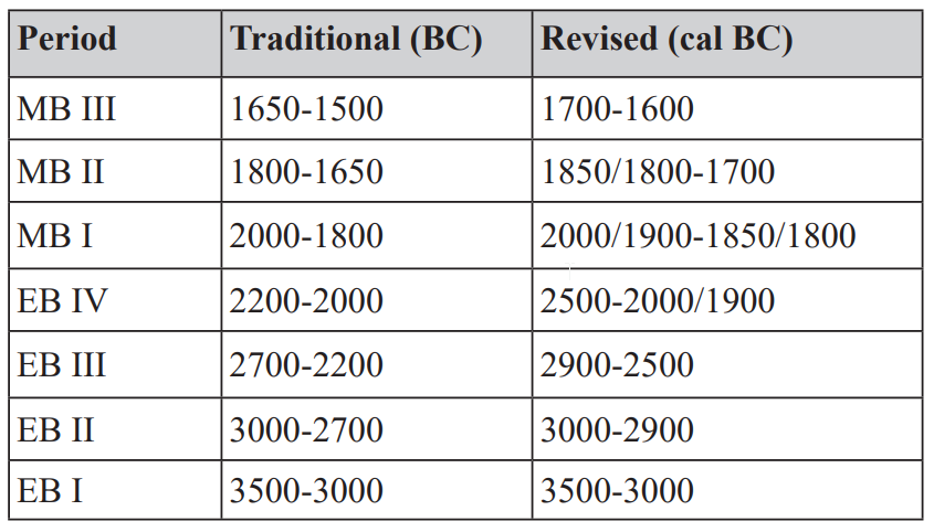 Table 1.1
Traditional and revised Early and Middle Bronze Age chronologies for the Southern Levant. Traditional chronology based on Levy (1995: fi g. 3); revised chronology based on Regev et al. (2012a), Falconer and Fall (2016, 2017) and Höfl mayer (2017)
click on image to open in a new tab
Falconer et al. (2019)
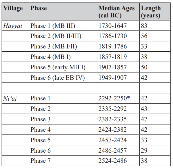 Table 5.2
Radiocarbon chronologies for the occupations of Early Bronze IV Tell Abu en-Ni‘aj and Middle Bronze Age Tell el-Hayyat. AMS ages based on phase boundary medians produced by Bayesian modelling of calibrated 14C ages. Calibration and modelling of Tell Abu en-Ni‘aj uses OxCal 4.3.2 (Bronk Ramsey 2017) and the IntCal13 atmospheric curve (Reimer et al. 2013). Calibration and modelling of Tell el-Hayyat follows Falconer and Fall (2017) and uses OxCal 4.2.4 (Bronk Ramsey and Lee 2013) and the IntCal 13 atmospheric curve (Reimer et al. 2013). (*Estimated end date for Tell Abu en-Ni‘aj Phase 1)
click on image to open in a new tab
Falconer et al. (2019)
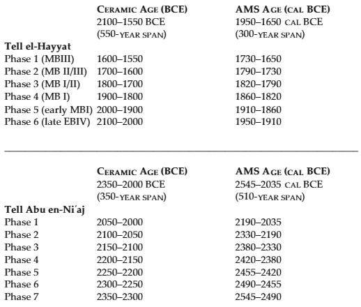 Table 1
Chronological revision for the occupations of Middle Bronze Age Tell el-Hayyat and Early Bronze IV Tell Abu en-Ni‘aj. AMS ages based on phase boundary medians produced by Bayesian analysis of 14 radiocarbon ages from Tell el-Hayyat and 24 radiocarbon ages from Tell Abu en-Ni‘aj.
click on image to open in a new tab
Falconer and Fall (2017)
- from Ferry et al. (2011)
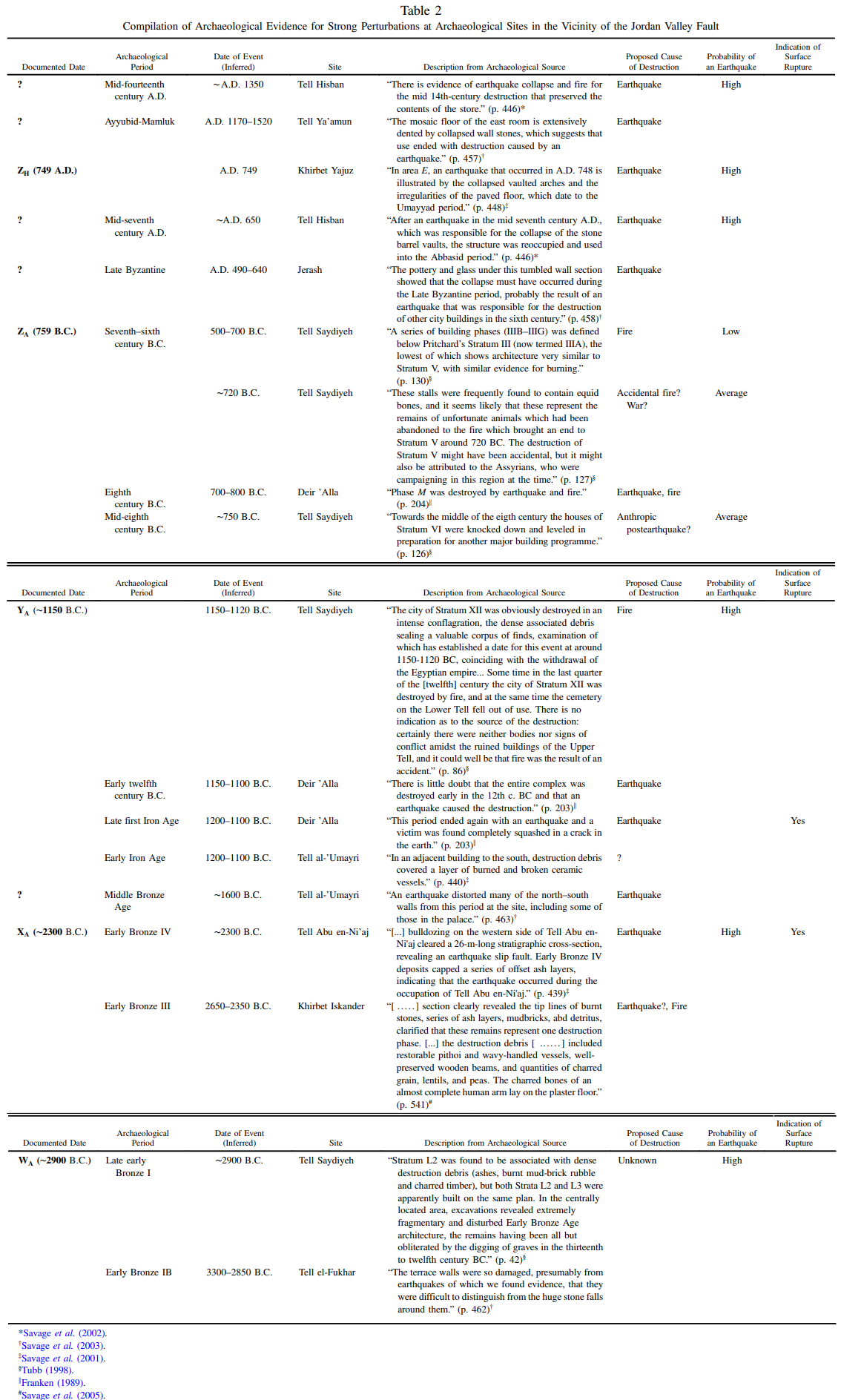 Table 2
Compilation of Archaeological Evidence for Strong Perturbations at Archaeological Sites in the Vicinity of the Jordan Valley Fault
click on image to open in a new tab
Ferry et al. (2011)
- Earthquake Archeological Effects chart
of Rodríguez-Pascua et al (2013: 221-224)
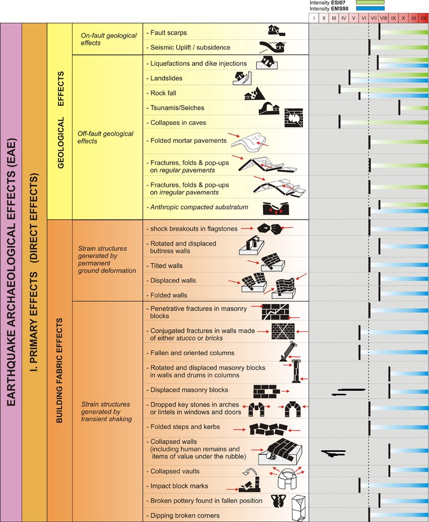 Earthquake Archeological Effects (EAE)
Rodríguez-Pascua et al (2013: 221-224)
| Effect | Location | Image(s) | Comments | Intensity |
|---|---|---|---|---|
| Offset Layers (fault scarp) | western side of Tell |
|
VII+ |