Petra - Urn Tomb
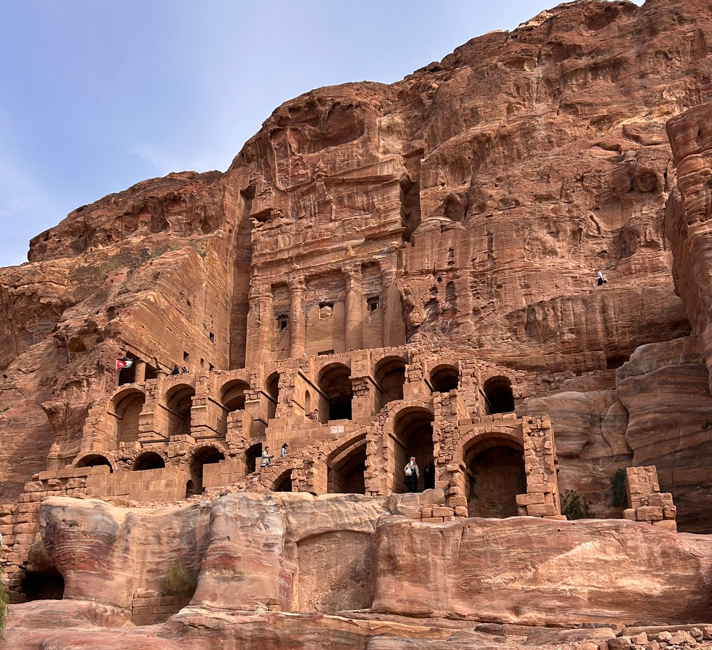 Urn Tomb
Click on image to open in a new tab
Photo by Jefferson Williams - 21 Jan. 2026
| Transliterated Name | Source | Name |
|---|---|---|
| Urn Tomb | ||
| al-Mahkamah | Arabic | الءماهكاماه |
- Location Map from Jones (2021)
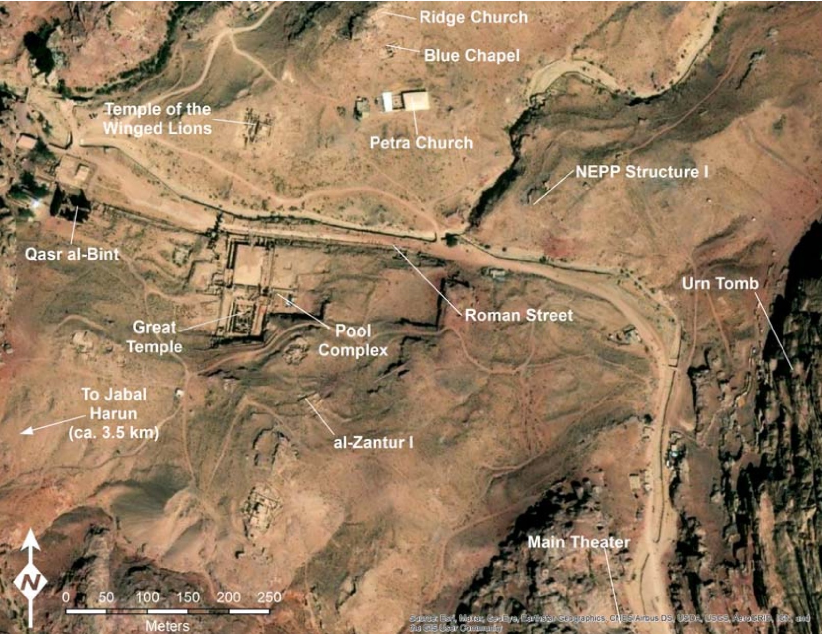 Figure 2
Map of Petra with the locations of major excavations marked
Jones (2021)
Basemap: Esri, Maxar, Earthstar Geographics, USDA FSA, USGS, Aerogrid, IGN, IGP, and the GIS User Community - Urn Tomb in Google Earth
 Urn Tomb in Google Earth
click on image to explore this site on a new tab in Google Earth
- Urn Tomb photo by JW
 Urn Tomb
Click on image to open in a new tab
Photo by Jefferson Williams - 21 Jan. 2026 - Urn Tomb from wikipedia
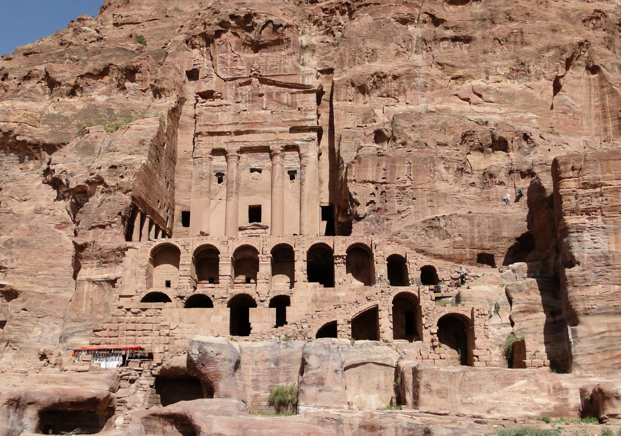 The Urn Tomb
Bernard Gagnon - Wikipedia - CC BY-SA 3.0
- Urn Tomb photo by JW
Urn Tomb
Click on image to open in a new tab
Photo by Jefferson Williams - 21 Jan. 2026 - Urn Tomb from wikipedia
The Urn Tomb
Bernard Gagnon - Wikipedia - CC BY-SA 3.0
- Earthquake Archeological Effects chart
of Rodríguez-Pascua et al (2013: 221-224)
 Earthquake Archeological Effects (EAE)
Rodríguez-Pascua et al (2013: 221-224)
| Effect | Location | Image(s) | Description/Comments | Intensity |
|---|---|---|---|---|
| Destruction (Collapsed Walls) | House II | Within the Urn Tomb complex, earlier interpretations had proposed earthquake destruction in multiple loci, including damage attributed to a 363 event in a cave below the tomb and in House II. House II was then partly rebuilt, and by the 6th century it was reportedly being “used as a quarry” (Zeitler 1993:256–257, as discussed by Jones 2021). Kolb’s proposal of a second destruction in 419 relied largely on analogy with al-Zantur I, but Jones notes that the archaeological evidence for House II cannot be independently evaluated because only a preliminary report has appeared. Jones further raises an alternative historical explanation for a 5th-century shift in House II’s use: it may relate to the modification of the Urn Tomb for use as a church in 446 (Bikai 2002:271, as summarized by Jones 2021), rather than requiring a discrete 419 earthquake destruction horizon. | VIII+ |