Petra - NEPP Site
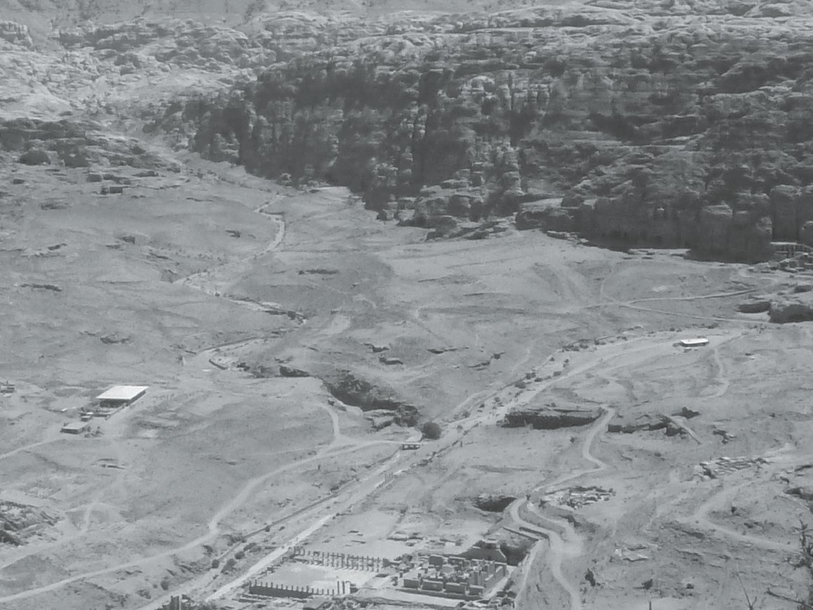 Fig. 2
The NEPP area located between the Wadi Matahah (left), the Wadi Musa (right) and the face of the al-Khubthah massif.View from the West. Photo by S.G. Schmid
Fiema and Schmid (2014)
| Transliterated Name | Source | Name |
|---|---|---|
| NEPP site |
- Fig. 2 - Location Map from Jones (2021)
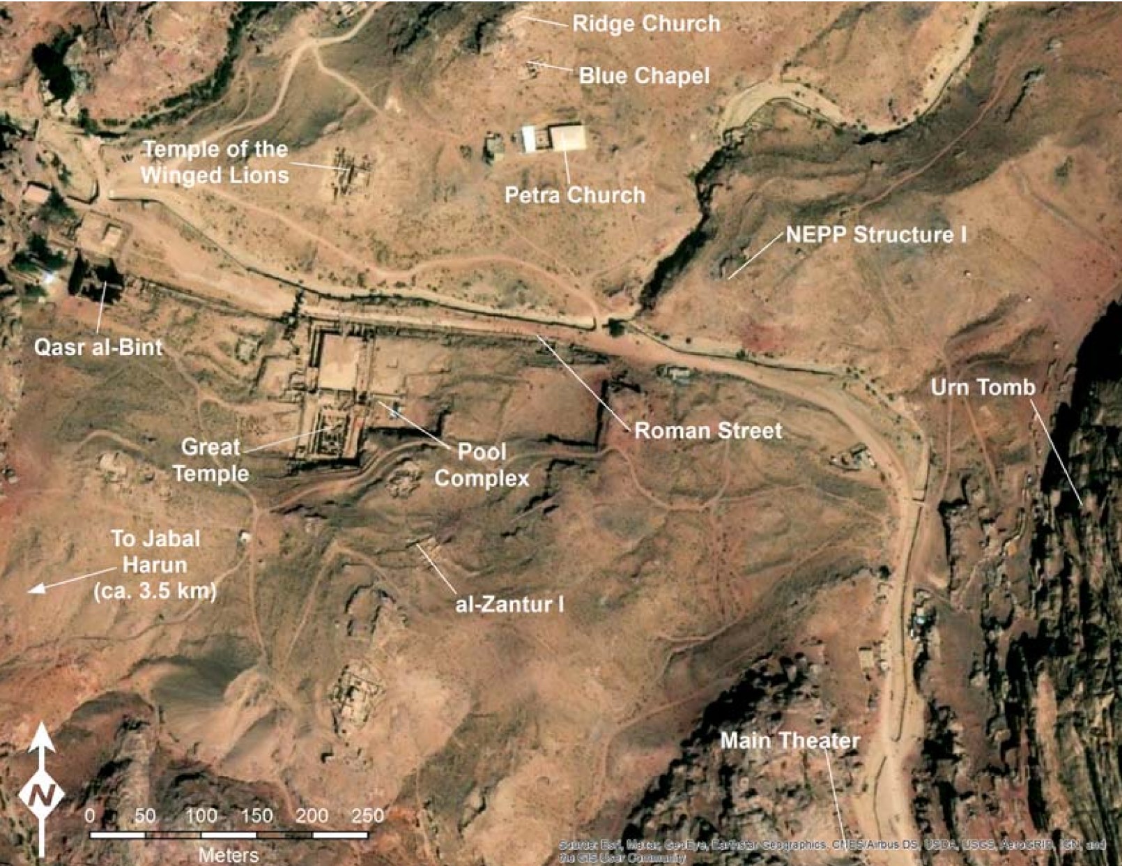 Figure 2
Map of Petra with the locations of major excavations marked
Jones (2021)
Basemap: Esri, Maxar, Earthstar Geographics, USDA FSA, USGS, Aerogrid, IGN, IGP, and the GIS User Community - NEPP area in Google Earth
 NEPP area in Google Earth
click on image to explore this site on a new tab in Google Earth
- Fig. 3 - Plan of the NEPP area
from Fiema and Schmid (2014)
 Figure 3
The plan of the NEPP area featuring Structures 1, 2, and 3. Plan by Jana Falkenberg and Maija Holappa
Fiema and Schmid (2014)
- Fig. 3 - Plan of the
NEPP area from Fiema and Schmid (2014)
Figure 3
The plan of the NEPP area featuring Structures 1, 2, and 3. Plan by Jana Falkenberg and Maija Holappa
Fiema and Schmid (2014)
- Fig. 6 - Structure 1 interior
featuring a collapsed granite column from Fiema and Schmid (2014)
 Figure 6
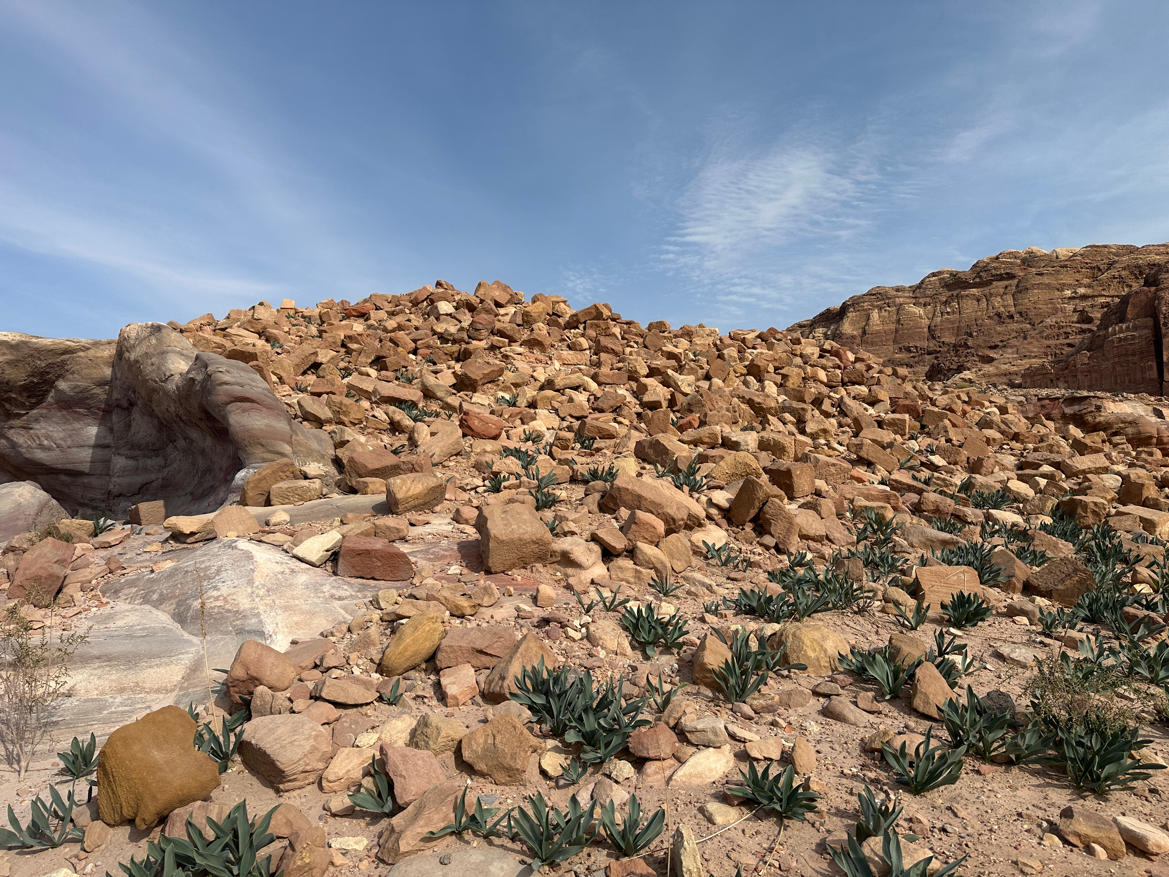
Structure 1. The interior featuring a collapsed granite column. In the background: the Petra Church (left) and the Blue Chapel (centre). Photo by Z.T. Fiema
click on image to open in a new tab
Fiema and Schmid (2014) - Structure 1 photo by JW
 Structure 1 at the NEPP site
Click on image to open in a new tab
Photo by Jefferson Williams - 21 Jan. 2026
- Fig. 6 - Structure 1 interior
featuring a collapsed granite column from Fiema and Schmid (2014)
Figure 6
Structure 1. The interior featuring a collapsed granite column. In the background: the Petra Church (left) and the Blue Chapel (centre). Photo by Z.T. Fiema
click on image to open in a new tab
Fiema and Schmid (2014) - Structure 1 photo by JW
Structure 1 at the NEPP site
Click on image to open in a new tab
Photo by Jefferson Williams - 21 Jan. 2026
- from Schmid (1995)
- Ez-Zantur Excavations utilized Nabatean fineware chronology of Schmid (2000) - which I don't currently have access to
- This chronology appears to have been utilized for the NEPP site
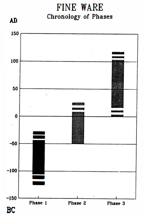
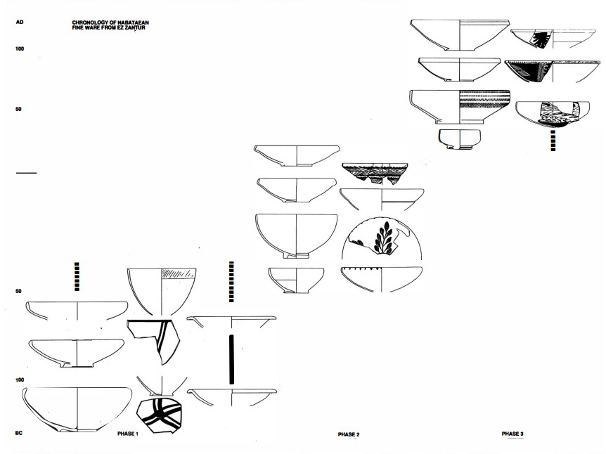
Left
Chronology of Nabatean finewares
Right
Typology and chronology of the Nabataean fine ware
Both from Schmid (1995)
- Fig. 2 - Location Map from Jones (2021)
Figure 2
Map of Petra with the locations of major excavations marked
Jones (2021)
Basemap: Esri, Maxar, Earthstar Geographics, USDA FSA, USGS, Aerogrid, IGN, IGP, and the GIS User Community - Fig. 3 - Plan of the NEPP area
from Fiema and Schmid (2014)
Figure 3
The plan of the NEPP area featuring Structures 1, 2, and 3. Plan by Jana Falkenberg and Maija Holappa
Fiema and Schmid (2014)
| Effect | Location | Image(s) | Description |
|---|---|---|---|
|
Structure 1 Figure 3
The plan of the NEPP area featuring Structures 1, 2, and 3. Plan by Jana Falkenberg and Maija Holappa click on image to open in a new tab Fiema and Schmid (2014) |
|
| Effect | Location | Image(s) | Description |
|---|---|---|---|
|
Structure 1
Figure 3 The plan of the NEPP area featuring Structures 1, 2, and 3. Plan by Jana Falkenberg and Maija Holappa click on image to open in a new tab Fiema and Schmid (2014) |
Figure 6 Structure 1. The interior featuring a collapsed granite column. In the background: the Petra Church (left) and the Blue Chapel (centre). Photo by Z.T. Fiema click on image to open in a new tab Fiema and Schmid (2014) |
|
-
Earthquake Archeological Effects chart
of Rodríguez-Pascua et al (2013: 221-224)
 Earthquake Archeological Effects (EAE)
Rodríguez-Pascua et al (2013: 221-224)
| Effect | Location | Image(s) | Description | Intensity |
|---|---|---|---|---|
|
Structure 1
Figure 3 The plan of the NEPP area featuring Structures 1, 2, and 3. Plan by Jana Falkenberg and Maija Holappa click on image to open in a new tab Fiema and Schmid (2014) |
|
|
-
Earthquake Archeological Effects chart
of Rodríguez-Pascua et al (2013: 221-224)
Earthquake Archeological Effects (EAE)
Rodríguez-Pascua et al (2013: 221-224)
| Effect | Location | Image(s) | Description | Intensity |
|---|---|---|---|---|
|
Structure 1
Figure 3 The plan of the NEPP area featuring Structures 1, 2, and 3. Plan by Jana Falkenberg and Maija Holappa click on image to open in a new tab Fiema and Schmid (2014) |
Figure 6 Structure 1. The interior featuring a collapsed granite column. In the background: the Petra Church (left) and the Blue Chapel (centre). Photo by Z.T. Fiema click on image to open in a new tab Fiema and Schmid (2014) |
|
|