 General Area of Excavations at Mazliah on govmap.gov.il
| Transliterated Name | Language | Name |
|---|---|---|
| Mazliah | ||
| Ramla (South) |
 Fig. 1
 Fig. 1
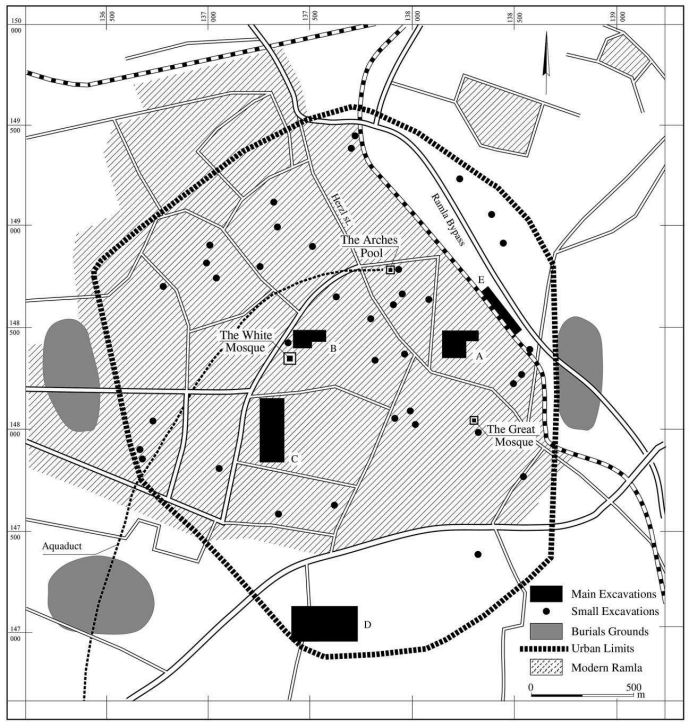 Fig. 2
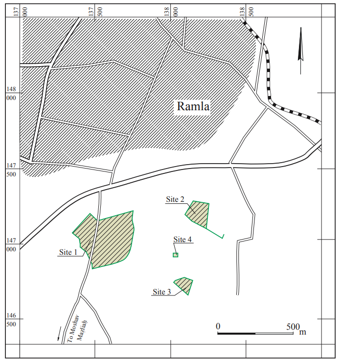 Fig. 1.4
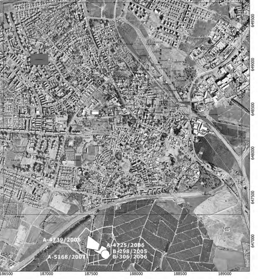 Fig. 6.1
 General Area of Excavations at Mazliah in Google Earth
General Area of Excavations at Mazliah on govmap.gov.il
General Area of Excavations at Mazliah in Google Earth
General Area of Excavations at Mazliah on govmap.gov.il
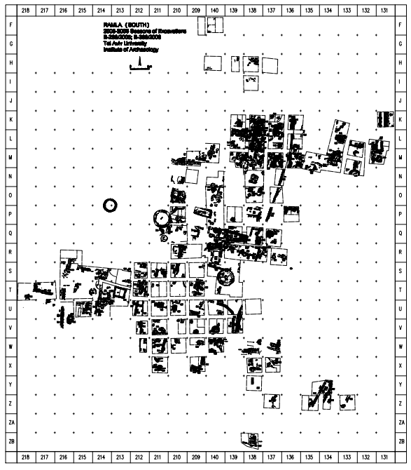 Master Excavation Map
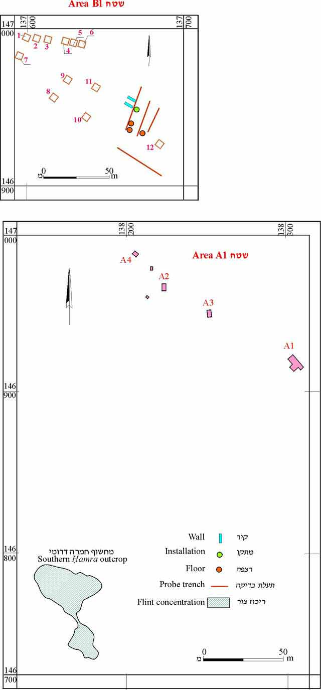 Fig. 2
 Fig. 2
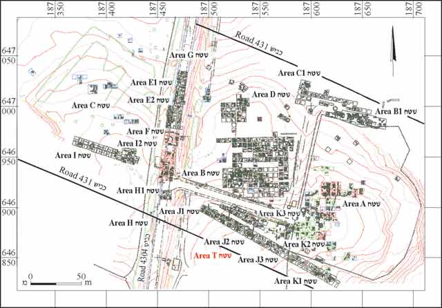 Fig. 1
 Fig. 1.5
Master Excavation Map
Fig. 2
Fig. 2
Fig. 1
Fig. 1.5
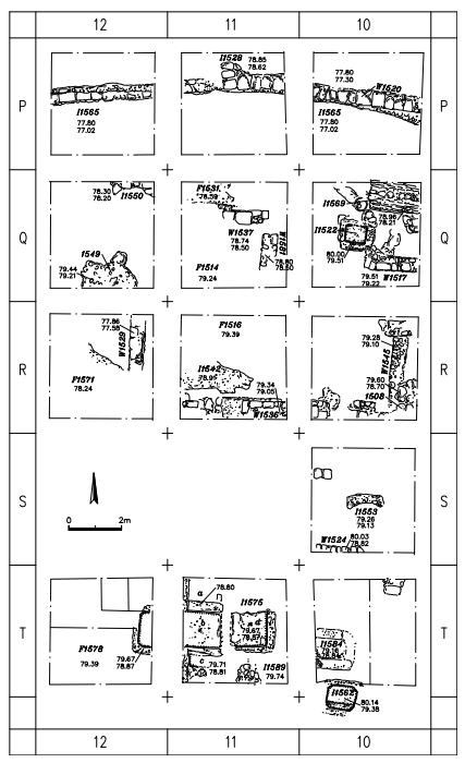 Fig. 1.6a
Fig. 1.6a
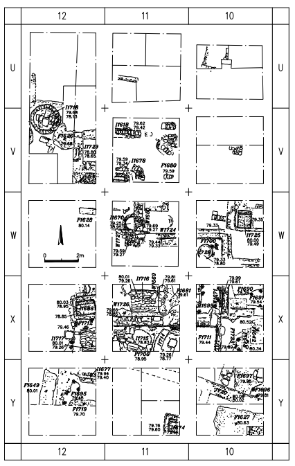 Fig. 1.6b
Fig. 1.6b
 Fig. 2.1
Fig. 2.1
 Fig. 4.1a
Fig. 4.1a
 Fig. 4.3a
Fig. 4.3a
 Fig. 5.1
Fig. 5.1
 Fig. 5.9
Fig. 5.9
 Fig. 5.17
 Fig. 5.18
Fig. 5.17
Fig. 5.18
 Fig. 5.24
Fig. 5.24
 Fig. 6.2
Fig. 6.2
 Fig. 6.3a
 Fig. 6.5a
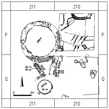 Fig. 6.8a
Fig. 6.3a
Fig. 6.5a
Fig. 6.8a
 Fig. 6.15b
Fig. 6.15b
 Fig. 6.32a
 Fig. 6.33a
Fig. 6.32a
Fig. 6.33a
| Effect | Location | Image(s) | Description |
|---|---|---|---|
|
Areas K1, J2, and possibly K2
Fig. 2 הפמ תיללכ לש יחטש הריפחה חילעמב Gorzalczany (2008)
Fig. 1General Plan. Gorzalczany and Ad (2010) |
|
 Earthquake Archeological Effects (EAE)
| Effect | Location | Image(s) | Description | Intensity |
|---|---|---|---|---|
|
Areas K1, J2, and possibly K2
Fig. 2 הפמ תיללכ לש יחטש הריפחה חילעמב Gorzalczany (2008)
Fig. 1General Plan. Gorzalczany and Ad (2010) |
|
|