Petra - Katute
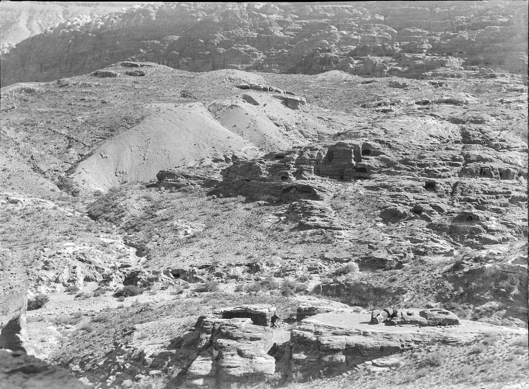 The rubbish dumps known as "Katoote"
click on image to open a high res magnifiable image in a new tab
Copyright UCL Institute of Archaeology
| Transliterated Name | Source | Name |
|---|---|---|
| el-Katute | Arabic | يلءكاتوتي |
- Fig. 1 - Location Map from
Parr (1960)
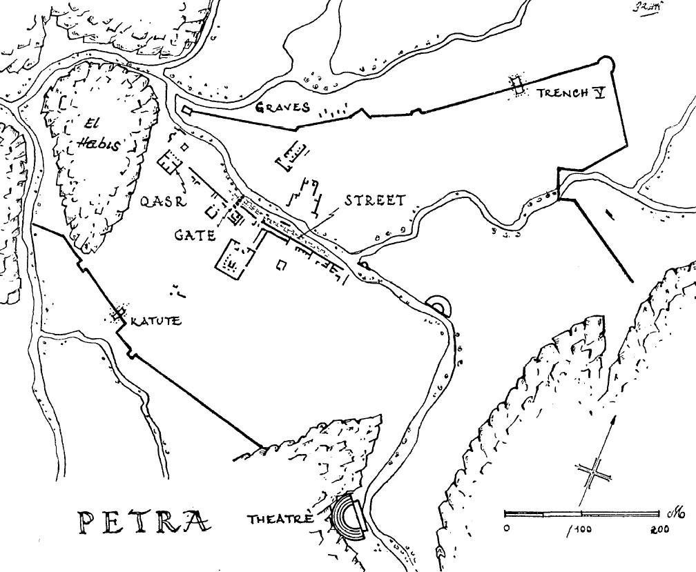 Figure 1
JW:Map of Petra. Katute is middle left
Parr (1960) - Fig. 1a - Location Map from
Jordan et al. (2016)
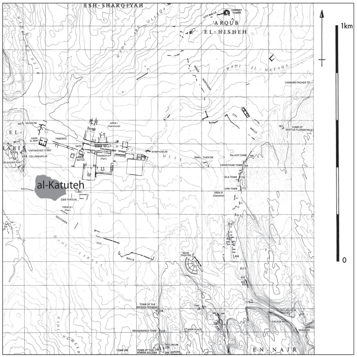 Figure 1a
The location of the site (McKenzie 1990: Map 7)
Click on image to open in a new tab
Jordan et al. (2016)
- Fig. 1 - Location Map from
Parr (1960)
Figure 1
JW:Map of Petra. Katute is middle left
Parr (1960) - Fig. 1a - Location Map from
Jordan et al. (2016)
Figure 1a
The location of the site (McKenzie 1990: Map 7)
Click on image to open in a new tab
Jordan et al. (2016)
- Fig. 1b #1 Aerial View of
site from Jordan et al. (2016)
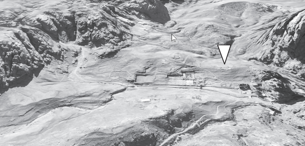 Figure 1b #1
Aerial View of site (F. Berger/D. Jordan)
Click on image to open in a new tab
Jordan et al. (2016) - Fig. 1b #2 Aerial View of
excavation areas from Jordan et al. (2016)
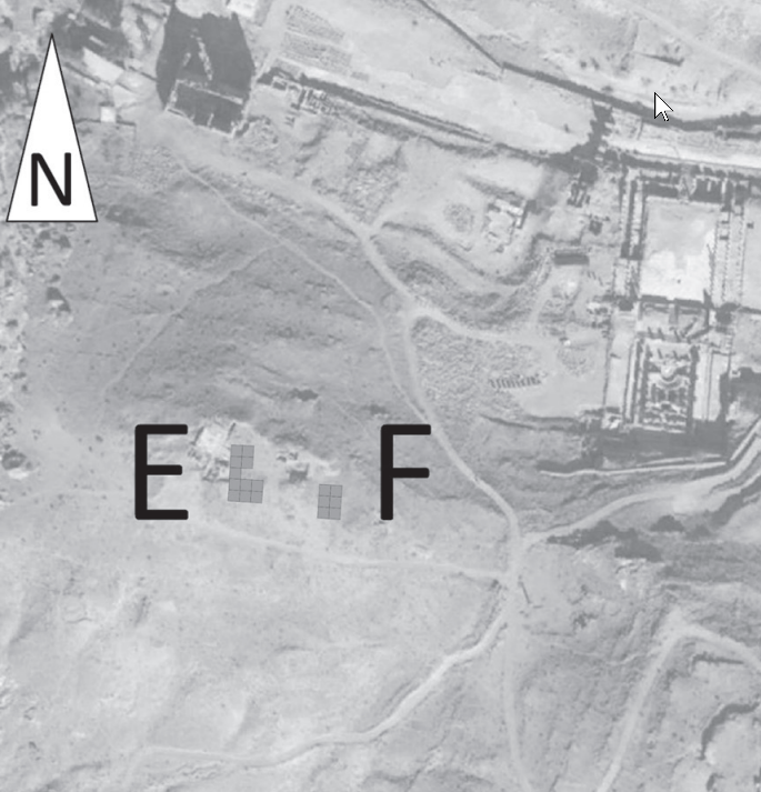 Figure 1b #2
Aerial View of excavation areas (F. Berger/D. Jordan)
Click on image to open in a new tab
Jordan et al. (2016) - Fig. 1b #3 Aerial View of
geophysical survey areas from Jordan et al. (2016)
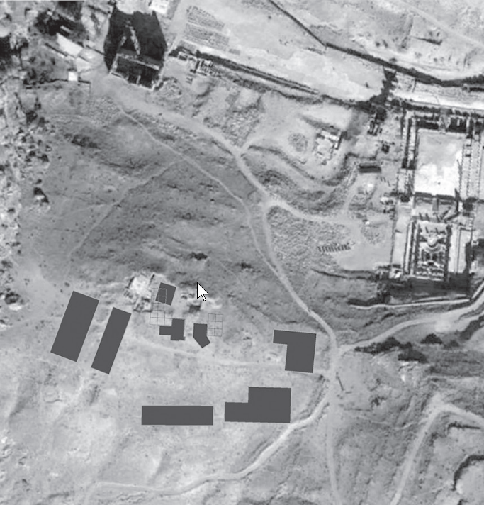 Figure 1b #3
Aerial View of geophysical survey areas (F. Berger/D. Jordan)
Click on image to open in a new tab
Jordan et al. (2016) - Approximate location of Katute in Google Earth
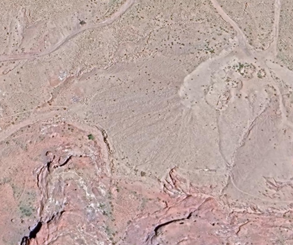 Approximate location of Katute in Google Earth
click on image to explore this site on a new tab in Google Earth
- Fig. 1b #1 Aerial View of
site from Jordan et al. (2016)
Figure 1b #1
Aerial View of site (F. Berger/D. Jordan)
Click on image to open in a new tab
Jordan et al. (2016) - Fig. 1b #2 Aerial View of
excavation areas from Jordan et al. (2016)
Figure 1b #2
Aerial View of excavation areas (F. Berger/D. Jordan)
Click on image to open in a new tab
Jordan et al. (2016) - Fig. 1b #3 Aerial View of
geophysical survey areas from Jordan et al. (2016)
Figure 1b #3
Aerial View of geophysical survey areas (F. Berger/D. Jordan)
Click on image to open in a new tab
Jordan et al. (2016) - Approximate location of Katute in Google Earth
Approximate location of Katute in Google Earth
click on image to explore this site on a new tab in Google Earth
- Panorama at Katute photo by
JW
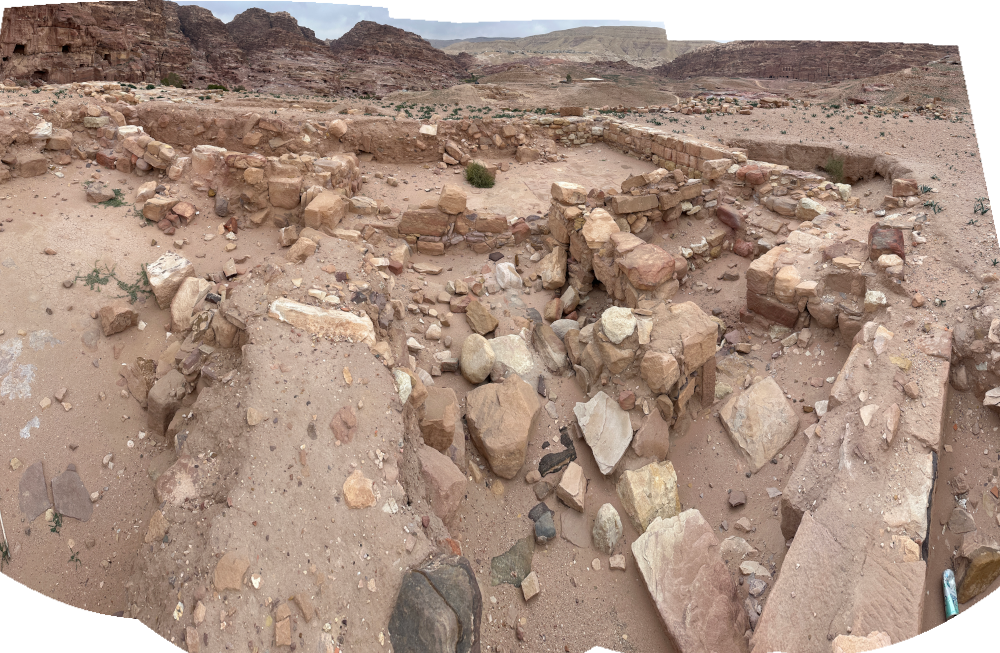 Panorama at Katute
Click on image to open in a new tab
Photo by Jefferson Williams - 22 Jan. 2026
- Panorama at Katute photo by
JW
Panorama at Katute
Click on image to open in a new tab
Photo by Jefferson Williams - 22 Jan. 2026
- Earthquake Archeological Effects chart
of Rodríguez-Pascua et al (2013: 221-224)
 Earthquake Archeological Effects (EAE)
Rodríguez-Pascua et al (2013: 221-224)
| Effect | Location | Image(s) | Description | Intensity |
|---|---|---|---|---|
| Displaced Walls | a building outside of the "monumental structure" at Katute | partial destruction of the interior walls- Parr (1960) |
VII + |