Jerash - Umayyad House
 Jerash Umayyad House
click on image to open in a new tab
Photo by Jefferson Williams - 24 Jan. 2026
- Jerash Umayyad House in Google Earth
 Jerash Umayyad House
click on image to explore this site on a new tab in Google Earth
- General Plan of Jerash
from Wikipedia
- Fig. 2 - Plan of Umayyad
Jerash from Walmsley and Daamgaard (2005)

Figure 2
Plan summarising the principal urban features of Umayyad Jarash.
- Umayyad mosque
- possible Islamic administrative centre
- market (suq)
- South Tetrakonia piazza (built over)
- Macellum, with Umayyad–Abbasid rebuilding, and south cardo, encroached by structures;
- Oval piazza domestic quarter with fountain;
- Zeus temple forecourt (kiln, monastery?)
- hippodrome and Bishop Marianos church, eighth century use
- church of SS Peter and Paul and Mortuary Church (Umayyad construction date?)
- churches of SS Cosmas and Damianus, St George and St John theBaptist, with Umayyad–Abbasid occupation and iconoclastic-effected mosaics (later eighth century)
- Christian complex of two churches (Cathedral to the east with stairs from the street, St Theodore’s to the west), mid-5th to late 6th century Bath of Placcus (north of St Theodore’s) and houses west of St Theodore’s with extensive Umayyad occupation including a kiln and oil press
- Artemis compound used for ceramic manufacture
- Synagogue church with iconoclastic-effected mosaics
- North Theatre, also industrialised with kilns
- the 1981 ‘mosque’
- central Cardo with blacksmith’s shop and offices
Map modfied from R.E. Pillen in Zayadine (1986).
Walmsley and Daamgaard (2005) - Fig. 13 - Early Islamic
Jerash - 8th to 13th century CE - from Rattenborg and Blanke (2017)
 Figure 13
Early Islamic Jerash
8th to 13th century CE
Rattenborg and Blanke (2017)

- Fig. 2 - Plan of Umayyad
Jerash from Walmsley and Daamgaard (2005)
Figure 2
Plan summarising the principal urban features of Umayyad Jarash.
- Umayyad mosque
- possible Islamic administrative centre
- market (suq)
- South Tetrakonia piazza (built over)
- Macellum, with Umayyad–Abbasid rebuilding, and south cardo, encroached by structures;
- Oval piazza domestic quarter with fountain;
- Zeus temple forecourt (kiln, monastery?)
- hippodrome and Bishop Marianos church, eighth century use
- church of SS Peter and Paul and Mortuary Church (Umayyad construction date?)
- churches of SS Cosmas and Damianus, St George and St John theBaptist, with Umayyad–Abbasid occupation and iconoclastic-effected mosaics (later eighth century)
- Christian complex of two churches (Cathedral to the east with stairs from the street, St Theodore’s to the west), mid-5th to late 6th century Bath of Placcus (north of St Theodore’s) and houses west of St Theodore’s with extensive Umayyad occupation including a kiln and oil press
- Artemis compound used for ceramic manufacture
- Synagogue church with iconoclastic-effected mosaics
- North Theatre, also industrialised with kilns
- the 1981 ‘mosque’
- central Cardo with blacksmith’s shop and offices
Map modfied from R.E. Pillen in Zayadine (1986).
Walmsley and Daamgaard (2005) - Fig. 13 - Early Islamic
Jerash - 8th to 13th century CE - from Rattenborg and Blanke (2017)
Figure 13
Early Islamic Jerash
8th to 13th century CE
Rattenborg and Blanke (2017)
- Early Islamic Jerash from
Rattenborg and Blanke (2017)
 Early Islamic Jerash
Rattenborg and Blanke (2017)
- Early Islamic Jerash from
Rattenborg and Blanke (2017)
Early Islamic Jerash
Rattenborg and Blanke (2017)
- Fig. 1 - Plan of the
Umayyad House from Gawlikowski (1992)
 Fig. 1
Plan of the Umayyad House (7th century CE). from A. Ostrasz.
Gawlikowski (1992)
- Fig. 1 - Plan of the
Umayyad House from Gawlikowski (1992)
Fig. 1
Plan of the Umayyad House (7th century CE). from A. Ostrasz.
Gawlikowski (1992)
- Panorama of Ummayad
House - photo by JW
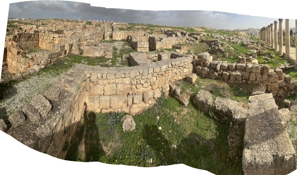 Stitched Panorama 0f Ummayad House at Jerash
Click on image to open a high resolution magnifiable image in a new tab
Photos by Jefferson Williams - 24 Jan. 2026 - Panorama of Ummayad
House - photo by JW
 Stitched Panorama 0f Ummayad House at Jerash
Click on image to open a high resolution magnifiable image in a new tab
Photos by Jefferson Williams - 24 Jan. 2026 - Panorama of Ummayad
House - photo by JW
 Stitched Panorama 0f Ummayad House at Jerash
Click on image to open a high resolution magnifiable image in a new tab
Note: Some distortion is inevitable in a stitched panorama
Photos by Jefferson Williams - 23 June 2025 - Re-used building elements
in the Ummayad House - photo by JW
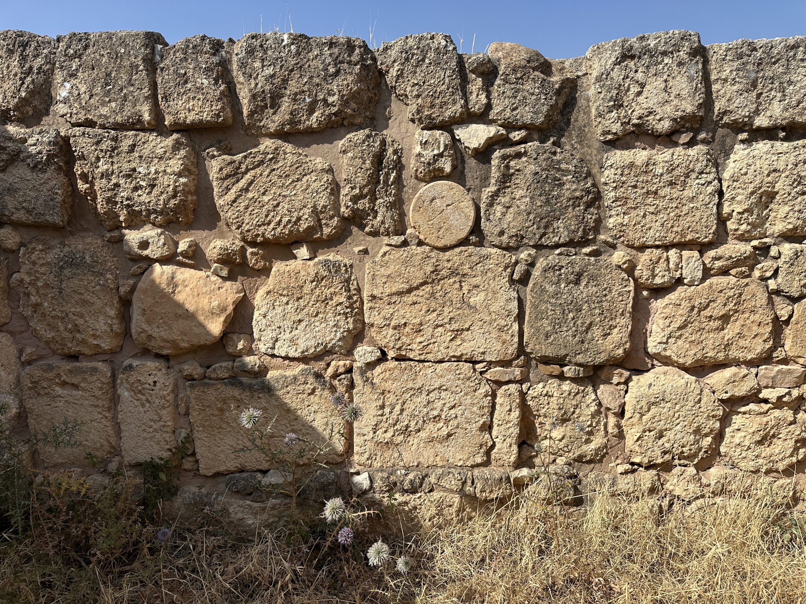 Re-used building elements in the Ummayad House at Jerash
JW: This wall shows signs of recent reconstruction however the reconstruction may have preserved the re-used building elements present in the original wall
Click on image to open a high resolution magnifiable image in a new tab
Photo by Jefferson Williams - 23 June 2025
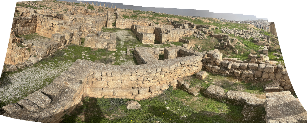
- Panorama of Ummayad
House - photo by JW
Stitched Panorama 0f Ummayad House at Jerash
Click on image to open a high resolution magnifiable image in a new tab
Photos by Jefferson Williams - 24 Jan. 2026 - Panorama of Ummayad
House - photo by JW
Stitched Panorama 0f Ummayad House at Jerash
Click on image to open a high resolution magnifiable image in a new tab
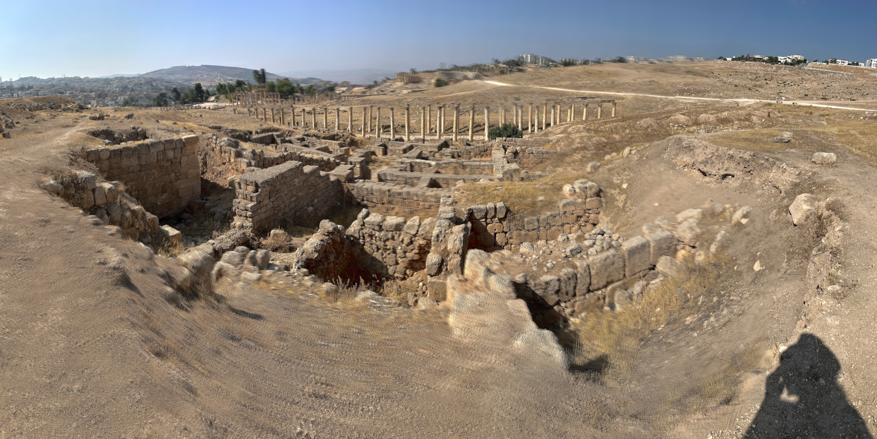
Photos by Jefferson Williams - 24 Jan. 2026 - Panorama of Ummayad
House - photo by JW
Stitched Panorama 0f Ummayad House at Jerash
Click on image to open a high resolution magnifiable image in a new tab
Note: Some distortion is inevitable in a stitched panorama
Photos by Jefferson Williams - 23 June 2025 - Re-used building elements
in the Ummayad House - photo by JW
Re-used building elements in the Ummayad House at Jerash
JW: This wall shows signs of recent reconstruction however the reconstruction may have preserved the re-used building elements present in the original wall
Click on image to open a high resolution magnifiable image in a new tab
Photo by Jefferson Williams - 23 June 2025
- General Plan of Jerash
from Wikipedia
- Early Islamic Jerash from
Rattenborg and Blanke (2017)
Early Islamic Jerash
Rattenborg and Blanke (2017) - Fig. 1 - Plan of the Umayyad House
from Gawlikowski (1992)
Fig. 1
Plan of the Umayyad House (7th century CE). from A. Ostrasz.
Gawlikowski (1992)
- General Plan of Jerash
from Wikipedia
- Early Islamic Jerash from
Rattenborg and Blanke (2017)
Early Islamic Jerash
Rattenborg and Blanke (2017) - Fig. 1 - Plan of the Umayyad House
from Gawlikowski (1992)
Fig. 1
Plan of the Umayyad House (7th century CE). from A. Ostrasz.
Gawlikowski (1992)
-
Earthquake Archeological Effects chart
of Rodríguez-Pascua et al (2013: 221-224)
 Earthquake Archeological Effects (EAE)
Rodríguez-Pascua et al (2013: 221-224)
| Effect | Location | Image(s) | Description | Intensity |
|---|---|---|---|---|
|
Umayyad House |
|
|
- Earthquake Archeological Effects chart
of Rodríguez-Pascua et al (2013: 221-224)
Earthquake Archeological Effects (EAE)
Rodríguez-Pascua et al (2013: 221-224)
| Effect | Location | Image(s) | Description | Intensity |
|---|---|---|---|---|
|
Umayyad House |
|
|