Jerash - City Walls
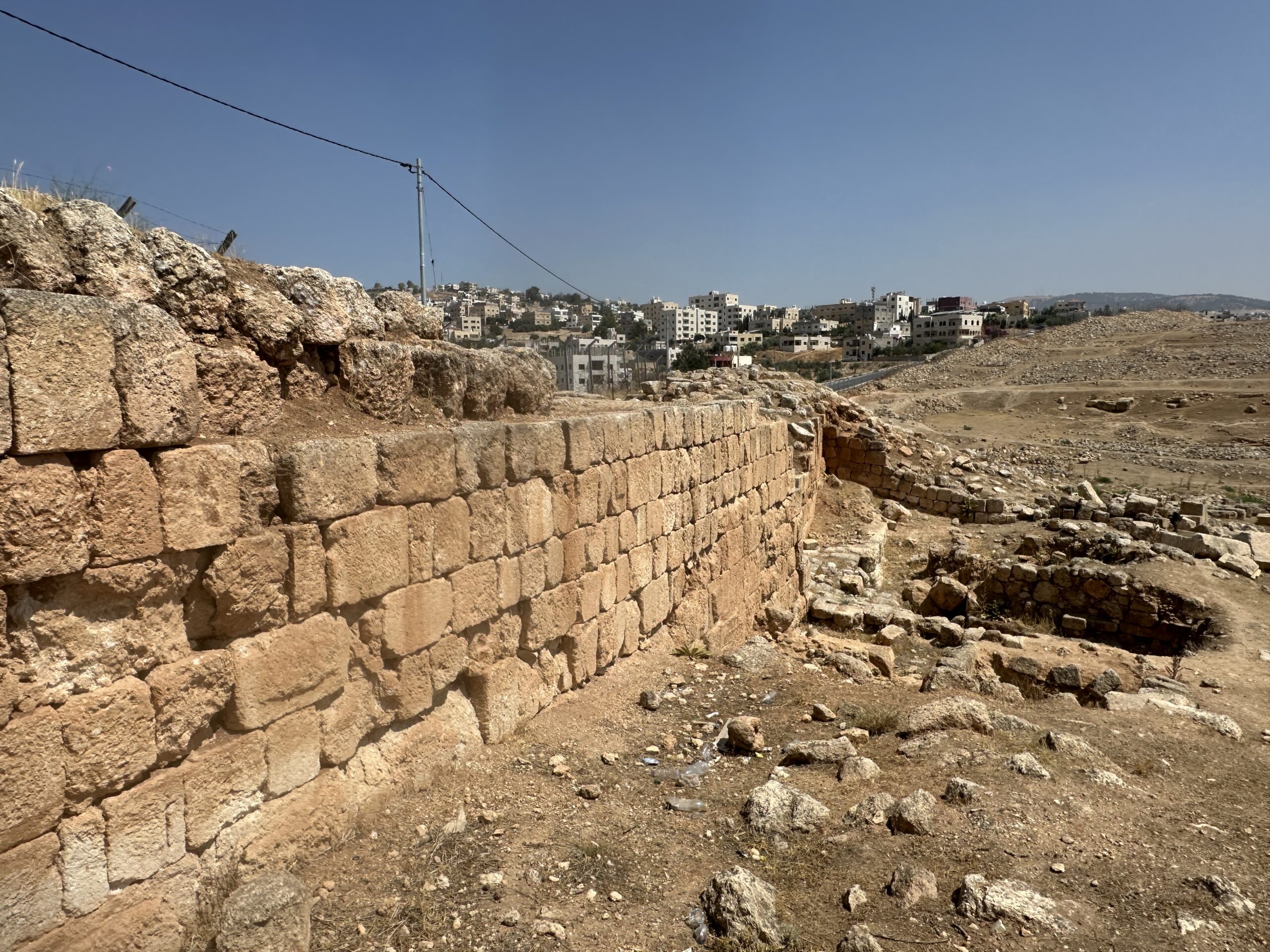 Western City Walls in Jerash
click on image to open in a new tab
Photo by Jefferson Williams - 23 June 2025
- Site Plan of Jerash
from Wikipedia
- Fig. 1 - Jerash City Walls
and Trench locations from Kehrberg-Ostrasz and Manley (2019)
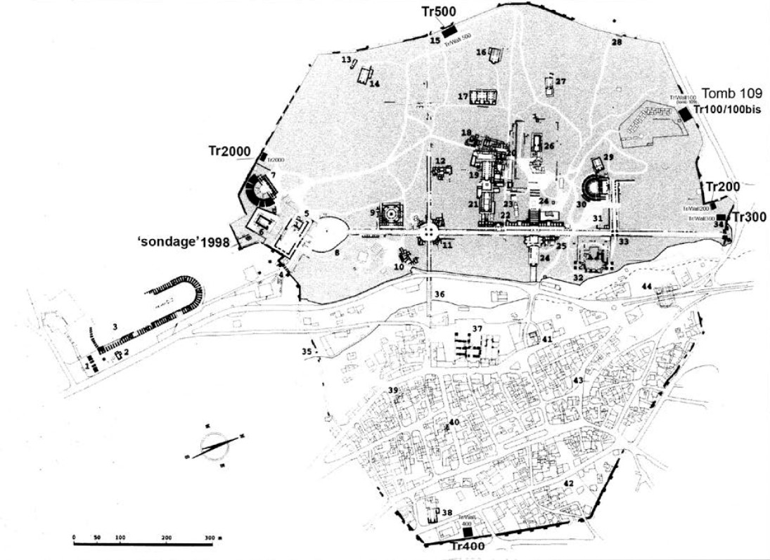 Fig. 1
JCW [Jarash City Walls] Project - trench locations:
- Tr/Wall 2000 (IFAPO season 2000)
- Tr/Wall 100,200,300 (JCWP season 2001)
- Tr/Wall 400,500 (JCWP 2002)
The AD 2000 plan of Gerasa (IFAPO, JP Braun et al (2001) ADAJ
Kehrberg-Ostrasz and Manley (2019)

- Site Plan of Jerash
from Wikipedia
- Fig. 1 - Jerash City Walls
and Trench locations from Kehrberg-Ostrasz and Manley (2019)
Fig. 1
JCW [Jarash City Walls] Project - trench locations:
- Tr/Wall 2000 (IFAPO season 2000)
- Tr/Wall 100,200,300 (JCWP season 2001)
- Tr/Wall 400,500 (JCWP 2002)
The AD 2000 plan of Gerasa (IFAPO, JP Braun et al (2001) ADAJ
Kehrberg-Ostrasz and Manley (2019)
- Plate 1:10 - Lower city
wall tumble layers from Kehrberg-Ostrasz and Manley (2019)
 Pl. 1:10
Tr 400: lower city wall tumble layers; N and S sections of tumble
Kehrberg-Ostrasz and Manley (2019)
- Plate 1:10 - Lower city
wall tumble layers from Kehrberg-Ostrasz and Manley (2019)
Pl. 1:10
Tr 400: lower city wall tumble layers; N and S sections of tumble
Kehrberg-Ostrasz and Manley (2019)
- Site Plan of Jerash
from Wikipedia
- Fig. 1 - Jerash City Walls
and Trench locations from Kehrberg-Ostrasz and Manley (2019)
Fig. 1
JCW [Jarash City Walls] Project - trench locations:
- Tr/Wall 2000 (IFAPO season 2000)
- Tr/Wall 100,200,300 (JCWP season 2001)
- Tr/Wall 400,500 (JCWP 2002)
The AD 2000 plan of Gerasa (IFAPO, JP Braun et al (2001) ADAJ
Kehrberg-Ostrasz and Manley (2019)
- Plate 1:10 - Lower city
wall tumble layers from Kehrberg-Ostrasz and Manley (2019)
Pl. 1:10
Tr 400: lower city wall tumble layers; N and S sections of tumble
Kehrberg-Ostrasz and Manley (2019)
- Plate 1:10 - Lower city
wall tumble layers from Kehrberg-Ostrasz and Manley (2019)
Pl. 1:10
Tr 400: lower city wall tumble layers; N and S sections of tumble
Kehrberg-Ostrasz and Manley (2019)
| Effect | Location | Image(s) | Description |
|---|---|---|---|
| Collapsed Walls | East Wall - Trench 400
Fig. 1 JCW [Jarash City Walls] Project - trench locations:
The AD 2000 plan of Gerasa (IFAPO, JP Braun et al (2001) ADAJ Kehrberg-Ostrasz and Manley (2019) |
Pl. 1:10 Tr 400: lower city wall tumble layers; N and S sections of tumble Kehrberg-Ostrasz and Manley (2019) |
|
- Modified by JW from Fig. 1 of Kehrberg-Ostrasz and Manley (2019)
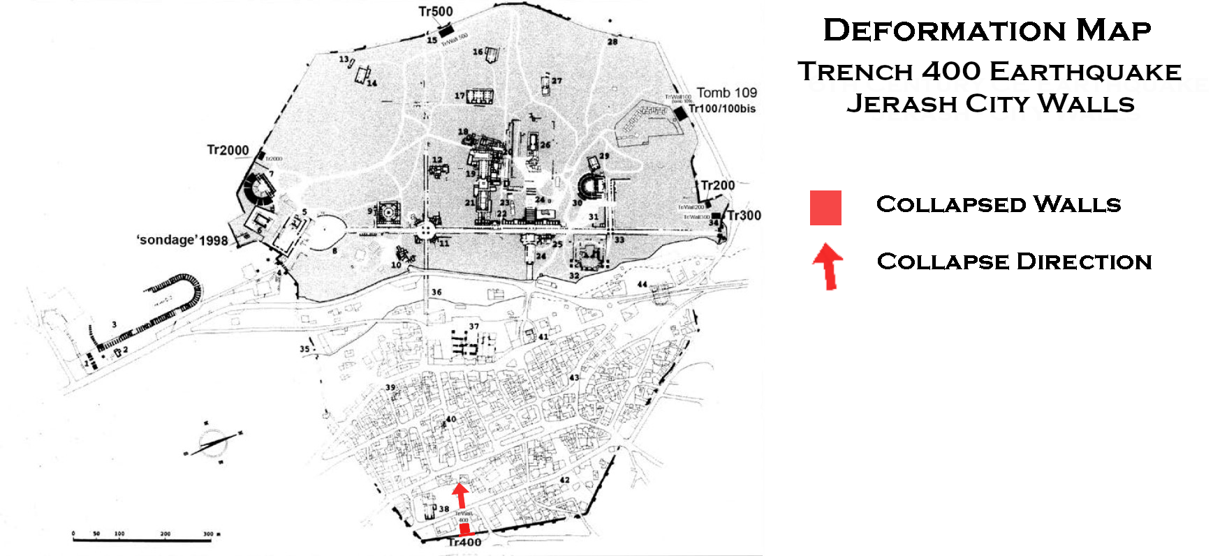 Deformation Map
Click on image to open in a new tab
Modified by JW from Fig. 1 of Kehrberg-Ostrasz and Manley (2019)
-
Earthquake Archeological Effects chart
of Rodríguez-Pascua et al (2013: 221-224)
 Earthquake Archeological Effects (EAE)
Rodríguez-Pascua et al (2013: 221-224)
| Effect | Location | Image(s) | Description | Intensity |
|---|---|---|---|---|
| Collapsed Walls | East Wall - Trench 400
Fig. 1 JCW [Jarash City Walls] Project - trench locations:
The AD 2000 plan of Gerasa (IFAPO, JP Braun et al (2001) ADAJ Kehrberg-Ostrasz and Manley (2019) |
Pl. 1:10 Tr 400: lower city wall tumble layers; N and S sections of tumble Kehrberg-Ostrasz and Manley (2019) |
|
VIII + |