Amman Citadel - Umayyad Structures
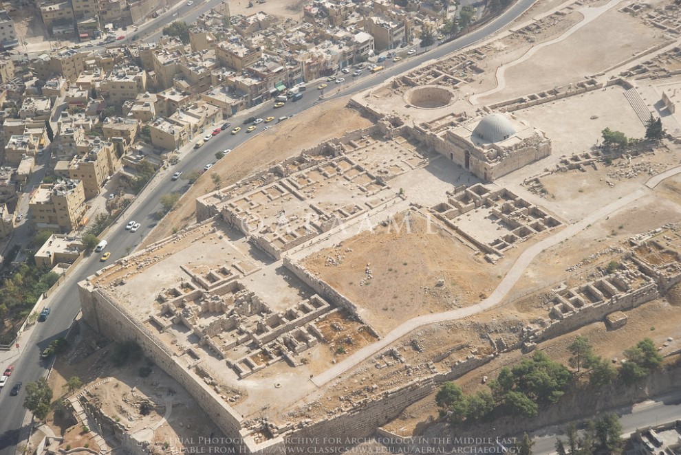 Aerial Photograph of the Northern part of Citadel in Amman with the Umayyad Palace and Umayyad Structures
APAAME CC BY-NC-ND 2.0
| Transliterated Name | Language | Name |
|---|---|---|
| Umayyad Palace | English | |
| al-Qasr | Arabic | القصر |
- Citadel of Amman in Google Earth
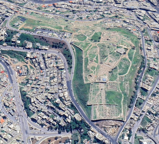 Citadel of Amman in Google Earth
click on image to explore this site on a new tab in Google Earth
- Site Plan of the entire
Citadel in Amman from maps-amman.com
 Amman Citadel
JW: Umayyad Palace at top of map
from maps-amman.com/amman-citadel-map
- Area Plan of the entire
Citadel in Amman from maps-amman.com
Amman Citadel
JW: Umayyad Palace at top of map
from maps-amman.com/amman-citadel-map
- Fig. 1 - General plan of
the north part of the Amman citadel from Alamgro et al (2000)
 Figure 1
General plan of the north part of the Amman citadel.
Alamgro et al (2000) - Fig. 1 - Congregational
Mosque and Souq Square on the Citadel in Amman from Arce (2000)
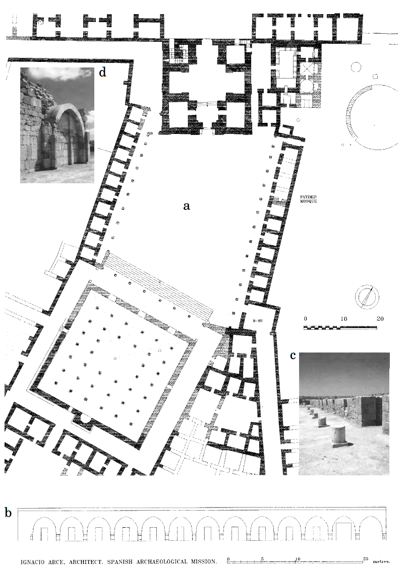 Figure 1
Congregational Mosque and Souq Square at Amman Citadel:
- General plan
- Elevation of the souq east portico.
- View to north of the souq east portico
- View of the blind arch on the western façade of the vestibule
Arce (2000)
- Fig. 1 - General plan of
the north part of the Amman citadel from Alamgro et al (2000)
Figure 1
General plan of the north part of the Amman citadel.
Alamgro et al (2000) - Fig. 1 - Congregational
Mosque and Souq Square on the Citadel in Amman from Arce (2000)
Figure 1
Congregational Mosque and Souq Square at Amman Citadel:
- General plan
- Elevation of the souq east portico.
- View to north of the souq east portico
- View of the blind arch on the western façade of the vestibule
Arce (2000)
- Fig. 2 - Plan of Building F
from Alamgro et al (2000)
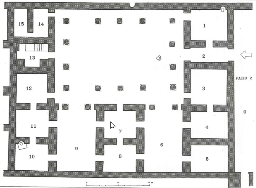 Figure 2
Plan of Building F
Alamgro et al (2000) - Fig. 3 - Aerial View of
Building F from Alamgro et al (2000)
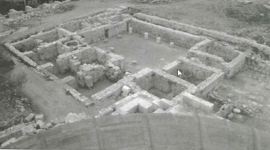 Figure 3
Building F from the top of the entrance hall dome
Alamgro et al (2000) - Fig. 5 - Aerial View of
Building F and the courtyard with remains of columns and arches from Alamgro et al (2000)
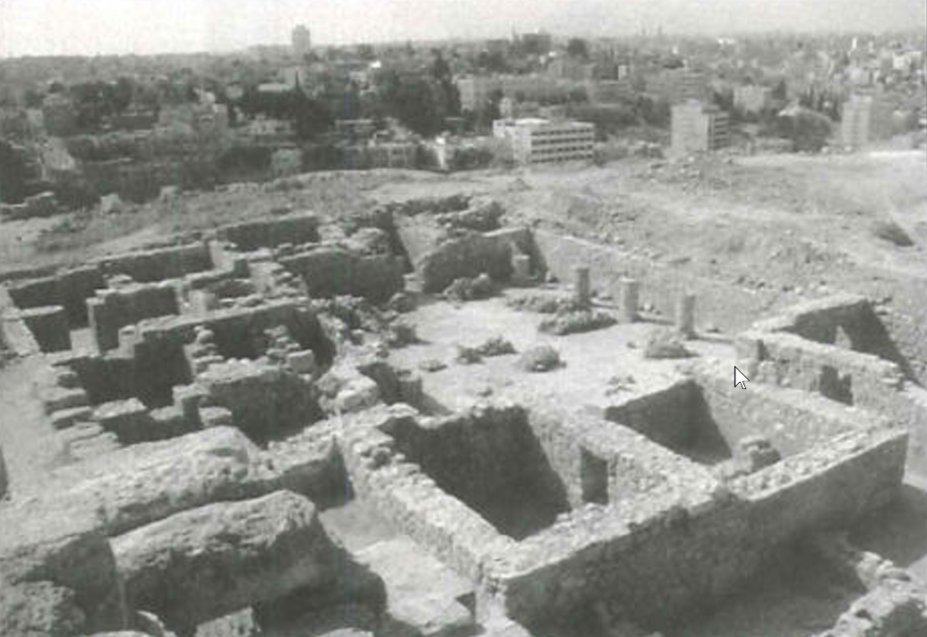 Figure 5
Building F and the courtyard with remains of the columns and arches
Alamgro et al (2000) - Fig. 6 - Plan of remains
of columns and arches in the courtyard of Building F from Alamgro et al (2000)
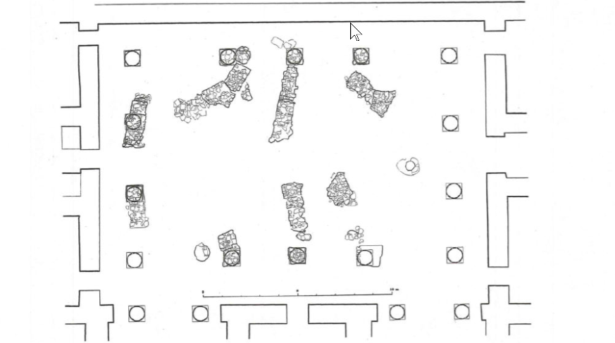 Figure 6
Remains of columns and arches in the courtyard of building F
Alamgro et al (2000) - Fig. 12 - Late structures
in building F from Alamgro et al (2000)
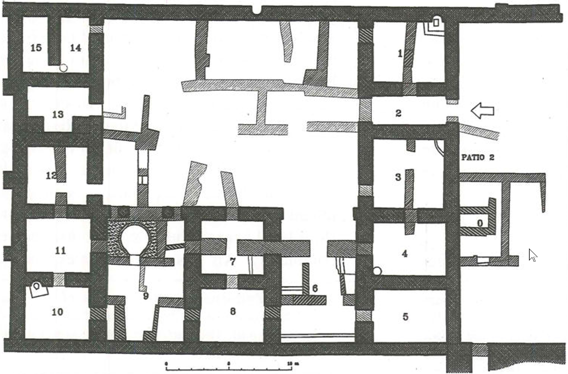 Figure 12
Late structures in building F
Alamgro et al (2000) - Early and Late structures
in building F
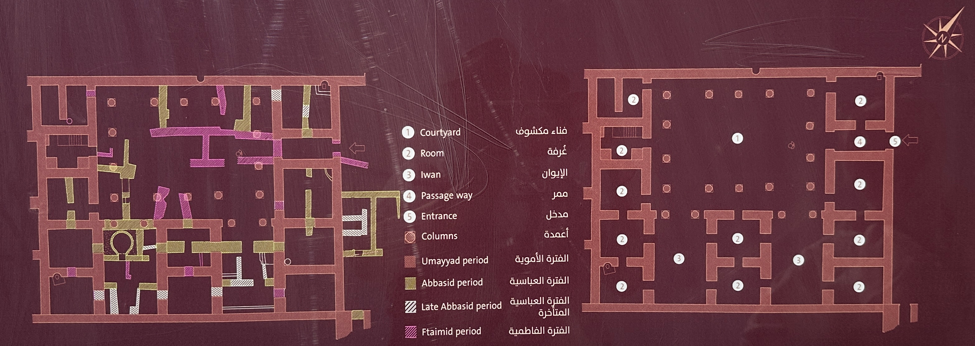 Plan of Early and Late structures in building F
Sign at Amman Citadel
Photo by Jefferson Williams - 19 June 2025
- Fig. 2 - Plan of Building F
from Alamgro et al (2000)
Figure 2
Plan of Building F
Alamgro et al (2000) - Fig. 3 - Aerial View of
Building F from Alamgro et al (2000)
Figure 3
Building F from the top of the entrance hall dome
Alamgro et al (2000) - Fig. 5 - Aerial View of
Building F and the courtyard with remains of columns and arches from Alamgro et al (2000)
Figure 5
Building F and the courtyard with remains of the columns and arches
Alamgro et al (2000) - Fig. 6 - Plan of remains
of columns and arches in the courtyard of Building F from Alamgro et al (2000)
Figure 6
Remains of columns and arches in the courtyard of building F
Alamgro et al (2000) - Fig. 12 - Late structures
in building F from Alamgro et al (2000)
Figure 12
Late structures in building F
Alamgro et al (2000) - Early and Late structures
in building F
Plan of Early and Late structures in building F
Sign at Amman Citadel
Photo by Jefferson Williams - 19 June 2025
- Fig. 1 - Plan from
Harding (1951)
 Figure 1
Harding (1951)
- Fig. 1 - Plan from
Harding (1951)
Figure 1
Harding (1951)
- Fig. 7 - South Front of
Courtyard of Building F from Alamgro et al (2000)
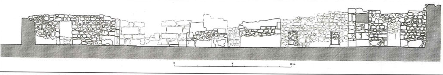 Figure 7
South Front of Courtyard of Building F
Alamgro et al (2000) - Fig. 8 - Stratigraphy of
Room 1 of Building F from Alamgro et al (2000)
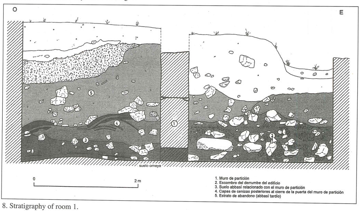 Figure 8
Stratigraphy of Room 1
Alamgro et al (2000) - Fig. 9 - Cross-section
of cistern in Room 1 of Building F from Alamgro et al (2000)
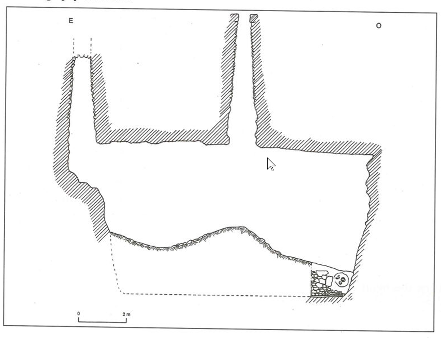 Figure 9
Cross-section of cistern in Room 1
Alamgro et al (2000) - Fig. 10 - Stratigraphy of
Room 3 of Building F from Alamgro et al (2000)
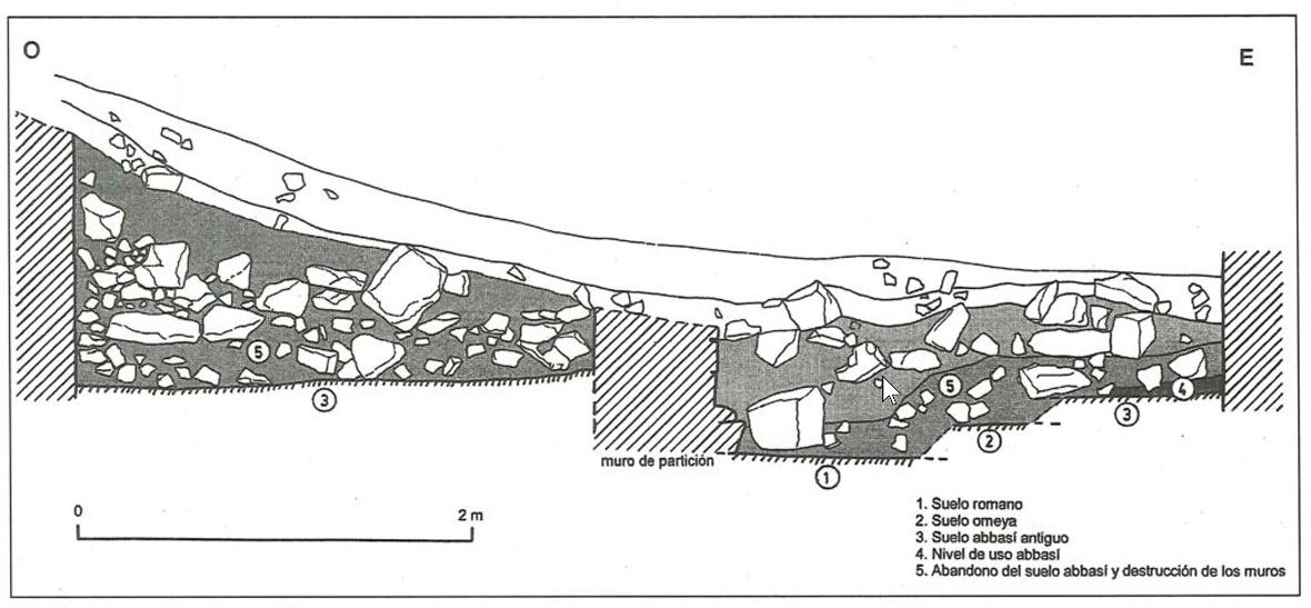 Figure 10
Stratigraphy of Room 3
Alamgro et al (2000)
- Fig. 7 - South Front of
Courtyard of Building F from Alamgro et al (2000)
Figure 7
South Front of Courtyard of Building F
Alamgro et al (2000) - Fig. 8 - Stratigraphy of
Room 1 of Building F from Alamgro et al (2000)
Figure 8
Stratigraphy of Room 1
Alamgro et al (2000) - Fig. 9 - Cross-section
of cistern in Room 1 of Building F from Alamgro et al (2000)
Figure 9
Cross-section of cistern in Room 1
Alamgro et al (2000) - Fig. 10 - Stratigraphy of
Room 3 of Building F from Alamgro et al (2000)
Figure 10
Stratigraphy of Room 3
Alamgro et al (2000)
- Fig. 11 - Column and Capital
made with rubble masonry and gypsum mortar in Building F from Alamgro et al (2000)
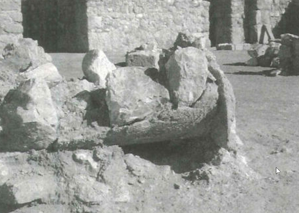 Figure 11
Column and Capital made with rubble masonry and gypsum mortar
Alamgro et al (2000) - Fig. 13 - Base Column and
Arch collapsed in the courtyard of Building F from Alamgro et al (2000)
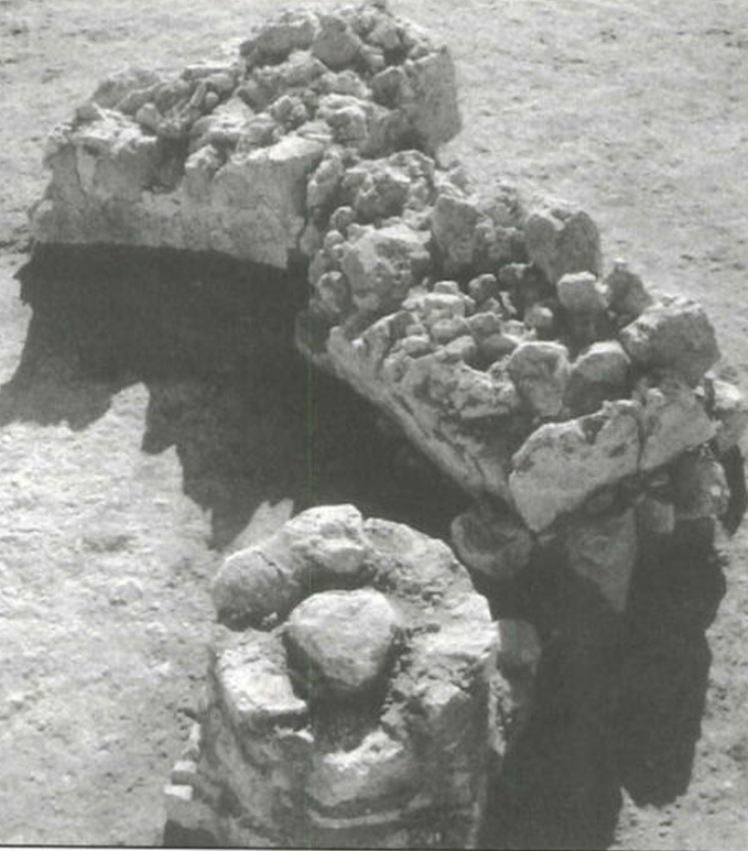 Figure 13
Base Column and Arch collapsed in the courtyard
Alamgro et al (2000) - Fig. 14 - The west iwan
blocked by late structures of Building F from Alamgro et al (2000)
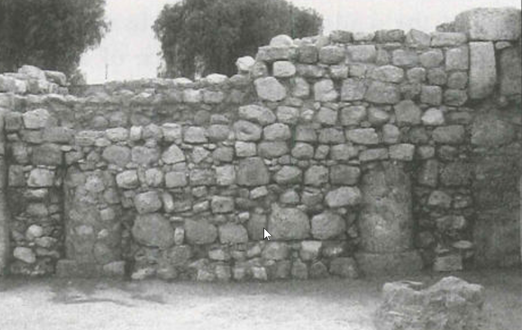 Figure 14
The west iwan blocked by late structures
Alamgro et al (2000) - Plaster Level in Building
F - photo by JW
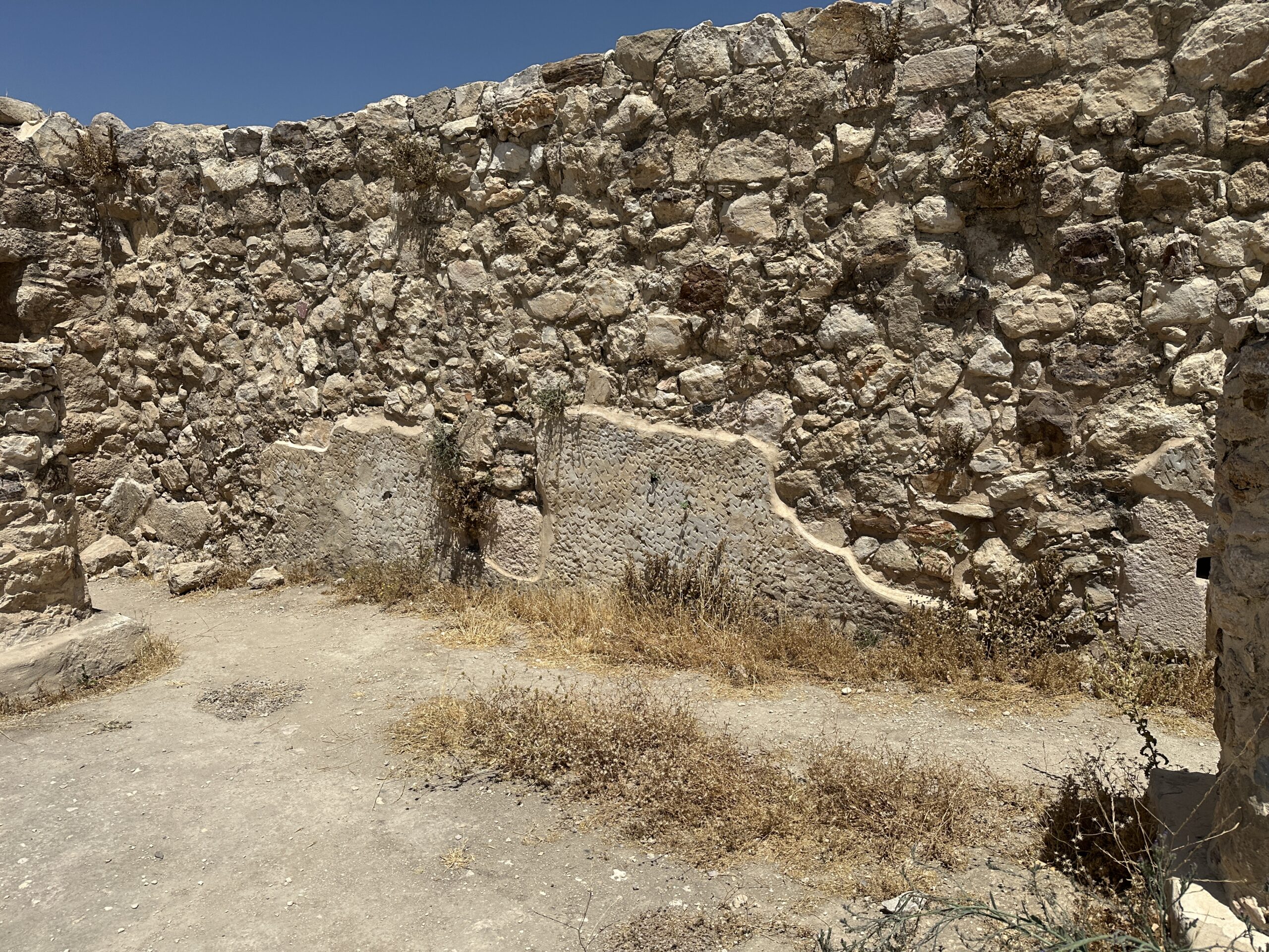 Plaster Level in Building F
Photo by Jefferson Williams - 19 June 2025 - Plaster Level in Building
F - another photo by JW
 Plaster Level in Building F
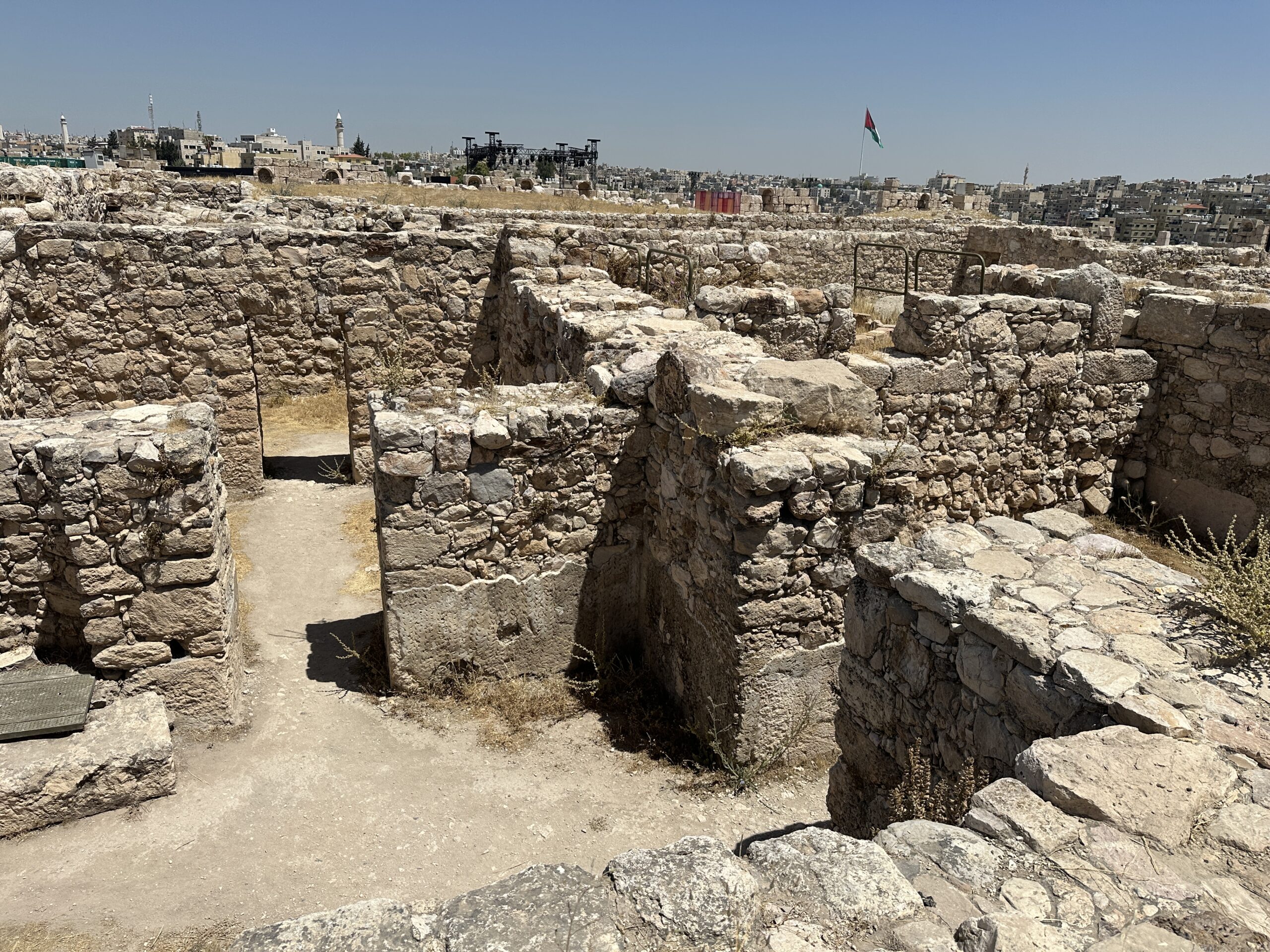
Another Photo by Jefferson Williams - 19 June 2025 - ~E-W Walls in Building F
- original Ummayad construction ? - photo by JW
 ~E-W Walls in Building F - original Ummayad construction ?
Photo by Jefferson Williams - 19 June 2025
- Fig. 11 - Column and Capital
made with rubble masonry and gypsum mortar in Building F from Alamgro et al (2000)
Figure 11
Column and Capital made with rubble masonry and gypsum mortar
Alamgro et al (2000) - Fig. 13 - Base Column and
Arch collapsed in the courtyard of Building F from Alamgro et al (2000)
Figure 13
Base Column and Arch collapsed in the courtyard
Alamgro et al (2000) - Fig. 14 - The west iwan
blocked by late structures of Building F from Alamgro et al (2000)
Figure 14
The west iwan blocked by late structures
Alamgro et al (2000) - Plaster Level in Building
F - photo by JW
Plaster Level in Building F
Photo by Jefferson Williams - 19 June 2025 - Plaster Level in Building
F - another photo by JW
Plaster Level in Building F
Another Photo by Jefferson Williams - 19 June 2025 - ~E-W Walls in Building F
- original Ummayad construction ? - photo by JW
~E-W Walls in Building F - original Ummayad construction ?
Photo by Jefferson Williams - 19 June 2025
- Area Plan of the Citadel
in Amman from maps-amman.com
Amman Citadel
JW: Umayyad Palace at top of map
from maps-amman.com/amman-citadel-map - Fig. 1 - General plan of
the north part of the Amman citadel from Alamgro et al (2000)
Figure 1
General plan of the north part of the Amman citadel.
Alamgro et al (2000) - Fig. 1 - Congregational
Mosque and Souq Square on the Citadel in Amman from Arce (2000)
Figure 1
Congregational Mosque and Souq Square at Amman Citadel:
- General plan
- Elevation of the souq east portico.
- View to north of the souq east portico
- View of the blind arch on the western façade of the vestibule
Arce (2000) - Fig. 1 - Plan from
Harding (1951)
Figure 1
Harding (1951)
| Effect | Location | Image (s) | Comments |
|---|---|---|---|
|
Building F
Figure 1 General plan of the north part of the Amman citadel. Alamgro et al (2000)
Figure 2Plan of Building F Alamgro et al (2000)
Figure 3Building F from the top of the entrance hall dome Alamgro et al (2000)
Figure 12Late structures in building F Alamgro et al (2000)
Plan of Early and Late structures in building FSign at Amman Citadel Photo by Jefferson Williams - 19 June 2025 |
Figure 5 Building F and the courtyard with remains of the columns and arches Alamgro et al (2000)
Figure 6Remains of columns and arches in the courtyard of building F Alamgro et al (2000)
Figure 13Base Column and Arch collapsed in the courtyard Alamgro et al (2000)
Figure 14The west iwan blocked by late structures Alamgro et al (2000)
Plaster Level in Building FPhoto by Jefferson Williams - 19 June 2025
Plaster Level in Building FAnother Photo by Jefferson Williams - 19 June 2025 |
|
|
Courtyard of Building F
Figure 1 General plan of the north part of the Amman citadel. Alamgro et al (2000)
Figure 2Plan of Building F Alamgro et al (2000)
Figure 3Building F from the top of the entrance hall dome Alamgro et al (2000)
Figure 12Late structures in building F Alamgro et al (2000)
Plan of Early and Late structures in building FSign at Amman Citadel Photo by Jefferson Williams - 19 June 2025 |
Figure 5 Building F and the courtyard with remains of the columns and arches Alamgro et al (2000)
Figure 6Remains of columns and arches in the courtyard of building F Alamgro et al (2000)
Figure 13Base Column and Arch collapsed in the courtyard Alamgro et al (2000) |
|
| Broken Columns | Colonnaded Street between Buildings C and B to the east and D and E to the west
Figure 1 General plan of the north part of the Amman citadel. Alamgro et al (2000) |
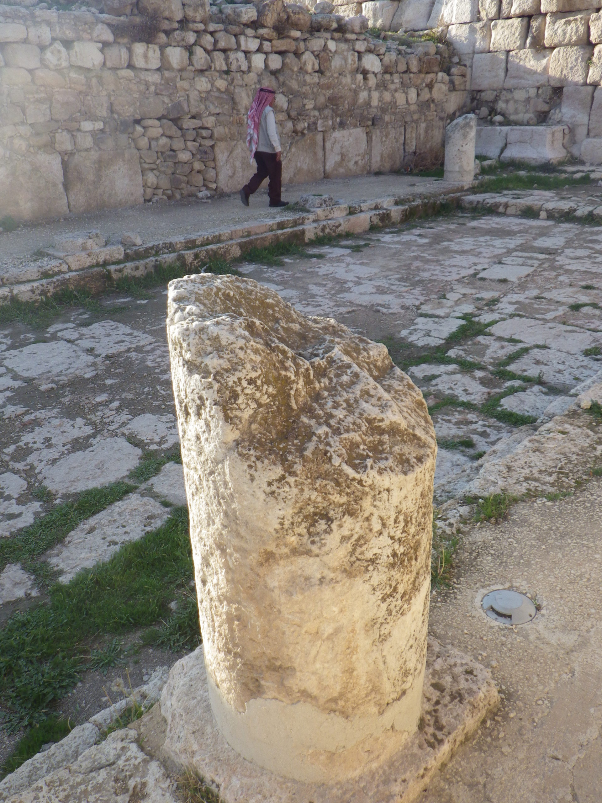 Broken Columns at Colonnaded Street in Umayyad Palace Amman, Jordan
Photo by Jefferson Williams |
JW: These breaks, albeit undated, may have occurred as a result of the Mid 8th century CE earthquake |
|
Room H of Harding (1951).
Harding (1951:7)
describes the area excavated as being located on the south side of the western, highest part of the citadelbeneath what is now the Jordan Museum.
Amman CitadelJW: Umayyad Palace at top of map from maps-amman.com/amman-citadel-map
Figure 1Harding (1951) |
Harding (1951:10-11) described wall collapse in Room H
associated with a fragments of a sandstone fire altarwhich he presumed was on a shelf before the wall collapsed. |
|
|
Rooms L and M of Harding (1951).
Harding (1951:7)
describes the area excavated as being located on the south side of the western, highest part of the citadelbeneath what is now the Jordan Museum.
Amman CitadelJW: Umayyad Palace at top of map from maps-amman.com/amman-citadel-map
Figure 1Harding (1951) |
Rooms L and M had what was probably a basement and a ground floor level both supported on arches. The arches of the basement were intact, but those of the ground floor had collapsed and fallen through into the basement.- Harding (1951:7-8) |
|
|
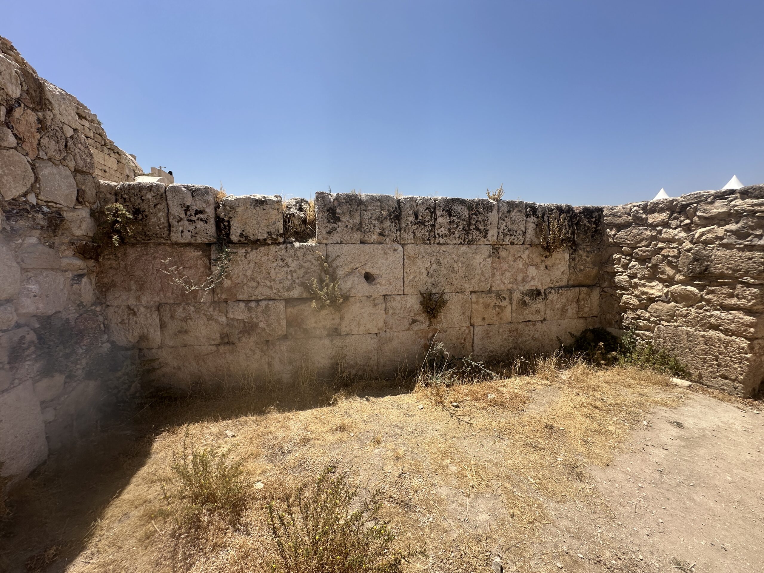
the portico and the architrave of the magnificent temple of Hercules
Amman Citadelfrom maps-amman.com/amman-citadel-map |
 Fallen Column at Temple of Herculus
JW: I do not know the reason for or date of the column collapse Photo by Jefferson Williams - 19 June 2025 |
The columns of the portico and the architrave of the magnificent temple of Hercules, which is a building from the middle of the second century A.D., which was already being used as a quarry, were demolished by the earthquake.- Alamgro et al (2000) |
|
Two Umayyad houses in the sector that Northedge denominated "C"
Amman Citadelfrom maps-amman.com/amman-citadel-map |
In the sector that Northedge denominated "C", the remains of two houses from the Umayyad period were discovered, together with the street which separated them. The westernmost one was so seriously affected by the seismic movement that it could only be partially reused in later periods. The easternmost dwelling showed similar signs of destruction to the previous one, and of a partial reoccupation after the disaster; the human skeleton of one of the victims was discovered here- Alamgro et al (2000) |
- Modified by JW from Figs. 2 and 6 of Almagro et al. (2000)
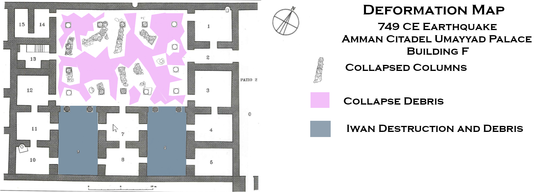 Deformation Map
Modified by JW from Figs. 2 and 6 of of Almagro et al. (2000)
- Earthquake Archeological Effects chart
of Rodríguez-Pascua et al (2013: 221-224)
 Earthquake Archeological Effects (EAE)
Rodríguez-Pascua et al (2013: 221-224)
| Effect | Location | Image (s) | Comments | Intensity |
|---|---|---|---|---|
|
Building F
Figure 1 General plan of the north part of the Amman citadel. Alamgro et al (2000)
Figure 2Plan of Building F Alamgro et al (2000)
Figure 3Building F from the top of the entrance hall dome Alamgro et al (2000)
Figure 12Late structures in building F Alamgro et al (2000)
Plan of Early and Late structures in building FSign at Amman Citadel Photo by Jefferson Williams - 19 June 2025 |
Figure 5 Building F and the courtyard with remains of the columns and arches Alamgro et al (2000)
Figure 6Remains of columns and arches in the courtyard of building F Alamgro et al (2000)
Figure 13Base Column and Arch collapsed in the courtyard Alamgro et al (2000)
Figure 14The west iwan blocked by late structures Alamgro et al (2000)
Plaster Level in Building FPhoto by Jefferson Williams - 19 June 2025
Plaster Level in Building FAnother Photo by Jefferson Williams - 19 June 2025 |
|
|
|
Courtyard of Building F
Figure 1 General plan of the north part of the Amman citadel. Alamgro et al (2000)
Figure 2Plan of Building F Alamgro et al (2000)
Figure 3Building F from the top of the entrance hall dome Alamgro et al (2000)
Figure 12Late structures in building F Alamgro et al (2000)
Plan of Early and Late structures in building FSign at Amman Citadel Photo by Jefferson Williams - 19 June 2025 |
Figure 5 Building F and the courtyard with remains of the columns and arches Alamgro et al (2000)
Figure 6Remains of columns and arches in the courtyard of building F Alamgro et al (2000)
Figure 13Base Column and Arch collapsed in the courtyard Alamgro et al (2000) |
|
|
| Broken Columns | Colonnaded Street between Buildings C and B to the east and D and E to the west
Figure 1 General plan of the north part of the Amman citadel. Alamgro et al (2000) |
Broken Columns at Colonnaded Street in Umayyad Palace Amman, Jordan Photo by Jefferson Williams |
JW: These breaks, albeit undated, may have occurred as a result of the Mid 8th century CE earthquake | VIII+ |
|
Room H of Harding (1951).
Harding (1951:7)
describes the area excavated as being located on the south side of the western, highest part of the citadelbeneath what is now the Jordan Museum.
Amman CitadelJW: Umayyad Palace at top of map from maps-amman.com/amman-citadel-map
Figure 1Harding (1951) |
Harding (1951:10-11) described wall collapse in Room H
associated with a fragments of a sandstone fire altarwhich he presumed was on a shelf before the wall collapsed. |
|
|
|
Rooms L and M of Harding (1951).
Harding (1951:7)
describes the area excavated as being located on the south side of the western, highest part of the citadelbeneath what is now the Jordan Museum.
Amman CitadelJW: Umayyad Palace at top of map from maps-amman.com/amman-citadel-map
Figure 1Harding (1951) |
Rooms L and M had what was probably a basement and a ground floor level both supported on arches. The arches of the basement were intact, but those of the ground floor had collapsed and fallen through into the basement.- Harding (1951:7-8) |
|
|
|
the portico and the architrave of the magnificent temple of Hercules
Amman Citadelfrom maps-amman.com/amman-citadel-map |
Fallen Column at Temple of Herculus JW: I do not know the reason for or date of the column collapse Photo by Jefferson Williams - 19 June 2025 |
The columns of the portico and the architrave of the magnificent temple of Hercules, which is a building from the middle of the second century A.D., which was already being used as a quarry, were demolished by the earthquake.- Alamgro et al (2000) |
|
|
Two Umayyad houses in the sector that Northedge denominated "C"
Amman Citadelfrom maps-amman.com/amman-citadel-map |
In the sector that Northedge denominated "C", the remains of two houses from the Umayyad period were discovered, together with the street which separated them. The westernmost one was so seriously affected by the seismic movement that it could only be partially reused in later periods. The easternmost dwelling showed similar signs of destruction to the previous one, and of a partial reoccupation after the disaster; the human skeleton of one of the victims was discovered here- Alamgro et al (2000) |
|