Amman - Introduction
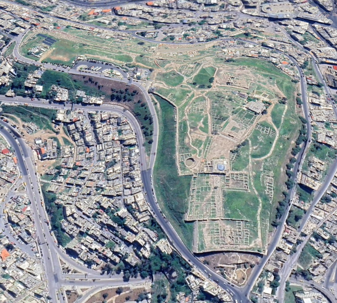
 Central Amman in Google Earth
click on image to explore this site on a new tab in Google Earth
| Transliterated Name | Language | Name |
|---|---|---|
| Amman | Arabic | عَمَّان |
| Philadelphia | Ancient Greek | Φιλαδέλφεια |
| Rabbat Amman | Ammonite | |
| Rabbat Bnei ʿAmmon" | Biblical Hebrew | רבת בני עמון |
| Rabbaṯ Bəne ʿAmmôn | Tiberian Hebrew | |
| Rabbat Ammon | Modern Hebrew | |
| Bit Ammanu | Assyrian | |
| KURBīt Ammān | Akkadian |
- Citadel of Amman in Google Earth
 Citadel of Amman in Google Earth
click on image to explore this site on a new tab in Google Earth
- Area Plan of the Citadel
in Amman from maps-amman.com
 Amman Citadel
JW: Umayyad Palace at top of map
from maps-amman.com/amman-citadel-map
- Area Plan of the Citadel
in Amman from maps-amman.com
Amman Citadel
JW: Umayyad Palace at top of map
from maps-amman.com/amman-citadel-map
- Fig. 3 - Plan of the
Roman Theater and Forum Area from Meyers et. al. (1997)
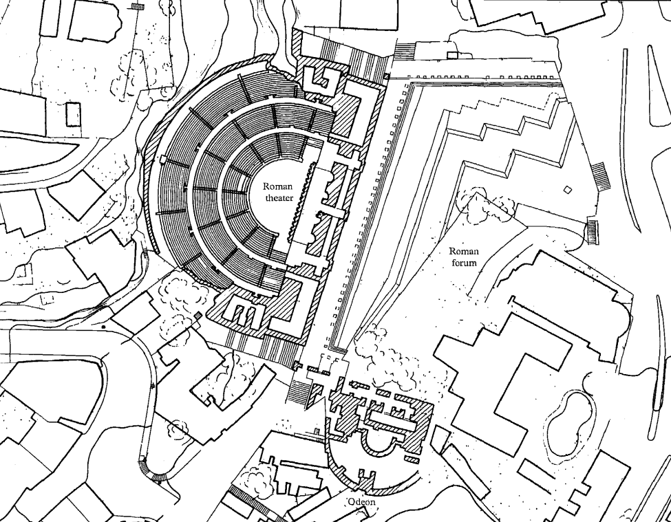 Figure 3
Plan of the Roman Theater and Forum Area
Courtesy of R. Dornemann
Meyers et. al. (1997)
- Fig. 3 - Plan of the
Roman Theater and Forum Area from Meyers et. al. (1997)
Figure 3
Plan of the Roman Theater and Forum Area
Courtesy of R. Dornemann
Meyers et. al. (1997)
- Fallen Column at Temple of Herculus
on the Amman Citadel - photo by JW
 Fallen Column at Temple of Herculus
JW: I do not know the reason for or date of the column collapse
Photo by Jefferson Williams - 19 June 2025 - Displaced voissor in arch
in Ummayad part of the Amman Citadel - photo by JW
 Displaced voissor in arch on Amman Citadel
JW: LOcation was in the Ummayad part of the Amman Citadel. Cause and date of displacement unknown
Photo by Jefferson Williams - 19 June 2025 - Closeup of Displaced voissor
in arch in Ummayad part of the Amman Citadel - photo by JW
 Closeup of displaced voissor in arch on Amman Citadel
JW: LOcation was in the Ummayad part of the Amman Citadel. Cause and date of displacement unknown
Photo by Jefferson Williams - 19 June 2025
- Fallen Column at Temple of Herculus
on the Amman Citadel - photo by JW
Fallen Column at Temple of Herculus
JW: I do not know the reason for or date of the column collapse
Photo by Jefferson Williams - 19 June 2025 - Displaced voissor in arch
in Ummayad part of the Amman Citadel - photo by JW
Displaced voissor in arch on Amman Citadel
JW: LOcation was in the Ummayad part of the Amman Citadel. Cause and date of displacement unknown
Photo by Jefferson Williams - 19 June 2025 - Closeup of Displaced voissor
in arch in Ummayad part of the Amman Citadel - photo by JW
Closeup of displaced voissor in arch on Amman Citadel
JW: LOcation was in the Ummayad part of the Amman Citadel. Cause and date of displacement unknown
Photo by Jefferson Williams - 19 June 2025