Earthquake I

Area J-East in the archaeological site of Aila preserves one of the
most detailed archaeoseismic records along the southern
Dead Sea Transform. Located approximately 500 m north
of the modern shoreline of the Gulf of Aqaba and about
500 m northwest of the later Islamic city of
Ayla, the Nabatean, Roman, Byzantine, and Early Islamic
occupation sequence spans from the first century CE
through the Early Islamic period.
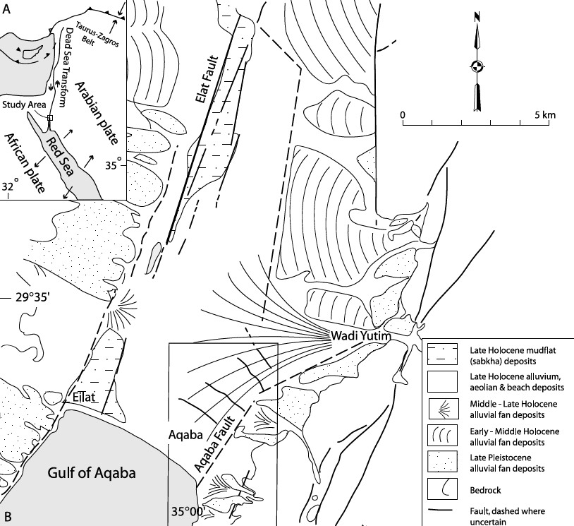
Aila occupies a tectonic setting at
the northern end of the Gulf of Aqaba where
left-lateral motion on the Aqaba Fault is transferred
westward across the Wadi Arabah by a series of
shoreline-parallel normal cross faults. One of these
active faults (CF-5) intersects the western part of
Area J-East, providing a rare opportunity to document
repeated surface faulting, structural damage, repair,
and stratigraphic displacement within a well-dated
archaeological sequence.
Thomas et al. (2007)
described Earthquake I as “the youngest earthquake
recorded at this site,” noting that it “ruptured faults
very close to the modern ground surface.” They reported
that an intervening
aeolian layer between
Earthquakes II and I contained “Late Byzantine (sixth
to early seventh century A.D.) and Umayyad (mid
seventh to mid eighth century) pottery.” They further
explained that “the fault rupture of Earthquake I was
capped by sand and disturbed modern car park
construction deposits, thus preventing finer dating
than post–mid to late eighth century.”
Earthquake I ruptured Faults F and H.
Thomas et al. (2007)
measured a total of 35 cm of southwest dip-slip with
“little or no apparent strike-slip.” They also observed
that the fault ruptures “trend more toward the west
(N12°W and N34°W) than the fault rupture in previous
earthquakes (ca. 10° more than II to III, and ca. 20°
more than the Byzantine Earthquakes V to VI).”



Deformation Map