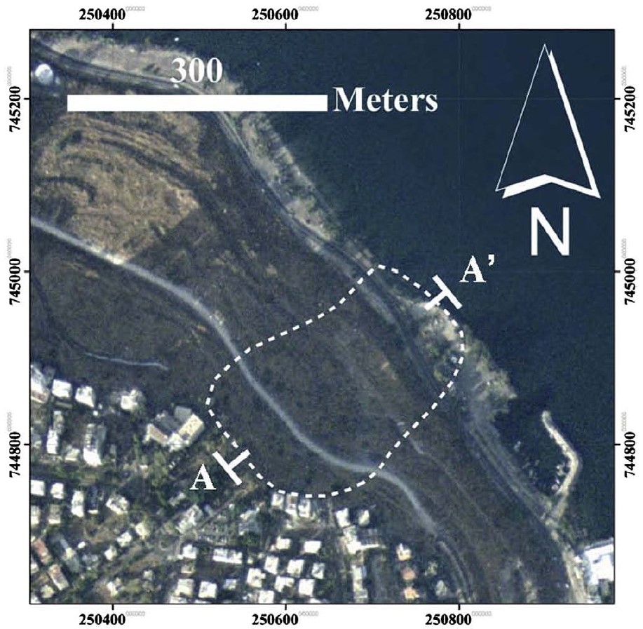
Fishing Dock Landslide Earthquake (?)

The Fishing Dock landslide is effectively undated.
While Yagoda-Biran et al. (2010)
suggested that it is relatively young because the landslide
scarp is still clearly visible today, its age is only broadly
constrained to between about 60,000 years
BP
and recent times. The authors speculated that the
landslide may have been triggered by one of the
749 CE Sabbatical Year earthquakes.
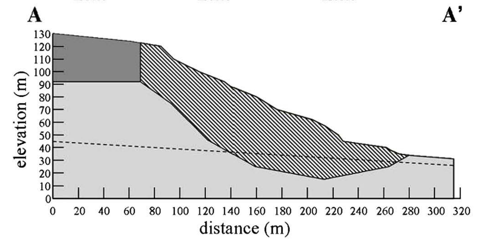
Yagoda-Biran et al. (2010)
also conducted a
slope-stability back-analysis
of the landslide and estimated that a
local shaking intensity
between 6.5 and 8.2 was required to initiate sliding.
Their analysis demonstrated that the position of the water
table strongly influences the results of the
slope-stability back-analysis.
When the water table was elevated and near to the surface, the slope
was less stable and required weaker shaking to fail, with
sliding predicted at intensities as low as about 6.5. When the
water table was deeper, the slope was more stable and required
stronger shaking, approaching an intensity of 8.2, to initiate
sliding. The higher value corresponds to the water-table depth
present at the time
Yagoda-Biran et al. (2010)
conducted their study.