The northern Ein Gev landslide shows a multi-phase sliding history. The youngest slide was dated to ca. 5 BP, equivalent to roughly 3050 BCE. According to Kagan (2011), the dating uncertainty is ±300 years, placing the event between about 3350 and 2750 BCE. Katz et al. (2009:281–282) report that the event produced roughly 0.8 m of vertical displacement of the slope surface and estimate a moment magnitude greater than MW 6.0. Katz et al. (2009) also conducted a slope-stability back-analysis of the landslide and estimated a local shaking intensity between approximately VIII (8) and IX (9).
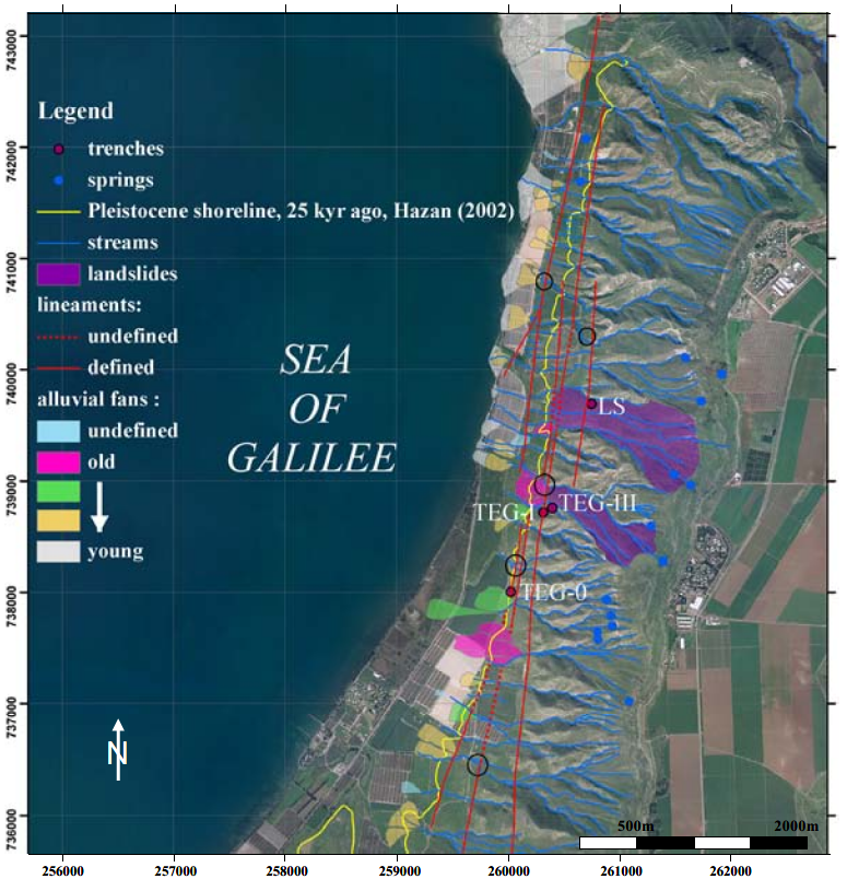
Fig. 2 - Morphotectonic map of the studied area (coordinates are in Israeli TM grid). The map is based mainly on areal photos (dated 1945), interpretation, and complementary field work. Mapped are all lineaments, landslides, fluvial systems (with sites of channel displacement marked by open black circle) and alluvial fans located within the study area. Also shown are the sites of the paleoseismic trenches and the highest shore line of the Sea of Galilee, 170 m below sea level, achieved at 25 ka (Hazan et al., 2005) - Click on image to open in a new tab - Katz et al (2009)
