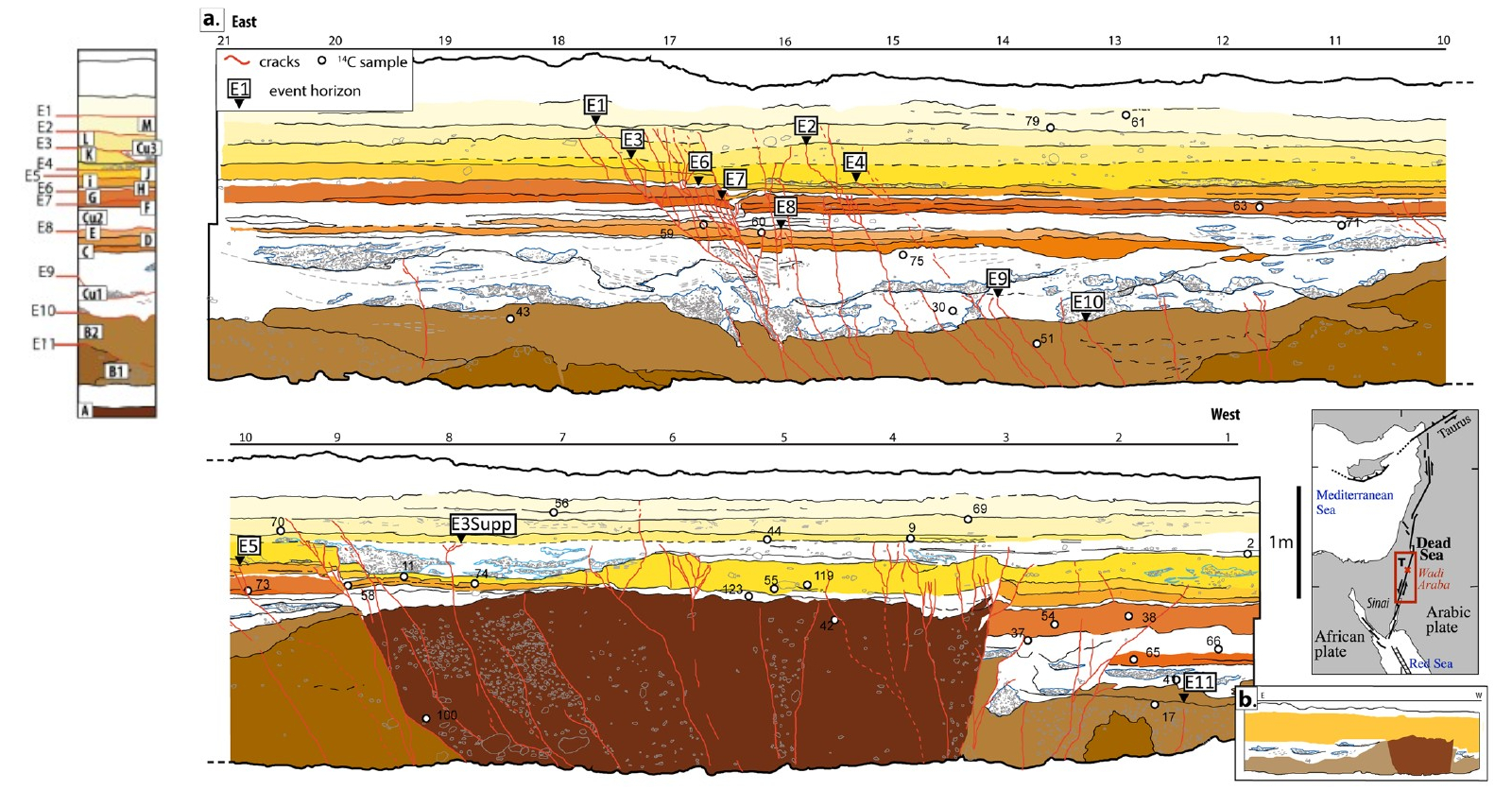
Event E9

In the Taybeh Trench, excavated across the
Arava Fault,
Lefevre et al. (2018)
identify Event E9 as an early rupture within the
Taybeh sequence, preserved within the channelized
unit Cu1. The event horizon is defined by an erosional
contact separating two channel layers, following the
base of gravel lenses and forming a distinct stratigraphic
boundary across the trench; fractures terminate at
this contact and do not propagate into the overlying deposits.
Unlike E10, which is expressed at the top of a
more continuous sandy unit, E9 is associated with
a depositional discontinuity rather than a clear
set of vertically offset layers. The erosional
contact that defines the event horizon truncates
underlying sediments, making direct observation
of displacement difficult. Deformation may
have been accommodated through a combination of
fracturing and rapid reworking, with subsequent
channel processes removing or obscuring much of
the original rupture evidence.
From a tectonic perspective, the limited and
diffuse nature of the preserved deformation is
consistent with strike-slip motion along the
Arava Fault,
where lateral displacement is difficult to detect
in fault-perpendicular trench exposures. Any
vertical component of motion is either minimal or
has been removed by erosion. The occurrence of E9 within a
highly dynamic channel environment suggests that sedimentation
and erosion occurred broadly at the same time as tectonic activity,
with earthquake-induced disruption rapidly overprinted by fluvial processes.
Chronologically, E9 is poorly constrained. Based
on
Bayesian modeling of
radiocarbon dating of
detrital
charcoal samples
from units bracketing the channel sequence,
Lefevre et al. (2018)
place this event broadly between approximately
2400 BCE and 956 BCE
(
2σ).
This wide interval reflects the limited number of
datable samples within the channelized units, as
well as the presence of erosional contacts that
complicate the stratigraphic framework and
introduce substantial chronological uncertainty.