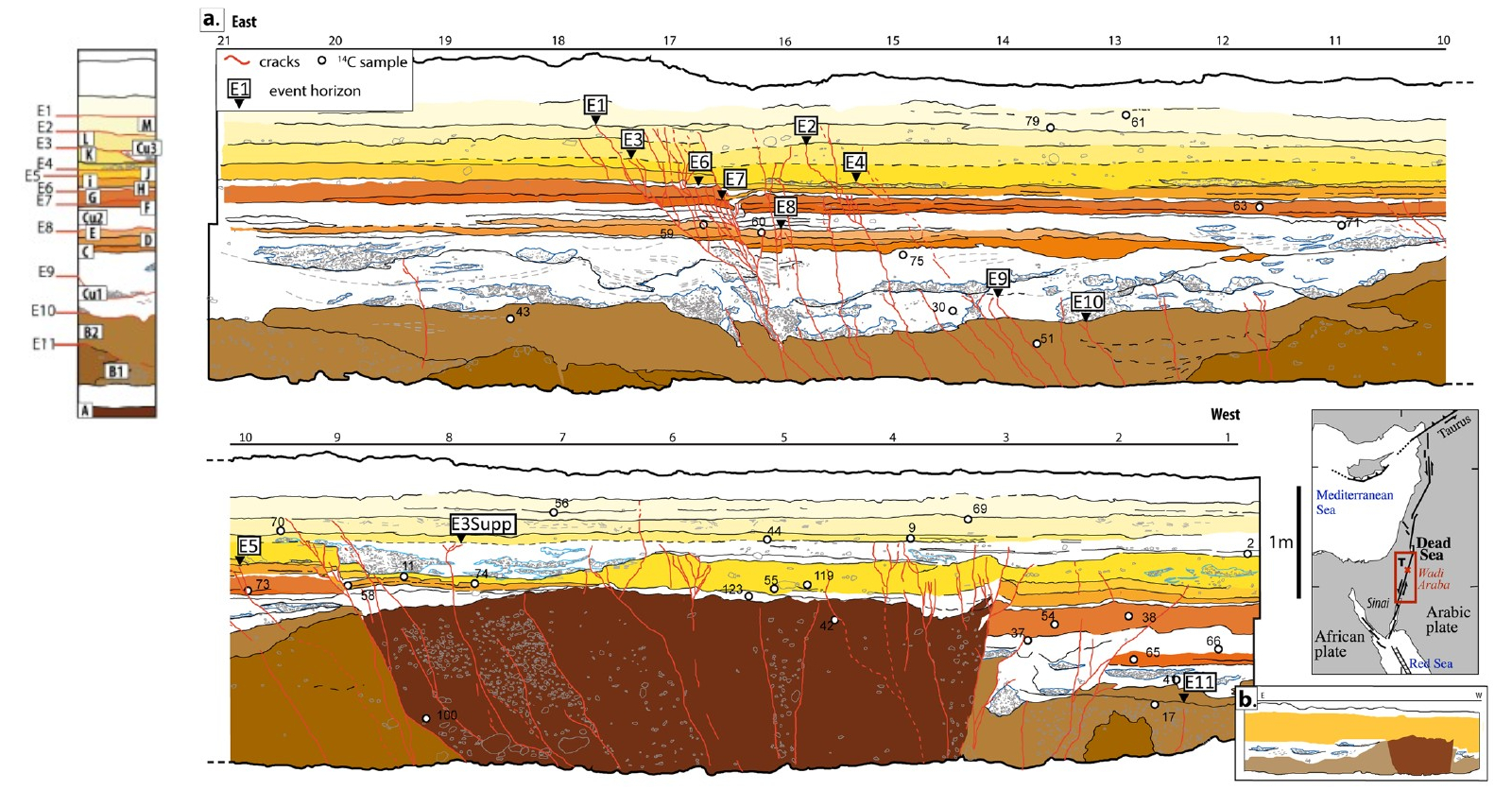
Event E8

In the Taybeh Trench, excavated across the
Arava Fault,
Lefevre et al. (2018)
identify Event E8 as the first clearly expressed
rupture within the sequence of finer-grained,
laminated units overlying the channel deposits.
The event horizon is located within layer E, a
fine sandy unit, where deformation is expressed
through cracks and localized vertical offset,
particularly visible near M16.
Unlike earlier events (E11–E9), which are
preserved within coarse or highly reworked
deposits, E8 is recorded within laminated sands
that allow clearer identification of deformation
structures. At M16, layers C and D are displaced
downward by approximately 3 cm, providing one of
the first measurable vertical offsets in the
sequence. Additional cracks are observed within
layer E; however, the top of layer E remains
undeformed, indicating that the earthquake
occurred during the deposition of this unit.
Lefevre et al. (2018) also note
that some and possibly all cracks
and small offsets attributed to E8 may instead
reflect deformation that propagated downward due to later earthquakes, rather
than a distinct rupture event, particularly where
fractures are shallow and do not extend to depth.
As with other trench
observations along strike-slip systems, lateral
displacement is not directly observable, and
deformation is instead recorded through vertical
offsets and fracture patterns.
The downward movement observed at M16,
together with associated fracturing,
is consistent with strike-slip motion accompanied by minor
normal or transtensional components,
reflecting localized vertical deformation superimposed
on dominant strike-slip motion.
From a depositional standpoint, the occurrence of
E8 within layer E indicates that seismic
deformation took place during an interval of
relatively stable sedimentation.
Chronologically, E8 is moderately well constrained. Based on
Bayesian modeling of
radiocarbon dating of
detrital
charcoal samples
from bounding units,
Lefevre et al. (2018)
place the event between approximately 885 BCE and
514 BCE
(
2σ).
Although still relatively broad, this interval is
significantly narrower than those of earlier
events, reflecting improved preservation of
datable material and clearer stratigraphic
relationships within the upper part of the trench.