Event E2

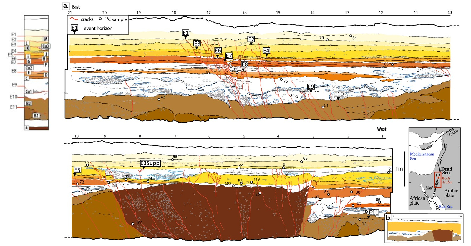
In the Taybeh Trench, excavated across the
Arava Fault,
Lefevre et al. (2018)
identify Event E2 as a well-expressed rupture
within the upper laminated sandy sequence,
particularly concentrated in the main zone of
deformation between M18 and M16. The event
horizon corresponds to the top of layer L, a
sandy unit containing cobbles and small gravel
lenses, where deformation is clearly visible
across multiple layers. Event E2 is characterized by a coherent set of cracks
and measurable vertical displacement. Between
M17 and M16, the event produced a significant
downward displacement of approximately 6–9 cm,
which is clearly observable in layers I, K, and
L. This consistent offset across several
stratigraphic units provides strong evidence
for a distinct surface-rupturing earthquake.
The structural expression of E2 is therefore
clear and diagnostic. The combination of
well-defined fracture networks and measurable
vertical displacement distinguishes this event
from adjacent ruptures and allows confident
identification of its event horizon. As in
other trench observations across strike-slip
fault systems, lateral displacement is not
directly observable, but the magnitude and
distribution of vertical deformation indicate
significant strain release along the fault.
From a tectonic perspective, E2 represents a
substantial episode of slip within the upper
part of the sequence. The concentration of
deformation within the main fault zone suggests
localized strain accumulation and release,
consistent with repeated activity along a
dominantly strike-slip system. The magnitude of
vertical offset implies a moderate to large
earthquake relative to other events preserved
in the trench, reflecting a significant
rupture affecting the near-surface sedimentary
record.
Chronologically, E2 is moderately to poorly constrained. Based on
Bayesian modeling of
radiocarbon dating of
detrital
charcoal samples
from bounding units,
Lefevre et al. (2018)
place the event between approximately 1448 and 1714 CE (
2σ)
and associate it with the
1458 CE Earthquake.