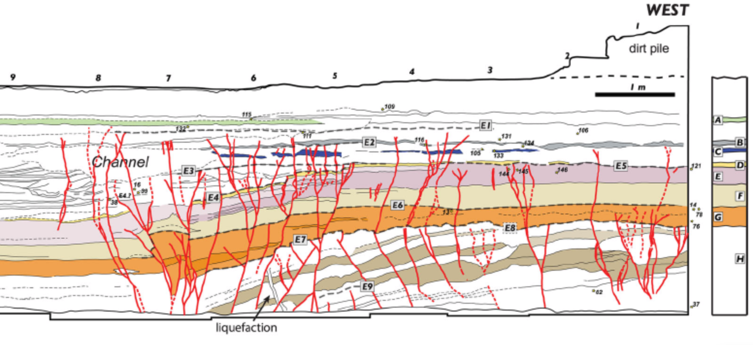
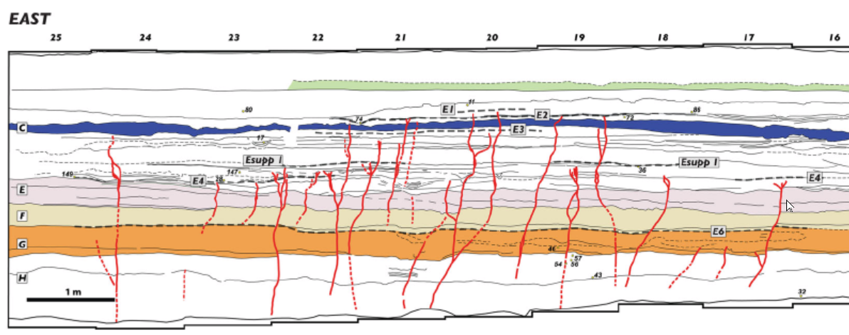
Event E4

In the Qatar Trench, oriented perpendicular to the
Arava Fault
within the Yotvata Playa and just south of the
Yotvata extensional step,
Klinger et al. (2015)
identify Event E4 as one of the most significant
ruptures in the trench sequence, younger than E5 and
older than E3. Evidence is present in the western and eastern fault zones and is expressed in the west by numerous faults that
offset unit D between
MM5
and
MM8,
together with broader deformation of the surrounding
sedimentary units. When the vertical offsets of these
faults are combined with off-fault warping, the total
vertical displacement reaches approximately 65 cm.
This makes E4 one of the two events in the trench,
along with E8, that display comparatively large
vertical deformation.
The deformation associated with E4 includes a clear
subsidence of the eastern compartment relative to
the western side of the trench. At
MM7,
additional deformation indicates local compression
superimposed on the dominant
strike-slip motion,
resulting in the formation of a metre-scale
pressure ridge. Although this feature was later eroded and is
only partially preserved, it provides further
evidence that E4 involved substantial and complex
ground deformation rather than simple faulting. In
contrast to smaller events such as E5, E4 affected a
broad zone and produced both discrete fault offsets
and distributed warping of the
stratigraphic sequence.
The rupture created significant
accommodation space on the eastern side of the trench,
which was subsequently filled by a thick package of
sediments up to unit C. This infilling differs from
earlier units in that it consists largely of thin,
cross-bedded layers and channel deposits of silt to
sand, with limited lateral continuity. These deposits
onlap the
palaeo-fault scarp formed during E4, making
correlation of individual layers across the main fault
zone difficult. Only the upper units A, B, and C can
be traced confidently across the trench after this
event. The creation of this
sedimentary wedge is one
of the most distinctive consequences of E4 and marks
a major reorganization of the local depositional
environment following the earthquake.
Chronologically, E4 forms a closely spaced pair with
E5.
Klinger et al. (2015)
place the E4–E5 sequence within a 671–845 CE time
window derived from a
Bayesian model
of
radiocarbon dates
derived from
detrital charcoal.
Within this interval, they interpret E4 as the larger
of two closely spaced earthquakes associated with the
8th-century CE seismic crisis.