Open this page in a new tab

Tella

Tella (Viranşehir)

click on image to explore this site on a new tab in Google Earth


Names
Transliterated Name Language Name
Viranşehir Modern Turkish
Constantina, Constantia Latin
Konstantina Greek Κωνσταντίνη
Tella Syriac ܬܠܐ
Tella Greek Τέλλα
Maximianopolis Latin
Antiochia in Mesopotamia Latin
Antiochia Arabis Latin
Introduction
Introduction

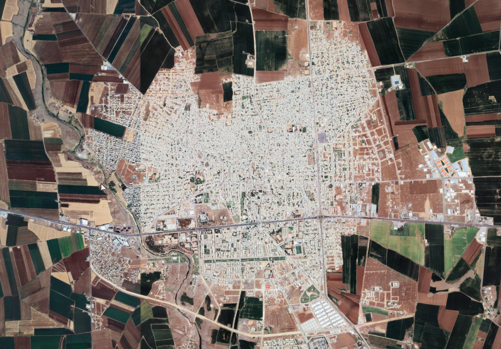
Tella, known in Late Antique sources as a major urban center of northern Mesopotamia, corresponds to the site of modern Viranşehir in southeastern Turkey. Located along the transition zone between the upper Mesopotamia and the northern Syrian plains, the city occupied a strategic position within a network of routes linking Edessa, Nisibis, and the Euphrates basin. Its location facilitated both commercial exchange and military movement across a frontier zone that was frequently contested in antiquity.

In the Roman and Byzantine periods, the city was renamed Constantina or Constantia, reflecting imperial patronage and administrative integration into the eastern provinces of the Byzantine Empire. The settlement developed into a fortified city and ecclesiastical center, with bishopric status and a documented role in regional theological and institutional networks. Its prominence in Syriac Christian tradition is underscored by its association with figures such as John of Tella, highlighting the city’s importance as a center of religious life and doctrinal activity.

The Syriac name ܬܠܐ (Tellā), meaning “mound” or “settlement,” reflects the site’s long occupation and its physical character as a tell-like urban accumulation. This continuity of habitation, from earlier phases into Late Antiquity and beyond, suggests the persistence of local settlement patterns despite changing political control. The city’s multiple names—Greek, Latin, and Syriac— illustrate its position at a cultural and linguistic interface between the Hellenistic, Roman, and Near Eastern worlds.

Following the early Islamic conquests, the city declined in prominence, though occupation continued under varying names and administrative frameworks. Its position within a zone of shifting frontiers contributed to cycles of urban transformation, contraction, and reuse, a pattern common across northern Mesopotamia during the transition from Byzantine to Islamic rule.

Maps and Aerial Views
Aerial Views

Aerial Views

Normal Size

  • Tella in Google Earth

Magnified

  • Tella in Google Earth

Notes and Further Reading
References

Articles and Books

Barsoum, Ignatius Afram (1991) ܒܪ̈ܘܠܐ ܒܕܝܪ̈ܐ ܕܥܠ ܡܪܕܘܬ ܝܘܠܦܢ̈ܐ ܣܘܪ̈ܝܝܐ ܗܕܝܪ̈ܐ, 2nd ed., Holland: Bar Hebraeus Verlag, pp. 537–538

Barsoum, Ignatius Afram (1987) كتاب اللؤلؤ المنثور في تاريخ العلوم والأداب السريانية, 4th ed., Holland: Bar Hebraeus Verlag, p. 505

Barsoum, Ignatius Aphram (2003) The Scattered Pearls: A History of Syriac Literature and Sciences, 2nd revised ed., Piscataway, New Jersey: Gorgias Press, p. 559

Brock, S. P. et al. (2011) Gorgias Encyclopedic Dictionary of the Syriac Heritage, Piscataway, New Jersey: Gorgias Press, pp. 114, 267, 325, 419, 431, 447, Maps I B1, II B1, III

Brooks, E. W. (1935–1936) Iohannis Ephesini historiae ecclesiasticae pars tertia, CSCO Syr. III.3, Louvain: L. Durbecq, pp. 50, 238, 276, 308, 309, 313, chs. 3.1.41, 3.6.13, 3.6.17, 3.6.26

Brooks, E. W. (1935–1936) Iohannis Ephesini historiae ecclesiasticae pars tertia, CSCO Syr. III.3, Louvain: L. Durbecq, p. 329, ch. 3.6.26

Constantina (Tella) at Oxford Dictionary of Byzantium - open access - bookmarked to entry

Harvey, S. A. (2019) Women and Children in Syriac Christianity: Sounding Voices, in King, D. (ed.), The Syriac World, Routledge Worlds, London: Routledge, pp. 554–567

Loopstra, J. A. (2019) The Syriac Bible and Its Interpretation, in King, D. (ed.), The Syriac World, Routledge Worlds, London: Routledge, pp. 293–308

Mladjov, I. (2018) Diachronic Maps of Syriac Cultures and Their Geographic Contexts, in King, D. and Michelson, D. A. (eds.), The Syriac World, London–New York: Routledge, maps 1, 7

Potter, W. L. and Michelson, D. A. (2018) Index of Maps, in King, D. (ed.), The Syriac World, London–New York: Routledge, p. 826

Potter, W. L. and Michelson, D. A. (2018) Index of Maps, in King, D. (ed.), The Syriac World, London–New York: Routledge, p. 833

Wilmshurst, D. (2000) The Ecclesiastical Organisation of the Church of the East, 1318–1913, CSCO 582, Subs. 104, Louvain: Peeters, p. 76

Yāqūt al-Ḥamawī (1990) معجم البلدان, Beirut: Dār al-kutub al-ʿilmiyya, vol. II, p. 52

Wikipedia pages

Viranşehir


Constantia (Osrhoene)


John of Tella