Tel Dover
 Figure 2
The lower terrace of the tell, wedged in between the Yarmuk River on the left and a local basalt cliff on the right, looking south-west. Note the smaller tell or acropolis, centre right
click on image to explore this site on a new tab
Golani and Wolff (2016)
| Transliterated Name | Source | Name |
|---|---|---|
| Tel Dover | Hebrew? | |
| Tel Dober | Hebrew? | |
| Khirbet ed Duweir | Arabic | |
| Tall al Mudawwarr | Arabic |
- Fig. 1 - Location Map
from Eisenberg and Osband (2022)
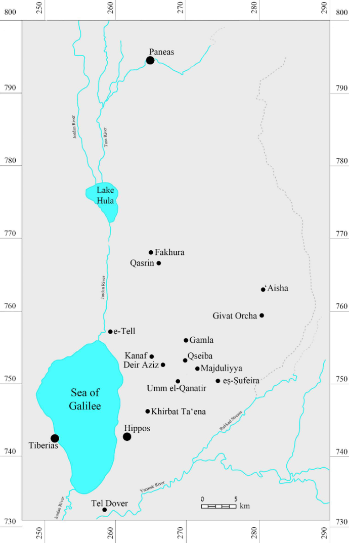 Figure 1
Map with sites mentioned in the text
(D. Shalem and M. Eisenberg)
Eisenberg and Osband (2022) - Fig. 1 - Location Map
from Golani and Wolff (2016)
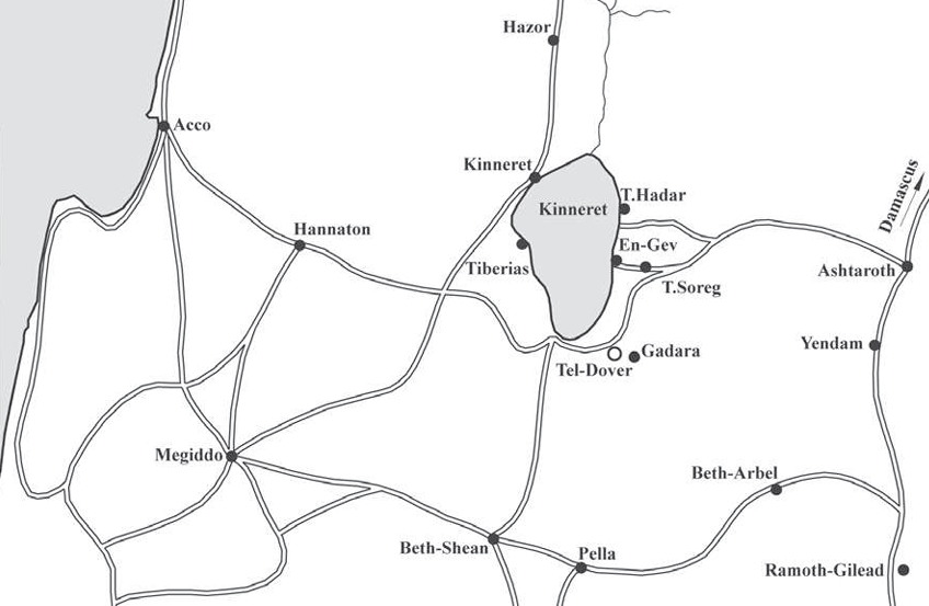 Figure 1
General location map of Tel Dover
Golani and Wolff (2016)
- Fig. 1 - Location Map
from Eisenberg and Osband (2022)
Figure 1
Map with sites mentioned in the text
(D. Shalem and M. Eisenberg)
Eisenberg and Osband (2022) - Fig. 1 - Location Map
from Golani and Wolff (2016)
Figure 1
General location map of Tel Dover
Golani and Wolff (2016)
- Fig. 2 - Aerial View
from Golani and Wolff (2016)
 Figure 2
The lower terrace of the tell, wedged in between the Yarmuk River on the left and a local basalt cliff on the right, looking south-west. Note the smaller tell or acropolis, centre right
Golani and Wolff (2016) - Tel Dover in Google Earth
 Tel Dover
click on image to explore this site on a new tab in Google Earth - Tel Dover on govmap.gov.il
 Tel Dover
click on image to explore this site on a new tab in govmap.gov.il
- Fig. 2 - Aerial View
from Golani and Wolff (2016)
Figure 2
The lower terrace of the tell, wedged in between the Yarmuk River on the left and a local basalt cliff on the right, looking south-west. Note the smaller tell or acropolis, centre right
Golani and Wolff (2016) - Tel Dover in Google Earth
Tel Dover
click on image to explore this site on a new tab in Google Earth - Tel Dover on govmap.gov.il
Tel Dover
click on image to explore this site on a new tab in govmap.gov.il
- Fig. 4 - Remains of the
Late Bronze Age Stratum VIII from Golani and Wolff (2016)
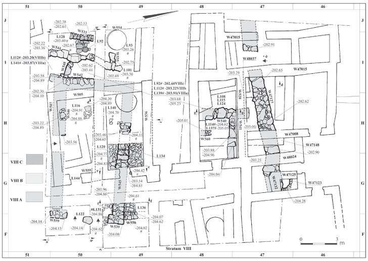 Figure 4
Remains of the Late Bronze Age Stratum VIII in the south-western portion of the terrace
Golani and Wolff (2016)
- Fig. 4 - Remains of the
Late Bronze Age Stratum VIII from Golani and Wolff (2016)
Figure 4
Remains of the Late Bronze Age Stratum VIII in the south-western portion of the terrace
Golani and Wolff (2016)
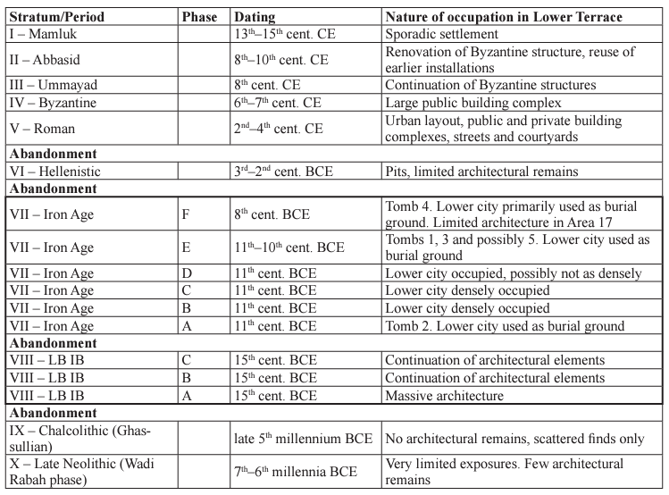 Fig. 3
The archaeological periods of settlement revealed through the excavation of the lower terrace at Tel Dover
Golani and Wolff (2016)
 Fig. 13
Comparative stratigraphy and chronology of Tel Dover with other sites of the region
Golani and Wolff (2016)
- Earthquake Archeological Effects chart
of Rodríguez-Pascua et al (2013: 221-224)
 Earthquake Archeological Effects (EAE)
Rodríguez-Pascua et al (2013: 221-224)
| Damage Type | Location | Image | Comments | Intensity |
|---|---|---|---|---|
| Destruction (collapsed walls) | Tel Dover |
|
VIII+ |