Rujm Beni Yasser
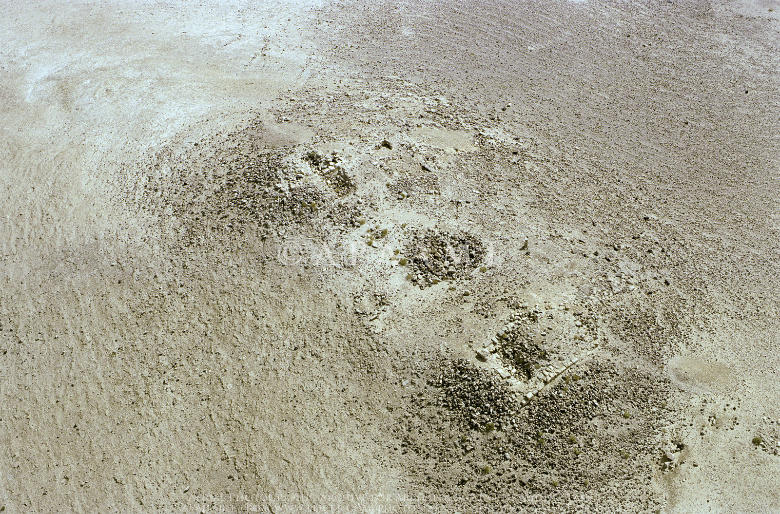
APAAME
- Reference: APAAME_20081005_FFR-0782
- Photographer: Francesca Radcliffe
- Credit: Aerial Photographic Archive for Archaeology in the Middle East
- Copyright: Creative Commons Attribution-Noncommercial-No Derivative Works
Click photo for high res magnifiable image
| Transliterated Name | Language | Name |
|---|---|---|
| Rujm Beni Yasser | Arabic | روجم بيني ياسسير |
| Rujm Lejjun | Nelson Glueck's publications |
- Map of Limes Arabicus
Fortresses in Jordan from Wikipedia
 Limes arabicus, central part in Jordan - Azraq basin and Wadi el-Mujib basin. Red squares are
Roman fortresses and forts from the end of the 3rd/beginning of the 4th century.
Limes arabicus, central part in Jordan - Azraq basin and Wadi el-Mujib basin. Red squares are
Roman fortresses and forts from the end of the 3rd/beginning of the 4th century.
(modified from S. T. Parker, An Empire's New Holy Land: The Byzantine Perio, Near Eastern Archaeology , Sep., 1999, Vol. 62, No. 3 (Sep., 1999), p. 138)
Ursus - Wikipedia - CC-BY-SA 4.0
- Map of Limes Arabicus
Fortresses in Jordan from Wikipedia
Limes arabicus, central part in Jordan - Azraq basin and Wadi el-Mujib basin. Red squares are
Roman fortresses and forts from the end of the 3rd/beginning of the 4th century.
(modified from S. T. Parker, An Empire's New Holy Land: The Byzantine Perio, Near Eastern Archaeology , Sep., 1999, Vol. 62, No. 3 (Sep., 1999), p. 138)
Ursus - Wikipedia - CC-BY-SA 4.0
- Vicinity of Rujm Beni Yasser
in Google Earth
 Vicinity of Rujm Beni Yasser
1 km. east of el-Lejjun
click on image to explore this site on a new tab in Google Earth
- Plan of Rujm Beni Yasser
from wikipedia
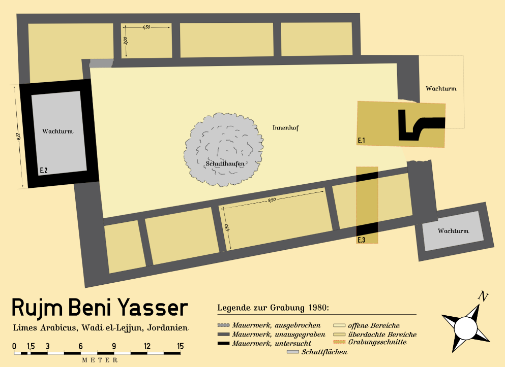 Fig. 85.1
Plan of the Rujm Beni Yasser fortification according to the research of the Limes Arabicus Project
Mediatus - Wikipedia - CC BY-SA 3.0 & GFDL - Fig. 85.1 - Plan of Rujm Beni Yasser
from Bloom and Parker (1987)
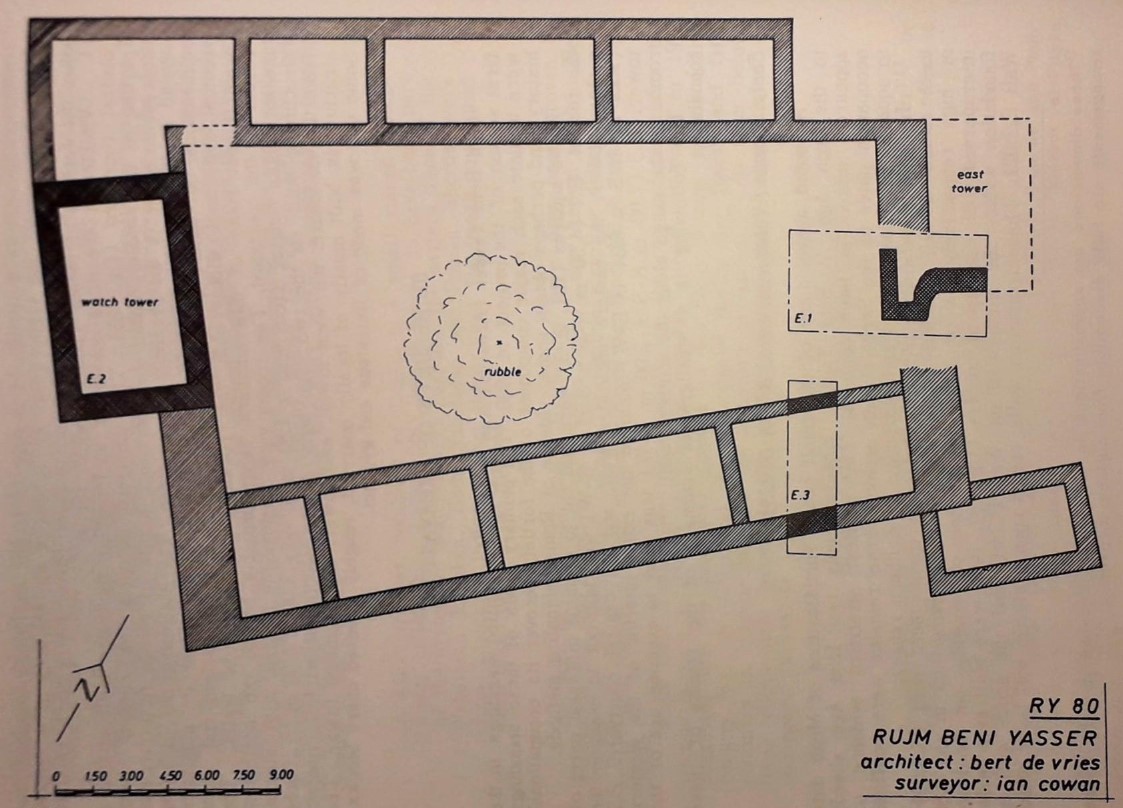 Fig. 85.1
Plan of Rujm Beni Yasser with soundings
1980-89
Bloom and Parker (1987)
- Plan of Rujm Beni Yasser
from wikipedia
Fig. 85.1
Plan of the Rujm Beni Yasser fortification according to the research of the Limes Arabicus Project
Mediatus - Wikipedia - CC BY-SA 3.0 & GFDL - Fig. 85.1 - Plan of Rujm Beni Yasser
from Bloom and Parker (1987)
Fig. 85.1
Plan of Rujm Beni Yasser with soundings
1980-89
Bloom and Parker (1987)