 Mishmar David and environs on govmap.gov.il
| Transliterated Name | Language | Name |
|---|---|---|
| Mishmar David | Hebrew | מִשְׁמַר דָּוִד |
| Hulda | Arabic | |
| Khulda | Arabic | |
| The Fortress at Khulda | Greek | τό καστέλι τὸ καλαούμενον Χοῦλδα |
 Fig. 1
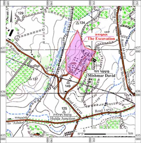 Fig. 1
 Fig. 4
 Fig. 5
 Fig. 8
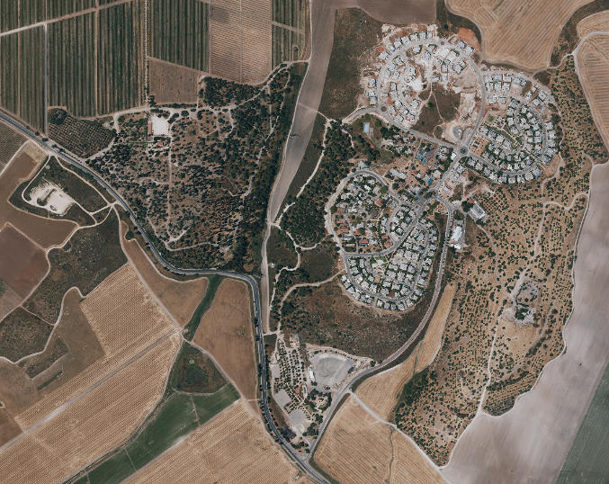
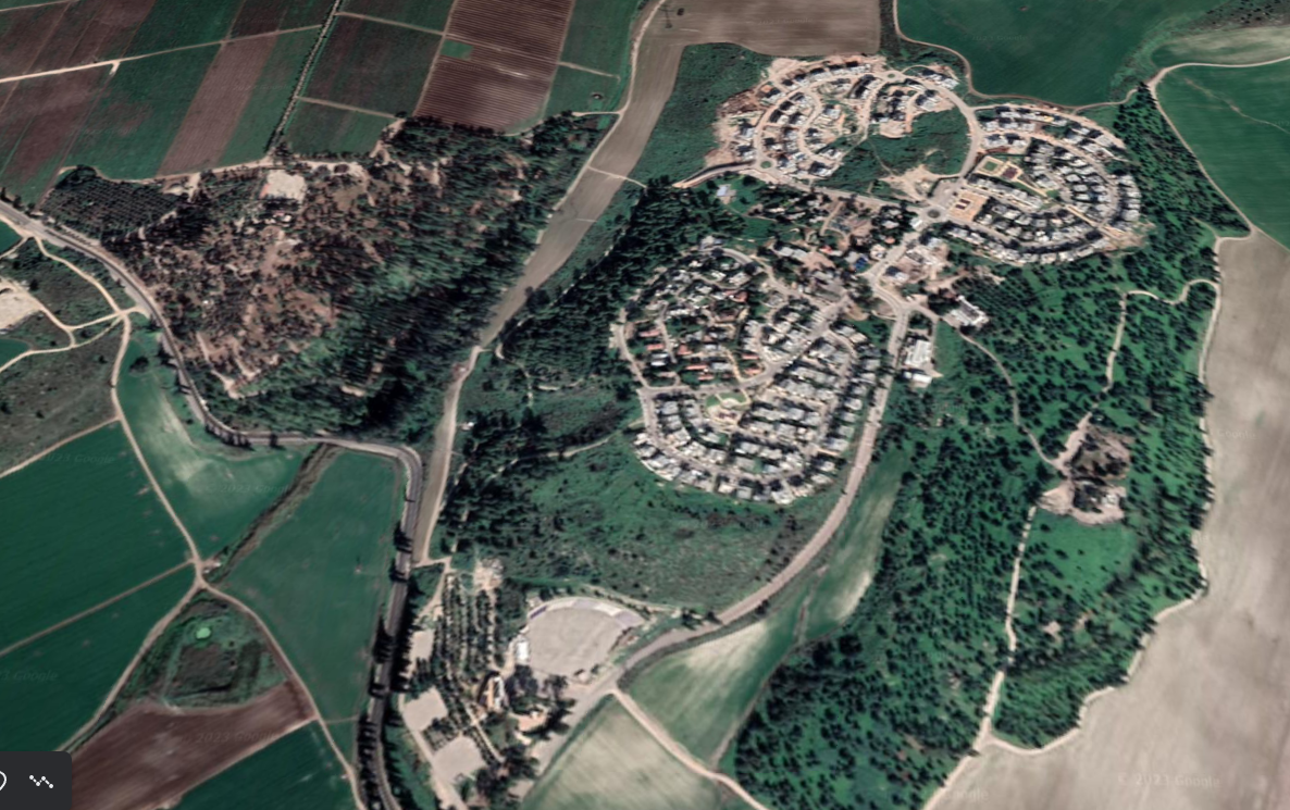 Mishmar David and environs in Google Earth
Mishmar David and environs on govmap.gov.il
Mishmar David and environs in Google Earth
Mishmar David and environs on govmap.gov.il
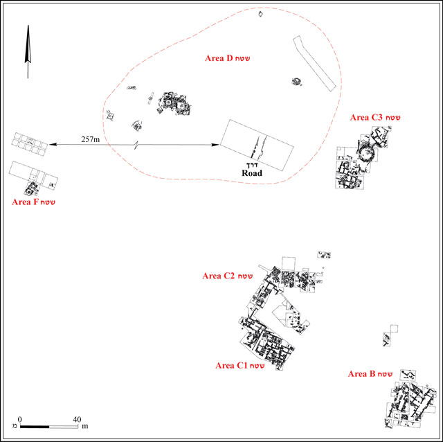 Fig. 2
Fig. 2
| Effect(s) | Location | Image(s) | Description |
|---|---|---|---|
| Collapsed Walls | Area B
Fig. 2 The excavation areas, plan Yannai (2013)
Fig. 4Aerial view of Area B Yannai (2013) |
Stratum VI was destroyed in an earthquake (possibly in 749 CE), after which a number of new walls were built in the area (Stratum V).- Yannai (2014) |
|
| Collapsed Walls | sub-Area C1
Fig. 2 The excavation areas, plan Yannai (2013)
Fig. 5Aerial view of Area C1 Yannai (2013) |
the buildings and tower of Stratum VI were destroyed by an earthquake, perhaps in 749 CE- Yannai (2014) |
|
| Collapsed Walls | sub-Area C3
Fig. 2 The excavation areas, plan Yannai (2013)
Fig. 8Aerial view of Area C3 Yannai (2013) |
Yannai (2014) reports that Stratum VI structures were destroyed in an earthquakewhich would date to ~749 CE based on the Stratum (VI). |
| Effect(s) | Location | Image(s) | Description |
|---|---|---|---|
| Collapsed Walls | Area B - Square Building comprising rooms surrounding the central courtyard of Stratum VI
Fig. 2The excavation areas, plan Yannai (2013)
Fig. 4Aerial view of Area B Yannai (2013) |
This immense building was damaged, possibly in another earthquake, either that of 1033 or of 1068 CE.- Yannai (2014) |
|
| Collapsed Walls | sub-Area C1
Fig. 2 The excavation areas, plan Yannai (2013)
Fig. 5Aerial view of Area C1 Yannai (2013) |
The Stratum V buildings were destroyed by a second earthquake, either the one that struck in 1033 or that of 1068 CE. The partially destroyed buildings were renovated (a second phase in Stratum V).- Yannai (2014) |
 Earthquake Archeological Effects (EAE)
| Effect(s) | Location | Image(s) | Description | Intensity |
|---|---|---|---|---|
| Collapsed Walls | Area B
Fig. 2 The excavation areas, plan Yannai (2013)
Fig. 4Aerial view of Area B Yannai (2013) |
Stratum VI was destroyed in an earthquake (possibly in 749 CE), after which a number of new walls were built in the area (Stratum V).- Yannai (2014) |
VIII + | |
| Collapsed Walls | sub-Area C1
Fig. 2 The excavation areas, plan Yannai (2013)
Fig. 5Aerial view of Area C1 Yannai (2013) |
the buildings and tower of Stratum VI were destroyed by an earthquake, perhaps in 749 CE- Yannai (2014) |
VIII + | |
| Collapsed Walls | sub-Area C3
Fig. 2 The excavation areas, plan Yannai (2013)
Fig. 8Aerial view of Area C3 Yannai (2013) |
Yannai (2014) reports that Stratum VI structures were destroyed in an earthquakewhich would date to ~749 CE based on the Stratum (VI). |
VIII + |
Earthquake Archeological Effects (EAE)| Effect(s) | Location | Image(s) | Description | Intensity |
|---|---|---|---|---|
| Collapsed Walls | Area B - Square Building comprising rooms surrounding the central courtyard of Stratum VI
Fig. 2The excavation areas, plan Yannai (2013)
Fig. 4Aerial view of Area B Yannai (2013) |
This immense building was damaged, possibly in another earthquake, either that of 1033 or of 1068 CE.- Yannai (2014) |
VIII + | |
| Collapsed Walls | sub-Area C1
Fig. 2 The excavation areas, plan Yannai (2013)
Fig. 5Aerial view of Area C1 Yannai (2013) |
The Stratum V buildings were destroyed by a second earthquake, either the one that struck in 1033 or that of 1068 CE. The partially destroyed buildings were renovated (a second phase in Stratum V).- Yannai (2014) |
VIII + |