Minya

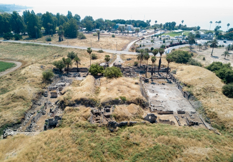 (left) Aerial view of Khirbet Minya looking west
Click on Image for high resolution magnifiable image
Drone photos taken by Jefferson Williams on 11 June 2023
(right) Aerial view of Khirbet Minya looking east
Used with permission from biblewalks.com
| Transliterated Name | Source | Name |
|---|---|---|
| Minya | ||
| Horvat Minnim | Hebrew | |
| Khirbat el-Minya | Arabic | قصر المنية |
| Ayn Minyat Hisham | Arabic |
- Minya in Google Earth
 Minya in Google Earth
click on image to explore this site on a new tab in Google Earth - Minya on govmap.gov.il
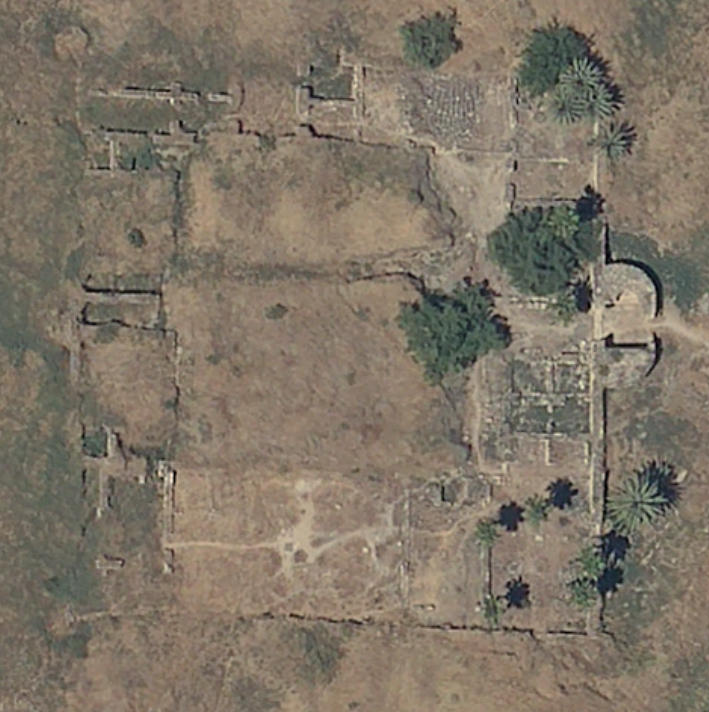 Minya on govmap.gov.il
click on image to explore this site on a new tab in govmap.gov.il
- Fig. 1 - Plan of Horvat
Minnim Site from Kuhnen et al (2018)
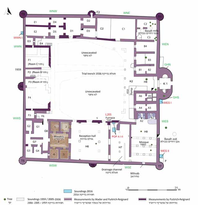 Fig. 1
Plan
Kuhnen et al (2018)
- Fig. 1 - Plan of Horvat
Minnim Site from Kuhnen et al (2018)
Fig. 1
Plan
Kuhnen et al (2018)
- Figure 2 - Collapse debris
in foundation trench south of east gate (Square WES I) from Kuhnen et al (2018)
 Fig. 2
Square WES I, looking west.
Kuhnen et al (2018) - Figure 4 - Broken roof
tiles found in the fills east of WES from Kuhnen et al (2018)
 Fig. 4
Roof tiles found in the fills east of WES.
Kuhnen et al (2018)
- Fig. 1 - Plan of Horvat Minnim Site
from Kuhnen et al (2018)
Fig. 1
Plan
Kuhnen et al (2018) - Figure 2 - Collapse debris
in foundation trench south of east gate (Square WES I) from Kuhnen et al (2018)
Fig. 2
Square WES I, looking west.
Kuhnen et al (2018) - Figure 4 - Broken roof
tiles found in the fills east of WES from Kuhnen et al (2018)
Fig. 4
Roof tiles found in the fills east of WES.
Kuhnen et al (2018)
| Effect(s) | Location | Image(s) | Description |
|---|---|---|---|
| Collapsed Walls | Square WES I - foundation trench just south of east gate
Fig. 1 Plan Kuhnen et al (2018) |
Fig. 2 Square WES I, looking west. Kuhnen et al (2018) |
Kuhnen et al (2018) reports the presence of fragments of limestone ashlars mixed with basalt bouldersin the foundation trench in Square WES I, which was excavated at the corner between the eastern curtain wall and the southern gate tower. |
| Collapsed Roof | fill alongside the eastern curtain wall
Fig. 1 Plan Kuhnen et al (2018) |
Fig. 2 Square WES I, looking west. Kuhnen et al (2018)
Fig. 4Roof tiles found in the fills east of WES. Kuhnen et al (2018) |
The fill alongside the eastern curtain wall contained numerous broken roof tiles (Figs. 2 and 4). They were made of crudely mixed clay with organic temper, and were lightly burnt. The tiles may indicate that the roof of the eastern wing, which collapsed in an earthquake apparently dated to 749 CE, was rebuilt in medieval times.- Kuhnen et al (2018) |
- Modified by JW from Fig. 1 of Kuhnen et al (2018)
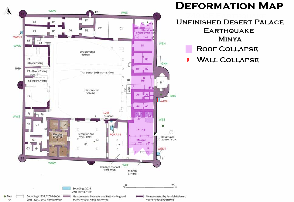 Deformation Map
click on image to open in a new tab
Modified by JW from Fig. 1 of Kuhnen et al (2018)
-
Earthquake Archeological Effects chart
of Rodríguez-Pascua et al (2013: 221-224)
 Earthquake Archeological Effects (EAE)
Rodríguez-Pascua et al (2013: 221-224)
| Effect(s) | Location | Image(s) | Description | Intensity |
|---|---|---|---|---|
| Collapsed Walls | Square WES I - foundation trench just south of east gate
Fig. 1 Plan Kuhnen et al (2018) |
Fig. 2 Square WES I, looking west. Kuhnen et al (2018)
Fig. 4Roof tiles found in the fills east of WES. Kuhnen et al (2018) |
Kuhnen et al (2018) reports the presence of fragments of limestone ashlars mixed with basalt bouldersin the foundation trench in Square WES I, which was excavated at the corner between the eastern curtain wall and the southern gate tower. |
VIII+ |
| Collapsed Roof suggesting displaced walls | fill alongside the eastern curtain wall
Fig. 1 Plan Kuhnen et al (2018) |
Fig. 2 Square WES I, looking west. Kuhnen et al (2018)
Fig. 4Roof tiles found in the fills east of WES. Kuhnen et al (2018) |
The fill alongside the eastern curtain wall contained numerous broken roof tiles (Figs. 2 and 4). They were made of crudely mixed clay with organic temper, and were lightly burnt. The tiles may indicate that the roof of the eastern wing, which collapsed in an earthquake apparently dated to 749 CE, was rebuilt in medieval times.- Kuhnen et al (2018) |
VII+ |
- Fig. 1 - Plan of Horvat Minnim Site
from Kuhnen et al (2018)
Fig. 1
Plan
Kuhnen et al (2018)
| Effect | Image(s) | Location | Description |
|---|---|---|---|
| Tilted Wall | Verticality Check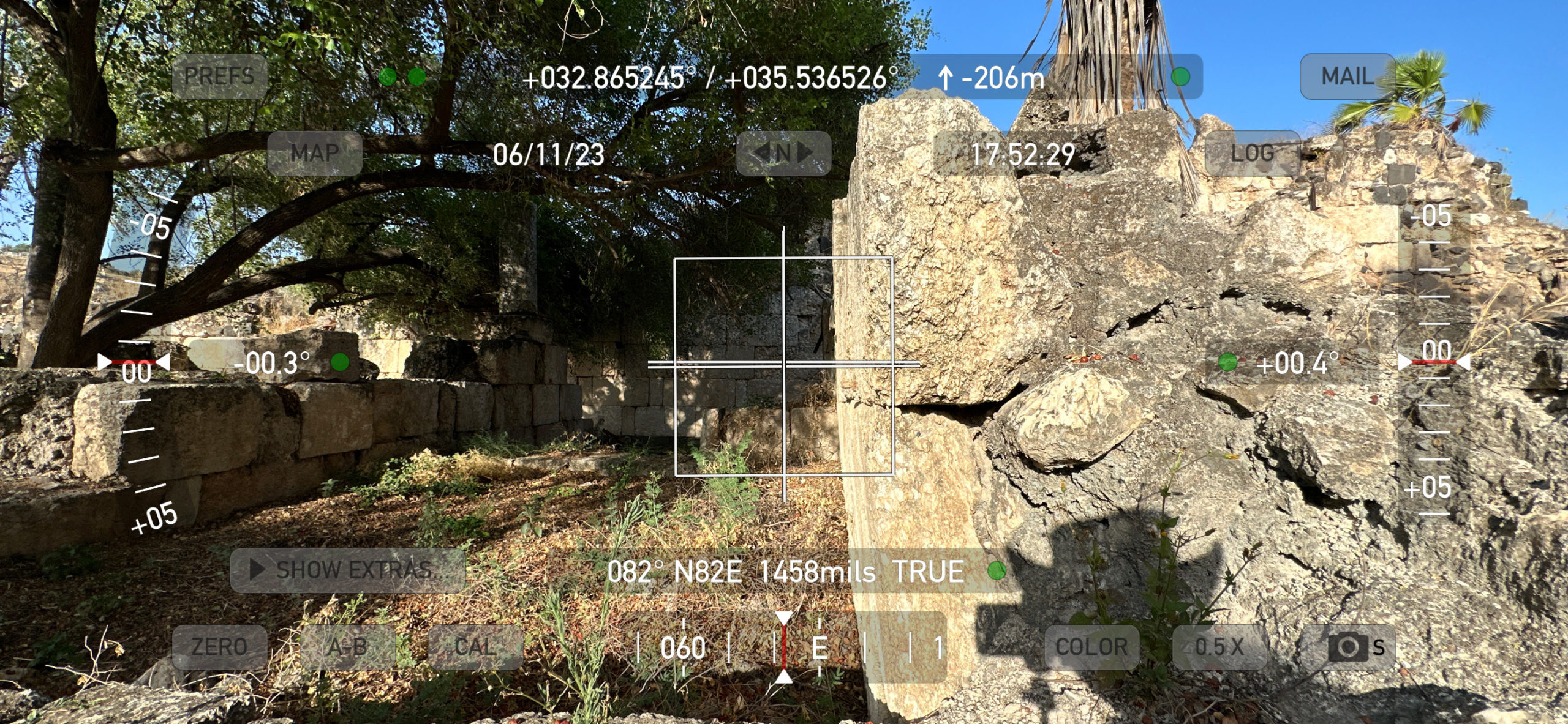 Verticality Check for tilted south wall of Area B1
View from the west Photo by Jefferson Williams - 11 June 2023 Tilt Measurement (4.1°)  Tilt Measurement (4.1°) for tilted south wall of Area B1
Yellow lines and box aligned with tilt View from the west Photo by Jefferson Williams - 11 June 2023 Azimuth Measurement (257°) 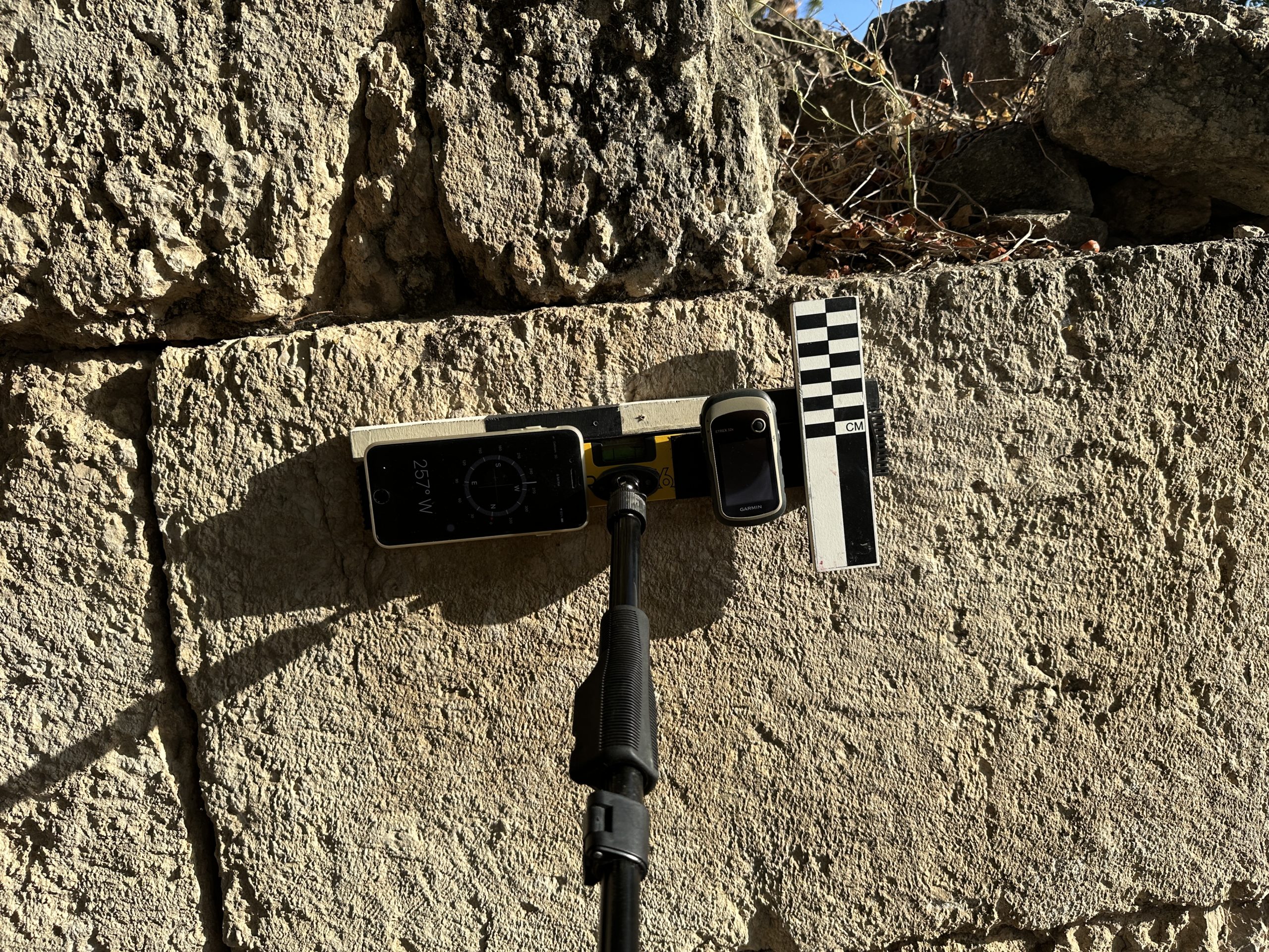 Azimuth Measurement (257°) for tilted south walls of Areas B1 and B2
Photo by Jefferson Williams - 11 June 2023 |
South Wall of Area B1 | JW: Parts of this wall tilt to the south. |
| Tilted Wall and Shifted Ashlars | Tilted south wall and shifted ashlars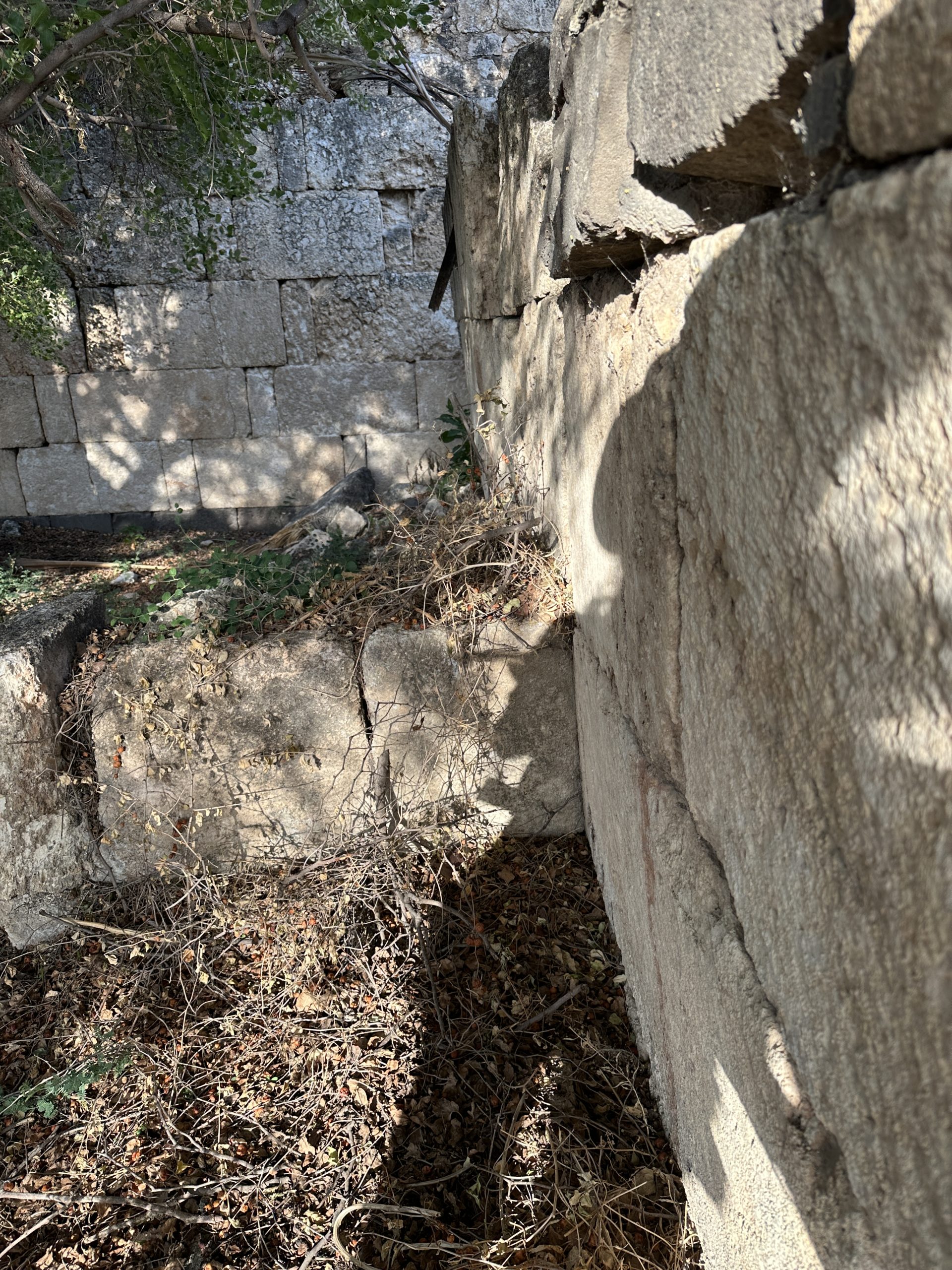 Tilted south wall and shifted ashlars in Area B1
View from the west Photo by Jefferson Williams - 11 June 2023 |
South Wall of Area B1 | JW: Tilting is pronounced higher up in the wall where moment stresses would be higher. |
| Tilted Wall and Shifted Ashlars |
Tilted south wall and shifted ashlars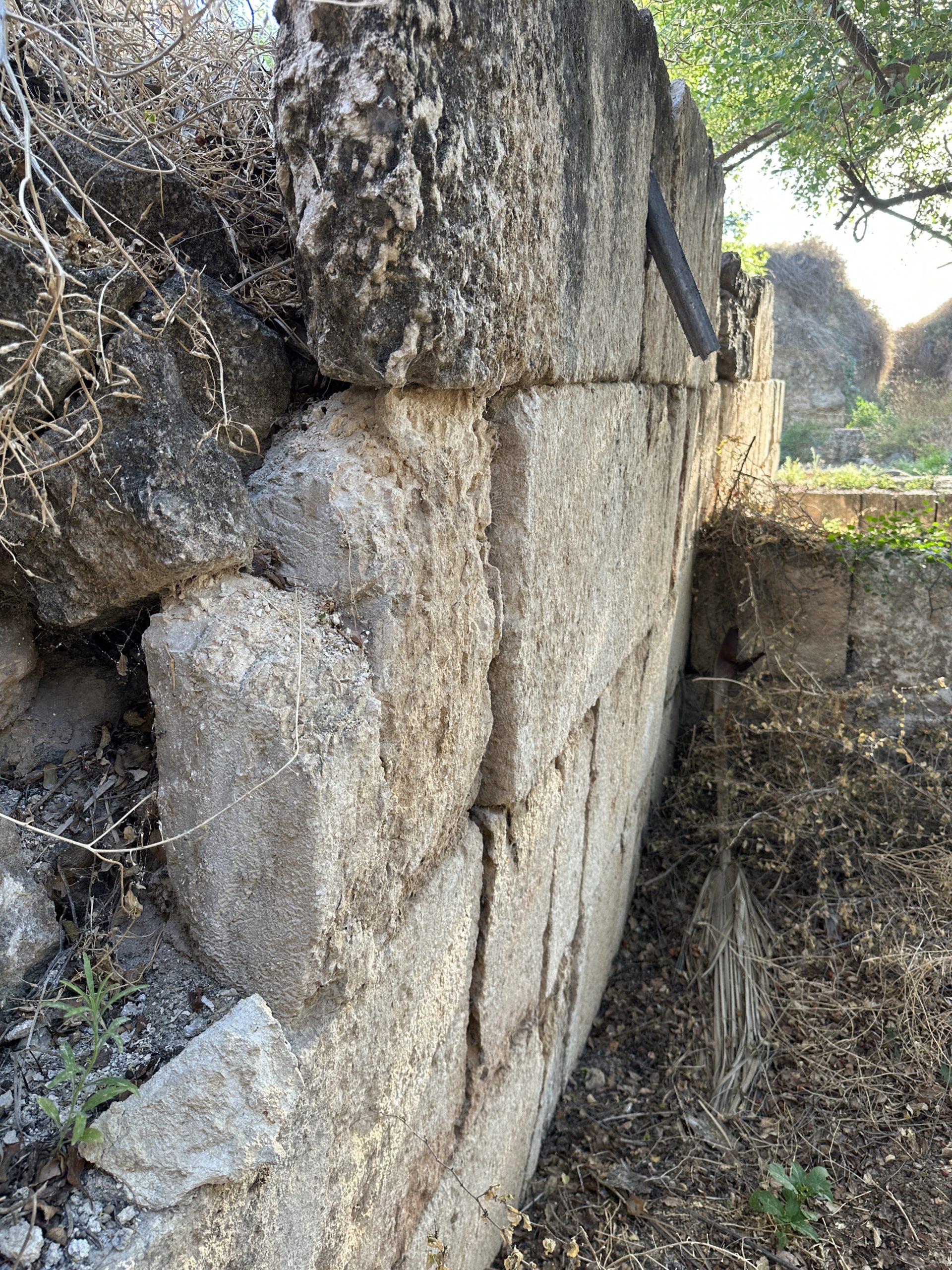 Tilted south wall and shifted ashlars in Area B2
View from the east Photo by Jefferson Williams - 11 June 2023 |
South Wall of Area B2 | JW: This part of the south wall has a pronounced bulge (not photographed) which may have a seismic origin. Alternatively, if this wall was repurposed as a retaining wall at some time in its history, the bulge could be explained by subsurface soil pressure. |
| Tilted Wall and Shifted Ashlars |
Tilted north wall and shifted ashlars Tilted north wall and shifted ashlars in Areas B1 and B2
View from the east Photo by Jefferson Williams - 11 June 2023 |
North Wall of Areas B1 and B2 | JW: Some parts of the north Wall of Areas B1 and B2 are tilted to the south while some parts of the south wall of Areas B1 and B2 are tilted to the north and to the south. Shifted Ashlars can be observed in both the north and south walls. |
| Shifted and tilted Ashlar | Shifted Ashlar Shifted Ashlar at bottom of photo on inner South wall of fortress
oblique view from the east Photo by Jefferson Williams - 11 June 2023 Azimuth Measurement (264°)  Azimuth Measurement (264°) for inner South wall of fortress
View from the east Photo by Jefferson Williams - 11 June 2023 |
Inner South wall of fortress | JW: Ashlar at the bottom center is shifted and tilted. The basalt stone that used to be at its base is missing and the basalt stone to the right is rotated |
| Parted Ashlars above shifted Ashlar | Parted Ashlars above shifted Ashlar Parted Ashlars above shifted Ashlar on inner South wall of fortress
View from the east Photo by Jefferson Williams - 11 June 2023 Shifted Ashlar
Shifted Ashlar on inner South wall of fortressOblique view from the east Photo by Jefferson Williams - 11 June 2023 |
Inner South wall of fortress | JW: This part of the structure appears to have bulged - parting the joints between the ashlars above the shifted and tilted ashlar. The fractures and broken corners in the lower left of the "Shifted Ashlar" photo may be related to this deformation. |
| Through-going joints | Through-going joints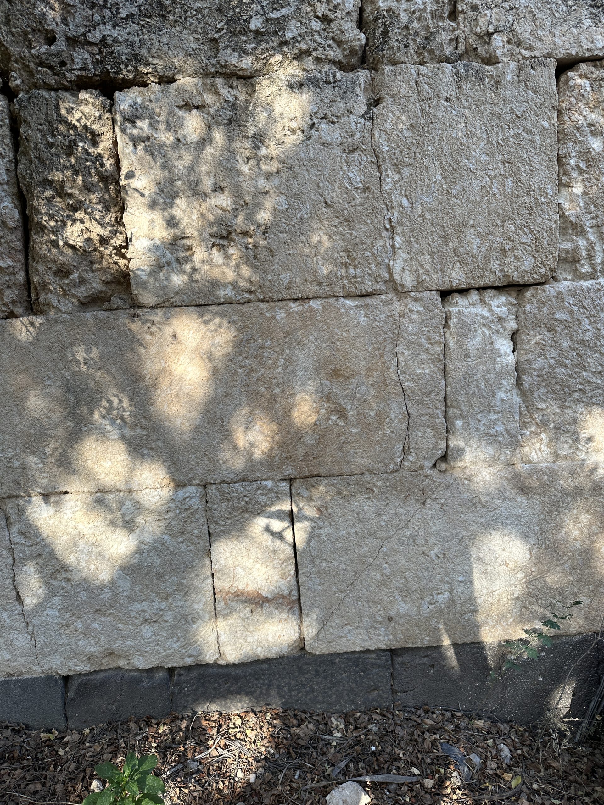 Through-going joints on inner South wall of fortress
View from the east Photo by Jefferson Williams - 11 June 2023 |
Inner South wall of fortress | JW: Joints passing through 2 or more adjacent stones can indicate high levels of local intensity as the fracture has to overcome the stress shadow between the ashlars (e.g. see Korjenkov and Mazor, 1999:197-198) |
| Displaced Wall | Displaced Wall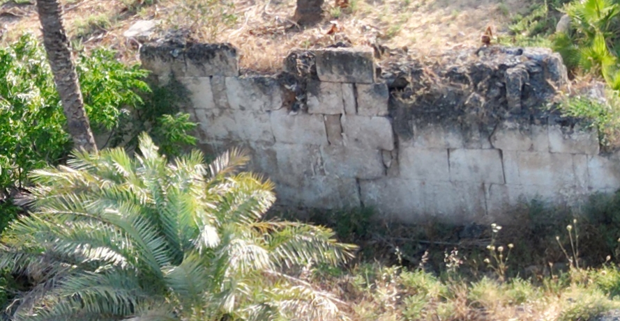 Displaced exterior east fortress wall south of the Main gate
View from the the northeast and above Drone Photo by Jefferson Williams - 11 June 2023 |
Exterior east fortress wall south of the Main gate | JW: Displaced Wall along with some fracturing. Could be due to soil pressure if this wall acted as a retaining wall at some time in its history |