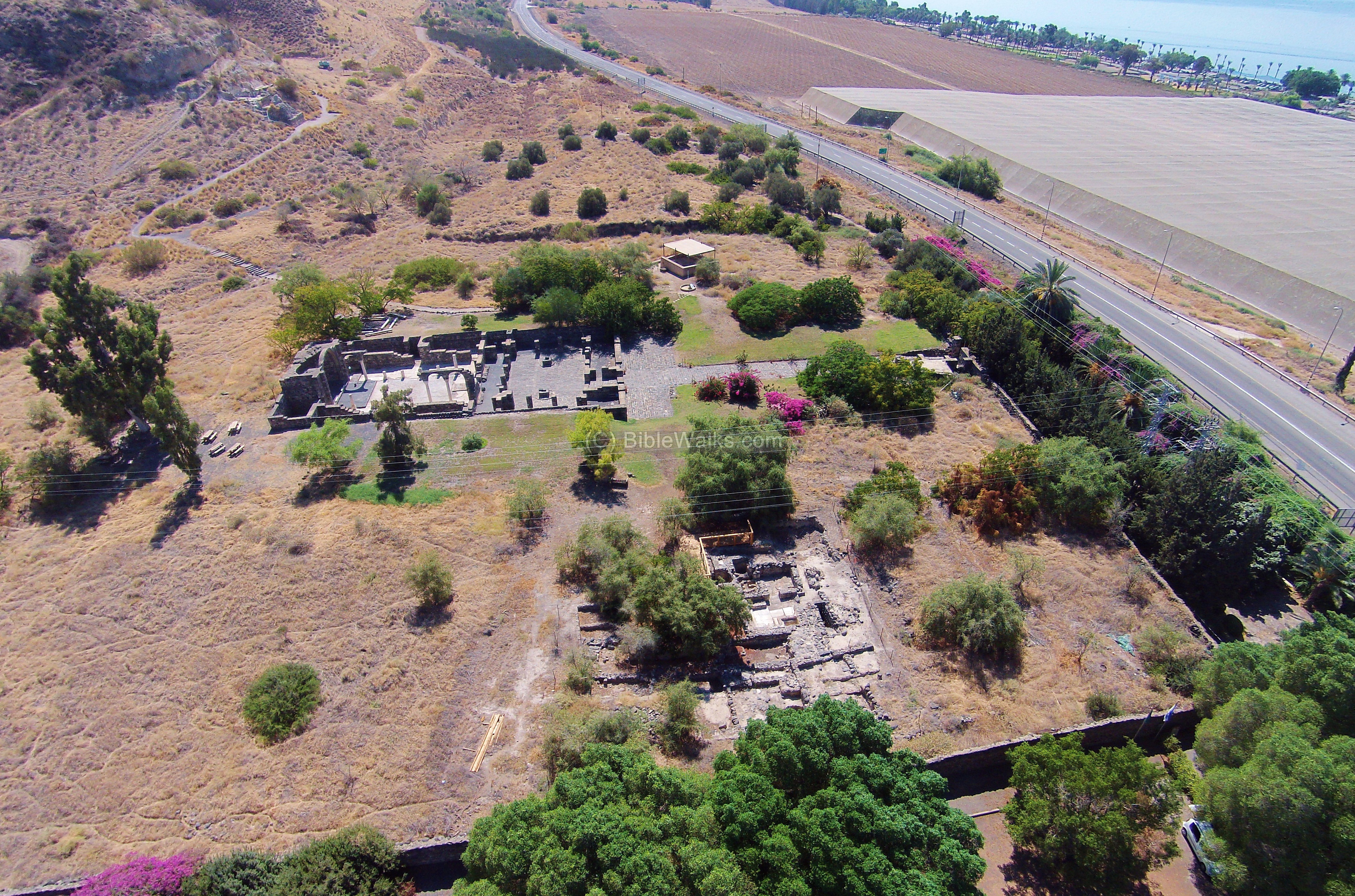
Transliterated Name | Source | Name |
---|---|---|
Kursi | Arabic | الكرسي |
Kursi | Hebrew | כורסי |
Kursi | Medieval Greek | Κυρσοί |
Tel el-Kursi |
Kursi is an archaeological site located on the eastern shore of the Sea of Galilee in the Golan Heights. It is renowned for the remains of a large Byzantine monastery and is traditionally identified as the site of the Miracle of the Swine, where Jesus exorcised demons from a man into a herd of pigs.
The site is situated near the mouth of Nahal Samakh, a wadi descending from the Golan Heights, creating a fertile valley along the shoreline. This strategic location provided access to both land and water routes, facilitating pilgrimage and trade during antiquity.
During the Byzantine era, Kursi became a significant Christian pilgrimage site. A substantial monastery complex was constructed in the 5th century CE to commemorate the miracle attributed to Jesus. The complex included a basilica, baptistery, living quarters for monks, and facilities for pilgrims. The church featured intricate mosaic floors depicting geometric patterns, flora, and fauna, some of which are still visible today.
In 614 CE, the Sasanian Empire invaded the region, leading to widespread destruction of Christian sites, including the monastery at Kursi. The complex suffered significant damage but was partially restored in the subsequent years.
Following the Muslim conquest of the Levant, the monastery continued to function under Islamic rule. However, its prominence declined over time.
In 749 CE, a devastating earthquake struck the region, causing extensive damage to Kursi and leading to the abandonment of the monastery. Archaeological evidence, such as collapsed walls and displaced masonry, supports the occurrence of this seismic event.
The ruins of Kursi were rediscovered in the 20th century during road construction. Excavations conducted between 1971 and 1974 uncovered the monastery complex
Tel el-Kursi is situated at the mouth of Wadi es-Samak, on the eastern shore of the Sea of Ga1ilee (map reference 2113.2478) and is traditionally identified with the site of the miracle of the Gadarene swine (Mt. 8:28-34; Mk. 5:1-20; Lk. 8:26-39). According to the Gospels, the miracle took place at Perea, or "the other side," which is the eastern shore of the lake. Each of the three Gospels names the place differently: Matthew calls it Gadara; Mark, Gerasa; and Luke, Gergesa. The three names apparently refer to different locations; according to Origen, the miracle actually happened at Gerasa. Since the end of the third century CE, however, Christians have identified a site on the eastern shore of the Sea of Galilee as the location in question. Topographical and archaeological studies done in the nineteenth century suggested Tell el-Kursi as a suitable identification, both because of the name and in view of its physical features. Some scholars, however, preferred to locate the site at the southern part of the eastern shore. Excavations at the mouth of Wadi es-Samak in the early 1970s settled the question.
In 1970, when a new road to the Golan was being built, a hitherto unknown site came to light in the el-Kursi valley, some 300m east of the mound. The discovery was followed by four consecutive seasons of excavation (1970- 1974), directed by V, Tzaferis, on behalf of the Israel Department of Antiquities and Museums. As a result an ancient Christian basilica and the remains of a walled monastery were cleared
Phase | Approximate Date | Evidence | Interpretation |
---|---|---|---|
I | 5th century CE | Initial construction of monastery and church | Establishment as a Christian pilgrimage site |
II | 614 CE | Damage and burning layers | Attributed to Sassanian invasion of Palestine |
III | Post-614 CE | Reconstruction of basilica and outbuildings | Restoration during late Byzantine rule |
IV | 749 CE | Widespread collapse debris, abandonment | Attributed to 749 CE earthquake |
V | 9th century CE | Light occupation layers inside ruins | Squatter occupation before final abandonment |
Vassilios Tzaferis in Stern et al. (1993 v. 3:896), without citing specific evidence, reports that at
Kursi, the Monastery, Church (also known as the Basilica), and a small tower and chapel located approximately
200 meters southeast of the Basilica were destroyed by an earthquake and subsequently abandoned in the mid-8th century CE.
At Kursi Beach,
Cohen and Artzy (2017) document that the western section of a building—possibly a synagogue—in Square B2
exhibited a sloping down and westward tilt, probably due to an earthquake
.
During the four seasons of excavations only part of the monastery was cleared: the wall (in its entirety), the main gate in the wall, and residential quarters in the northern part of the monastery. The wall surrounded the monastery, forming a large rectangular enclosure (120 by 140m). It was built of well-dressed basalt stones, covered with light-colored plaster and decorated with floral patterns. The monastery's main entrance was located in the middle of the western wall. It consisted of a stone-paved gate and an attached structure, probably first used as a hospice or an inn, that was later converted into a watchtower.
A street paved with basalt slabs led from the main gate to the monastery church, a basilica, in the center of the enclosure. In front of the church was an open square as wide as the church.
Based on ceramic and numismatic evidence, the construction of the church and the monastery began at the end of the fifth or the beginning of the sixth century CE. During this early phase the whole complex (wall, church, and streets) was built as a single organized unit. This was also the site's most prosperous phase, in which it functioned as a holy place and a much-frequented pilgrimage site.
After the excavations at Kursi had been completed, and steps were being taken to preserve the site, excavations were carried out on the slope southeast of the monastery. These excavations exposed the remains of a square tower and a small chapel. The tower was built around a fairly high natural rock pillar, and the chapel was built to the east, behind the tower but attached to it. Half of the chapel was a natural cave and the other half was hewn out of the rock. The location of these remains on the slope, only about 200m southeast of the church, supports the identification of the site with the locale of the miracle of the Gadarene swine because the topographical conditions are so similar to those described in the Gospel account. The pottery found here indicates that these buildings were also erected at the end of the fifth century CE, at the same time as the monastery and the church, and were destroyed in the mid-eighth century.
In November–December 2015, the first season of the Avery-Tsui excavations was conducted at Kursi Beach, located on the eastern shore of the Sea of Galilee, approximately 1 km northwest of Kursi National Park. ...
The Kursi Beach archaeological site (Hartal and Ben-Efraim 2012: Site 12 , H orbat Kursi [Harbor]; Fig. 1) is located in the Kursi Beach Nature Reserve, on the fringes of the western Golan Heights and the eastern shore of the Sea of Galilee, c. 1 km northwest of Kursi National Park. The entire complex was declared a nature reserve in 1980, and it was named Kursi Beach after the Syrian village and the nearby Byzantine site. It is widely believed that this is the settlement of Kursi that is mentioned in the Talmud or the “Land of the Gedarenes” or “Gerasenes”, where Jesus preformed the Miracle of the Swine (Matthew 8:28; Mark 5:1; Luke 8:26–27).
Phase | Approximate Date | Evidence | Interpretation |
---|---|---|---|
I | 5th century CE | Initial construction of monastery and church | Establishment as a Christian pilgrimage site |
II | 614 CE | Damage and burning layers | Attributed to Sassanian invasion of Palestine |
III | Post-614 CE | Reconstruction of basilica and outbuildings | Restoration during late Byzantine rule |
IV | 749 CE | Widespread collapse debris, abandonment | Attributed to 749 CE earthquake |
V | 9th century CE | Light occupation layers inside ruins | Squatter occupation before final abandonment |
Effect | Location | Image(s) | Description |
---|---|---|---|
|
Monastery and Basilica (Areas A, B, and C)![]() ![]() Vassilios Tzaferis in Stern et al. (1993 v. 3) | In 741 CE it [the Monastery and Basilica Complex] was destroyed by an earthquake and abandoned by the Christians [JW: Incorrect Date - should be 749]- Vassilios Tzaferis in Stern et al. (1993 v. 3:896) |
|
|
Chapel and Small Tower ~200 m SE of Monastery/Basilica Complex![]() ![]() Vassilios Tzaferis in Stern et al. (1993 v. 3) | The pottery found here indicates that these buildings were also erected at the end of the fifth century CE, at the same time as the monastery and the church, and were destroyed in the mid-eighth century.- Vassilios Tzaferis in Stern et al. (1993 v. 3:896) |
|
|
Building in Square B2 at Kursi Beach![]() ![]() Location Map and the excavation areas Cohen and Artzy (2017) ![]() ![]() Square B2, plan Cohen and Artzy (2017) |
![]() ![]() Square B2 Cohen and Artzy (2017) |
The western part of the building sloped downward, toward the west, probably due to an earthquake.- Cohen and Artzy (2017) |
Effect | Location | Image(s) | Description | Intensity |
---|---|---|---|---|
|
Monastery and Basilica (Areas A, B, and C)![]() ![]() Vassilios Tzaferis in Stern et al. (1993 v. 3) | In 741 CE it [the Monastery and Basilica Complex] was destroyed by an earthquake and abandoned by the Christians [JW: Incorrect Date - should be 749]- Vassilios Tzaferis in Stern et al. (1993 v. 3:896) |
|
|
|
Chapel and Small Tower ~200 m SE of Monastery/Basilica Complex![]() ![]() Vassilios Tzaferis in Stern et al. (1993 v. 3) | The pottery found here indicates that these buildings were also erected at the end of the fifth century CE, at the same time as the monastery and the church, and were destroyed in the mid-eighth century.- Vassilios Tzaferis in Stern et al. (1993 v. 3:896) |
|
|
|
Building in Square B2 at Kursi Beach![]() ![]() Location Map and the excavation areas Cohen and Artzy (2017) ![]() ![]() Square B2, plan Cohen and Artzy (2017) |
![]() ![]() Square B2 Cohen and Artzy (2017) |
The western part of the building sloped downward, toward the west, probably due to an earthquake.- Cohen and Artzy (2017) |
|
Alexandre, Y., & Bar-Nathan, R. (1997). Preliminary Excavation Reports from Kursi
. Israel Antiquities Authority Excavation and Survey Reports.
Cohen, Haim and Artzy, Michael (2017) Kursi Beach – 2015 - Preliminary Report
Hadashot Arkheologiyot, v. 129 Year 2017.
Marco, S., Agnon, A., & Ellenblum, R. (2003). The 749 CE Earthquake: Archaeology, Geology, and Historical Sources
. Journal of Archaeological Science, 30(8), 907–926. - Marco et al. (2003) cite Amrian et al. (1994) in assessing that
a church was destroyed in the Sabbatical Year Earthquakes and that local intensity was VII during this event.
Marco, S., Klinger, Y., & Lekkas, E. (2006) Archaeoseismology: Historical and Archaeological Evidence for Large Earthquakes in the Dead Sea Transform Region
. Tectonophysics, 408(1–4), 133–147.
Tzaferis, V. (1983). Excavations at Kursi: A Preliminary Report. Israel Exploration Journal, 33(3–4), 173–187.
Tzaferis, Vassilios and Bijovsky, Gabriela (2014) New Archaeological Finds from Kursi-Gergesa
, Atiqot 2014, 175-197.
Williams, J. (2024). Mid-8th Century CE Seismic Sequences Along the Dead Sea Transform. Supplemental Appendices
V. Tsaferis, The Excavations of Kursi~Gergesa ('Atiqot 16), Jerusalem 1983.
F. M. Abel, JPOS7 (1927), 112~121
D. Urman, CNI22 (1971), 72~76
V. Tsaferis,I£!22
(1972), 176~177
id., RB 79 (1972)
409~411
id., Actes du Xe Congres International d'Archeologie
Chretienne, Thessalonique 28~29.4.1980, Thessalonica 1984, 605~612
id., BAR 15/2 (1989), 44~
51
F. B. Lavio, BTS 152(1973), 6~16
A. Ovadiah, PEQ 109(1977), 123~124
Y. Blomme, RB87
(1980), 404~407
CNI27 (1979~1982), 170-172
M. Provera, La Terra Santa (1982), 43~47
id.,
Bibbia e Oriente !57 (1988), 139~143
J. Potin, MdB 38 (1985), 48~49
A. Raban, /JNA 17 (1988),
311-329.
J. F. Strange, BA 56 (1993), 153–157
V. Tzaferis. Ancient Churches Revealed (ed. Y. Tsafrir), Jerusalem
1993, 77–79
id., OEANE, 3, New York 1997, 314–315
M. Nun, The Land of the Gadarenes: New Light on
an Old Sea of Galilee Puzzle, Ein Gev 1996
id., BAR 25/4 (1999), 18–31, 64
Z. Safrai, Jerusalem Perspective 51 (1996), 16–19
H. Goldfus, Tombs and Burials in Churches and Monasteries of Byzantine Palestine
(324–628 A.D.), 1–2 (Ph.D. diss.), Ann Arbor, MI 1998, 206–211
H. Dudman, Galilee Revisited: With Mary
Magdalene and 20 Other Immortals in Search of Jesus, Jerusalem 2000
B. Bagatti, Ancient Christian Villages of Galilee (SBF Collectio Minor 37), Jerusalem 2001, 64–67
A. Ovadiah, Art and Archaeology in
Israel and Neighbouring Countries, London 2002 (index)
BAR 29/1 (2003), 55–56
30/1 (2004), 50–51
J.
Sudilovsky, ibid. 29/1 (2003), 18
P. Gruson, MdB Hors Série 2005, 37.