Khirbet Yajuz
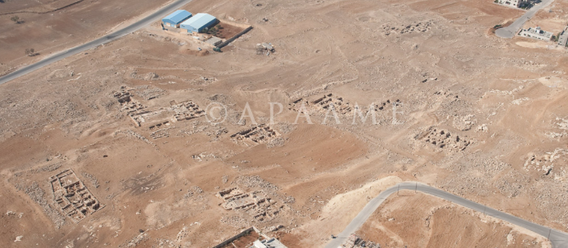 Aerial Photograph of Khirbet Yajuz
APAAME CC BY-NC-ND 2.0
| Transliterated Name | Language | Name |
|---|---|---|
| Khirbet Yajuz | Arabic | كهيربيت ياجوز |
| Khirbet Mudraj | Arabic | كهيربيت مودراج |
| Talat Nimr | Arabic | تالات نيمر |
- Aerial View of Khirbet Yajuz
from APAAME
 Aerial View of Khirbet Yajuz
APAAME - Khirbet Yajuz in Google Earth
 Khirbet Yajuz in Google Earth
click on image to explore this site on a new tab in Google Earth
- Fig. 1 - Site map from
Khalil and Kareem (2002)
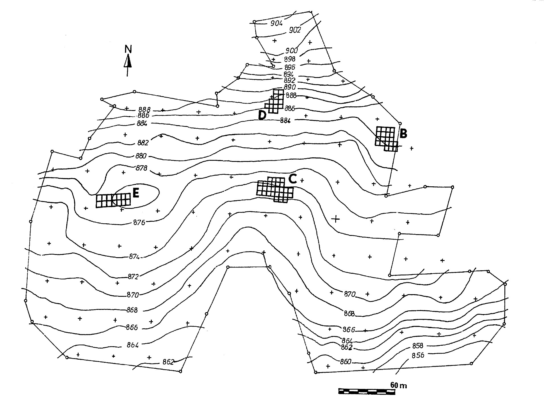 Figure 1.
Contour map of Khirbat Yajuz, showing the location of excavations (Areas: B, C, D and E).
Khalil and Kareem (2002)
- Fig. 1 - Site map from
Khalil and Kareem (2002)
Figure 1.
Contour map of Khirbat Yajuz, showing the location of excavations (Areas: B, C, D and E).
Khalil and Kareem (2002)
- Fig. 2 - Area E plan
from Khalil and Kareem (2002)
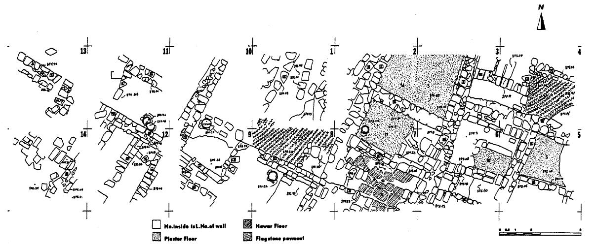 Figure 2
Khirbat Yajuz, Area E: plan of the architeetural features in squares 1-14.
Khalil and Kareem (2002) - Fig. 3 - Area E, east
section of square 7 from Khalil and Kareem (2002)
 Figure 3
Khirbat Yajuz, Area E, east section of square 7
Khalil and Kareem (2002) - Fig. 4 - isometric
reconstruction of Umayyad structures in squares 2, 6, 7. and 8 of Area E from Khalil and Kareem (2002)
 Figure 4
Khirbat Yajuz, Area E; isometric reconstruction of Umayyad structures in squares 2, 6, 7. and 8
Khalil and Kareem (2002) - Fig. 6 - isometric
reconstruction of Abbasid structures in squares 2, 6, 7. and 8 of Area E from Khalil and Kareem (2002)
 Figure 6
Khirbat Yajuz, Area E; isometric reconstruction of Abbasid structures in squares 2, 6, 7. and 8
Khalil and Kareem (2002)
- Fig. 2 - Area E plan
from Khalil and Kareem (2002)
Figure 2
Khirbat Yajuz, Area E: plan of the architeetural features in squares 1-14.
Khalil and Kareem (2002) - Fig. 3 - Area E, east
section of square 7 from Khalil and Kareem (2002)
Figure 3
Khirbat Yajuz, Area E, east section of square 7
Khalil and Kareem (2002) - Fig. 4 - isometric
reconstruction of Umayyad structures in squares 2, 6, 7. and 8 of Area E from Khalil and Kareem (2002)
Figure 4
Khirbat Yajuz, Area E; isometric reconstruction of Umayyad structures in squares 2, 6, 7. and 8
Khalil and Kareem (2002) - Fig. 6 - isometric
reconstruction of Abbasid structures in squares 2, 6, 7. and 8 of Area E from Khalil and Kareem (2002)
Figure 6
Khirbat Yajuz, Area E; isometric reconstruction of Abbasid structures in squares 2, 6, 7. and 8
Khalil and Kareem (2002)
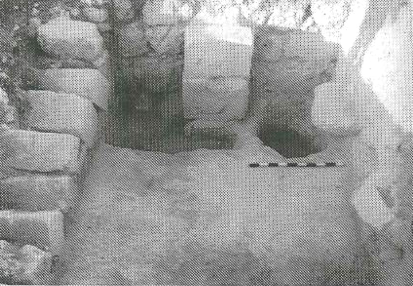
- Fig. 15 - Collapsed Arch from
Khalil (1998)
 15
15
Collapsed arch above plaster floor, looking south.
Khalil (1998) - Fig. 22 - Paved Room from
Savage et al (2001)
 Figure 22
Paved room at Khirbet Yajuz.
Savage et al (2001) - Fig. 25 - Early Abbasid finds from
Khalil and Kareem (2002)
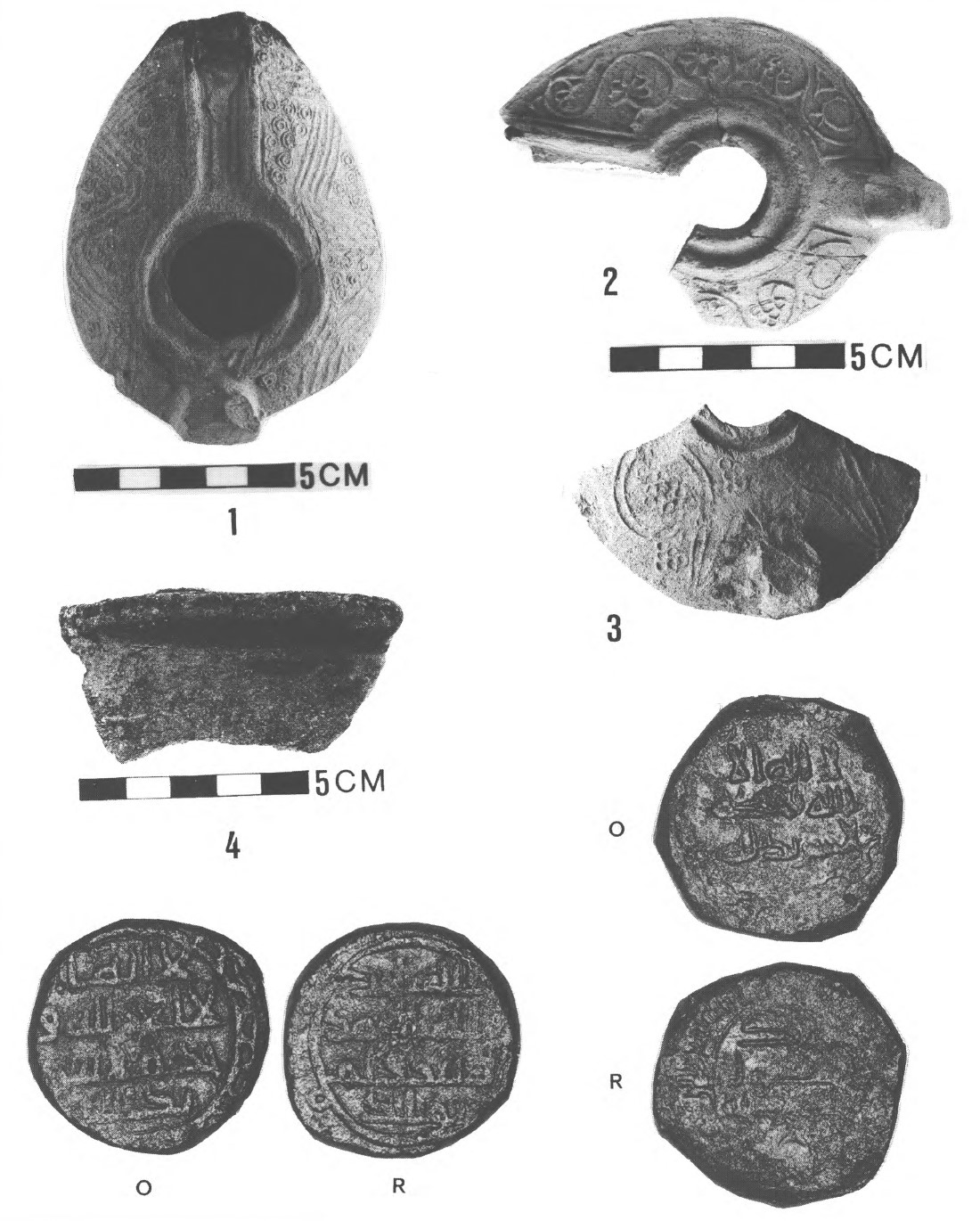 Figure 25
Khirbat Yajuz, Area E.
- Complete decorated lamp
- decorated lamp fragment
- decorated lamp fragments
- sherd of a steatite cooking pot
- copper coin
- copper coin
copper coins - Reg. no. 115 and Reg. no. 108, X2, 75; nos 5-6
Khalil and Kareem (2002) - Fig. 5 - Walls, arch,
and plaster floor in squares 2, 3, and 6 of Area E from Khalil and Kareem (2002)
 Figure 5
Khirbat Yajuz, Area E: Walls, arch, and plaster floor in squares 2, 3, and 6, looking north.
Khalil and Kareem (2002) - Fig. 7 - Walls, reinforced
bases of arches, plaster floors, and flagstone pavement in squares 2 and 7 of Area E from Khalil and Kareem (2002)
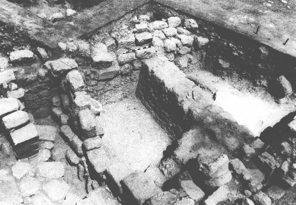 Figure 7
Khirbat Yajuz, Area E: Walls, reinforced bases of arches, plaster floors, and flagstone pavement in squares 2 and 7,looking north-west.
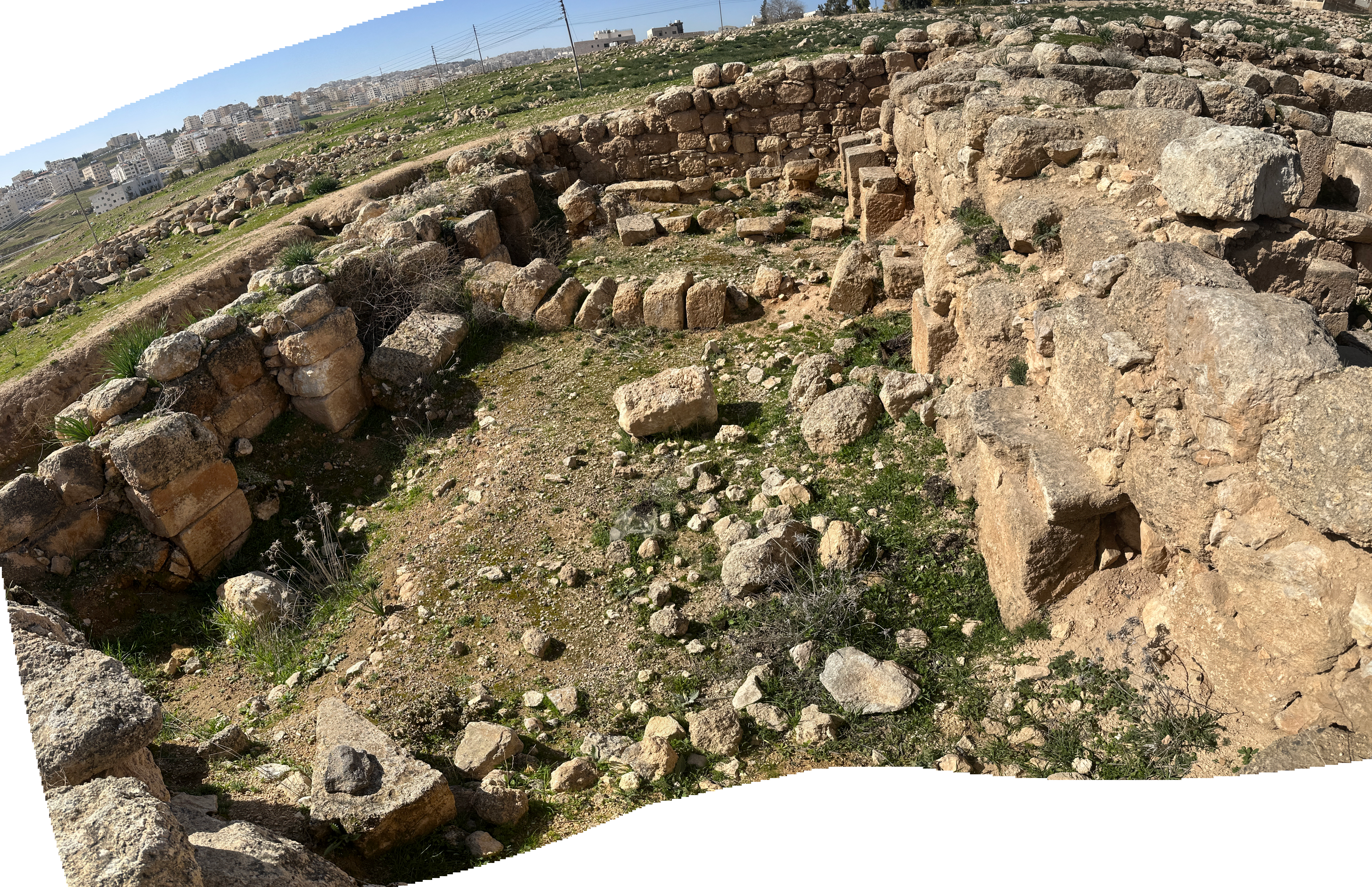
Khalil and Kareem (2002) - Collapsed Arch - photo by JW
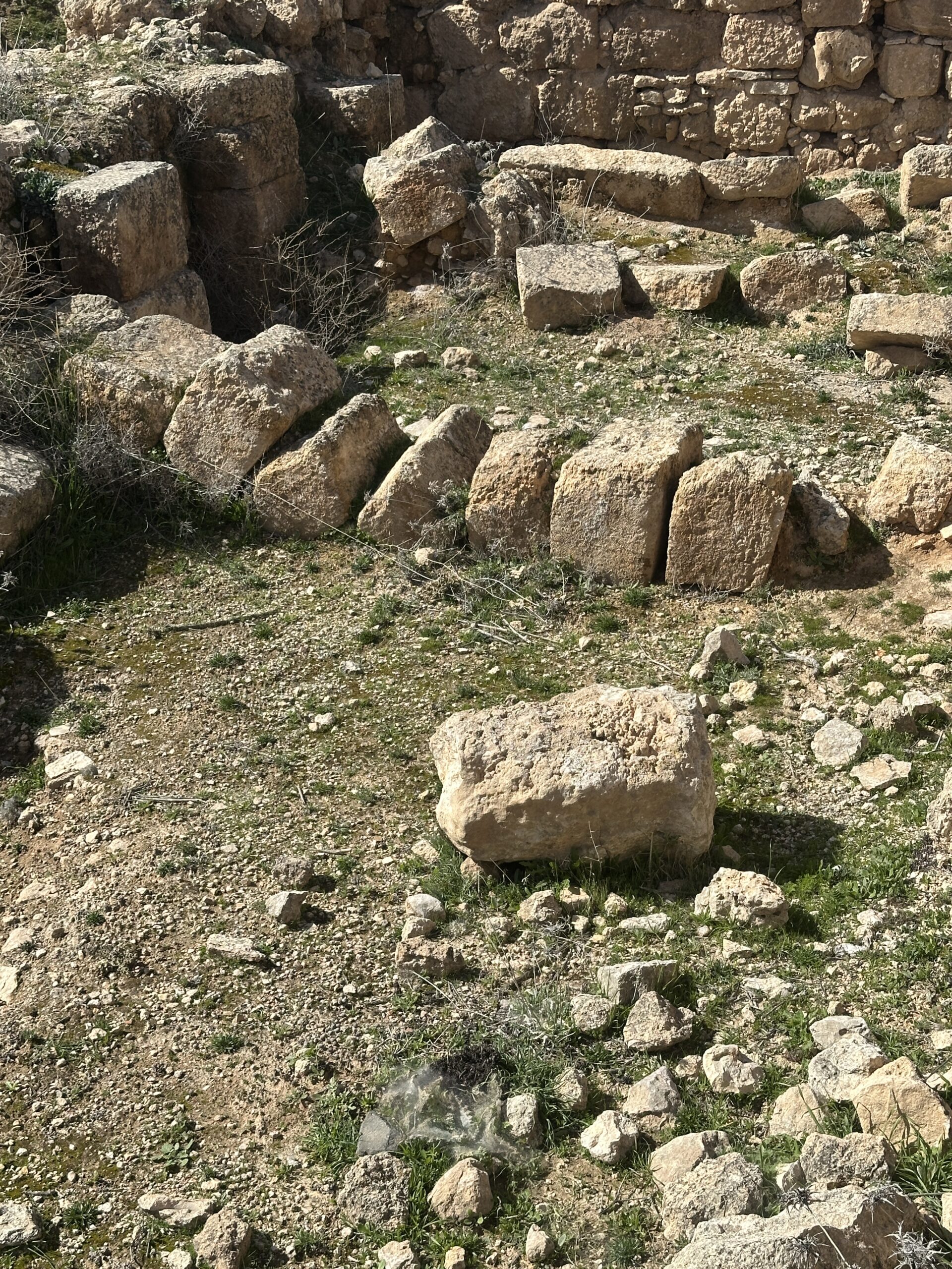 Collapsed Arch - looking west
Click on image to open in a new tab
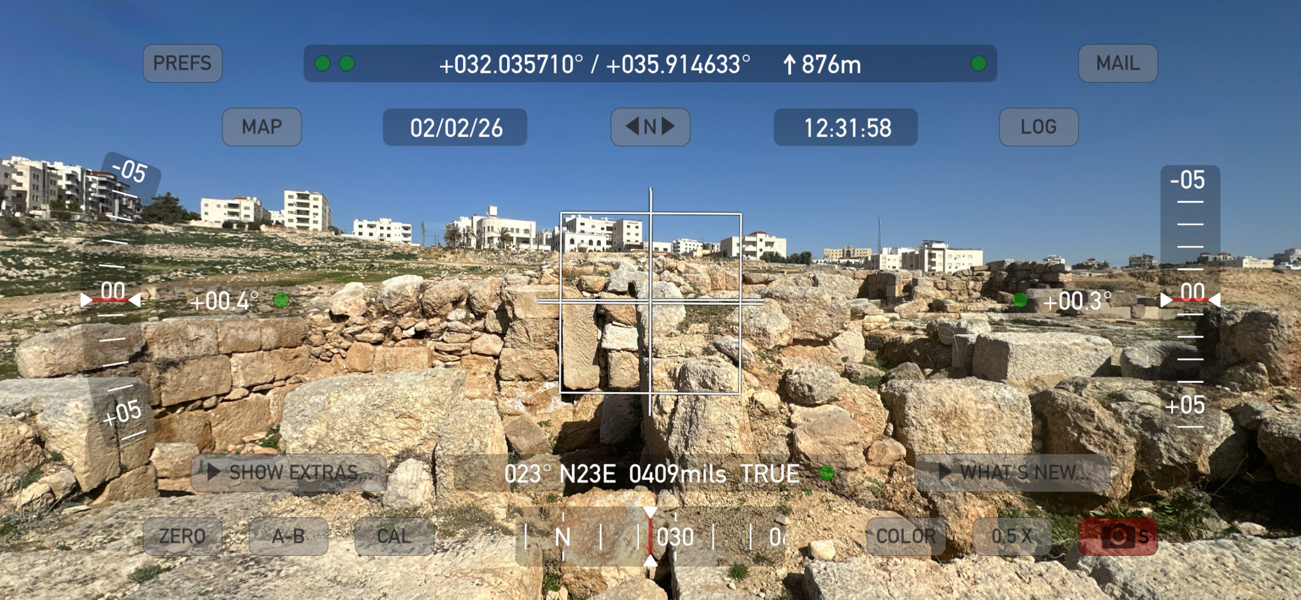
Photo by Jefferson Williams - 2 Feb. 2026 - Tilted Wall - digital theodolite
photo by JW
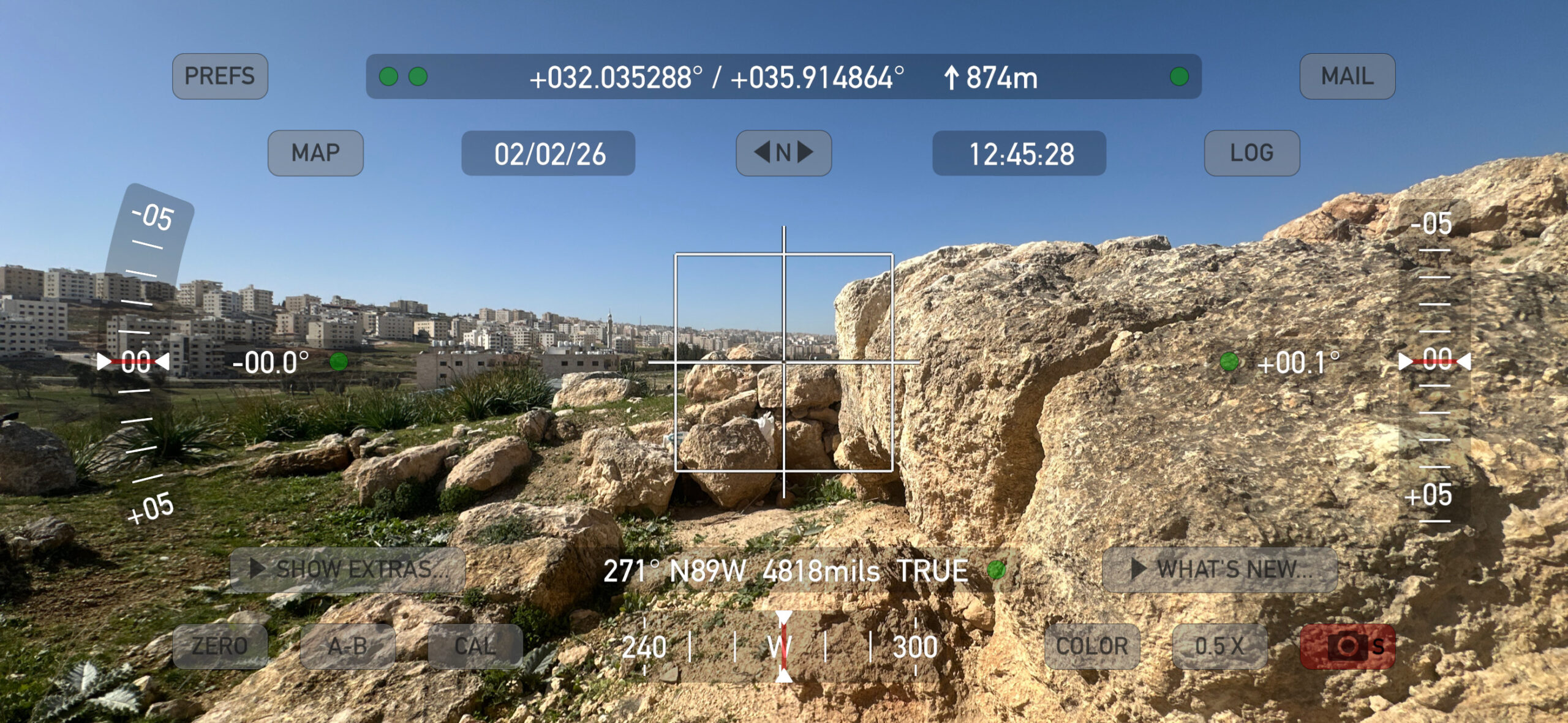 Digital Theodolite Photo of Tilted Wall
Click on image to open in a new tab
Photo by Jefferson Williams - 2 Feb. 2026 - Tilted Wall - digital theodolite
photo by JW
 Digital Theodolite Photo of Tilted Wall
Click on image to open in a new tab
Photo by Jefferson Williams - 2 Feb. 2026
- Fig. 15 - Collapsed Arch from
Khalil (1998)
15
Collapsed arch above plaster floor, looking south.
Khalil (1998) - Fig. 22 - Paved Room from
Savage et al (2001)
Figure 22
Paved room at Khirbet Yajuz.
Savage et al (2001) - Fig. 25 - Early Abbasid finds from
Khalil and Kareem (2002)
Figure 25
Khirbat Yajuz, Area E.
- Complete decorated lamp
- decorated lamp fragment
- decorated lamp fragments
- sherd of a steatite cooking pot
- copper coin
- copper coin
copper coins - Reg. no. 115 and Reg. no. 108, X2, 75; nos 5-6
Khalil and Kareem (2002) - Fig. 5 - Walls, arch,
and plaster floor in squares 2, 3, and 6 of Area E from Khalil and Kareem (2002)
Figure 5
Khirbat Yajuz, Area E: Walls, arch, and plaster floor in squares 2, 3, and 6, looking north.
Khalil and Kareem (2002) - Fig. 7 - Walls, reinforced
bases of arches, plaster floors, and flagstone pavement in squares 2 and 7 of Area E from Khalil and Kareem (2002)
Figure 7
Khirbat Yajuz, Area E: Walls, reinforced bases of arches, plaster floors, and flagstone pavement in squares 2 and 7,looking north-west.
Khalil and Kareem (2002) - Collapsed Arch - photo by JW
Collapsed Arch - looking west
Click on image to open in a new tab
Photo by Jefferson Williams - 2 Feb. 2026 - Tilted Wall - digital theodolite
photo by JW
Digital Theodolite Photo of Tilted Wall
Click on image to open in a new tab
Photo by Jefferson Williams - 2 Feb. 2026 - Tilted Wall - digital theodolite
photo by JW
Digital Theodolite Photo of Tilted Wall
Click on image to open in a new tab
Photo by Jefferson Williams - 2 Feb. 2026
- Fig. 1 - Site map from
Khalil and Kareem (2002)
Figure 1.
Contour map of Khirbat Yajuz, showing the location of excavations (Areas: B, C, D and E).
Khalil and Kareem (2002) - Fig. 15 - Collapsed Arch from
Khalil (1998)
15
Collapsed arch above plaster floor, looking south.
Khalil (1998) - Fig. 22 - Paved Room from
Savage et al (2001)
Figure 22
Paved room at Khirbet Yajuz.
Savage et al (2001) - Fig. 25 - Early Abbasid finds from
Khalil and Kareem (2002)
Figure 25
Khirbat Yajuz, Area E.
- Complete decorated lamp
- decorated lamp fragment
- decorated lamp fragments
- sherd of a steatite cooking pot
- copper coin
- copper coin
copper coins - Reg. no. 115 and Reg. no. 108, X2, 75; nos 5-6
Khalil and Kareem (2002)
| Effect | Location | Image(s) | Description |
|---|---|---|---|
|
Area B
Figure 1. Contour map of Khirbat Yajuz, showing the location of excavations (Areas: B, C, D and E). Khalil and Kareem (2002) |
|
|
|
Area C
Figure 1. Contour map of Khirbat Yajuz, showing the location of excavations (Areas: B, C, D and E). Khalil and Kareem (2002) |
Fig. 15
15 Collapsed arch above plaster floor, looking south. Khalil (1998) |
|
|
Area E
Figure 1. Contour map of Khirbat Yajuz, showing the location of excavations (Areas: B, C, D and E). Khalil and Kareem (2002)
Figure 2Khirbat Yajuz, Area E: plan of the architeetural features in squares 1-14. Khalil and Kareem (2002) |
Fig. 22 - example of paved floor
Figure 22 Paved room at Khirbet Yajuz. Savage et al (2001) Fig. 4
Figure 4Khirbat Yajuz, Area E; isometric reconstruction of Umayyad structures in squares 2, 6, 7. and 8 Khalil and Kareem (2002) Fig. 5
Figure 5Khirbat Yajuz, Area E: Walls, arch, and plaster floor in squares 2, 3, and 6, looking north. Khalil and Kareem (2002) Fig. 6
Figure 6Khirbat Yajuz, Area E; isometric reconstruction of Abbasid structures in squares 2, 6, 7. and 8 Khalil and Kareem (2002) Fig. 7
Figure 7Khirbat Yajuz, Area E: Walls, reinforced bases of arches, plaster floors, and flagstone pavement in squares 2 and 7,looking north-west. Khalil and Kareem (2002) |
|
- Modified by JW from Fig. 2 of Khalil and Kareem (2002)
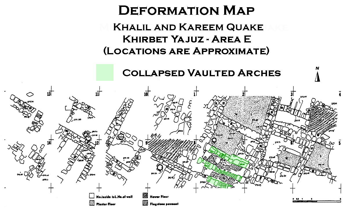 Deformation Map
click on image to open in a new tab
Modified by JW from Fig. 2 of Khalil and Kareem (2002)
-
Earthquake Archeological Effects chart
of Rodríguez-Pascua et al (2013: 221-224)
 Earthquake Archeological Effects (EAE)
Rodríguez-Pascua et al (2013: 221-224)
| Effect | Location | Image(s) | Description | Intensity |
|---|---|---|---|---|
|
Area B
Figure 1. Contour map of Khirbat Yajuz, showing the location of excavations (Areas: B, C, D and E). Khalil and Kareem (2002) |
|
|
|
|
Area C
Figure 1. Contour map of Khirbat Yajuz, showing the location of excavations (Areas: B, C, D and E). Khalil and Kareem (2002) |
Fig. 15
15 Collapsed arch above plaster floor, looking south. Khalil (1998) |
|
|
|
Area E
Figure 1. Contour map of Khirbat Yajuz, showing the location of excavations (Areas: B, C, D and E). Khalil and Kareem (2002)
Figure 2Khirbat Yajuz, Area E: plan of the architeetural features in squares 1-14. Khalil and Kareem (2002) |
Fig. 22 - example of paved floor
Figure 22 Paved room at Khirbet Yajuz. Savage et al (2001) Fig. 4
Figure 4Khirbat Yajuz, Area E; isometric reconstruction of Umayyad structures in squares 2, 6, 7. and 8 Khalil and Kareem (2002) Fig. 5
Figure 5Khirbat Yajuz, Area E: Walls, arch, and plaster floor in squares 2, 3, and 6, looking north. Khalil and Kareem (2002) Fig. 6
Figure 6Khirbat Yajuz, Area E; isometric reconstruction of Abbasid structures in squares 2, 6, 7. and 8 Khalil and Kareem (2002) Fig. 7
Figure 7Khirbat Yajuz, Area E: Walls, reinforced bases of arches, plaster floors, and flagstone pavement in squares 2 and 7,looking north-west. Khalil and Kareem (2002) |
|
|