Recently, based on the published pottery from their
excavation (Avissar 1997) and the results of more recent
excavations conducted at the site (e.g., Schetelowitz
and Oren 1999), I have revised Dar and Safrai’s above
interpretation of the chronology and nature of Ḥorvat
Bira (Taxel 2005: 236–42). With regard to the present
study, most relevant are the conclusions related to the
settlement’s Early Islamic phase.
17 The ceramic finds
from the two excavated industrial and domestic structures indeed point to their continuous use throughout
the Early Islamic period and even later. However, there
is no solid basis for the excavators’ conclusion that the
church building was converted into an oil press at the
very beginning of the Early Islamic period. This is due
to the fact that the ceramic assemblages from the church
are mixed, containing Byzantine through medieval pottery types, and thus cannot be used to date the transition. Nevertheless, the phenomenon of reusing Christian
churches for domestic or industrial purposes (such as
producing oil) is well documented throughout Early Islamic Palestine, with most cases apparently dated from
the late Umayyad period (Schick 1995: 129–31; Magen
2008a: 267–306; and see below). It therefore seems more
reasonable that the church at Ḥorvat Bira was abandoned
and reused only around the late seventh/early eighth century. The excavation of a Byzantine wine press located
on the fringes of the site supports this dating: At some
later stage, a new floor was built inside the wine press,
and some of its original components ceased to be used,
suggesting that it was converted into some other type of
industrial installation. A coin from the second half of the
seventh century and the latest pottery sherds found beneath the floor date its construction to no earlier than
the late seventh or eighth century (Taxel 2005: 240, with
references).
The cessation of the use of the church (and apparently
also the wine press) clearly indicates a shift in the religious affinity of at least some of the settlement’s population at the beginning of the Early Islamic period. Did
this change occur before or ater the establishment of
Ramla in ca. 715 c.e., and was it related in some way
to this event? Did Ḥorvat Bira’s Christian population
leave due to economic and/or sociopolitical pressures
and settle in places with larger and more resilient Christian communities, such as Lod, or even Ramla? Or did
the Christians not abandon their village, but rather their
faith, converting to Islam, either gradually or en masse?
I return to these and other questions below, not only as
they relate to Ḥorvat Bira but also within the broader
regional context. However, before doing so, it is necessary to address Dar and Safrai’s suggestion concerning
the Jewish identity of the settlement’s new occupants in
the Early Islamic period.
As I have previously demonstrated (Taxel 2005: 240–
41), whether the rock-cut element is indeed a miqveh
cannot be determined with certainty given the published data; nor can we establish whether it postdated
the church.
18 In any case, even if the excavators are correct in their interpretation, both the miqveh and the lamp
decorated with seven-branched menorahs could as easily
represent a Samaritan population as a Jewish one, as both
religious groups used ritual baths and employed the menorah motif in late antique and Early Islamic times (Magen 2008b). The literary sources, such as the
Continuatio
of the Samaritan chronicle of Abū l-Fatḥ (which was
composed in 1355 c.e. but deals with the early seventh to
early tenth centuries), indicate that throughout the Early
Islamic period, Samaritans lived not only in Ramla and
Lod but also in the nearby countryside.
19 This text also
preserves a positive Samaritan memory of the Umayyad
caliphs and their reign (Levy-Rubin 2002; see also Gil
1992: 821, with additional references).
20 This is not to
suggest that the population should necessarily be considered Samaritan either. Without additional evidence,
all proposals concerning the identification of the site’s
inhabitants at the beginning of the Early Islamic period
should be treated as tentative (see further below).
Footnotes
17 It is worth noting, however, that according to my revised chronology, the settlement was founded not in the Late Roman period but
only in the sixth century (based on the earliest published pottery) and
was inhabited by a Christian (and not Jewish) population from its very
beginning (Taxel 2005: 237–40, 242).
18 According to D. Amit (personal communication, 2012), the
rock-cut installation from Ḥorvat Bira is not a miqveh. Indeed, it is not
included in Amit and Adler’s 2010 study, which presents an updated
review of post-70 c.e. miqvaʾot in Palestine.
19 One of these rural settlements is Dājūn (modern Beth Dagan;
ca. 9 km northwest of Lod and Ramla), which, according to the Continuatio, was a Samaritan village well into the Early Islamic period
(Levy- Rubin 2002: 185). Interestingly, in the late 10th century, Muslims
already inhabited Dājūn, as indicated by al-Muqaddasī (2001: 165) and
other contemporary sources (Gil 1992: 332–33, with references). However, the published archaeological remains from Beth Dagan provide
relatively little information about the site in the Early Islamic period
(see, e.g., Peilstöcker and Kapitaikin 2000; Rauchberger 2008).
20 This is apparently despite the fact that the Continuatio also testiies that, at the time of the Muslim conquest, the Samaritans who lived
in many of the coastal settlements, including Lod, fled to Byzantium
“with the Byzantines” (namely, the Christians, who most probably
made up the region’s Greek-speaking elite; Levy-Rubin 2002: 51).
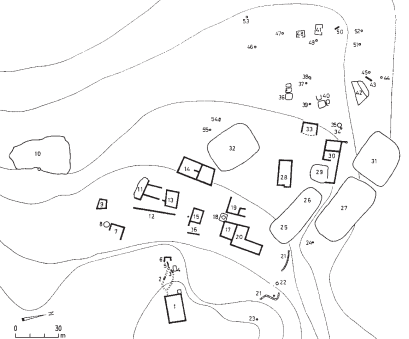
 Horvat Bira