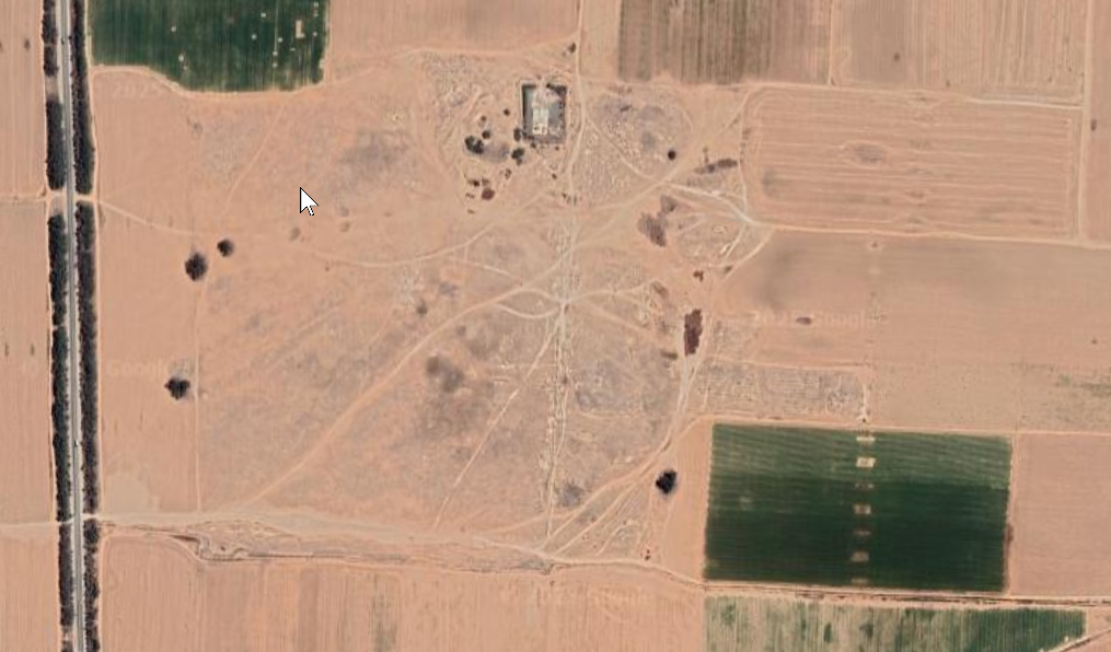
Horbat Be'er Shema
 Horbat Be'er Shema
click on image to explore this site on a new tab in govmap.gov.il
| Transliterated Name | Source | Name |
|---|---|---|
| Horbat Be'er Shema | Hebrew | |
| Be'er Shema | Hebrew | |
| Birsama | Greek | Βιρσαμίς |
| Castellum Versaminum | Latin | |
| Berzama | Greek | Βερζαμμα |
- Fig. 1 Location map
from Erickson-Gini et al. (2015)
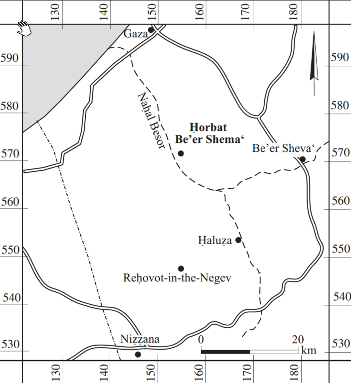 Figure 1
Location of Horbat Be’er Shema‘
Click on image to open a magnifiable image in a new tab
Erickson-Gini et al. (2015)
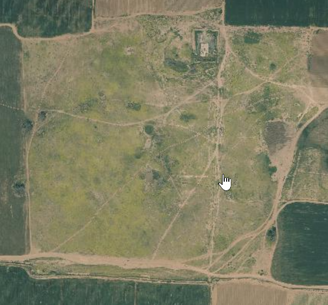
- Horbat Be'er Shema in Google Earth
 Horbat Be'er Shema
click on image to explore this site on a new tab in Google Earth - Horbat Be'er Shema on govmap.gov.il
Horbat Be'er Shema
click on image to explore this site on a new tab in govmap.gov.il
- Fig. 2 Excavation areas
from Erickson-Gini et al. (2015)
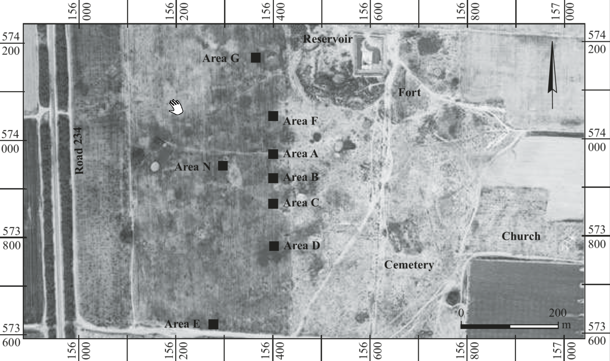 Figure 2
Excavation areas at Horbat Be’er Shema‘
Click on image to open a magnifiable image in a new tab
Erickson-Gini et al. (2015)
- Fig. 2 Excavation areas
from Erickson-Gini et al. (2015)
Figure 2
Excavation areas at Horbat Be’er Shema‘
Click on image to open a magnifiable image in a new tab
Erickson-Gini et al. (2015)
- Fig. 3 Mud-brick structure
at Horbat Be’er Shema‘ in the 1950s from Erickson-Gini et al. (2015)
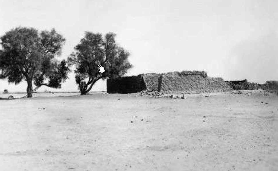 Figure 3
Mud-brick structure at Horbat Be’er Shema‘, 1950s
Click on image to open a magnifiable image in a new tab
Photo: Ram Gophna
Erickson-Gini et al. (2015) - Fig. 4 Stone and mud-brick
structure at Horbat Be’er Shema‘ in the 1950s from Erickson-Gini et al. (2015)
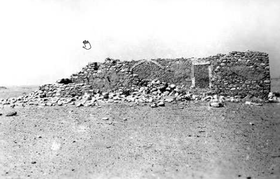 Figure 4
Stone and mud-brick structure at Horbat Be’er Shema‘, 1950s
Click on image to open a magnifiable image in a new tab
Photo: Ram Gophna
Erickson-Gini et al. (2015) - Fig. 21 Mud-brick structure
at Horbat Kasif from Erickson-Gini et al. (2015)
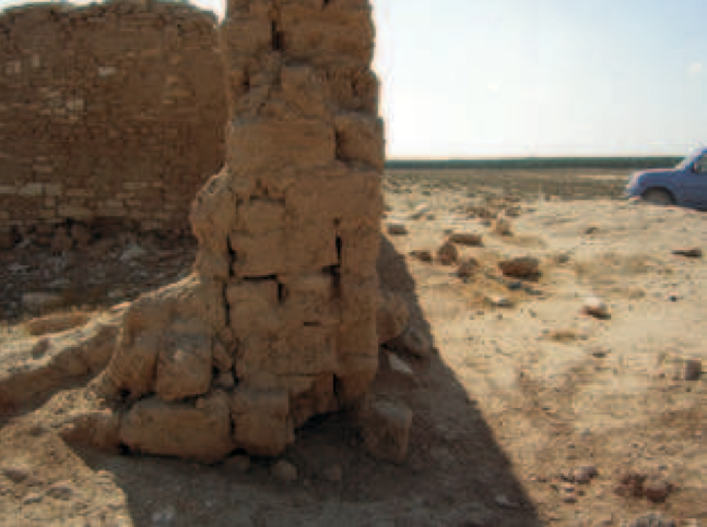 Figure 21
Mud-brick structure at Horbat Kasif
Click on image to open a magnifiable image in a new tab
Photo: Tali Erickson-Gini & Benjamin Saidel, 2006
Erickson-Gini et al. (2015)
- Fig. 3 Mud-brick structure
at Horbat Be’er Shema‘ in the 1950s from Erickson-Gini et al. (2015)
Figure 3
Mud-brick structure at Horbat Be’er Shema‘, 1950s
Click on image to open a magnifiable image in a new tab
Photo: Ram Gophna
Erickson-Gini et al. (2015) - Fig. 4 Stone and mud-brick
structure at Horbat Be’er Shema‘ in the 1950s from Erickson-Gini et al. (2015)
Figure 4
Stone and mud-brick structure at Horbat Be’er Shema‘, 1950s
Click on image to open a magnifiable image in a new tab
Photo: Ram Gophna
Erickson-Gini et al. (2015) - Fig. 21 Mud-brick structure
at Horbat Kasif from Erickson-Gini et al. (2015)
Figure 21
Mud-brick structure at Horbat Kasif
Click on image to open a magnifiable image in a new tab
Photo: Tali Erickson-Gini & Benjamin Saidel, 2006
Erickson-Gini et al. (2015)