Gadara
 Aerial Photograph of Gadara/Umm Qais
APAAME CC BY-NC-ND 2.0
| Transliterated Name | Language | Name |
|---|---|---|
| Gadara | Greek | Γάδαρα |
| Gedaris | Greek | Γαδαρίς |
| Umm Qeis | Arabic | ومم قييس |
- Fig. 1 - Location Map
from El-Khouri and Omoush (2015)
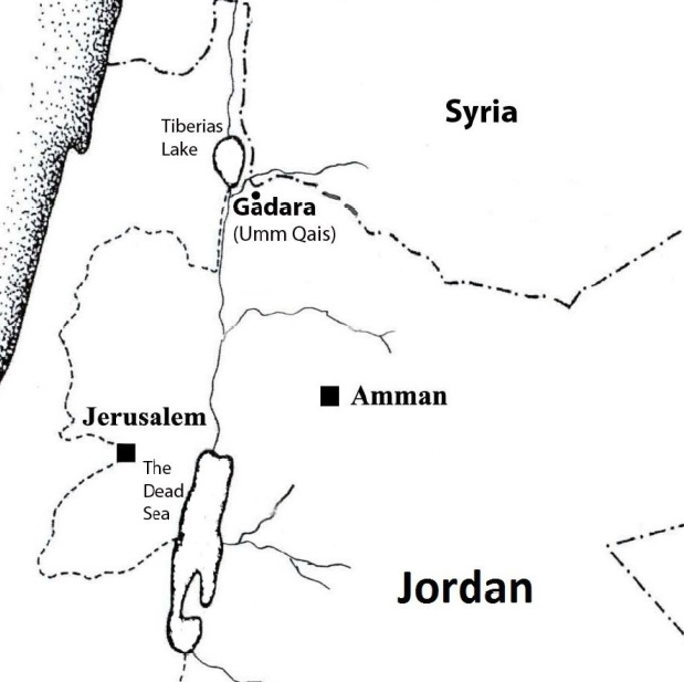 Figure 1
Map of Jordan, location of Gadara.
El-Khouri and Omoush (2015)
- Gadara in Google Earth
 Gadara
click on image to explore this site on a new tab in Google Earth
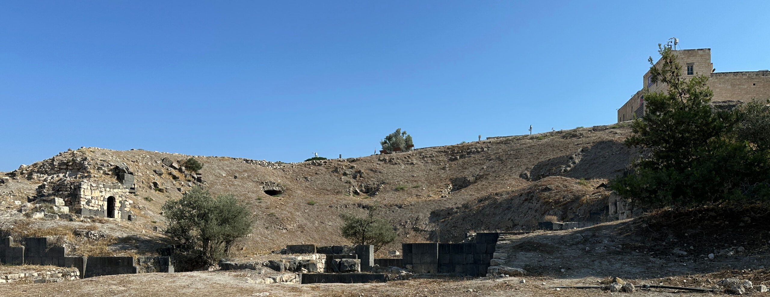
- Site plan of Ancient Gadara
from www.BibleIsTrue.com (Lion Tracks Ministries)
 Map of Ancient Gadara
www.BibleIsTrue.com (Lion Tracks Ministries)
- Site plan of Ancient Gadara
from www.BibleIsTrue.com (Lion Tracks Ministries)
Map of Ancient Gadara
www.BibleIsTrue.com (Lion Tracks Ministries)
- Fig. 1- Plan of Umm Qays
(ancient Gadara) Areas I and III from Vriezen and Mulder (1997)
 Figure 1
Plan of Umm Qays (ancient Gadara) Areas I and III.
Vriezen and Mulder (1997) - Fig. 6 - The Terrace and
its buildings in the Byzantine Period (1st half of 6th century) from Vriezen and Mulder (1997)
 Figure 6
The Terrace and its buildings in the Byzantine Period (first half of sixth century).
Vriezen and Mulder (1997)
- Fig. 1- Plan of Umm Qays
(ancient Gadara) Areas I and III from Vriezen and Mulder (1997)
Figure 1
Plan of Umm Qays (ancient Gadara) Areas I and III.
Vriezen and Mulder (1997) - Fig. 6 - The Terrace and
its buildings in the Byzantine Period (1st half of 6th century) from Vriezen and Mulder (1997)
Figure 6
The Terrace and its buildings in the Byzantine Period (first half of sixth century).
Vriezen and Mulder (1997)
- Fig. 2 - Two phases of Abassid
occupation in Area Z from El-Khouri and Omoush (2015)
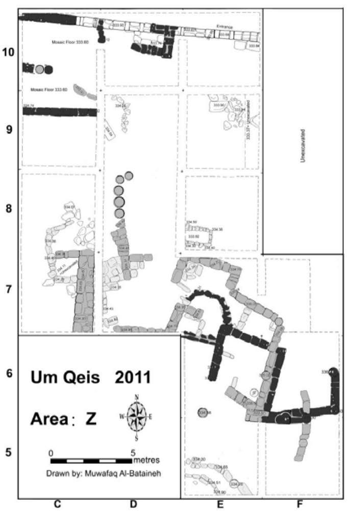 Figure 2
The first and the second phases of occupation in the Abbasid Period, the second phase is shown in light grey, the first phase is shown in dark grey.
El-Khouri and Omoush (2015)
- Fig. 2 - Two phases of Abassid
occupation in Area Z from El-Khouri and Omoush (2015)
Figure 2
The first and the second phases of occupation in the Abbasid Period, the second phase is shown in light grey, the first phase is shown in dark grey.
El-Khouri and Omoush (2015)
- Fig. 4 - Abassid constructions
in SE part of excavations from El-Khouri and Omoush (2015)
 Figure 4
Top view of the Abbasid constructions in squares E6, E7, F6 and F7, older constructions are also shown in the picture.
JW: N is to the left
El-Khouri and Omoush (2015) - Fig. 3 - Mosaic Floor
in Squares C9 and C10 of Area Z from El-Khouri and Omoush (2015)
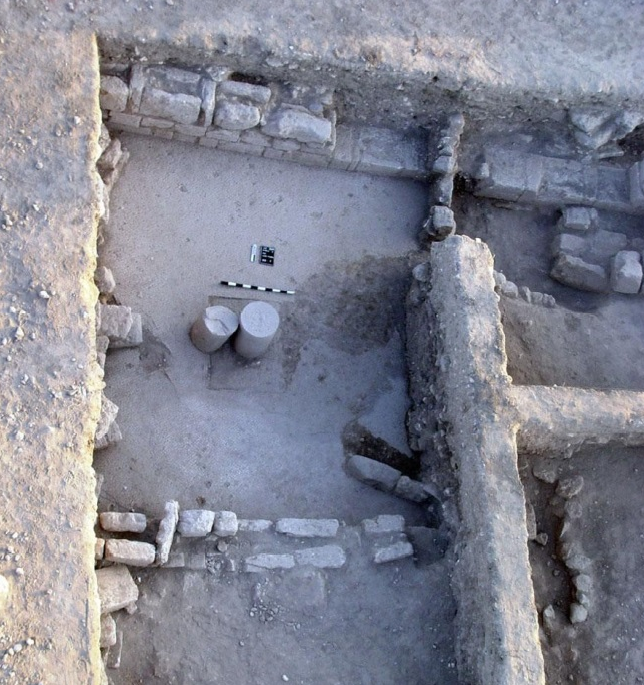 Figure 3
The Mosaic floor in Squares C9 and C10, Umayyad and first Abbasid Phase of occupation.
El-Khouri and Omoush (2015)
- Fig. 4 - Abassid constructions
in SE part of excavations from El-Khouri and Omoush (2015)
Figure 4
Top view of the Abbasid constructions in squares E6, E7, F6 and F7, older constructions are also shown in the picture.
JW: N is to the left
El-Khouri and Omoush (2015) - Fig. 3 - Mosaic Floor
in Squares C9 and C10 of Area Z from El-Khouri and Omoush (2015)
Figure 3
The Mosaic floor in Squares C9 and C10, Umayyad and first Abbasid Phase of occupation.
El-Khouri and Omoush (2015)
- Fig. 3 - Fallen columns
in Gadara from Walmsley (2007)
 Figure 11
Columns down at Jadar, A.D. 749
(Walmsley)
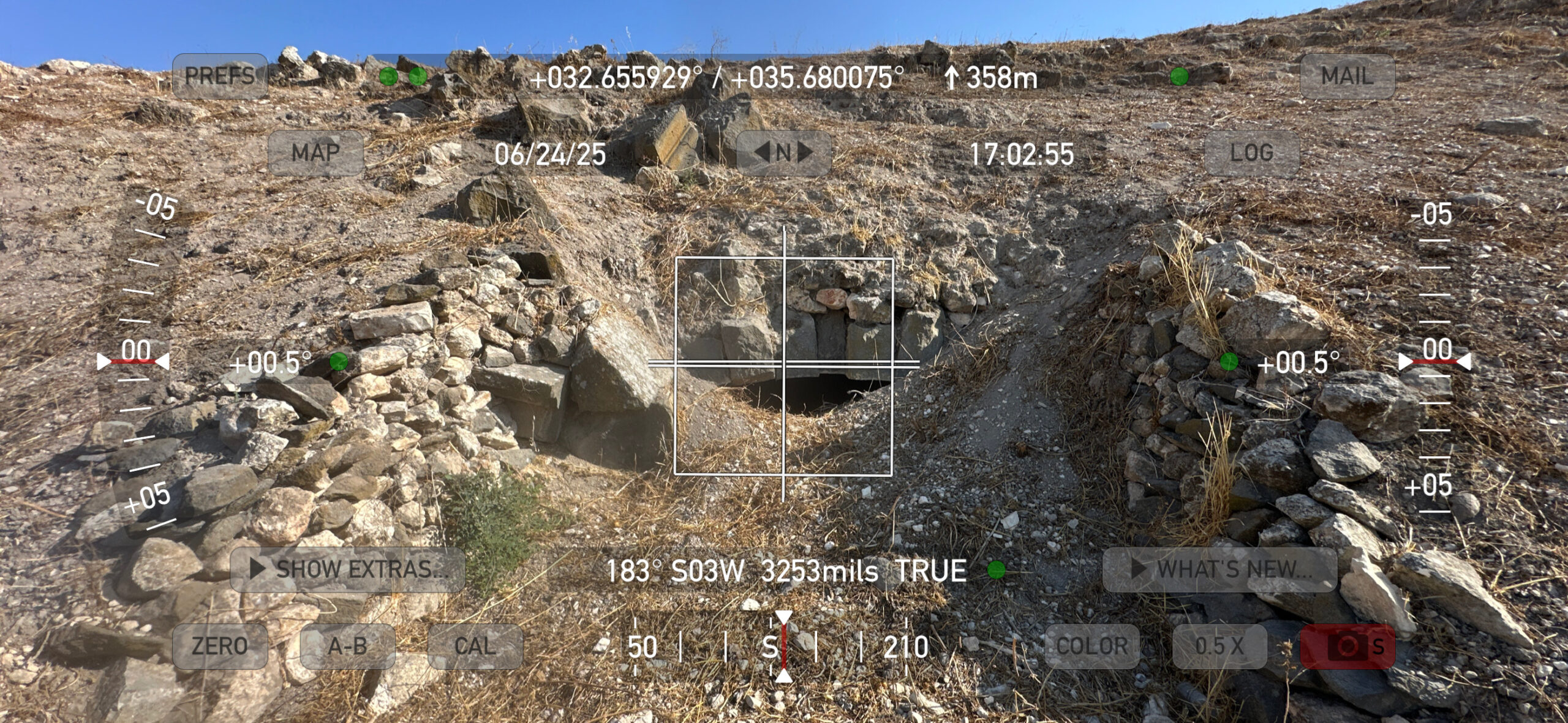
Walmsley (2007) - Warped Pavement of
Decumanus Maximus in Gadara - photo by JW
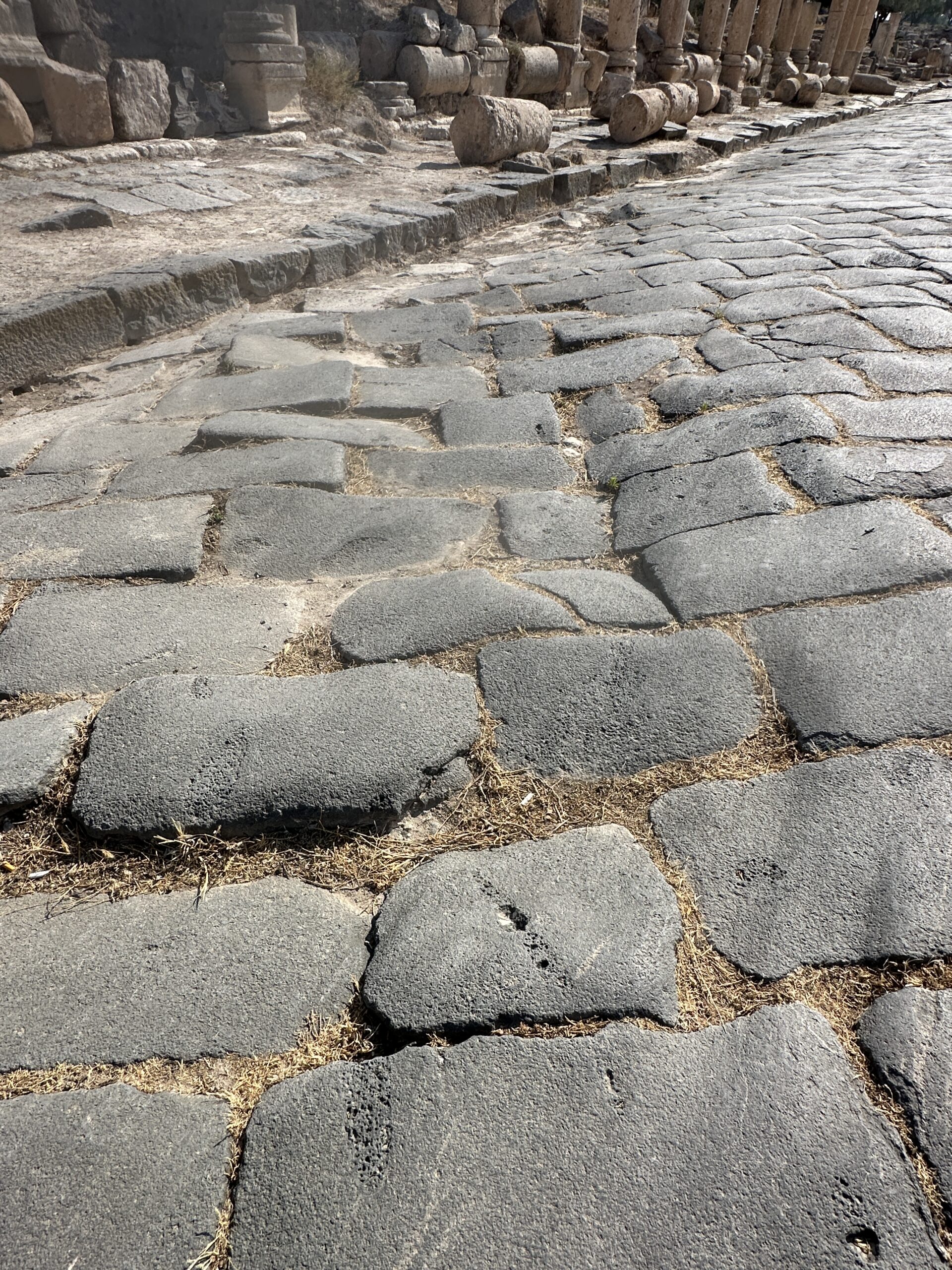 Warped Pavement of Decumanus Maximus in Gadara
Photo by Jefferson Williams - 24 June 2025
- Fig. 3 - Fallen columns
in Gadara from Walmsley (2007)
Figure 11
Columns down at Jadar, A.D. 749
(Walmsley)
Walmsley (2007) - Warped Pavement of
Decumanus Maximus in Gadara - photo by JW
Warped Pavement of Decumanus Maximus in Gadara
Photo by Jefferson Williams - 24 June 2025
- Tilted Upper Course in
Terrace Churches in Gadara - photo by JW
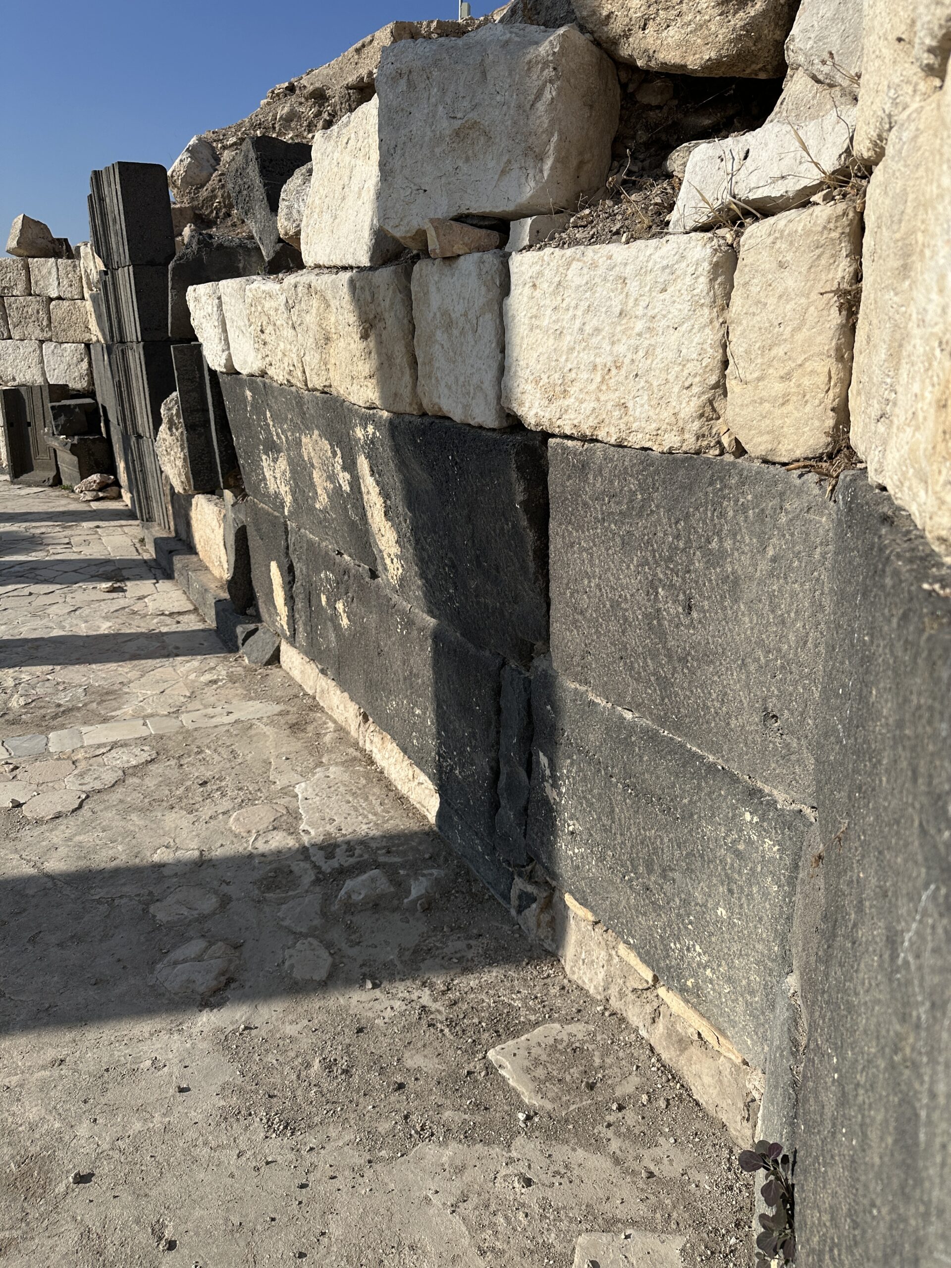 Upper Course of Basaltic Wall is Titled. Terrace Churches N of Eastern Theater in Gadara
Photo by Jefferson Williams - 24 June 2025
- Tilted Upper Course in
Terrace Churches in Gadara - photo by JW
Upper Course of Basaltic Wall is Titled. Terrace Churches N of Eastern Theater in Gadara
Photo by Jefferson Williams - 24 June 2025
- Warped Seats in the
Eastern Theater of Gadara - photo by JW
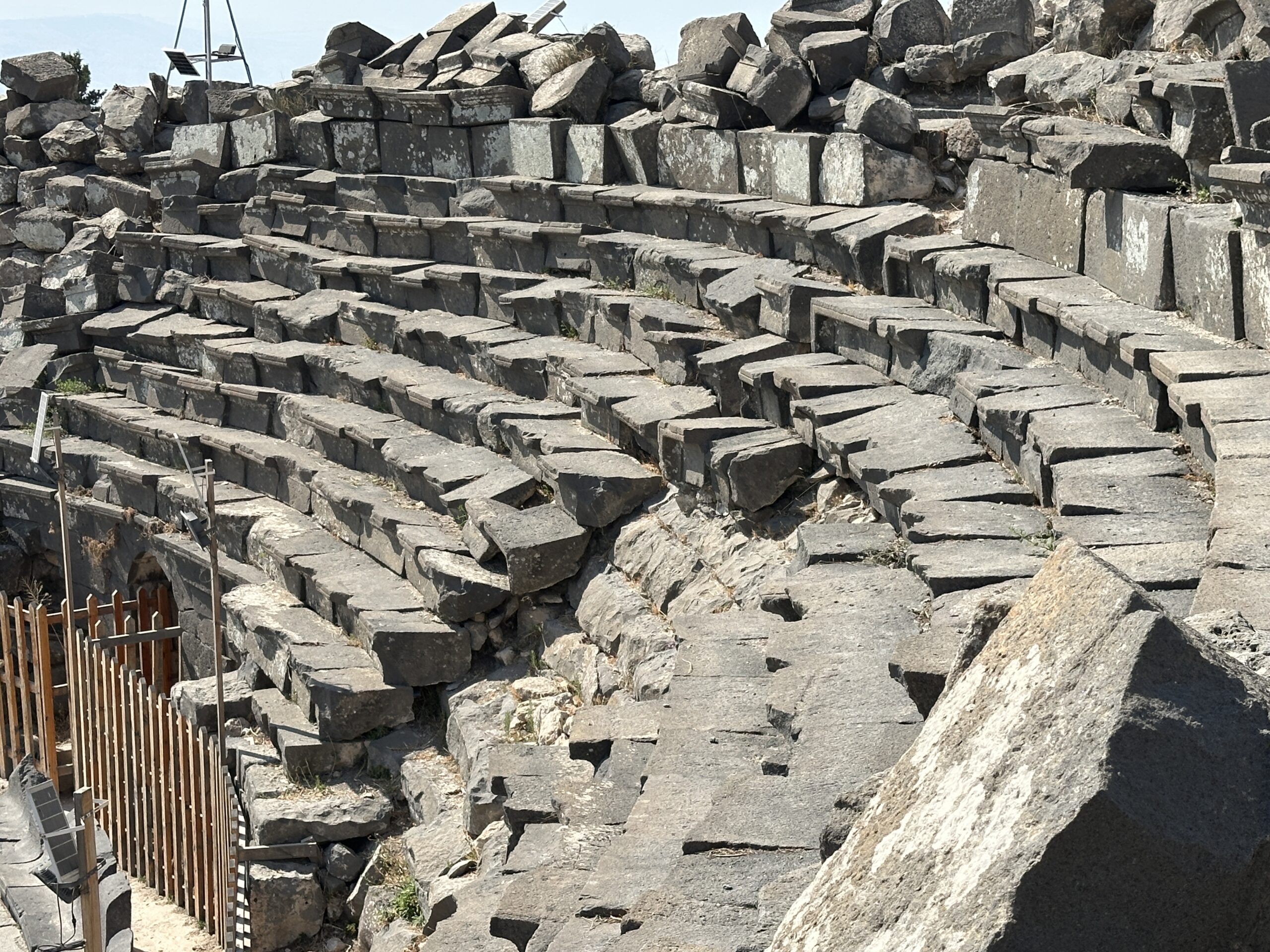 Warped Seats in the Eastern Theater in Gadara
Photo by Jefferson Williams - 24 June 2025 - Displaced and fractured
ashlars in the Eastern Theater of Gadara - photo by JW
 Displaced and fractured ashlars in the Eastern Theater in Gadara
Photo by Jefferson Williams - 24 June 2025 - Displaced vault stones
in the Eastern Theater of Gadara - photo by JW
 Displaced vault stones in the Eastern Theater in Gadara
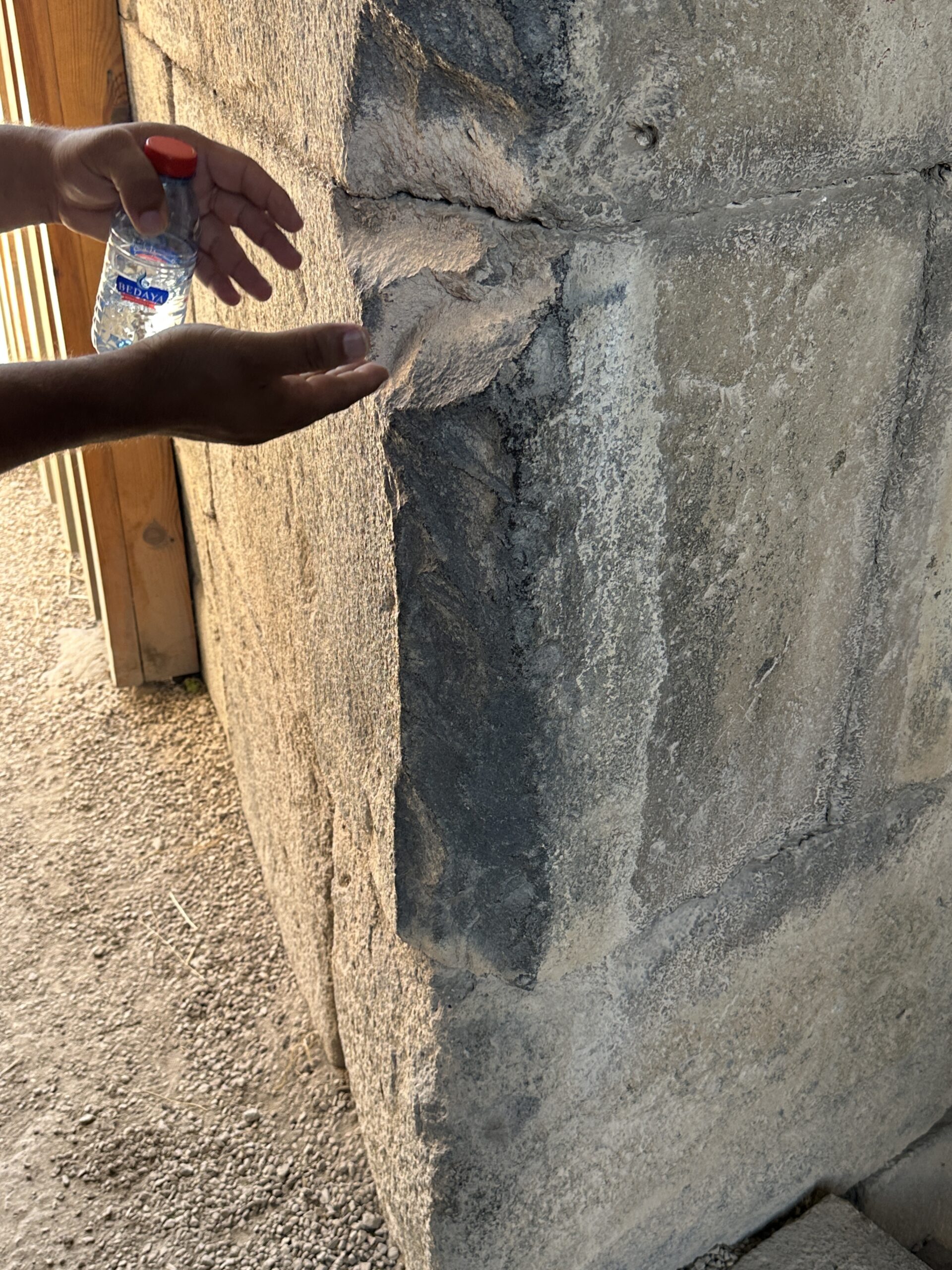
Photo by Jefferson Williams - 24 June 2025 - Spalled Corners in the
Eastern Theater of Gadara - photo by JW
 Spalled Corners in the Eastern Theater in Gadara
Photo by Jefferson Williams - 24 June 2025 - Spalled Corners in the
Eastern Theater of Gadara - photo by JW
 Spalled Corners in the Eastern Theater in Gadara
Photo by Jefferson Williams - 24 June 2025
- Warped Seats in the
Eastern Theater of Gadara - photo by JW
Warped Seats in the Eastern Theater in Gadara
Photo by Jefferson Williams - 24 June 2025 - Displaced and fractured
ashlars in the Eastern Theater of Gadara - photo by JW
Displaced and fractured ashlars in the Eastern Theater in Gadara
Photo by Jefferson Williams - 24 June 2025 - Displaced vault stones
in the Eastern Theater of Gadara - photo by JW
Displaced vault stones in the Eastern Theater in Gadara
Photo by Jefferson Williams - 24 June 2025 - Spalled Corners in the
Eastern Theater of Gadara - photo by JW
Spalled Corners in the Eastern Theater in Gadara
Photo by Jefferson Williams - 24 June 2025 - Spalled Corners in the
Eastern Theater of Gadara - photo by JW
Spalled Corners in the Eastern Theater in Gadara
Photo by Jefferson Williams - 24 June 2025
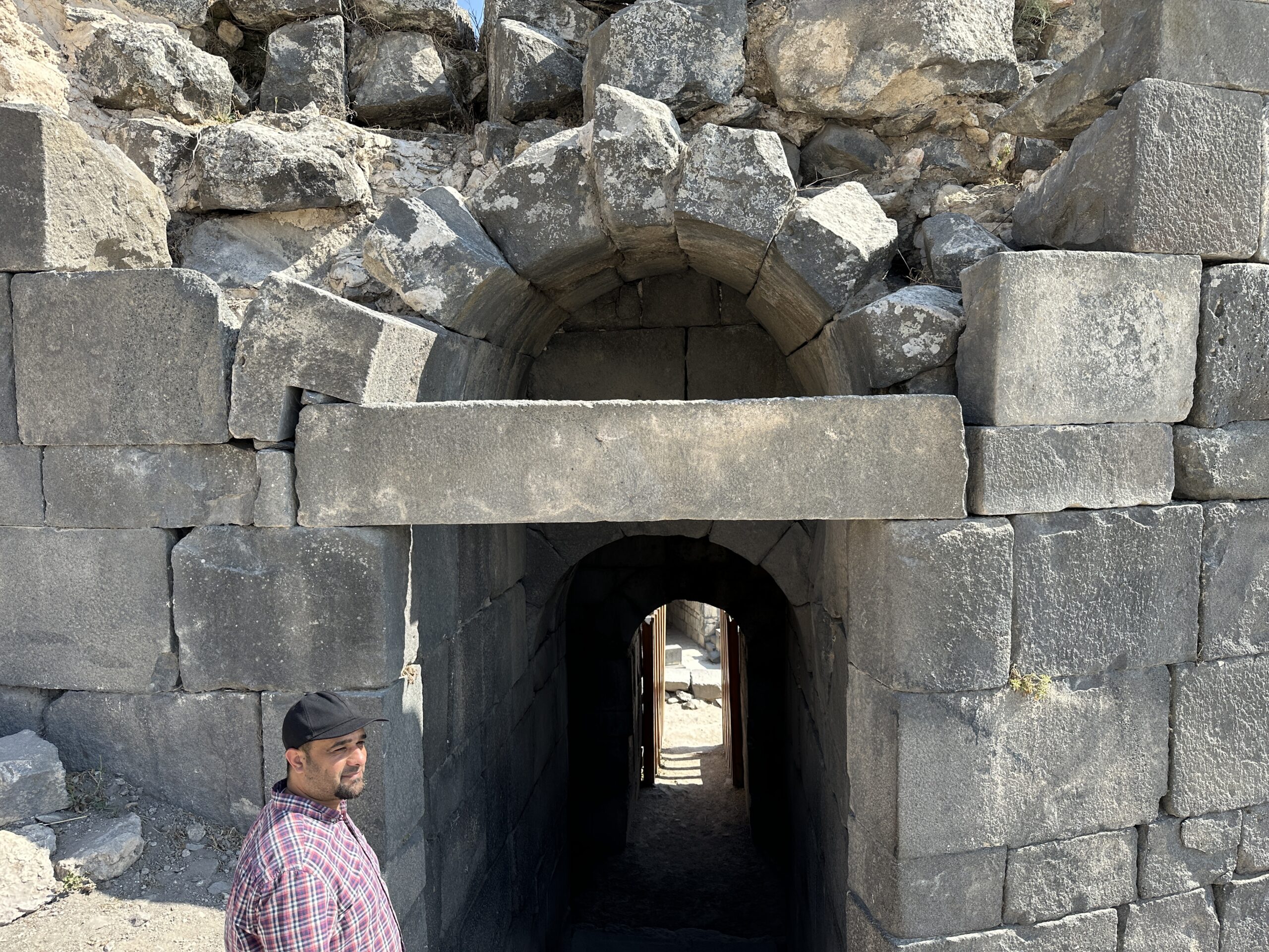
- Wide shot of Western Theater
in Gadara - photo by JW
 Wide shot of Western Theater in Gadara
Photo by Jefferson Williams - 24 June 2025
- Wide shot of Western Theater
in Gadara - photo by JW
Wide shot of Western Theater in Gadara
Photo by Jefferson Williams - 24 June 2025
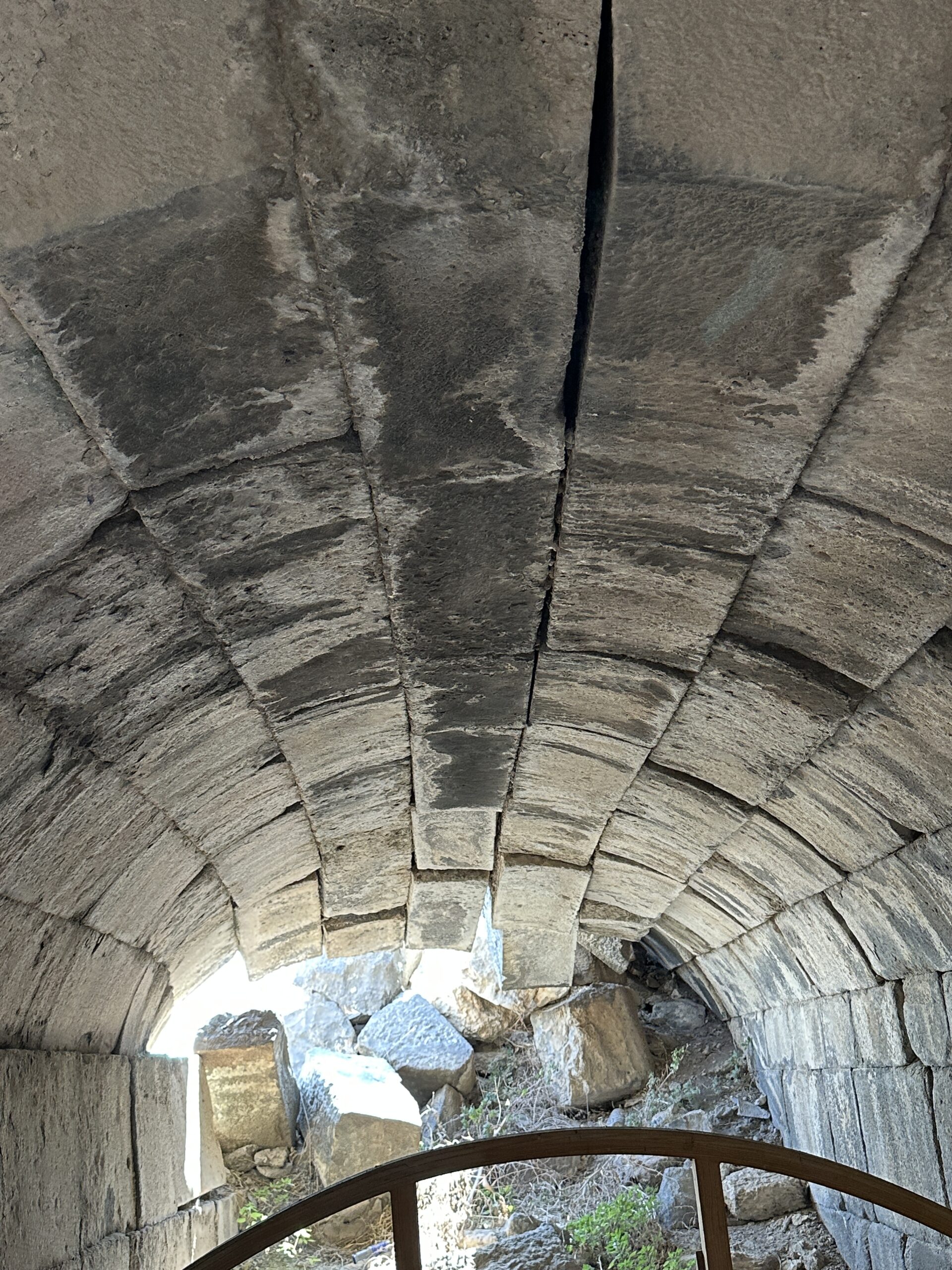
- Vault with displaced stones
at bottom level towards the west - Western Theater in Gadara - photo by JW
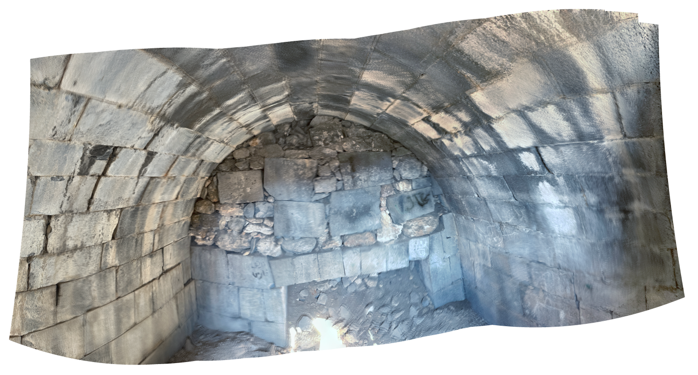 Vault with displaced stones at bottom level towards the west - Western Theater in Gadara
Click on image to open a high resolution magnifiable image in a new tab
Photo by Jefferson Williams - 24 June 2025
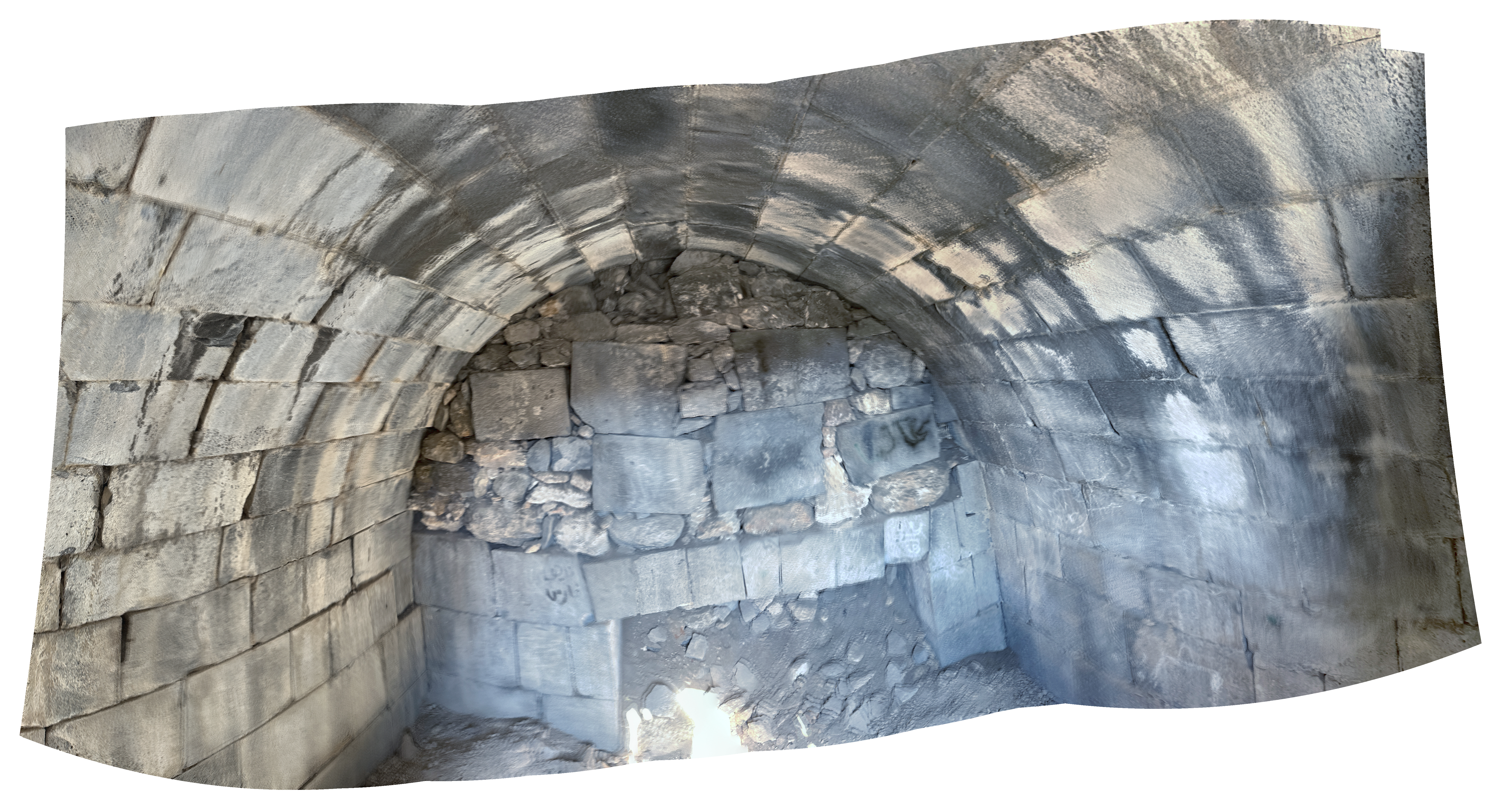
- Vault with displaced stones
at bottom level towards the west - Western Theater in Gadara - photo by JW
Vault with displaced stones at bottom level towards the west - Western Theater in Gadara
Click on image to open a high resolution magnifiable image in a new tab
Photo by Jefferson Williams - 24 June 2025
- Displaced and tilted
Ashlars at top of Western Theater in Gadara - photo by JW
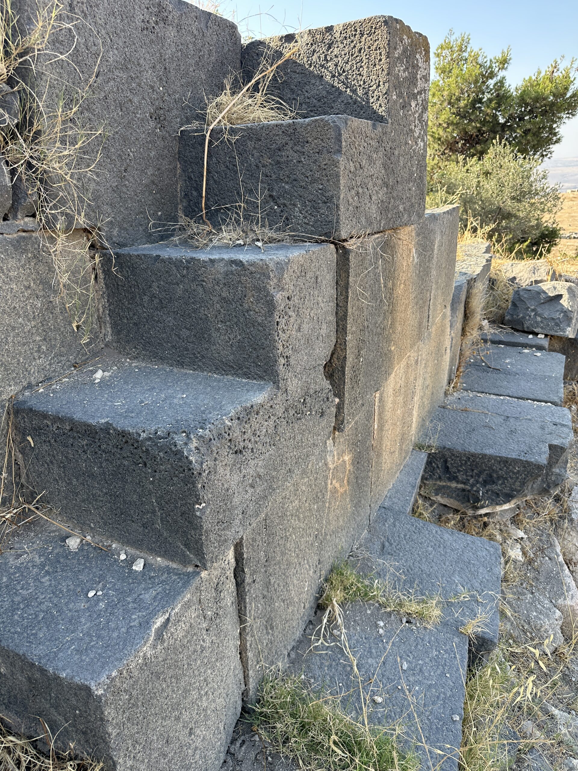 Displaced Ashlars at top of Western Theater in Gadara
Photo by Jefferson Williams - 24 June 2025 - Displaced and tilted
Ashlars at top of Western Theater in Gadara - digital theodolite (Az = 197) photo by JW
 Displaced Ashlars at top of Western Theater in Gadara
Az = 197
Digital Theodolite Photo by Jefferson Williams - 24 June 2025
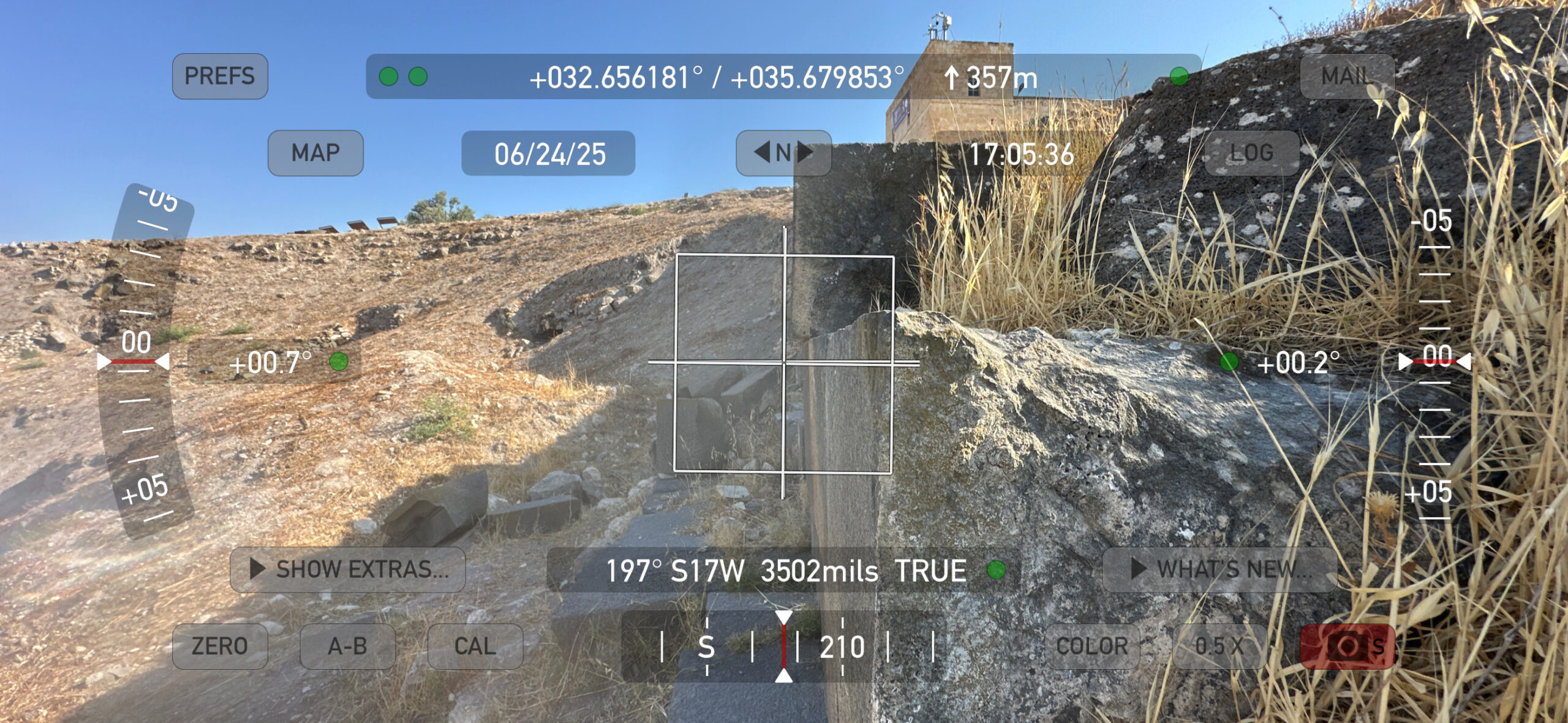
- Displaced and tilted
Ashlars at top of Western Theater in Gadara - photo by JW
Displaced Ashlars at top of Western Theater in Gadara
Photo by Jefferson Williams - 24 June 2025 - Displaced and tilted
Ashlars at top of Western Theater in Gadara - digital theodolite (Az = 197) photo by JW
Displaced Ashlars at top of Western Theater in Gadara
Az = 197
Digital Theodolite Photo by Jefferson Williams - 24 June 2025
- Dropped Archstones in far
western arch at bottom level of Western Theater in Gadara - photo by JW
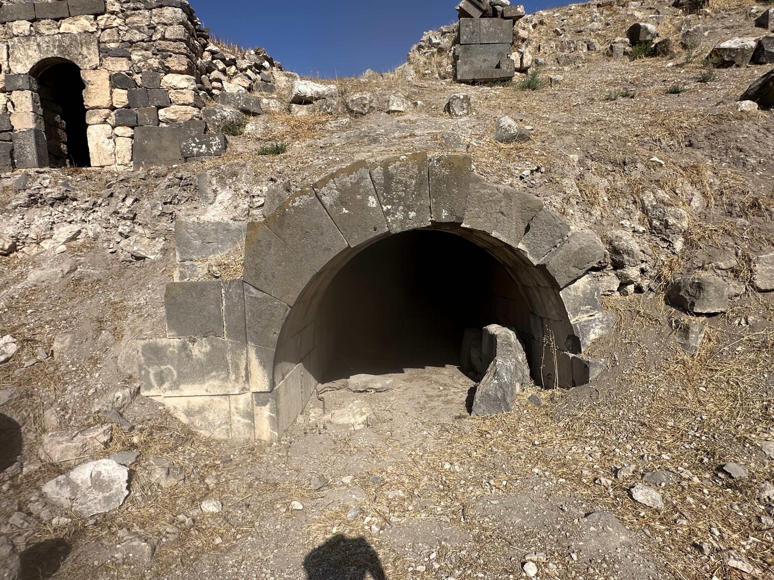 Dropped Archstones in far western arch at bottom level of Western Theater in Gadara
Photo by Jefferson Williams - 24 June 2025 - Dropped Archstones in far
western arch at bottom level of Western Theater in Gadara - closeup photo by JW
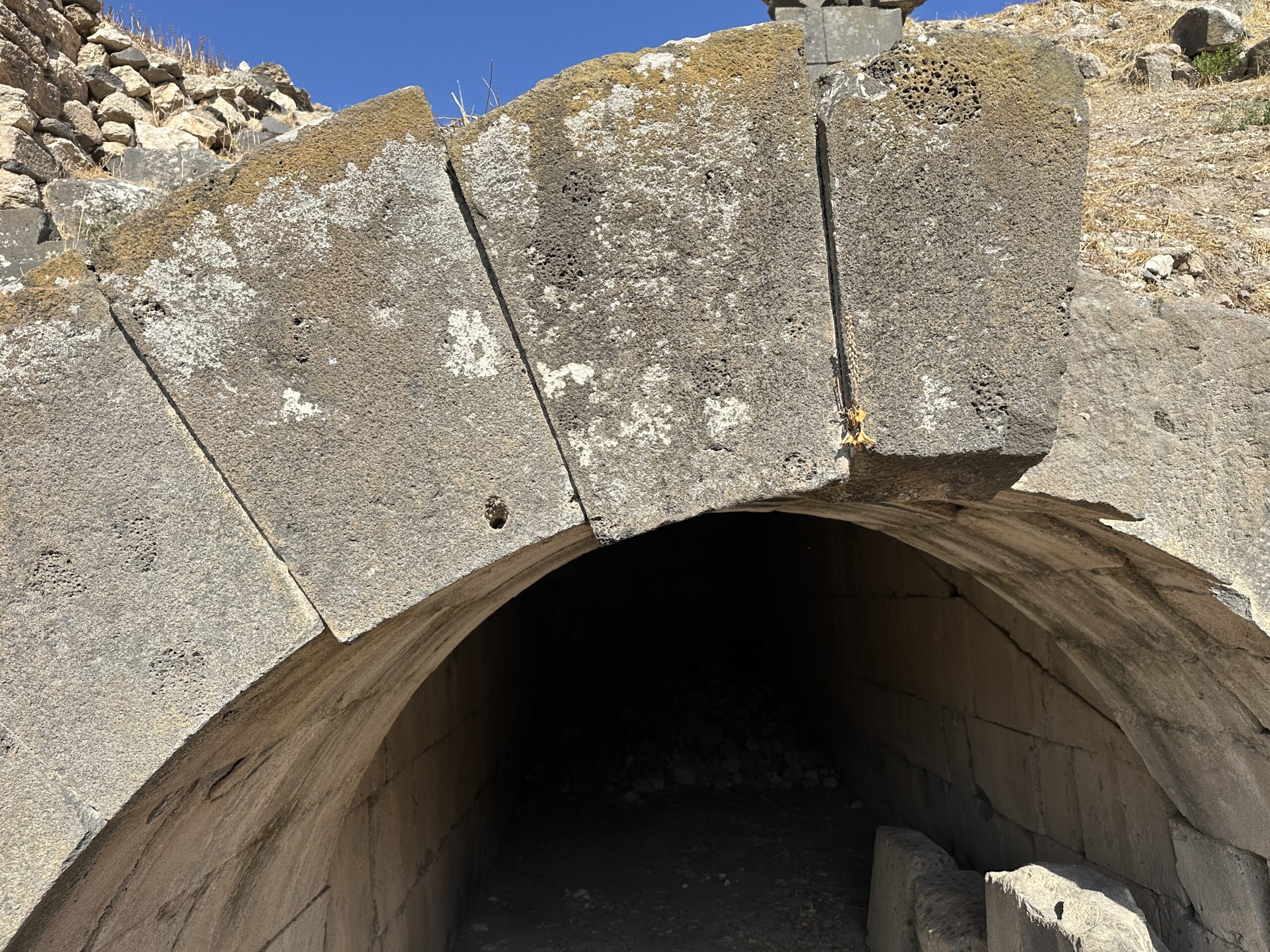 Dropped Archstones in far western arch at bottom level of Western Theater in Gadara
Photo by Jefferson Williams - 24 June 2025 - Dropped Archstones at
bottom level of Western Theater in Gadara - digital theodolite photo (Az = 110) by JW
 Dropped Archstones at bottom level of Western Theater in Gadara
Az = 110
Digital theodolite photo by Jefferson Williams - 24 June 2025
- Dropped Archstones in far
western arch at bottom level of Western Theater in Gadara - photo by JW
Dropped Archstones in far western arch at bottom level of Western Theater in Gadara
Photo by Jefferson Williams - 24 June 2025 - Dropped Archstones in far
western arch at bottom level of Western Theater in Gadara - closeup photo by JW
Dropped Archstones in far western arch at bottom level of Western Theater in Gadara
Photo by Jefferson Williams - 24 June 2025 - Dropped Archstones at
bottom level of Western Theater in Gadara - digital theodolite photo (Az = 110) by JW
Dropped Archstones at bottom level of Western Theater in Gadara
Az = 110
Digital theodolite photo by Jefferson Williams - 24 June 2025
- Dropped Archstones at top
level of Western Theater in Gadara - photo by JW
 Dropped Archstones at top level of Western Theater in Gadara
Photo by Jefferson Williams - 24 June 2025 - Dropped Archstones at top
level of Western Theater in Gadara - Digital theodolite photo (Az = 148) by JW
 Dropped Archstones at top level of Western Theater in Gadara
Az = 148
Digital Theodolite photo by Jefferson Williams - 24 June 2025 - Dropped Archstones at top
level of Western Theater in Gadara - photo by JW
 Dropped Archstones at top level of Western Theater in Gadara
Photo by Jefferson Williams - 24 June 2025 - Dropped Archstones at top
level of Western Theater in Gadara - Digital theodolite photo (Az = 183) by JW
 Dropped Archstones at top level of Western Theater in Gadara
Az = 183
Digital Theodolite photo by Jefferson Williams - 24 June 2025
- Dropped Archstones at top
level of Western Theater in Gadara - photo by JW
Dropped Archstones at top level of Western Theater in Gadara
Photo by Jefferson Williams - 24 June 2025 - Dropped Archstones at top
level of Western Theater in Gadara - Digital theodolite photo (Az = 148) by JW
Dropped Archstones at top level of Western Theater in Gadara
Az = 148
Digital Theodolite photo by Jefferson Williams - 24 June 2025 - Dropped Archstones at top
level of Western Theater in Gadara - photo by JW
Dropped Archstones at top level of Western Theater in Gadara
Photo by Jefferson Williams - 24 June 2025 - Dropped Archstones at top
level of Western Theater in Gadara - Digital theodolite photo (Az = 183) by JW
Dropped Archstones at top level of Western Theater in Gadara
Az = 183
Digital Theodolite photo by Jefferson Williams - 24 June 2025
- Fig. 1- Plan of Umm Qays (ancient Gadara)
Areas I and III from Vriezen and Mulder (1997)
Figure 1
Plan of Umm Qays (ancient Gadara) Areas I and III.
Vriezen and Mulder (1997) - Fig. 11- Fallen Columns
from Walmsley (2007)
 Figure 11
Columns down at Jadar, A.D. 749 (Walmsley).
Walmsley (2007)
| Effect | Location | Image(s) | Description |
|---|---|---|---|
| Collapsed Walls | Abbasid layers, especially in Squares F5 and F6
Figure 2 The first and the second phases of occupation in the Abbasid Period, the second phase is shown in light grey, the first phase is shown in dark grey. El-Khouri and Omoush (2015) |
|
|
| Re-used building elements | Abbasid layers
Figure 2 The first and the second phases of occupation in the Abbasid Period, the second phase is shown in light grey, the first phase is shown in dark grey. El-Khouri and Omoush (2015) |
Figure 4 Top view of the Abbasid constructions in squares E6, E7, F6 and F7, older constructions are also shown in the picture. JW: N is to the left El-Khouri and Omoush (2015) |
|
| Destruction of mosaic floor (dented from falling ashlars ?) | Squares C9 and C10 in Area Z
Figure 2 The first and the second phases of occupation in the Abbasid Period, the second phase is shown in light grey, the first phase is shown in dark grey. El-Khouri and Omoush (2015) |
Figure 3 The Mosaic floor in Squares C9 and C10, Umayyad and first Abbasid Phase of occupation. El-Khouri and Omoush (2015) |
|
| Fallen Columns | main east-west decumanus
Map of Ancient Gadara www.BibleIsTrue.com (Lion Tracks Ministries) |
Figure 11 Columns down at Jadar, A.D. 749 (Walmsley) Walmsley (2007) |
|
-
Earthquake Archeological Effects chart
of Rodríguez-Pascua et al (2013: 221-224)
 Earthquake Archeological Effects (EAE)
Rodríguez-Pascua et al (2013: 221-224)
| Effect | Location | Image(s) | Description | Intensity |
|---|---|---|---|---|
| Collapsed Walls | Abbasid layers, especially in Squares F5 and F6
Figure 2 The first and the second phases of occupation in the Abbasid Period, the second phase is shown in light grey, the first phase is shown in dark grey. El-Khouri and Omoush (2015) |
|
VIII+ | |
| Destruction of mosaic floor (dented from falling ashlars ?) | Squares C9 and C10 in Area Z
Figure 2 The first and the second phases of occupation in the Abbasid Period, the second phase is shown in light grey, the first phase is shown in dark grey. El-Khouri and Omoush (2015) |
Figure 3 The Mosaic floor in Squares C9 and C10, Umayyad and first Abbasid Phase of occupation. El-Khouri and Omoush (2015) |
|
VIII+ |
| Fallen Columns | main east-west decumanus
Map of Ancient Gadara www.BibleIsTrue.com (Lion Tracks Ministries) |
Figure 11 Columns down at Jadar, A.D. 749 (Walmsley) Walmsley (2007) |
|
V+ |