Augustopolis in Palaestina
 Augustopolis in Palaestina
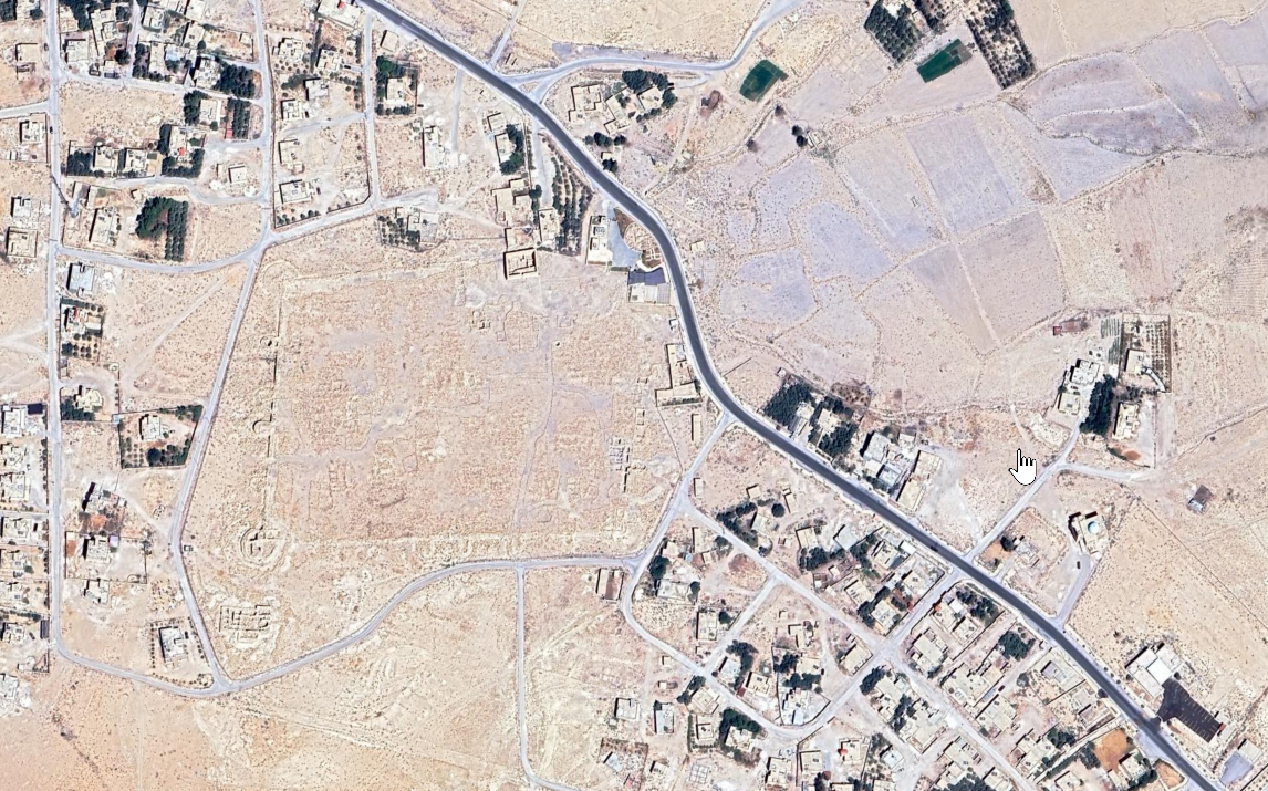
click on image to explore this site on a new tab in Google Earth
| Transliterated Name | Language | Name |
|---|---|---|
| Augustopolis in Palaestina | Latin | |
| Adhruh, Udhruh | Arabic | اذرح |
| Adrou | Greek | Άδρου |
- Fig. 1 Roman-Byzantine
Southern Jordan from Fiema (1995)
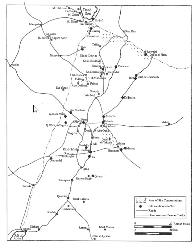 Figure 1
Roman-Byzantine Southern Jordan
Fiema (1995)
- Fig. 1 Roman-Byzantine
Southern Jordan from Fiema (1995)
Figure 1
Roman-Byzantine Southern Jordan
Fiema (1995)
- Fig. 2 Oblique Aerial
Photograph from Danah, F.A.B et al. (2010)
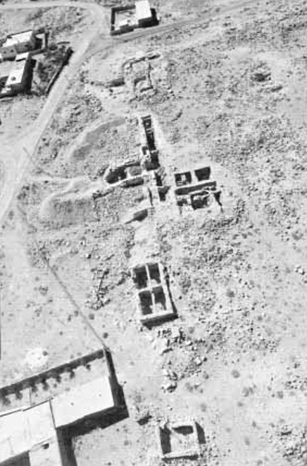 Figure 2
Oblique aerial photograph of the excavation area, taken by D. Kennedy in 2009
APAAME_20090930_ DLK-0299
Danah, F.A.B et al. (2010) - Augustopolis in Palaestina
in Google Earth
Augustopolis in Palaestina
click on image to explore this site on a new tab in Google Earth
- Fig. 2 Oblique Aerial
Photograph from Danah, F.A.B et al. (2010)
Figure 2
Oblique aerial photograph of the excavation area, taken by D. Kennedy in 2009
APAAME_20090930_ DLK-0299
Danah, F.A.B et al. (2010) - Augustopolis in Palaestina
in Google Earth
Augustopolis in Palaestina
click on image to explore this site on a new tab in Google Earth