Al-Muwaqqar
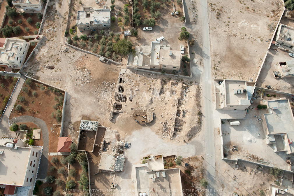
APAAME
- Reference: APAAME_20141028_
DLK-0157.jpg - Credit: Aerial Photographic Archive for Archaeology in the Middle East
- Copyright: Creative Commons Attribution-Noncommercial-No Derivative Works
Click photo for high res magnifiable image
| Transliterated Name | Language | Name |
|---|---|---|
| Al-Muwaqqar | Arabic | الموقر) |
| Qasr al-Muwaqqar | Arabic | الموقر)اققار |
- Qasr Al-Muwaqqar in Google Earth
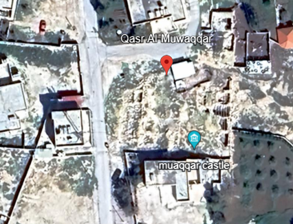 Qasr Al-Muwaqqar in Google Earth
click on image to explore this site on a new tab in Google Earth - Fig. 2 - Plan of Qasr Al-Muwaqqar
from ADAJ (1989)
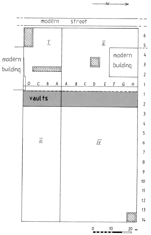 Figure 2
ADAJ (1989)
- Earthquake Archeological Effects chart
of Rodríguez-Pascua et al (2013: 221-224)
 Earthquake Archeological Effects (EAE)
Rodríguez-Pascua et al (2013: 221-224)
| Effect | Location | Image (s) | Comments | Intensity |
|---|---|---|---|---|
| Collapsed Walls inferred from rebuilding evidence | Umayyad Palace | the destruction layer was cleared (the walls of the second phase were built directly above the flagstone pavement of the Umayyad Palace)- Najjar (1989) |
VIII + |
- Earthquake Archeological Effects chart
of Rodríguez-Pascua et al (2013: 221-224)
Earthquake Archeological Effects (EAE)
Rodríguez-Pascua et al (2013: 221-224)
| Effect | Location | Image (s) | Comments | Intensity |
|---|---|---|---|---|
| Destruction - Collapsed Walls | Umayyad Palace | the Palace was abandoned after another destruction (earthquake?) later in the 9th century- Najjar (1989) |
VIII + |