Earthquake VII

Area J-East in the archaeological site of Aila preserves one of the
most detailed archaeoseismic records along the southern
Dead Sea Transform. Located approximately 500 m north
of the modern shoreline of the Gulf of Aqaba and about
500 m northwest of the later Islamic city of
Ayla, the Nabatean, Roman, Byzantine, and Early Islamic
occupation sequence spans from the first century CE
through the Early Islamic period.
Aila occupies a tectonic setting at
the northern end of the Gulf of Aqaba where
left-lateral motion on the Aqaba Fault is transferred
westward across the Wadi Arabah by a series of
shoreline-parallel normal cross faults. One of these
active faults (CF-5) intersects the western part of
Area J-East, providing a rare opportunity to document
repeated surface faulting, structural damage, repair,
and stratigraphic displacement within a well-dated
archaeological sequence.
Thomas et al. (2007:63) assigned Earthquake VII to the
second century CE on the basis of
Nabataean pottery recovered from both the collapse
layer and the underlying deposit. They noted that the
cause of the collapse could not be determined with
certainty, observing that following the
Roman annexation of Nabataea in 106 CE there is “debate about the degree
of Nabataean resistance to the annexation that might have
resulted in destruction by human agency in this period.” Nevertheless,
Thomas et al. (2007) also remarked that “a complete
section of
collapsed wall might suggest earthquake destruction.”
Because excavations were extended to approximately
2
masl depth in only a limited part of the site, the authors were unable to determine whether
the event produced measurable vertical or horizontal
surface displacement.
In Area B, Dolinka (2003:32) found that
some structures "exhibited inwardly collapsed walls and/or tumbled-over
mudbricks (Fig. 14)" which was attributed to earthquake destruction in the
early 2nd century CE.

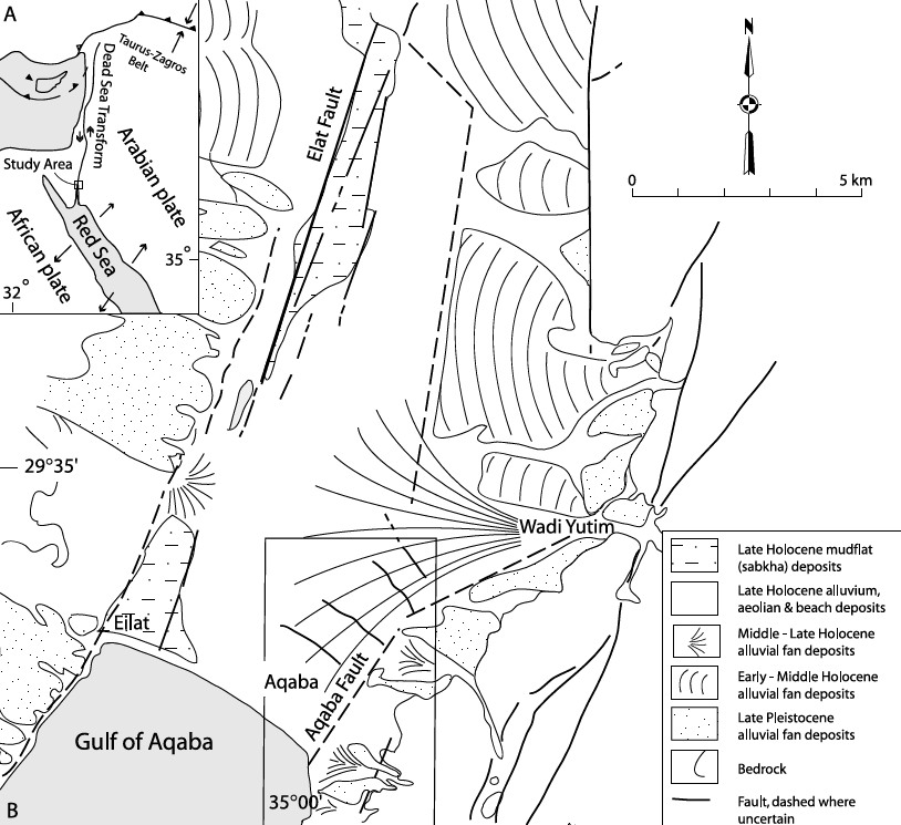


Figure 14