Earthquake V

Area J-East in the archaeological site of Aila preserves one of the
most detailed archaeoseismic records along the southern
Dead Sea Transform. Located approximately 500 m north
of the modern shoreline of the Gulf of Aqaba and about
500 m northwest of the later Islamic city of
Ayla, the Nabatean, Roman, Byzantine, and Early Islamic
occupation sequence spans from the first century CE
through the Early Islamic period.
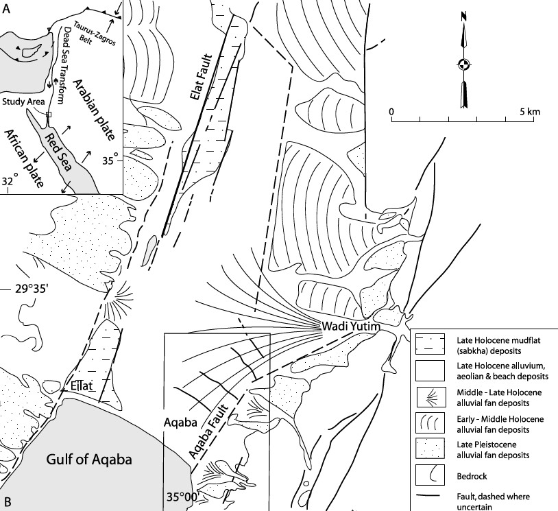
Aila occupies a tectonic setting at
the northern end of the Gulf of Aqaba where
left-lateral motion on the Aqaba Fault is transferred
westward across the Wadi Arabah by a series of
shoreline-parallel normal cross faults. One of these
active faults (CF-5) intersects the western part of
Area J-East, providing a rare opportunity to document
repeated surface faulting, structural damage, repair,
and stratigraphic displacement within a well-dated
archaeological sequence.
Thomas et al. (2007)
identified earthquake destruction (Earthquake V) within
a collapse layer that they correlated with the
363 CE Cyril Quake. A
terminus post quem
of 360 CE was established from coins and pottery. They
reported that “thin wall construction and surface
layers produced pottery from the mid to late fourth
century A.D.” They further noted that “the latest
pottery dates from about A.D. 360 onward (based on
several examples of
African Red Slip form 67, introduced ca. A.D.
360; Hayes 1972).” In addition, “over 100 coins were
found on the final floor of this phase. The majority of
these coins were found associated with the remains of a
broken box in Room 2. The latest coins date to the
reign of
Constantius II, who
reigned from A.D. 337 to 361 (Parker 1999a), and
provide a
terminus post quem
for this building phase."
Thomas et al. concluded that “the very refined pottery
and coin dates give a secure post A.D. 360 date for the
Earthquake V event.” They further observed that “the
scarcity of post A.D. 360 pottery and the location of
the coin hoard at the interface between occupation
surface and collapse horizon indicate that this event
cannot have occurred long after A.D. 360.” On this
basis, they interpreted the destruction as “the
historically attested earthquake of May 19, A.D. 363,”
which is listed in this catalog as one of the
363 CE Cyril Quakes.
Powers (2010)
provides additional archaeological context, noting
that “at the end of the troubled third century, the
Legio X Fretensis
was transferred from Jerusalem to bolster the
Limes Arabicus,
with the effect that the population increased
substantially and the city emerged as a regional
centre.” He further states that “a church was built in
c. 300, one of the oldest in the world, testifying to the
early progress of Christianity in Palestine; it was
apparently destroyed by the earthquake of 363 and
subsequently covered by the new city wall.”
Thomas et al. (2007:64,66)
reported a "more severe reactivation of Faults C and D" during Earthquake V although "along a slightly different rupture plane
(through the Room 20 north wall) than during EQ VI."
They estimated that Earthquake V produced at least
23 cm of dip-slip together with a "maximum of 30 cm of
left-lateral strike-slip." The measured strike-slip,
recorded where Fault D displaced wall J.1:53, reflects
cumulative movement from Earthquakes VI, V, and IV.
However, the authors concluded that "the majority of
the lateral slip across Fault D is likely to have
occurred predominantly in Earthquake V," consistent
with the substantially greater structural damage
produced by this event. Thomas et al. (2007) reported that "the collapse
layer for Earthquake V exceeds 90 cm in places." They
observed that the tumble was "more evenly distributed
throughout the site than was the case for the earlier
Earthquake VI, with a bias to the north side of
collapsing walls." They concluded that "this thick
collapse horizon across the site suggests Earthquake V
was stronger in intensity compared with Earthquake VI."



Deformation Map