- Neugebauer et al (2014)
- Neugebauer et al (2015)
- ICDP Publications database
- ICDP Publications - Israel, Jordan
- See site in Google Earth
- Locations should be considered as approximate. Lats and Longs provided by Neugebauer do not match exactly with the locations shown in the maps in her article. Further, the location for En Gedi Core (DS-En) in her 2015 article maps to the middle of a field outside of the En Gedi Spa. This location is marked by a PVC Pipe which was left in the ground next to the road from the Spa Building to the beach and has been observed many times in the field by Jefferson Williams who used a GPS to obtain the exact location of the En Gedi Core (DS-En). The En Gedi Core (DS-En) location is accurately represented in the Google Earth maps which accompany this catalog. Generally speaking, much of the published literature presents inaccuracies in locations likely due to insufficiently precise presentations of Latitude and Longitude and/or use of different spheroids.
- Based purely on the precision of the latitude and longitudes presented, it appears that 5017-3 is the most accurately located, while 5017-1 and 5017-2 may be tens of meters mislocated. This is due to insufficient precision of Longitude.
- It should be further noted that only one Lat and Long is presented for the various sections (A, B, C, D, E, H) of the same "location" (5017-1) when taking new cores would necessitate either moving the rig or the core barrel. Since the sea floor for A-E and H are all presented as 297.46 m below the lake level, there may be some rig depth control inaccuracies at play. However, these appear to have been largely been taken care of via core to core correlation of markers.
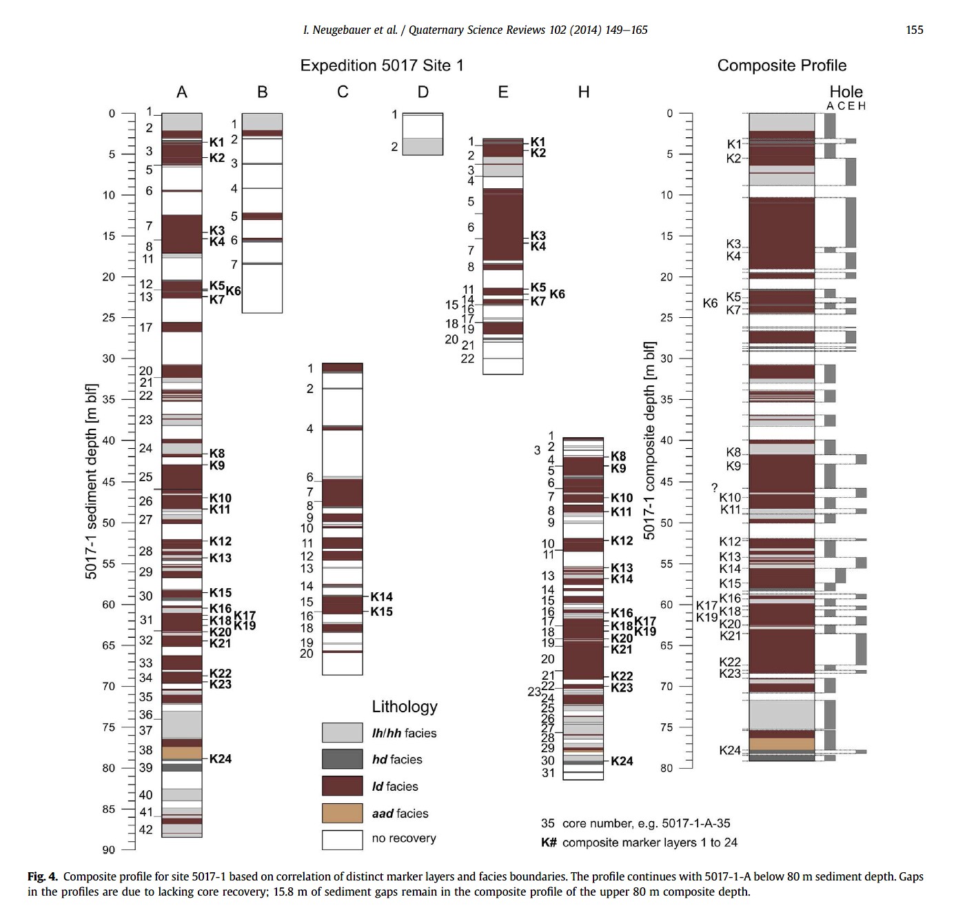
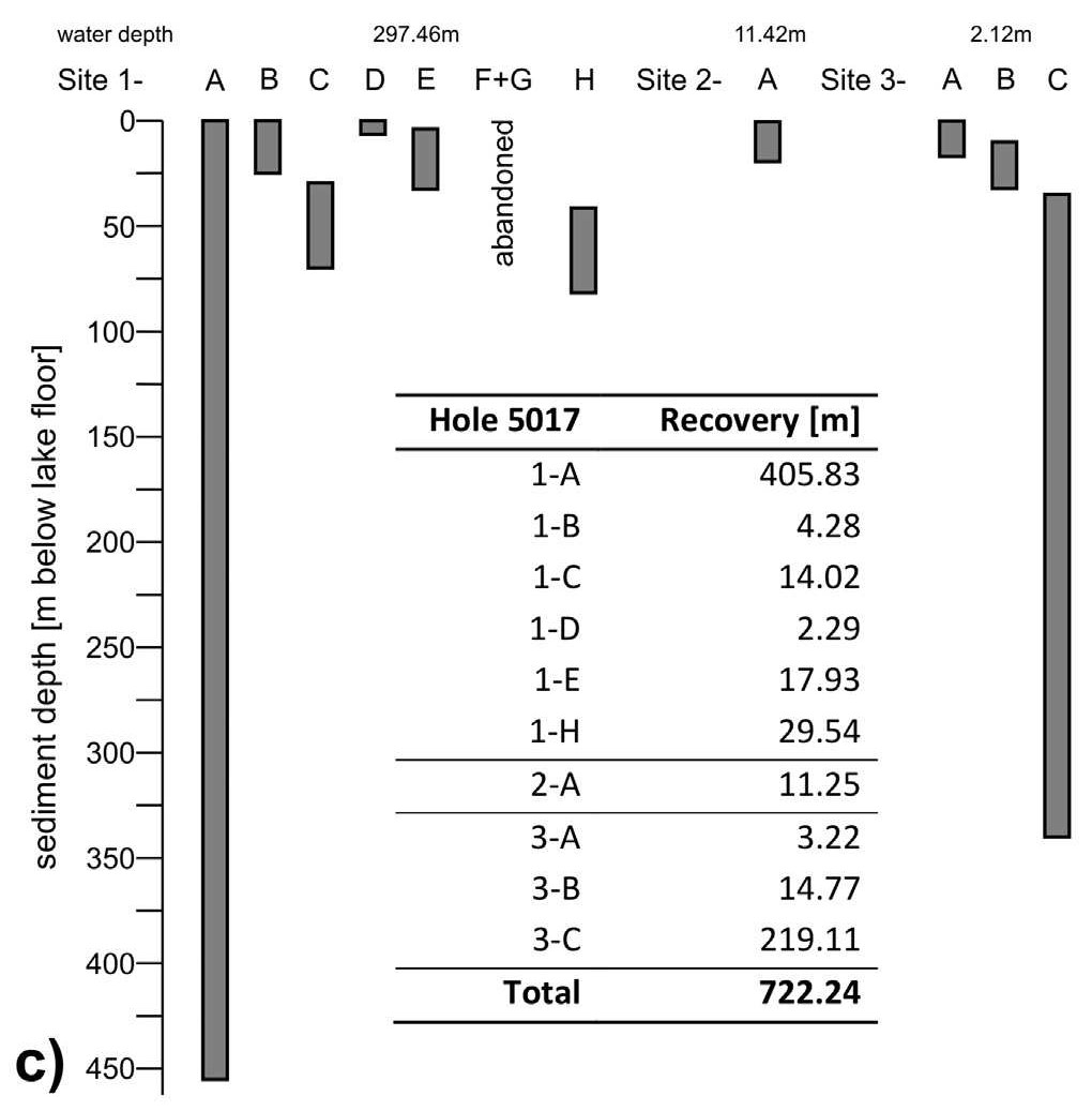
Figure 2 c) Overview about the recovered sediment cores from all holes of sites 5017 -1, 2, and 3