Seismic Events at Hacipasa Trenches
Location
Sources and Links
Akyuz, H. S., et al. (2006). "Historical earthquake activity of the northern part of the Dead Sea Fault Zone, southern Turkey." Tectonophysics 426(3–4): 281-293.
| Description | Image | Source | Comments |
|---|---|---|---|
| Location Map |
 Fig. 2
Simplified map of the offset stream beds between the Syrian-Turkish border in south and Amik Basin in north. Note that the western fault does not extend further north of Hacıpaşa town and it does not offset any stream bed. The border between Turkey and Syria is the dashed bold line in south and Asi River. Numbers indicate locations of offset measurements given in Table 2. Map also shows trench locations. Akyuz et al (2006) |
Akyuz et al (2006) | Figure 2 |
| Harabe Trench Log |
 Fig. 5
Log of Harabe trench, southern wall. Akyuz et al (2006) |
Akyuz et al (2006) | Figure 5 |
| Yazlik Trench Log |
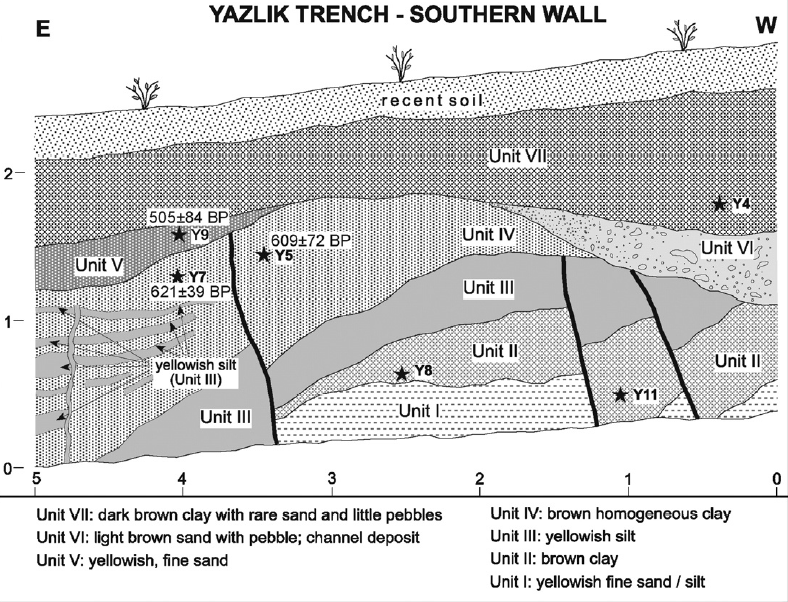 Fig. 6
Log of Yazlik trench, southern wall. Akyuz et al (2006) |
Akyuz et al (2006) | Figure 6 |
| Ziyaret Trench Log |
 Fig. 8
Log of Ziyaret trench, southern wall. Akyuz et al (2006) |
Akyuz et al (2006) | Figure 8 |
| Age Depth Model |
 Fig. 9
Probability distribution of calibrated 14C ages obtained from sequential radiocarbon dates. Akyuz et al (2006) |
Akyuz et al (2006) | Figure 9 |