
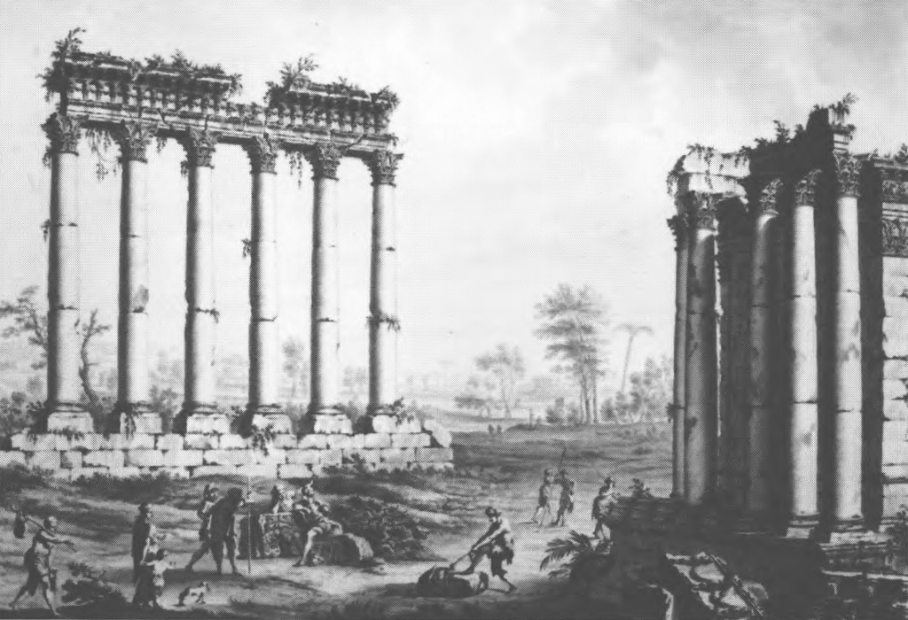
Side by side illustrations show that nine columns of the peristyle of the Great Temple (aka the Temple of Jupiter) in Baalbek were standing in 1751 CE (left) and only six remained in 1767 CE (right) - both Figures from Lewis (1999)
Two powerful earthquakes struck on 30 October and 25 November 1759 CE, each followed by a series of aftershocks. The shocks caused heavy destruction and numerous deaths in Lebanon, Syria, and northern Palestine. They triggered rockfalls, landslides, fissures, and may have generated tsunamis along the Mediterranean coast and the Sea of Galilee1. The first shock in October caused severe damage in Safed, where the historic core was affected and about 150 people were killed (Katz and Crouvi, 2007). Much of the destruction there appears to have resulted from earthquake-induced landslides. The second, apparently larger, shock occurred farther north. Ambraseys and Barazangi (1989) estimated magnitudes of MS ≈ 6.6 for the October event and MS ≈ 7.4 for the November one—values broadly consistent with the more refined estimates of Daeron et al. (2005). Based on paleoseismic trenching, geomorphological surveys, and a report from the French Consul in Saida describing a fissure over 110 km long near Baalbek2, Daeron et al. (2005) proposed that the 1759 earthquakes resulted from rupture of the **Rachaiya Fault** in October, followed by rupture of the **Serghaya Fault** in November. They estimated (2σ) magnitudes of 6.4–7.3 and 7.0–8.0 respectively.
Corroborating paleoseismic evidence probably appears at Bet Zeyda for the 30 October Safed quake and in the Tekieh Trenches (Syria) and Faqaa Trench (Lebanon) for the 25 November Baalbek quake. Marco et al. (2014) may have found tsunamogenic traces of one of these earthquakes at the Taninim Creek Dam site, although the dating of the observed flame structures there is poorly constrained. Ellenblum et al. (1998) documented about 0.5 m of displacement in an Ottoman mosque at Tel Ateret (also known as Vadum Iacob), possibly caused by the 30 October 1759 Safed quake. Extensive arch damage at Nimrod Castle may likewise stem from this event, with additional destruction resulting from the later 25 November Baalbek quake. At Baalbek, three columns of the peristyle of the Great Temple (Temple of Jupiter) reportedly collapsed during the November shock, and the soffit of the door of the Lesser Temple fell. Several sources recount large numbers of fatalities in the Beqaa Valley and deaths in Damascus caused by both earthquakes.
Many historical sources describe the effects of these two events, though only a portion are currently included in this catalog entry.